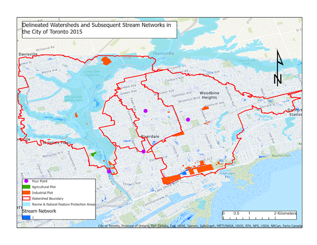
 Watershed Analysis Over the Don Valley River: The Potential Pathways of Aqueous Pollutants
Posted 3 years ago
By Lavanecha Chandran in the UofT Blog
Water is a crucial catalyst in propelling an inexhaustible list of anthropogenic activities such as agricultural practices, daily household commodities, and industrial/mining pursuits. Despite being limited to such a finite supply of freshwater resources, future generations will find themselves in a troubling situation as this fundamental resource is being exploited to an irreparable extent by […]
Read More
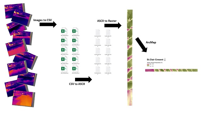 Batch Processing ACSII Files using Model Builder and Georeferencing Tools
Posted 3 years ago
By Karlos Lao in the Western Blog
Introduction For the past few months I had the pleasure to be working with my supervisor to construct a series of 2D thermal composites using ArcMap from a set of 3D images taken by a forward-looking infrared (FLIR) thermal camera in the field. The difficulty of the project comes from the fact that our images […]
Read More
 The Deeper Picture on Ghost Gear
Posted 3 years ago
By Leah Fulton in the Dalhousie Blog
Abandoned, lost or otherwise discarded fishing gear (ALDFG) is considered one of the most important marine debris issues that continues to threaten ocean sustainability. Globally, researchers are collectively working towards finding solutions to mitigate the impacts and reduce the presence of ALDFG in our oceans. Often, fishers don’t want to lose their gear, as it […]
Read More
 Exploring the Solar Rooftop Potential of Wortley Village/Old South in London, Ontario using ArcGIS Pro and LiDAR-derived DSM
Posted 3 years ago
By Karlos Lao in the Western Blog
Over the weekend in my exploration of ArcGIS Notebooks, I came across this very interesting ArcGIS Pro Lesson by Esri Senior Product Engineer Delphine Khanna. Although it was not related to my initial plan of learning how to use ArcGIS Notebooks, the project happened to use ArcGIS Pro which I had installed a few days […]
Read More
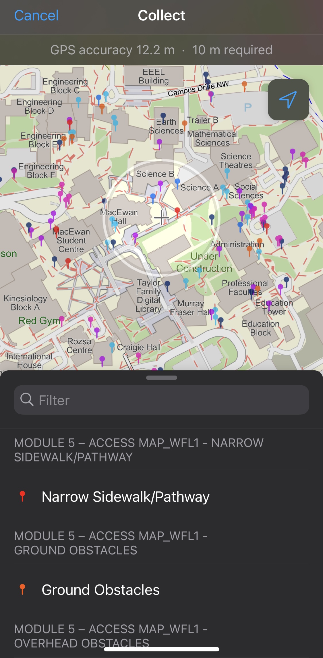 Using ArcGIS Field Maps to Collect Data on Sidewalk Obstacles in Calgary, Alberta, Canada
Posted 3 years ago
By Yui Tanagi in the UCalgary Blog
As a Master of Geographic Information Systems (MGIS) Student and a research assistant for Dr. Victoria Fast at the University of Calgary, I had the opportunity to assist in setting up and leading a module for undergraduate students that would require them to recognize barriers in the built environment that would affect the accessibility of […]
Read More
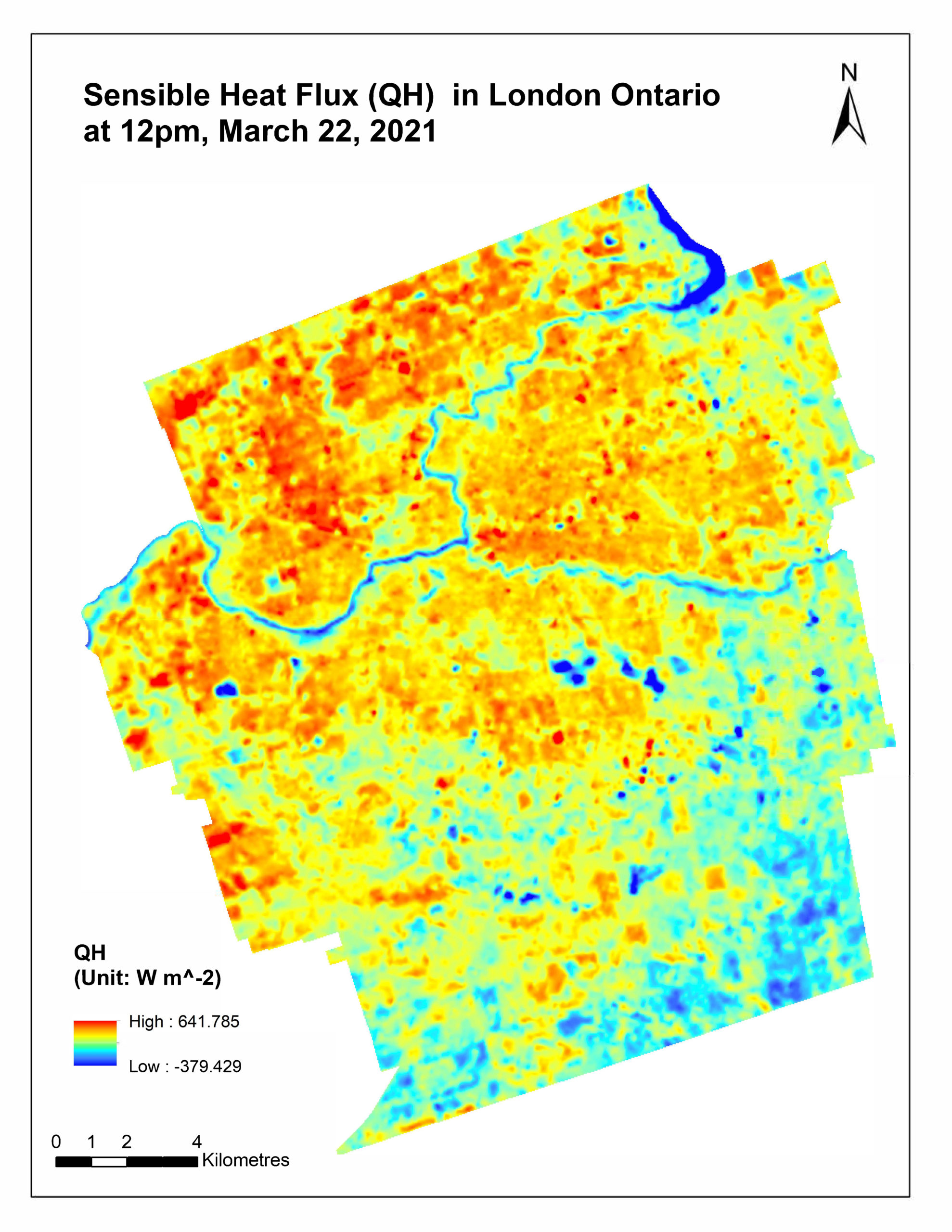 Uncovering the Power of Remote Sensing in Micrometeorological Studies
Posted 3 years ago
By Karlos Lao in the Western Blog
In my third-year micrometeorology class with Dr.Voogt, we were assigned a course project to work in small groups throughout the term, and each group had to conduct a research project for related to microclimate or micrometeorology. The course covered a wide range of topics such as solar radiation budget, soil microclimates, surface temperatures, etc. For […]
Read More
 Enhancing an Urban Development Proposal using ArcGIS Pro and Online.
Posted 3 years ago
By Syed Hammad Uddin in the McMaster Blog
Over the past summer, I had the opportunity to take part in a field course offered by the School of Earth, Environment & Society here at McMaster. This course was an exploration of urban environments and the processes at play within the city of Toronto. We spent three days exploring different neighborhoods and projects within […]
Read More
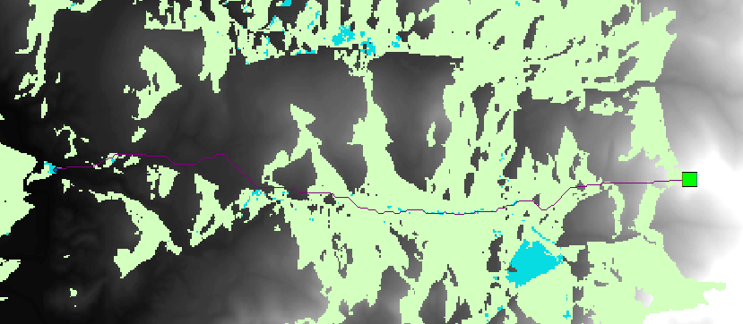 Analyzing the Best Tourism Spots
Posted 3 years ago
By Lincoln Chung in the UofT Blog
This blog post is about part of my GIS assignment from last term. The objective of this part was to teach us how to use viewshed analysis and least cost path analysis to find the best tourism spot (out of three candidate spots) based on how much of the city/urban-areas are visible from that particular […]
Read More
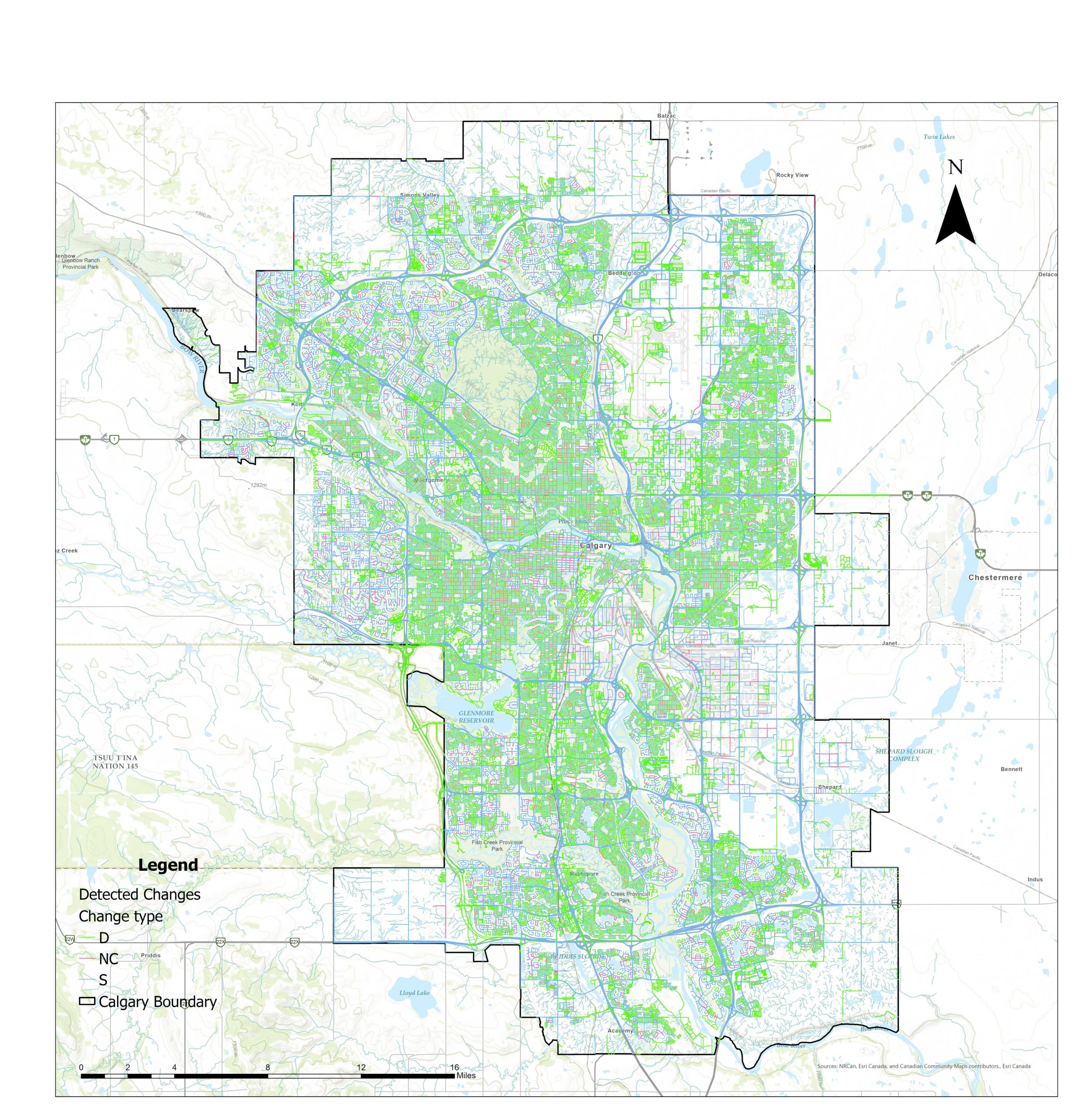 Quality Assessment of the OpenStreetMap Road Network in Calgary, Alberta Using ArcGIS Pro Python Notebook
Posted 3 years ago
By Reza Safarzadeh Ramhormozi in the UCalgary Blog
By rapidly growing the volunteered geographic information (VGI) platforms in recent years, accurate and up-to-date geospatial data are being provided more and more every day. Moreover, these open sources data are easily and freely accessible to the users. This creates a challenge for the various governmental mapping organizations which have well-established mandates to map the […]
Read More
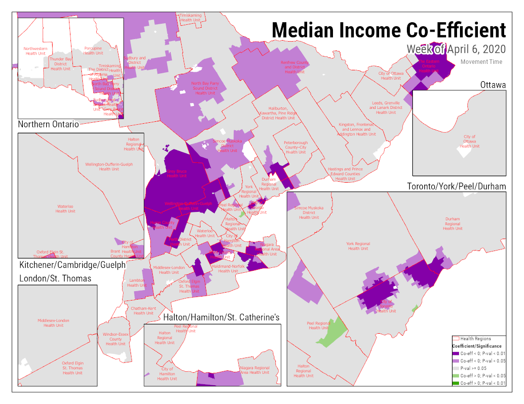 Using an ArcGIS Pro Python Noteboook to display results of a GWR model
Posted 3 years ago
By Ben Klar in the Western Blog
The Built-in Python notebooks feature in ArcGIS Pro is very useful for creating an automated and reproducible workflow for complex analysis. Personally though, my best use of the ArcPy library in ArcGIS Pro has been for a fairly simple purpose – to create multiple maps iterating over a categorical variable’s values. I often find myself […]
Read More
 Watershed Analysis Over the Don Valley River: The Potential Pathways of Aqueous Pollutants


