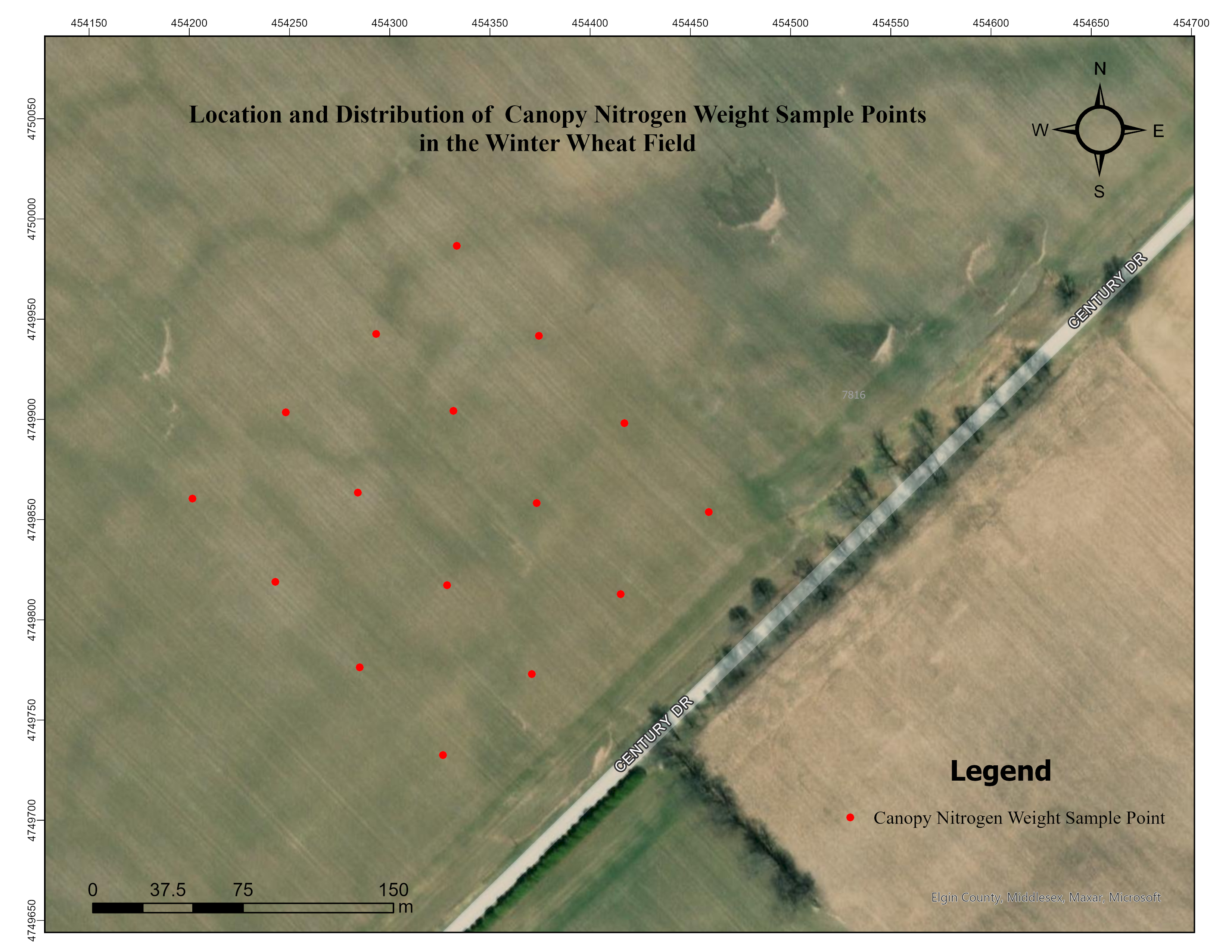
 The Upscaling of Winter Wheat Aboveground Nitrogen Content Estimation Using Geostatistical Analysis
Posted 2 months ago
By Mohammad Rokhafrouz in the Western Blog
Introduction Nitrogen is the most essential and demanded nutrient for plants [1]. It is also one of the most costly to supply, making commercial fertilizers a major expense in agriculture [2]. Nitrogen deficiency reduces crop growth and yields [3], while overapplication may have unwanted environmental impacts and cost of production [4]. Therefore, managing nitrogen fertilizers […]
Read More
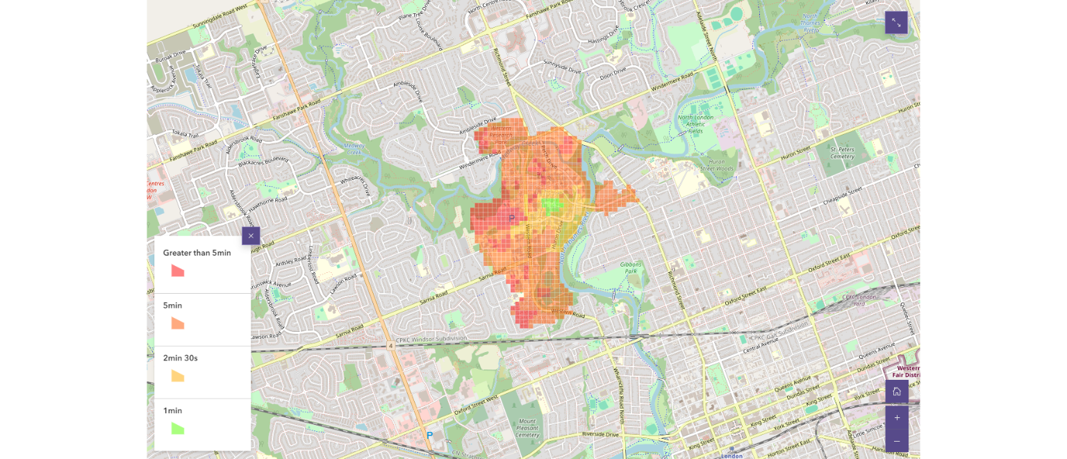 Emergency Response at the University of Western Ontario: Accessibility Analysis of Code Blue Emergency Phones
Posted 2 months ago
By Henry Shaver in the Western Blog
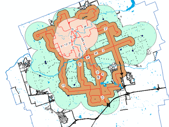
Background University campuses are busy places, with thousands of students and faculty frequenting the grounds every day – and the University of Western Ontario is no exception. With 38,000 students enrolled in the Fall of 2022, this large number of young adults brings numerous safety concerns. (Western Communications, 2022). The following campus safety concerns were […]
Read More
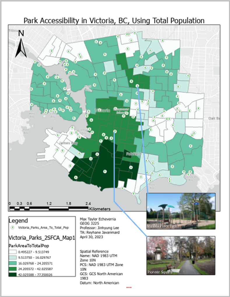 Park Accessibility in Victoria, British Columbia using Daytime Population & Total Population.
Posted 7 months ago
By Max Taylor Echeverria in the Western Blog
For my third year Transportation Geography & GIS term project, I delved into essential questions about park accessibility in Victoria, BC: Daytime vs. Total Population: What is the level of accessibility for parks using daytime population values in Victoria, BC? Comparative Analysis: What is the level of accessibility for parks using total population values in […]
Read More
 Hospital and Park Accessibility in Vancouver, BC, Canada: A Geospatial Analysis
Posted 9 months ago
By Max Taylor Echeverria in the Western Blog
For my third-year GIS final project, I decided to develop accessibility maps for two critical variables in selecting an ideal place to live in Vancouver, BC: hospitals and parks, as a young professional or recent graduate. The significance of these factors lies in their impact on our health and well-being. Why Hospitals and Parks? Hospitals […]
Read More
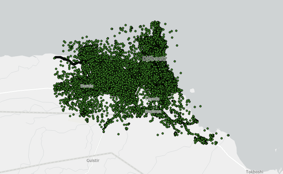 How to find frequently visited locations from human mobility data?
Posted 1 year ago
By Milad Malekzadeh in the Western Blog
One of the main steps in analyzing human mobility is finding the most visited locations of each person. In doing so, most researchers try to find locations where people spend most of their time. Whether we use a GPS tracking or mobile phone dataset, because of the errors pertaining to the underlying technology (e.g., atmospheric […]
Read More
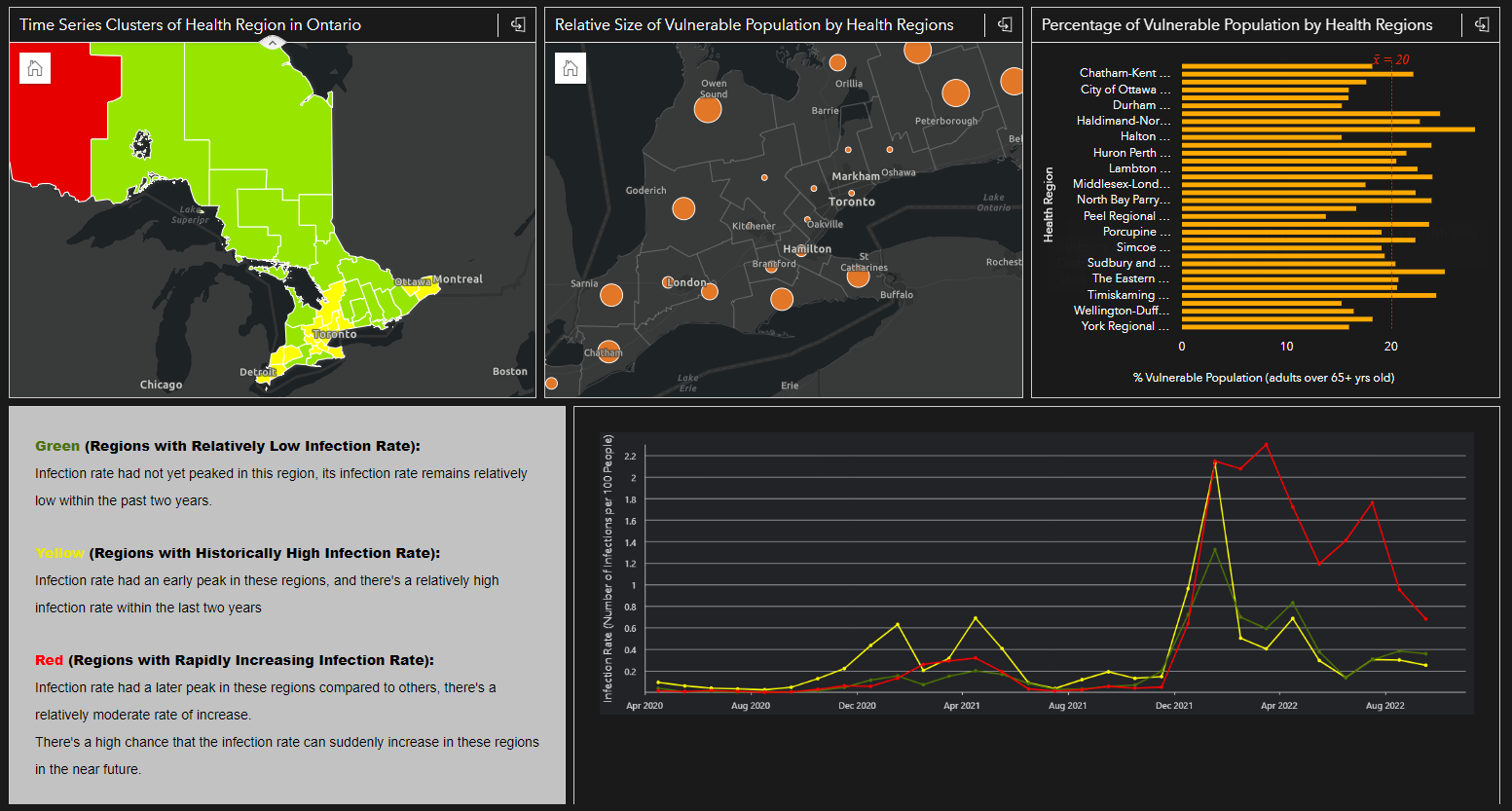 Integrating Space, Time and Geography with ArcGIS Insights: A Case Study of COVID-19 Infection Rates in Ontario Public Health Regions From 2020 to 2022
Posted 1 year ago
By Karlos Lao in the Western Blog
Introduction Tobler’s First Law of Geography “Everything is related to everything else, but near things are more related to distant things” reminds us how geography plays an important role in the spatial pattern of things that we see everyday. However, when it comes to analysis involving human mobility, epidemiology, or any spatial data that contain […]
Read More
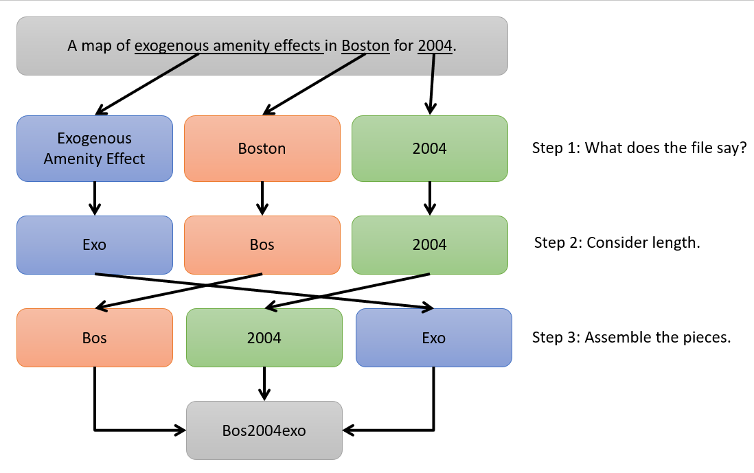 The Importance of Careful File Naming
Posted 1 year ago
By John Hutchenreuther in the Western Blog
When I was sitting in my courses learning how to use ArcGIS Pro to generate maps and analyze spatial data, I got the obligatory computer science warnings that come in any software course: put some thought into what you name your files. I did my best to take it seriously at the time, but when […]
Read More
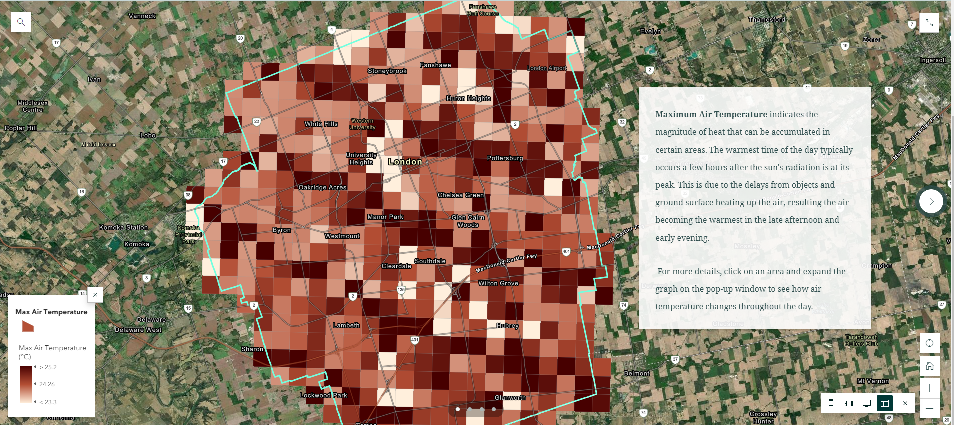 Visualizing Climate Model Data using Simple Query Tools from ArcGIS Pro and Web-Based Geovisualization Features
Posted 2 years ago
By Karlos Lao in the Western Blog
In my recent summer project as a NSERC-USRA student under the supervision of Dr. James Voogt, I was able to gain access to several datasets from Environment Canada that were not yet publicly avalilable, such as the “GEM-SURF (Global Environmental Multiscale Surface)” data. Our project focuses on using both the air temperature and surface temperature […]
Read More
 Using ArcGIS to Explore Suitable Housing Areas for Students in London
Posted 2 years ago
By Karlos Lao in the Western Blog
In my previous project in the third year GIS course with Dr. Jed Long, I completed a housing map using ArcMap, ArcGIS Online, and Story Map that aims to locate all the most accessible housing areas for Western students to live off-campus. Since the basic version of ArcGIS Online doesn’t provide access to the Spatial […]
Read More
 Doing Spatial Analysis with ArcGIS Online: A Reflection on Esri’s Going Places with Spatial Analysis MOOC
Posted 2 years ago
By Karlos Lao in the Western Blog
In the past two months with the majority of my school works being completed, I was able to dedicate myself to one of Esri’s ongoing MOOCs (Massive Open Online Course), and attend their weekly exercises and webinars that talk about the different tools and concepts for conducting spatial analysis using ArcGIS Online. This six-weeks course […]
Read More

