 Integrating Space, Time and Geography with ArcGIS Insights: A Case Study of COVID-19 Infection Rates in Ontario Public Health Regions From 2020 to 2022
Posted 1 year ago
By Karlos Lao
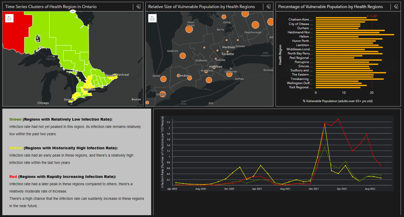
Introduction Tobler’s First Law of Geography “Everything is related to everything else, but near things are more related to distant things” reminds us how geography plays an important role in the spatial pattern of things that we see everyday. However, when it comes to analysis involving human mobility, epidemiology, or any spatial data that contain […]
Read More
 Visualizing Climate Model Data using Simple Query Tools from ArcGIS Pro and Web-Based Geovisualization Features
Posted 2 years ago
By Karlos Lao
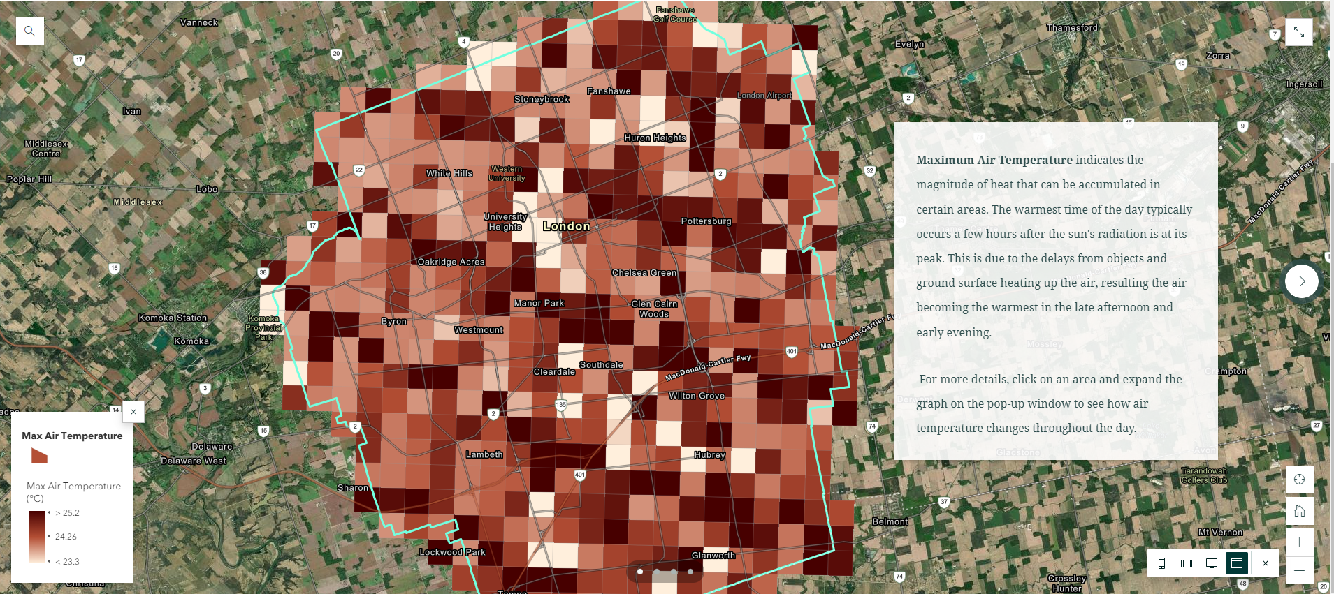
In my recent summer project as a NSERC-USRA student under the supervision of Dr. James Voogt, I was able to gain access to several datasets from Environment Canada that were not yet publicly avalilable, such as the “GEM-SURF (Global Environmental Multiscale Surface)” data. Our project focuses on using both the air temperature and surface temperature […]
Read More
 Using ArcGIS to Explore Suitable Housing Areas for Students in London
Posted 2 years ago
By Karlos Lao
In my previous project in the third year GIS course with Dr. Jed Long, I completed a housing map using ArcMap, ArcGIS Online, and Story Map that aims to locate all the most accessible housing areas for Western students to live off-campus. Since the basic version of ArcGIS Online doesn’t provide access to the Spatial […]
Read More
 Doing Spatial Analysis with ArcGIS Online: A Reflection on Esri’s Going Places with Spatial Analysis MOOC
Posted 2 years ago
By Karlos Lao
In the past two months with the majority of my school works being completed, I was able to dedicate myself to one of Esri’s ongoing MOOCs (Massive Open Online Course), and attend their weekly exercises and webinars that talk about the different tools and concepts for conducting spatial analysis using ArcGIS Online. This six-weeks course […]
Read More
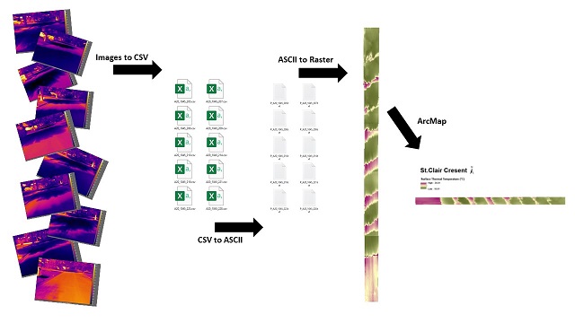 Batch Processing ACSII Files using Model Builder and Georeferencing Tools
Posted 2 years ago
By Karlos Lao
Introduction For the past few months I had the pleasure to be working with my supervisor to construct a series of 2D thermal composites using ArcMap from a set of 3D images taken by a forward-looking infrared (FLIR) thermal camera in the field. The difficulty of the project comes from the fact that our images […]
Read More
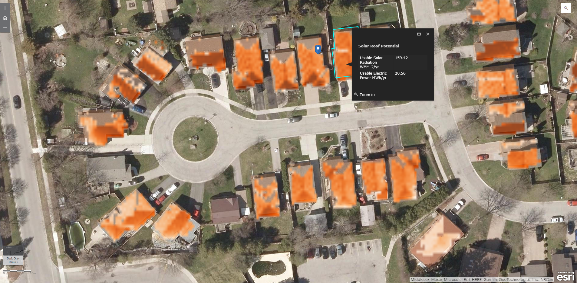 Exploring the Solar Rooftop Potential of Wortley Village/Old South in London, Ontario using ArcGIS Pro and LiDAR-derived DSM
Posted 2 years ago
By Karlos Lao
Over the weekend in my exploration of ArcGIS Notebooks, I came across this very interesting ArcGIS Pro Lesson by Esri Senior Product Engineer Delphine Khanna. Although it was not related to my initial plan of learning how to use ArcGIS Notebooks, the project happened to use ArcGIS Pro which I had installed a few days […]
Read More
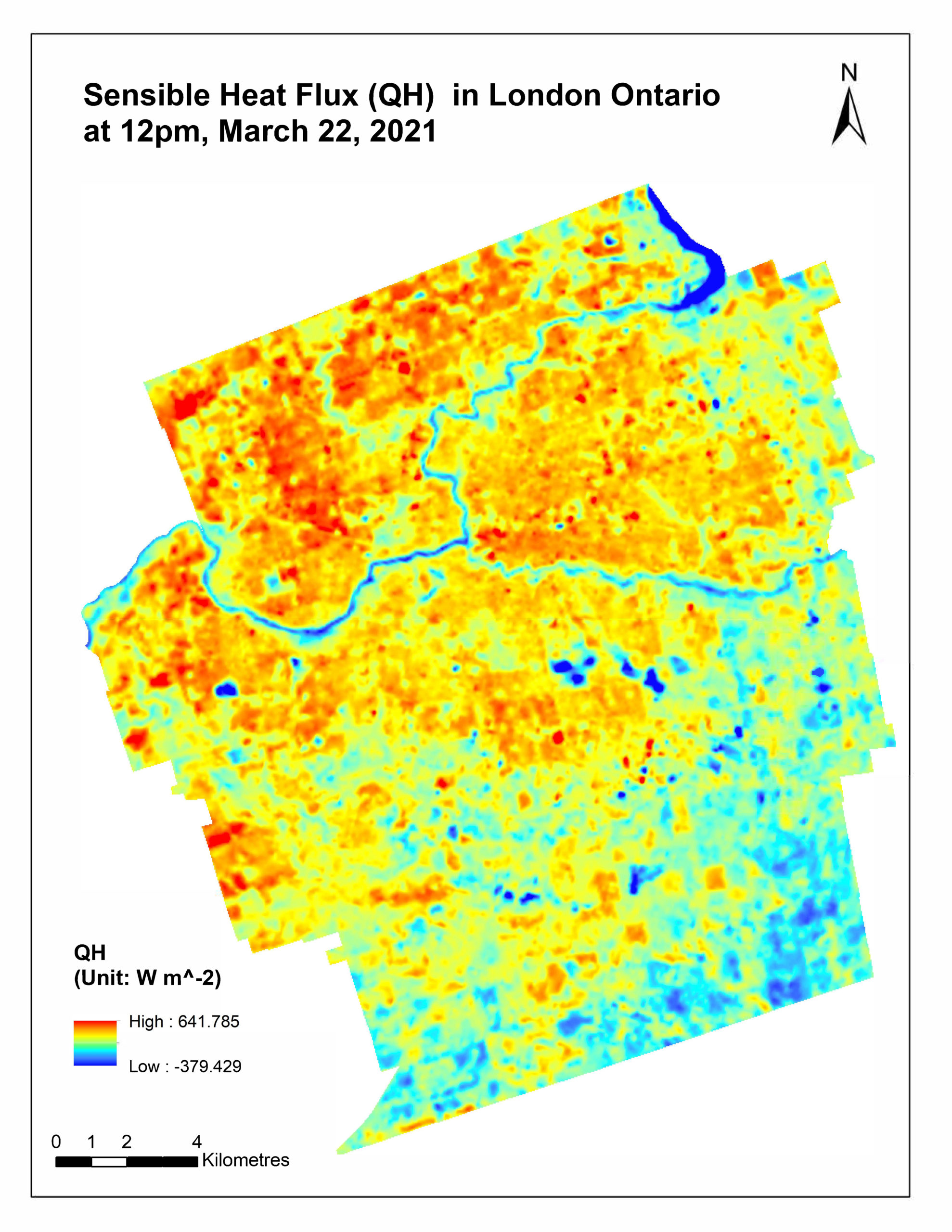 Uncovering the Power of Remote Sensing in Micrometeorological Studies
Posted 2 years ago
By Karlos Lao
In my third-year micrometeorology class with Dr.Voogt, we were assigned a course project to work in small groups throughout the term, and each group had to conduct a research project for related to microclimate or micrometeorology. The course covered a wide range of topics such as solar radiation budget, soil microclimates, surface temperatures, etc. For […]
Read More

