
The Importance of Careful File Naming
When I was sitting in my courses learning how to use ArcGIS Pro to generate maps and analyze spatial data, I got the obligatory computer science warnings that come in any software course: put some thought into what you name your files. I did my best to take it seriously at the time, but when your lab reports feature less than half a dozen layers in the vast majority of cases, sinking a lot of thought into what you were going to call your shapefile or layout didn’t seem worth it. I had projects to do, essays to write, and I just needed to get this lab handed in and out of the way! Undertaking my thesis work has really hammered home the importance of naming your files, both in the ways that professors talked about and also in other ways.
At the moment, I’m working on a study that encompasses 20 different study cities. Each of these cities is being studied over 12 years, and on 3 separate variables. Including some summary maps, this has me making just over 1000 maps in total for the one research project. With this volume of output, naming has become incredibly important.
How To Make a Naming Scheme
1. What does the file say?
An effective title tells you what makes this particular file unique from the others. Do you have time to page through dozens of layers trying to find the one you wanted? I certainly don’t. When you need a particular layer or data set, you should be able to read your title and know that you have the correct file even before you open it. Opening a file on your own, having to pop open three or four files just to figure out which one you want wastes time. Even worse is having your boss or your colleagues looking over your shoulder while you fumble around for the right map.
For my study, I considered the ‘search terms’ I might need. I’d need to know what city it was. I’d need to know what year it was. I’d need to know what variable it was. If I didn’t have all three components, I’d have to open several maps to get the right one. I could have put more information down though, right? What state are these in? There were two reasons I didn’t list the state. First, each city had a unique name, meaning adding the state didn’t make the map any more specific. Second, several cities actually share states with other study cities, meaning the state designation wouldn’t make it clearer. If I was doing a survey of Springfields (more than one Springfield in each state in the US!) I’d need that more specific factor. And as mentioned in the next point, the shorter the better. We only have so many characters to play with!
2. Consider Length
When looking to create a naming scheme, size matters. Windows lets file names go on for hundreds of characters, but when you open up a browser window to look at the file names, you rarely (if ever!) see all the characters allowed. When you are confronted by a wall of names, being able to see every character counts. It isn’t just in file explorer either, when you are clicking through your menus in ArcGIS, there is only so much space in that text box. You want your full title to appear! When making your title scheme, it’s better to be as compact as possible without sacrificing readability.
In my particular study, one of the cities I’m looking at is Oklahoma City. If I went with that for the name, I’d be pushing the limits of what gets displayed. I still need room in that name to include the year this map is of and the variable it is visualizing. So, I shrunk it down to OKC. The three-letter code allowed me to intuitively identify the city in as few characters as possible. In contrast, for the year, I use the full four digits, such as 2004. While only two digits are needed (04) to provide a unique designation, it just felt unintuitive.
3. Assembling the pieces
No matter how clever your naming scheme, you are ultimately going to be looking at a wall of text. Reading over each name every time is way too much work, so it is important to leverage the file name to make it easier on us. Files can be sorted in a number of ways, but the default is typically alphabetical order. I suggest making that work for you. Make the first component of your file name the biggest ‘section divider’ of your research. Follow that with the second biggest, then the third, ect. You want this to flow like a decision tree.
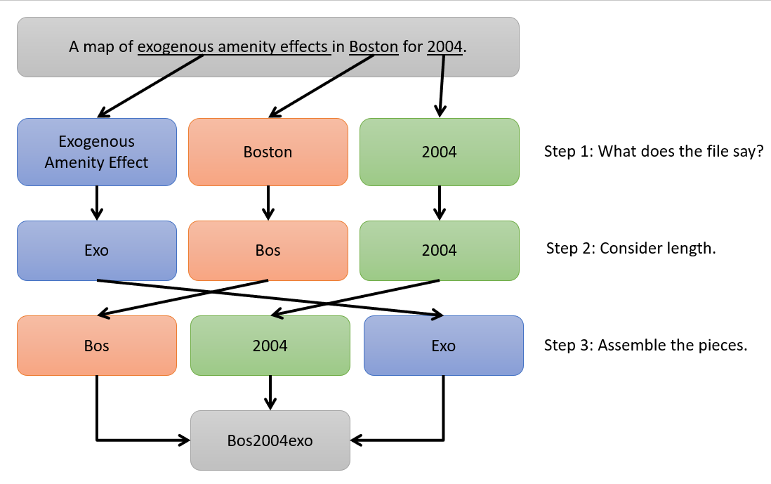
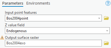
During the analysis, I knew I was going to be looking from map to map and I wanted to know roughly where to look, rather than scanning down a huge list. There isn’t a right or wrong answer here and it really depends on how your analysis will be approached. For me, I was already thinking of each city as a separate ‘case study’. So, I decided to make the city the first part of the name. This would mean that, when alphabetically listed, all the files for the same city would be clumped up together. Second, I put the year. I find that switching from letters to numbers provides a nice visual break and I wanted that visual break to help separate the components of my file name. Finally, I put my variable on the tail end. So, in my example, I had Bos2004Exo. When I decided I wanted to look at that map, I knew roughly where it would fall in my list of files and make it much easier to find.
4. Workflow benefits
Taking the time to sort these file names actually made the work flow much smoother too. When you are going through your tools and telling ArcGIS what settings you want, file navigation buttons and dropdown menus are incredibly convenient. They save you typing and also minimize the risk of typos. That said though, sometimes it can involve a lot of clicking as you move from one output to the next. For many steps, I found a few characters of typing was much faster.
For the first output layer I wanted to generate with each tool, I’d make sure to do it the drop or navigation way. Having outputs fail because I typed in the wrong character is something I find very frustrating. However, as long as I was using the same tool, I found changing the last few characters on my file outputs very easy and fast. If I didn’t have a consistent file naming scheme, or if I’d put the components in a different order, changing the settings from use to use would have taken much longer.
Summary
The next time you are faced with a large mapping project, I urge you to think though your file naming. It can make all the difference on the far end when you are trying to find that one thing you made or are in the middle of the slog and just want it to go a little faster. Your future you will thank you for the extra effort, and it’ll save you so much extra work in the long run.