 Quantifying Nationwide Greenspace Accessibility with CANUE
Posted 2 months ago
By Sarah Chen in the UofT Blog
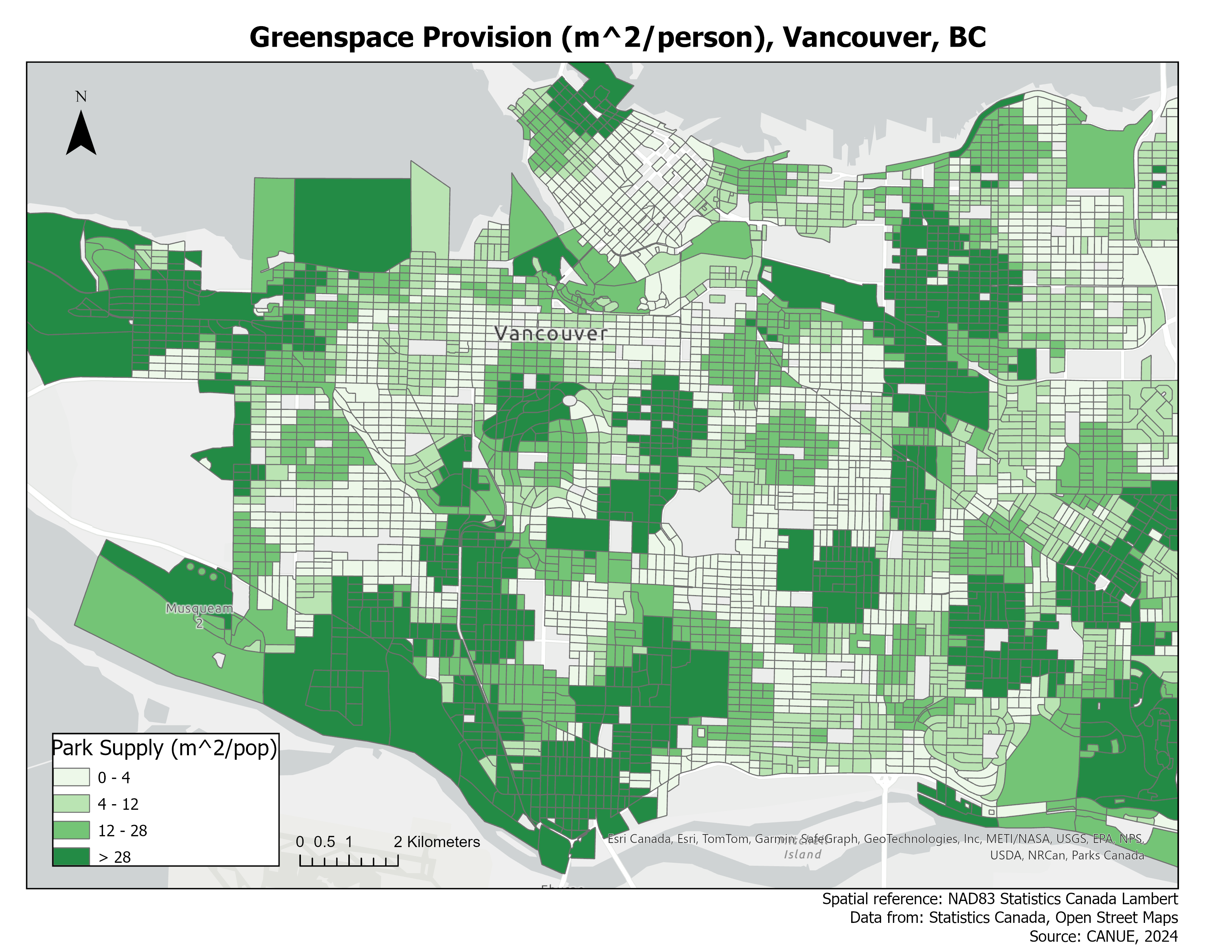
Introduction Over the past year, I worked with student collaborator Emily Moffat and supervisor Joey Syer from the Canadian Urban Environmental Health Research Consortium (CANUE) to produce a national greenspace provision layer as part of the University of Toronto’s geography professional experience placement course. Greenspaces refer to varied land designations such as parks, nature reserves, […]
Read More
 Unveiling Parking Ticket Disparities in Mississauga, Ontario, Canada
Posted 9 months ago
By Scarlett Rakowska in the UofT Blog
This blog will present the findings from a project completed during a graduate course, co-authored with Leila Denise Uy. A parking ticket is a citation for an inactive motor vehicle violating local laws, such as parking in a prohibited space or an unauthorized manner (Mucciolo et al., 2023). Usually, tickets are issued by police officers […]
Read More
 Remote and Direct Sensing: Merits of Mixed Method Protocols in Ecology
Posted 9 months ago
By Charlotte Kafka-Gibbons in the UofT Blog
This summer I had the opportunity to design and carry out a week-long research project at the Rocky Mountain Biological Laboratory (RMBL) in Gothic, Colorado—as part of an ecology and evolutionary biology field course. RMBL is a renowned site for long-term ecological research, especially that pertaining to global climatic change. Gothic is situated in a […]
Read More
 Exploring Historical and Modern Toronto With ArcGIS Pro
Posted 1 year ago
By Sarah Reeser in the UofT Blog
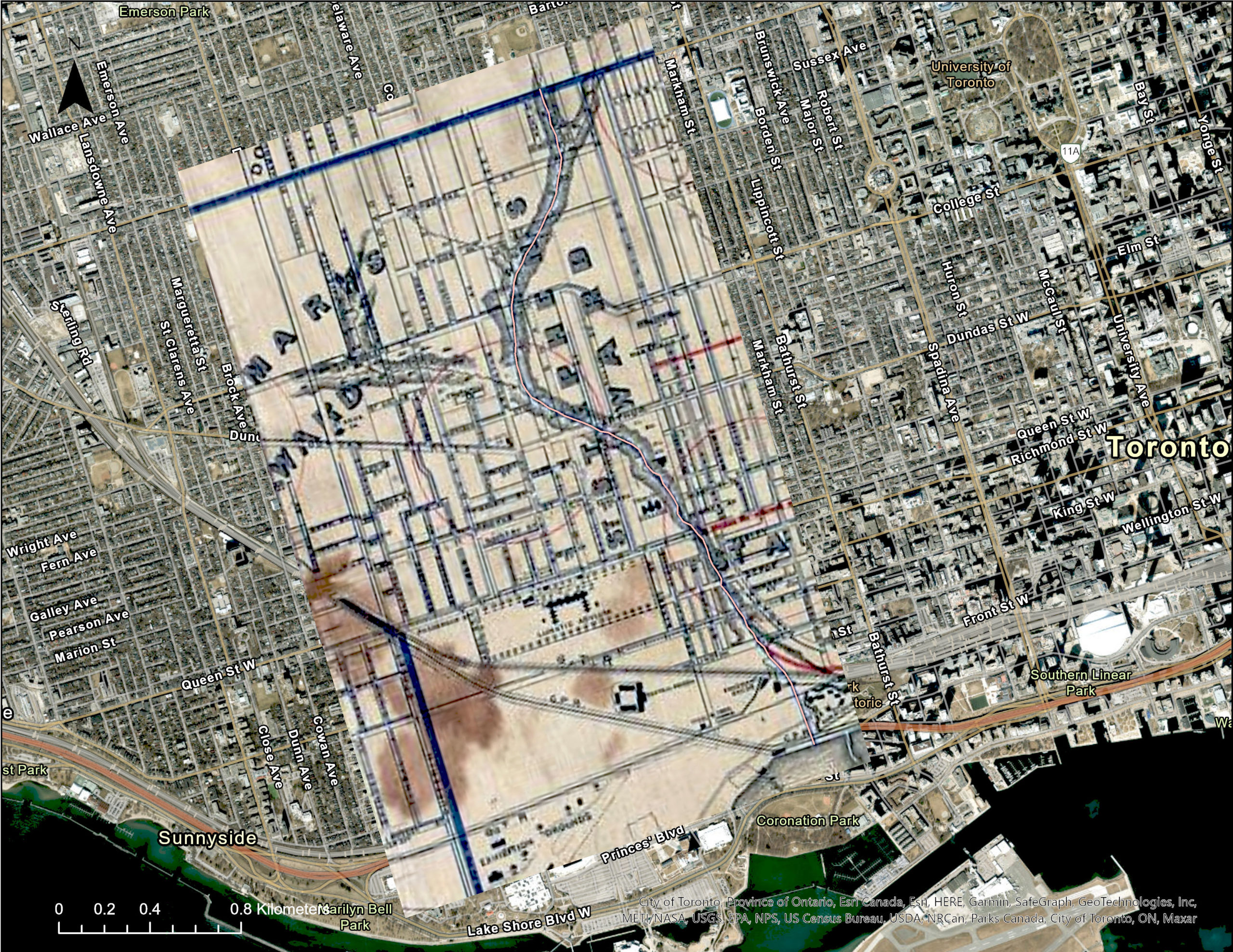
Visualizing historical and modern land use along lost rivers in Toronto.
Read More
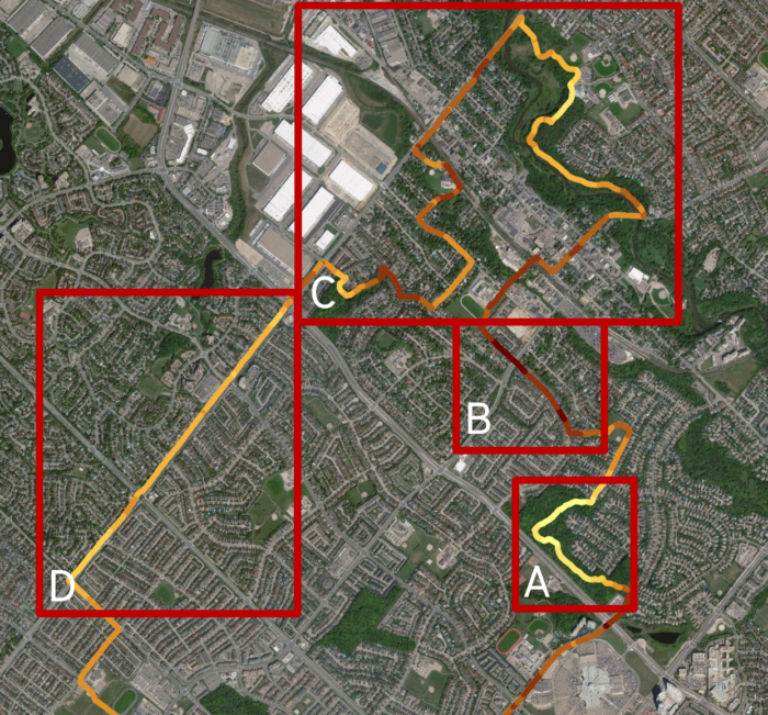
 Collecting and Calculating Land Data – Preparing for Analysis of Remote Sensing Microscale Urban Heat
Posted 2 years ago
By Scarlett Rakowska in the UofT Blog
A few months ago, I wrote a blog post introducing my MSc Thesis. Since then, I finished my summer fieldwork which consisted of cycling over 560 kilometres of cycling and road infrastructure measuring air temperature every 1-second in Mississauga, Ontario. I also had the opportunity to present my preliminary thoughts on this project at the […]
Read More
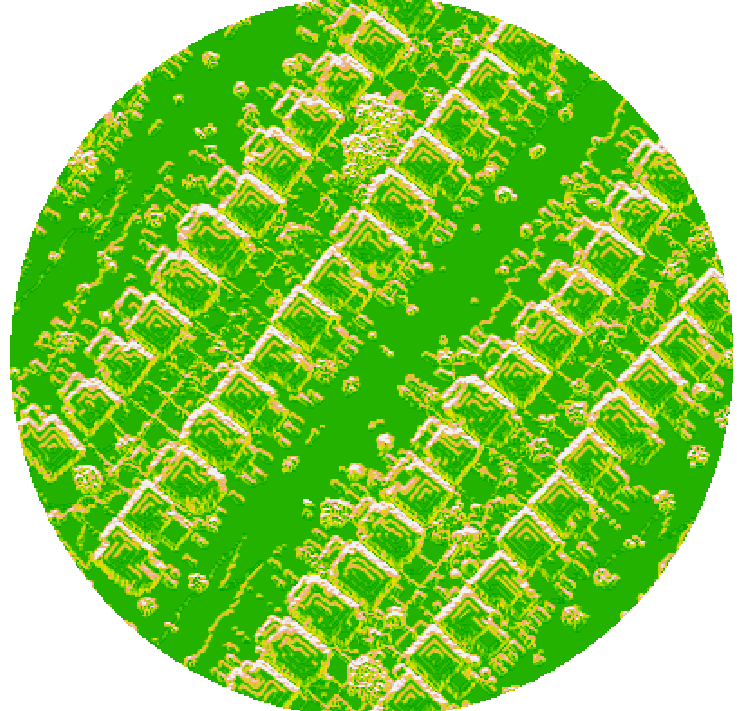
 Exploring Cycle-Level Heat – Preparing for Analysis of Remote Sensing Microscale Urban Heat
Posted 2 years ago
By Scarlett Rakowska in the UofT Blog
This blog post will present my current MSc Thesis project. As human population increases, we are seeing a trend towards more people living in cities than in rural areas (Hiemstra et al., 2017). In 1861, 16% of Canadians lived in urban regions; whereas, in 2011, 81.5% lives in urban regions (Statistics Canada, 2018). Urban areas […]
Read More
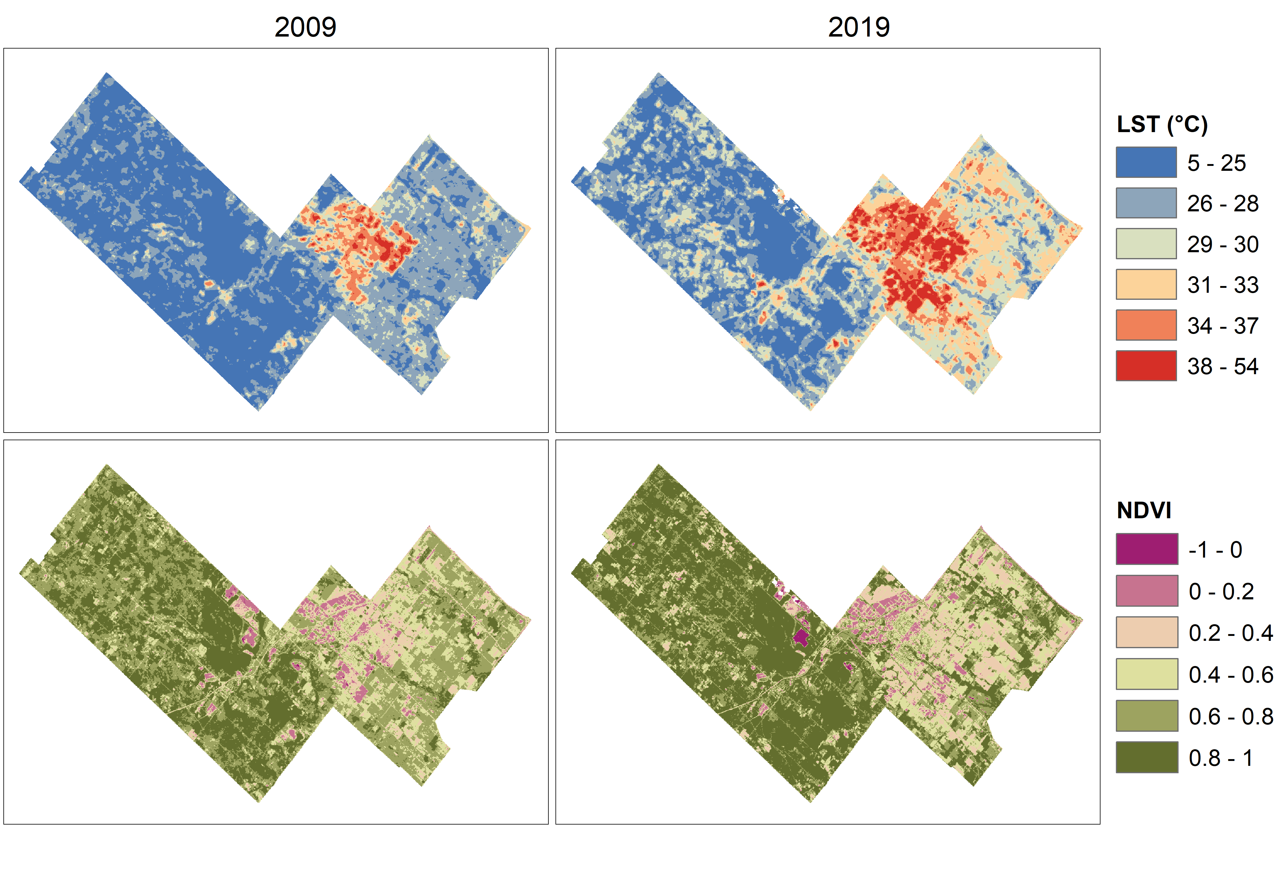 Temperature and vegetation variation within a rapidly growing town
Posted 2 years ago
By Scarlett Rakowska in the UofT Blog
As a first-year MSc student at the University of Toronto Mississauga, I wrote a paper for a planning course where I integrated remote sensing data with planning documents to understand environmental change in the rapidly growing Town of Milton, Ontario. In this blog post, I will summarize the paper including my methods and findings. However, […]
Read More
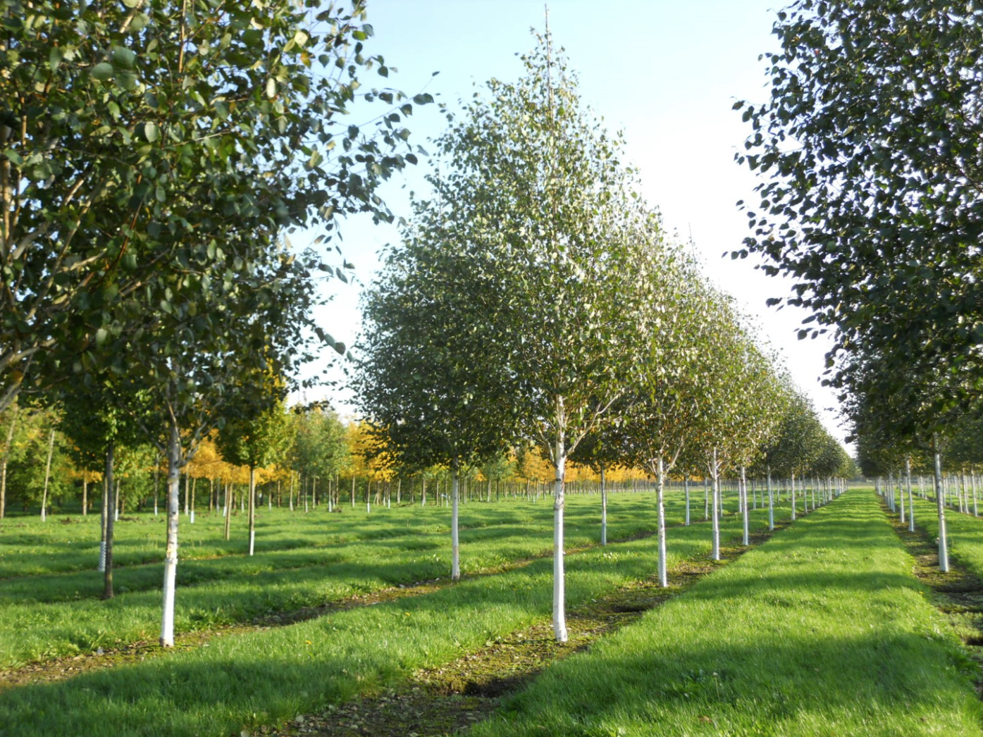 A Spatial Literature Review of the Human Impacts on Betula utilis and Betula papyrifera
Posted 2 years ago
By Sana Hashim in the UofT Blog
Independent Research In my second year at UTM, I did a spatial literature review of the human impacts on two birch species, Betula utilis and Betula papyrifera. More specifically, I analyzed the existing scholarly literature focusing on the effects of climate and environmental changes (2017 to 2022) and the human use (1982 to 2022) of […]
Read More
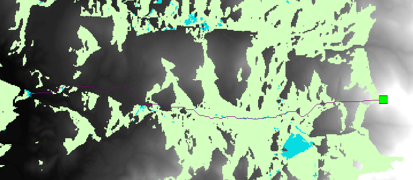
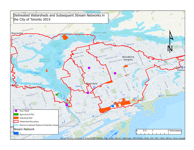 Watershed Analysis Over the Don Valley River: The Potential Pathways of Aqueous Pollutants
Posted 3 years ago
By Lavanecha Chandran in the UofT Blog
Water is a crucial catalyst in propelling an inexhaustible list of anthropogenic activities such as agricultural practices, daily household commodities, and industrial/mining pursuits. Despite being limited to such a finite supply of freshwater resources, future generations will find themselves in a troubling situation as this fundamental resource is being exploited to an irreparable extent by […]
Read More
 Analyzing the Best Tourism Spots
Posted 3 years ago
By Lincoln Chung in the UofT Blog
This blog post is about part of my GIS assignment from last term. The objective of this part was to teach us how to use viewshed analysis and least cost path analysis to find the best tourism spot (out of three candidate spots) based on how much of the city/urban-areas are visible from that particular […]
Read More

