

 Quality Assessment of the OpenStreetMap Road Network in Calgary, Alberta Using ArcGIS Pro Python Notebook
Posted 3 years ago
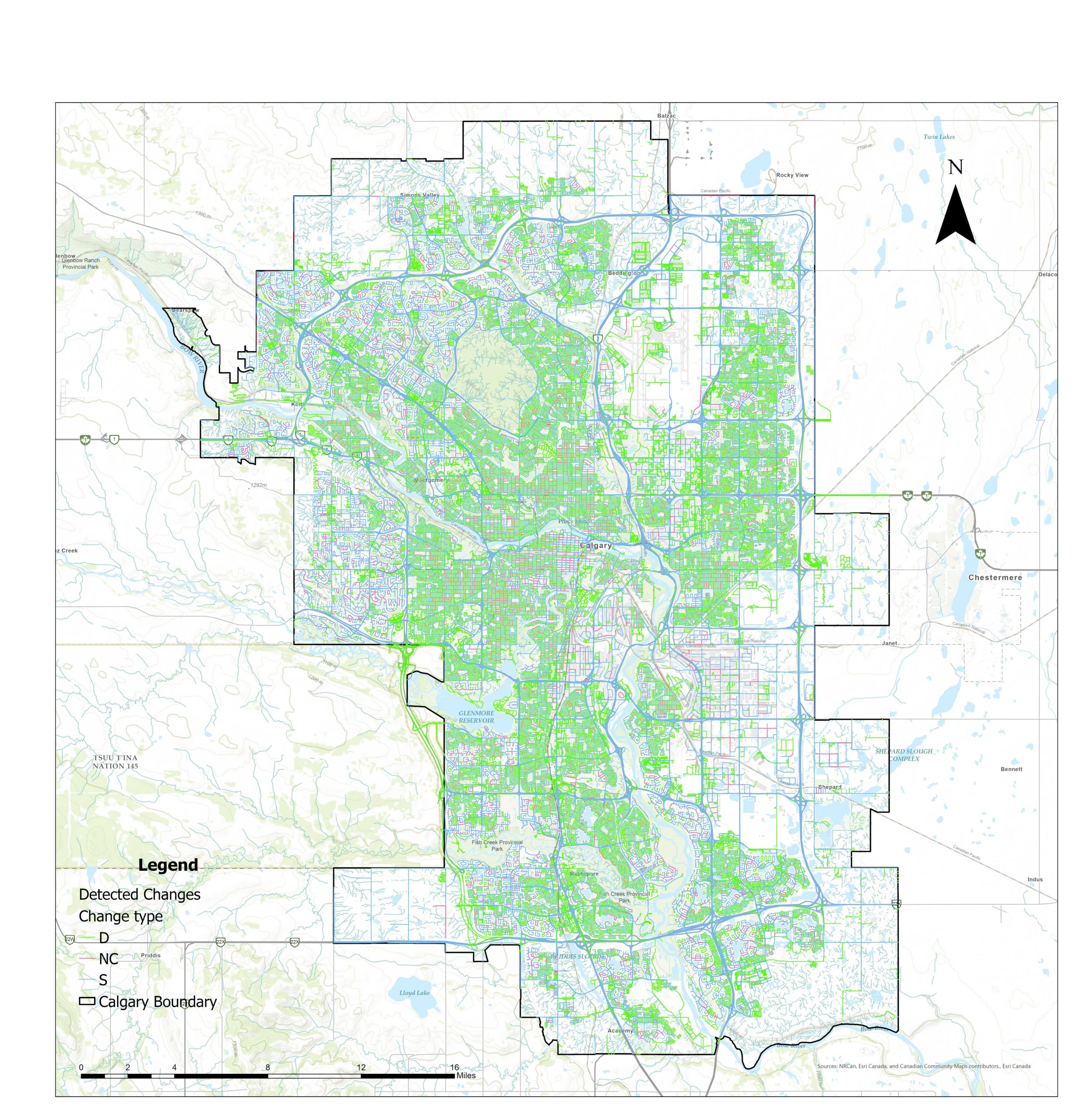
By rapidly growing the volunteered geographic information (VGI) platforms in recent years, accurate and up-to-date geospatial data are being provided more and more every day. Moreover, these open sources data are easily and freely accessible to the users. This creates a challenge for the various governmental mapping organizations which have well-established mandates to map the […]