 “Seeing” Peatland Stress from Space: Relationships between Sentinel satellite data and peat moisture. Part 1
Posted 2 days ago
By Alex Furukawa in the McMaster Blog
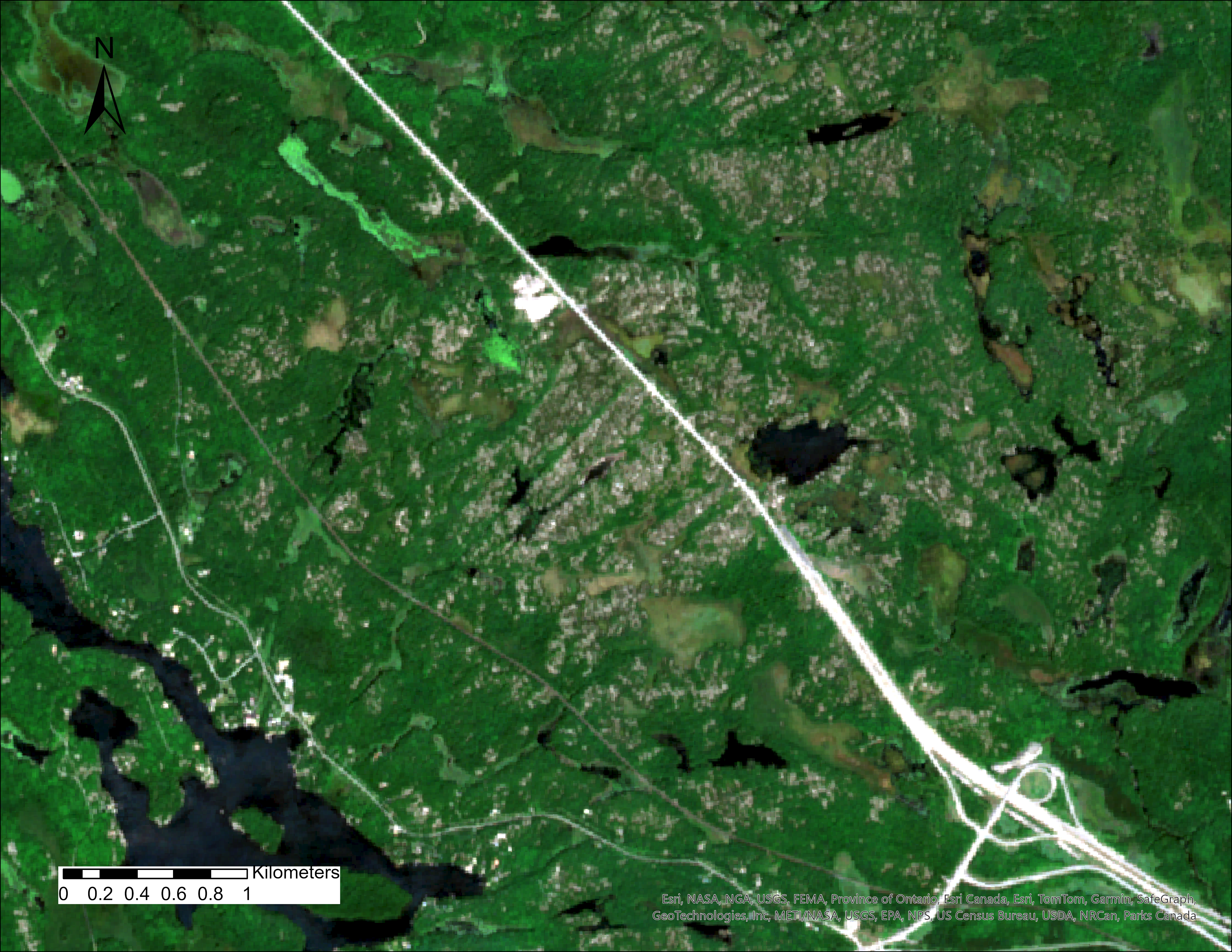
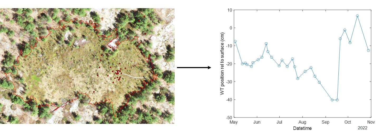
This is the first in a multi-part series detailing the process of linking in-situ peatland water table data to satellite data. While monitoring the water table, or moisture status of a peatland is by no means a complicated task that is usually accomplished simply with a groundwater well, they beg the question of ‘ungauged basins’ […]
Read More
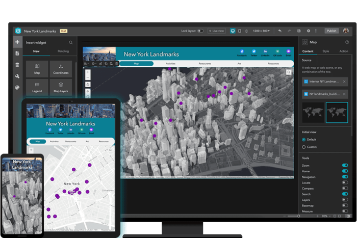 Gaining more experience with Experience Builder: Building Web Apps with ArcGIS Experience Builder
Posted 5 months ago
By Alex Furukawa in the McMaster Blog
Recently, as an ECCE associate I was fortunate to be able to partake in a two-day course offered by Esri Canada: Building Web Apps with ArcGIS Experience Builder. While I have dabbled a bit in the self-guided lesson options available through the Esri Course Catalogue, this was the first instructor-led course for me (and the […]
Read More
 GIS Day at McMaster University: Perspectives from an ECCE Student Associate
Posted 8 months ago
By William Russell in the McMaster Blog
Every year around GIS Day, McMaster University holds an exciting series of lighting talks and demonstrations from members of the University community using GIS. This year, there were 12 speakers who spoke on topics, whose level of expertise ranged from co-op undergraduate students to PhD candidates to Research Assistants to Postdoctoral Fellows. This post aims […]
Read More
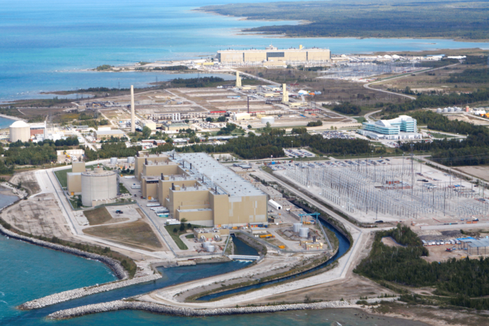 GIS Development Student at Bruce Power
Posted 1 year ago
By Madina Sulaymonova in the McMaster Blog
During the winter of 2022, an amazing opportunity came my way as a co-op student who thrives in expanding her connections and skills in GIS. I landed a position to work at Bruce Power as a GIS Development Student for an 8-month work term. Located on the eastern shore of Lake Huron, Bruce Power is […]
Read More
 ArcGIS in Hydrological Field Data Collection: Reflections on the 2022 Field Season
Posted 1 year ago
By Alex Furukawa in the McMaster Blog
This post is an overview of our research lab’s recent usage of ArcGIS applications, specifically the mobile platform, in the collection of field hydrological data. Our lab, the McMaster Ecohydrology Lab, has integrated ArcGIS in our field data collection since 2018 with the Collector App, and has since shifted to Field Maps in 2021 along […]
Read More
 Unlocking the secrets of glacial retreat using remote sensing: Peru’s Cordillera Blanca
Posted 2 years ago
By Henry Gage in the McMaster Blog
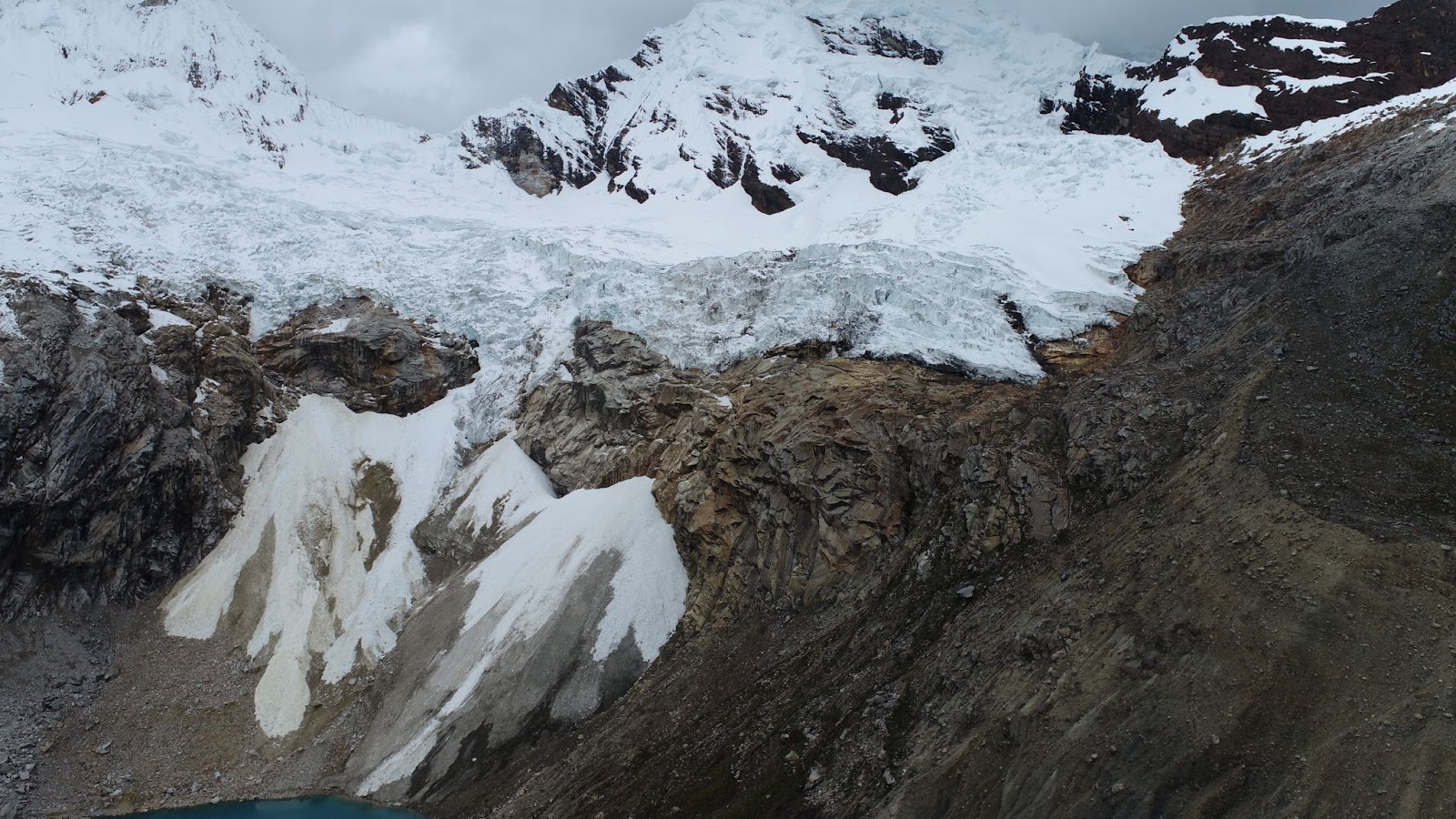
Hi everyone! My name is Henry Gage and I am a fourth year undergraduate student in McMaster’s Integrated Science program. I work in the McMaster Glacial Sedimentology lab, where I study the retreat of tropical glaciers. This summer I had the opportunity to travel to Peru to combine UAV and satellite remote sensing with paleoclimatic […]
Read More
 Do Separated Bike Lanes Increase Bike Share Traffic? Using ArcGIS Pro and ArcPy to determine Hamilton Bike Share’s Ridership Changes
Posted 2 years ago
By Daniel Van Veghel in the McMaster Blog
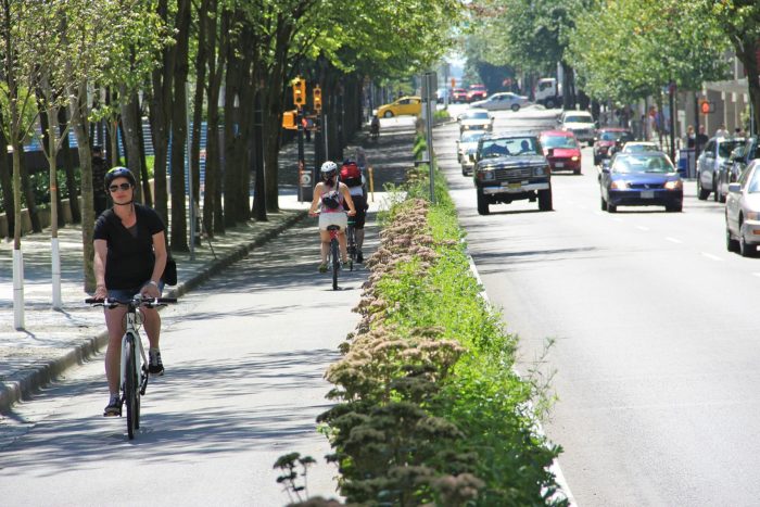
Hi everyone! It’s been a while since my last post, but I’ve been busy working on a component of my MSc thesis at McMaster’s TransLAB (Transportation Research Lab). The research is investigating the impacts of separated cycling infrastructure on Hamilton Bike Share ridership, along the affected road links. Active Transportation, and particularly cycling, are becoming […]
Read More
 Enhancing an Urban Development Proposal using ArcGIS Pro and Online.
Posted 2 years ago
By Syed Hammad Uddin in the McMaster Blog
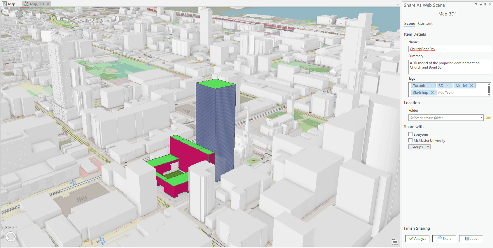
Over the past summer, I had the opportunity to take part in a field course offered by the School of Earth, Environment & Society here at McMaster. This course was an exploration of urban environments and the processes at play within the city of Toronto. We spent three days exploring different neighborhoods and projects within […]
Read More
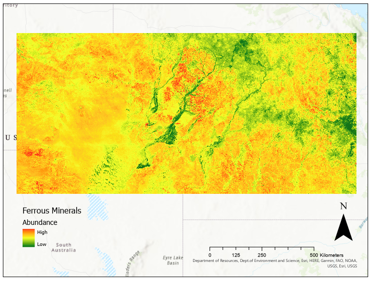 Mineralogical Analysis using Remote Sensing, Machine Learning, and ArcGIS Pro
Posted 3 years ago
By Jonathan Spence in the McMaster Blog
Due to the global pandemic, scientists worldwide have had to find remote alternatives to their usual in-person research. This is no different for geologists, many of whom have not been able to access the field sites they would usually visit to collect data. Thus, many earth scientists have turned to remote sensing as an alternative […]
Read More
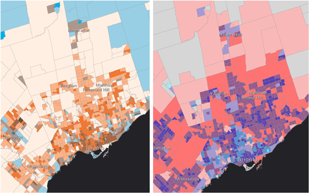 Winning this year’s ECCE app challenge on reducing the unequal exposure to air pollution in Canada
Posted 3 years ago
By Sherry Chen in the McMaster Blog
The ECCE annual app challenge started in 2015 and continued earlier this year (2021). This year was my second time participating. Like last year, we spent the entire week working virtually, which helped reduce commute time but was instead spent waiting for the other person’s screen to unfreeze. I am proud of our team for […]
Read More

