 Winning this year’s ECCE app challenge on reducing the unequal exposure to air pollution in Canada
Posted 3 years ago
By Sherry Chen in the McMaster Blog
The ECCE annual app challenge started in 2015 and continued earlier this year (2021). This year was my second time participating. Like last year, we spent the entire week working virtually, which helped reduce commute time but was instead spent waiting for the other person’s screen to unfreeze. I am proud of our team for […]
Read More
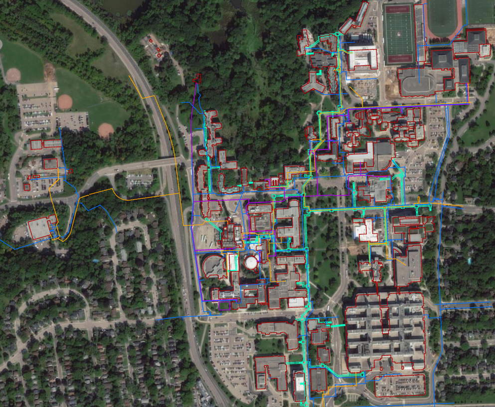 A Geographic Information Systems (GIS) Summer Student in the Department of Facility Services at McMaster University
Posted 3 years ago
By Madina Sulaymonova in the McMaster Blog
This summer I had the great pleasure of being a part of a great team and taking on an amazing opportunity offered by Facility Services at McMaster University as a Geographic Information Systems (GIS) Summer Student for a 4-month work term. This opportunity was brought to my attention by my professor Patrick DeLuca who taught […]
Read More
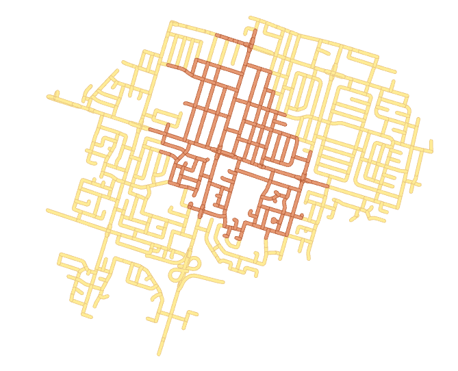 Assessing Carer-Worker Potential Path Areas with Python and ArcGIS Pro
Posted 3 years ago
By Daniel Van Veghel in the McMaster Blog
I’m so excited to be commencing my graduate studies back at McMaster, working in the School of Earth, Environment & Society’s Transportation Research Lab (TransLAB) — where I have the opportunity to pursue interesting research projects about transportation and travel behaviour problems, with GIS. In my last term of undergrad and through this past summer, […]
Read More
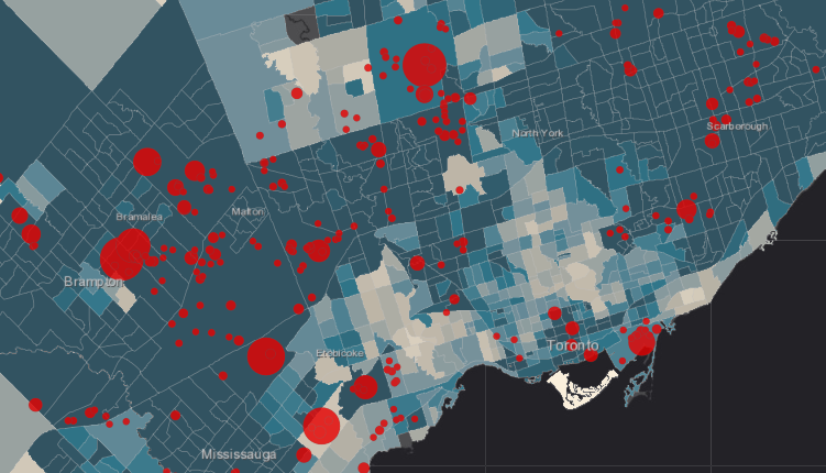
 Team McRaster: Looking Back on the 2021 ECCE App Challenge
Posted 3 years ago
By Angelina Abi Daoud in the McMaster Blog
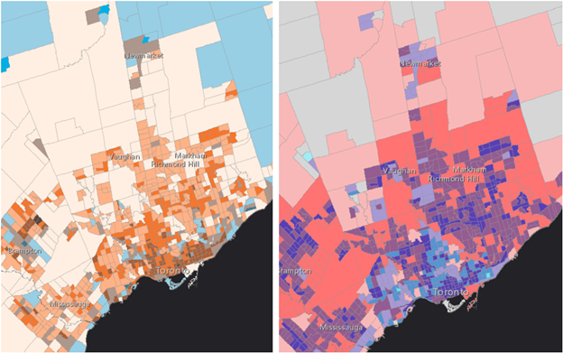
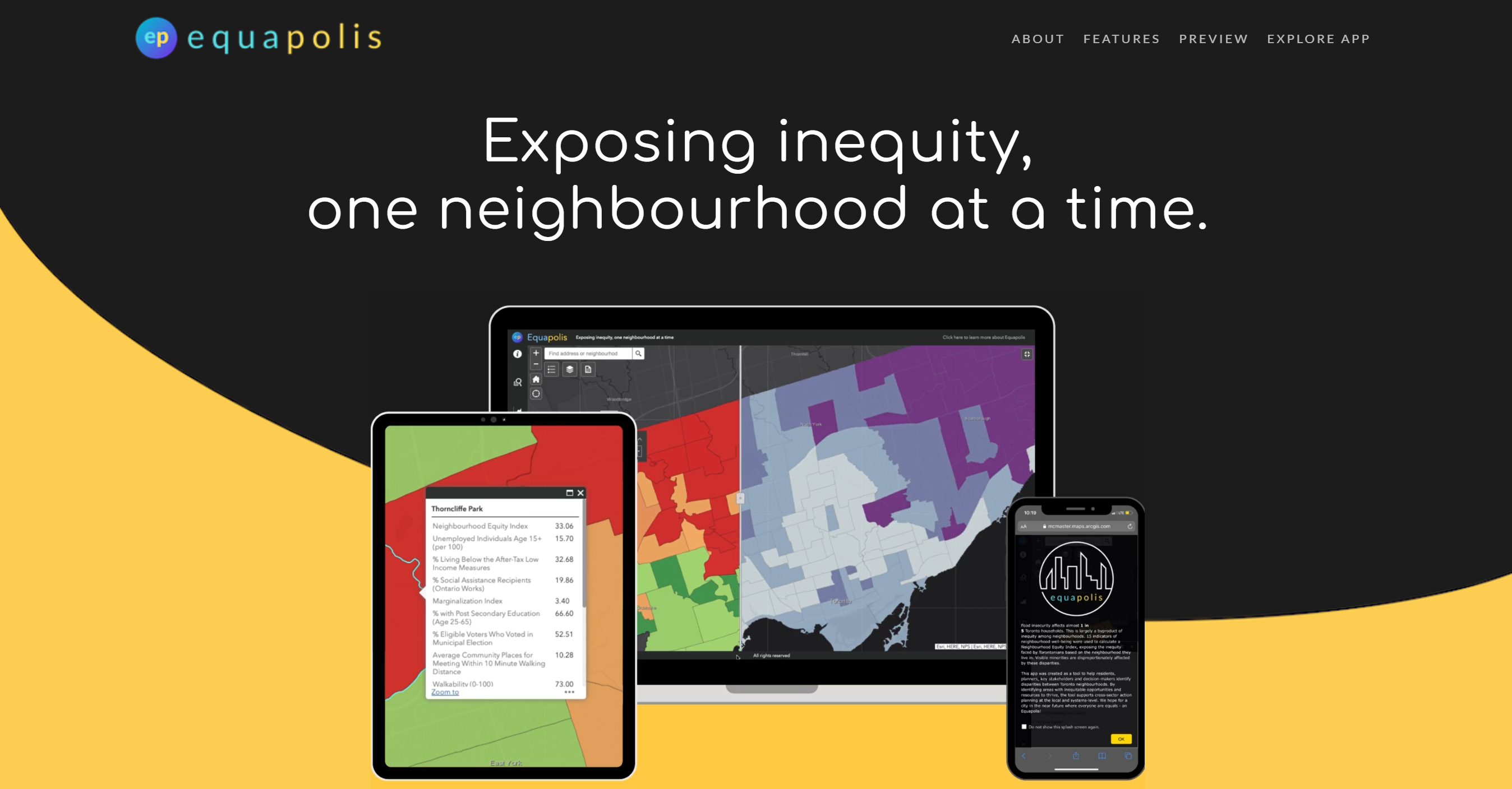
This is a collective look back on the 2021 ECCE App Challenge, co-authored by all three members of our team. In this competition, we produced an app that presents a Neighbourhood Equity Index for the City of Toronto, and ultimately tied as first runners-up. The app we created is called Equapolis.
Read More
 A behind-the-scenes look at one participant’s ECCE App Challenge week.
Posted 3 years ago
By Emma Sherwood in the McMaster Blog
Emma Sherwood, a first-time App Challenge participant, discusses her experience and contributions, and how her team worked together to create their winning ArcGIS Hub and video.
Read More
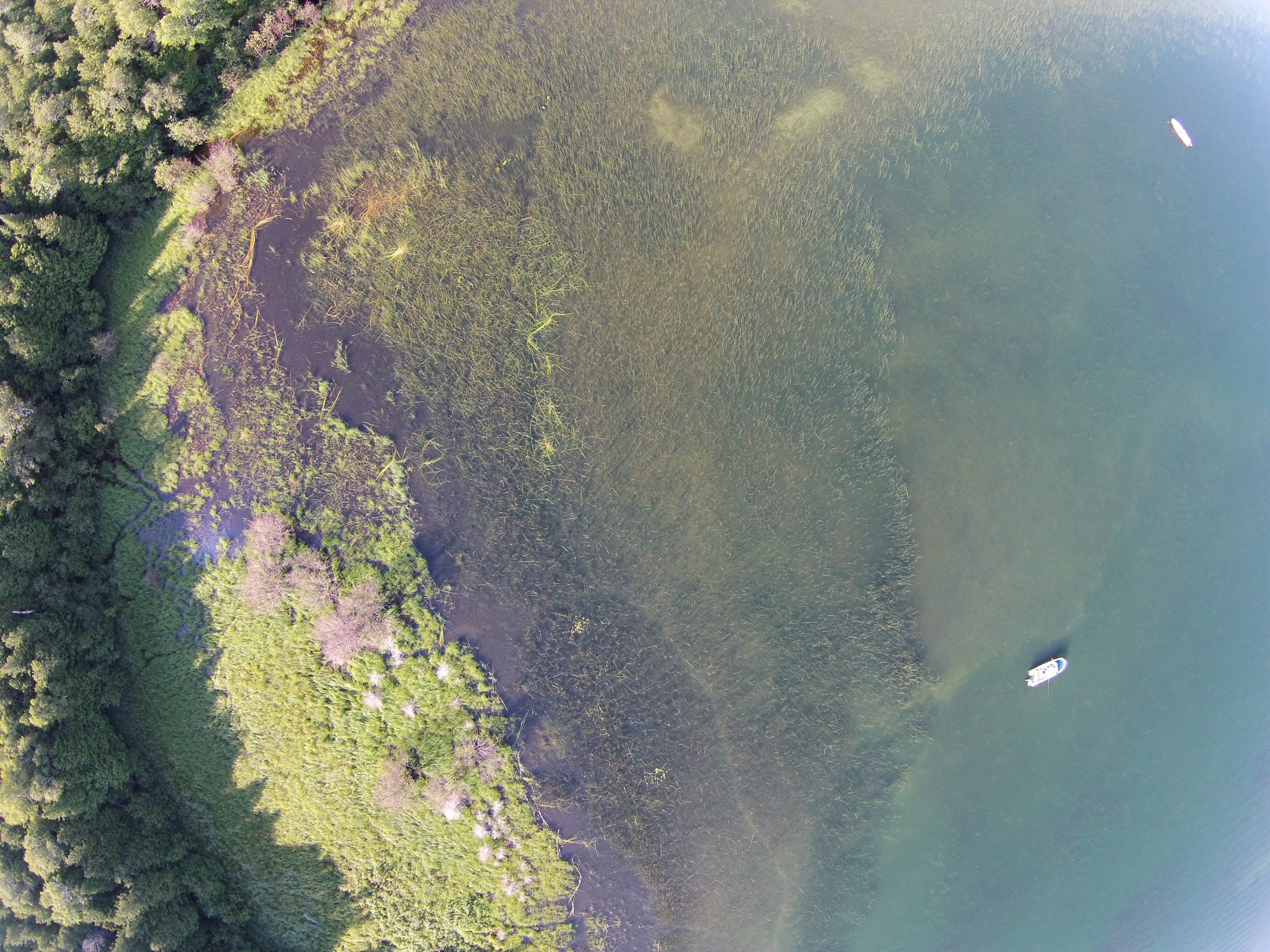 Creating websites using ArcGIS Hub: Atlas of Coastal Wetlands in Georgian Bay
Posted 4 years ago
By Sherry Chen in the McMaster Blog
ArcGIS Hub was used to create our interactive Atlas of Coastal Wetlands in Georgian Bay. For an ecology lab without any programmers or web design specialists, we published an interactive atlas (that is mostly under construction) to present and share qualitative, quantitative, and geographic data collected, published papers, photos and videos of sampling sites, and […]
Read More
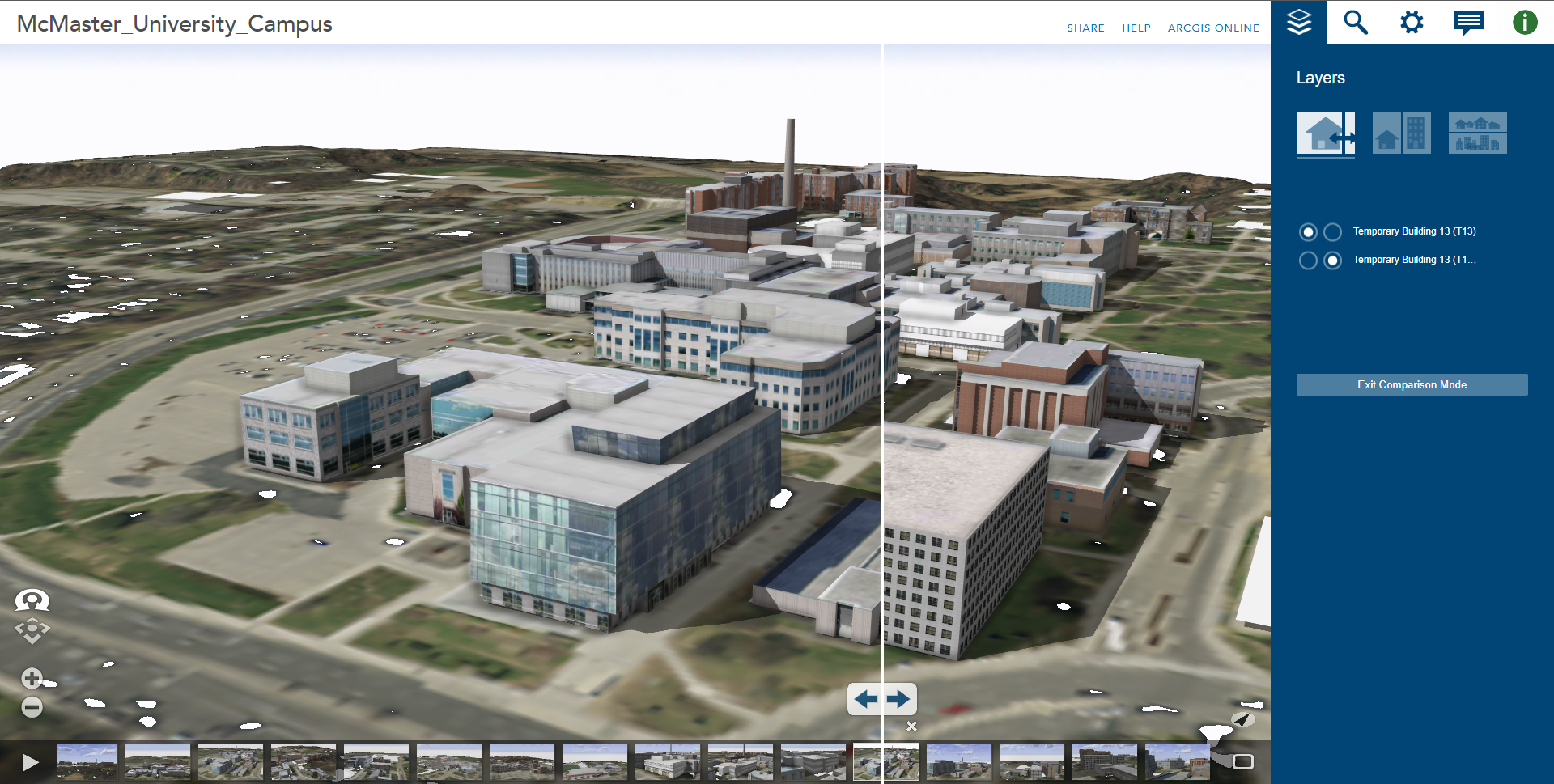 Using ArcGIS CityEngine for GeoDesign on McMaster Campus: Part 2
Posted 4 years ago
By Junli Hu in the McMaster Blog
This article continues from the initial two steps outlined in Part 1, where an initial 3D environment for the McMaster University campus was constructed using digital elevation data, aerial imagery, and 3D models for campus buildings available for download from the SketchUp 3D Warehouse website. In this second part, the remaining steps are outlined, describing […]
Read More
 Using ArcGIS CityEngine for GeoDesign on McMaster Campus: Part 1
Posted 4 years ago
By Junli Hu in the McMaster Blog
Esri’s ArcGIS CityEngine is an advanced three-dimensional (3D) modelling software for creating realistic, interactive, and immersive urban environments (Fabricius, 2020). CityEngine allows users to build entire 3D cities effectively in one step, design urban environments, master 3D content creation, and bring a community vision to life (Fabricius, 2020). If we take a look at case […]
Read More
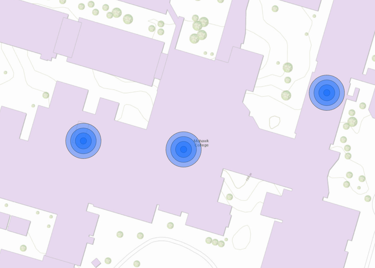 Custom Tools in ArcGIS Pro – An Alternative to the Multiple Ring Buffer Tool
Posted 4 years ago
By Madina Sulaymonova in the McMaster Blog
Various skills and tasks in terms of coding and the use of ArcGIS Pro can be enhanced through a GIS Programming course taught by Dr. Darren Scott. An assignment that caught my attention and would like to share in this article is about the use of custom tools in ArcGIS. Custom tools can be used […]
Read More
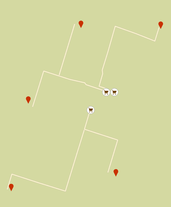 How food secure/insecure are Hamilton’s neighbourhoods? Using Python and ArcGIS’s Network Analyst Module to map Hamiltonians’ access to healthy food
Posted 4 years ago
By Daniel Van Veghel in the McMaster Blog
My name is Daniel Van Veghel, and I am a fourth year Arts & Science student at Mac. I am working to complete my Minor in GIS, and this semester I am taking “GIS Programming” through Mac’s School of Earth, Environment and Society. The course aims to show how Python can be a useful tool […]
Read More

