 Using an ArcGIS Pro Python Noteboook to display results of a GWR model
Posted 3 years ago
By Ben Klar
The Built-in Python notebooks feature in ArcGIS Pro is very useful for creating an automated and reproducible workflow for complex analysis. Personally though, my best use of the ArcPy library in ArcGIS Pro has been for a fairly simple purpose – to create multiple maps iterating over a categorical variable’s values. I often find myself […]
Read More
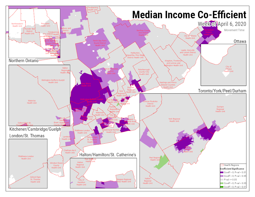
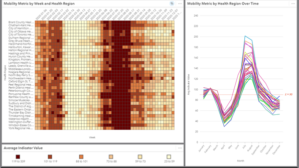 Mobility Patterns During COVID-19 with ArcGIS Insights
Posted 4 years ago
By Ben Klar
I’m sure we’re all well aware of the many impacts that COVID-19 has had on our typical lives. Working from home, attending school from home, and limits on social gatherings have significantly reduced our mobility. The Geospatial Lab at Western University has been working on a project to look at how mobility has changed over […]
Read More
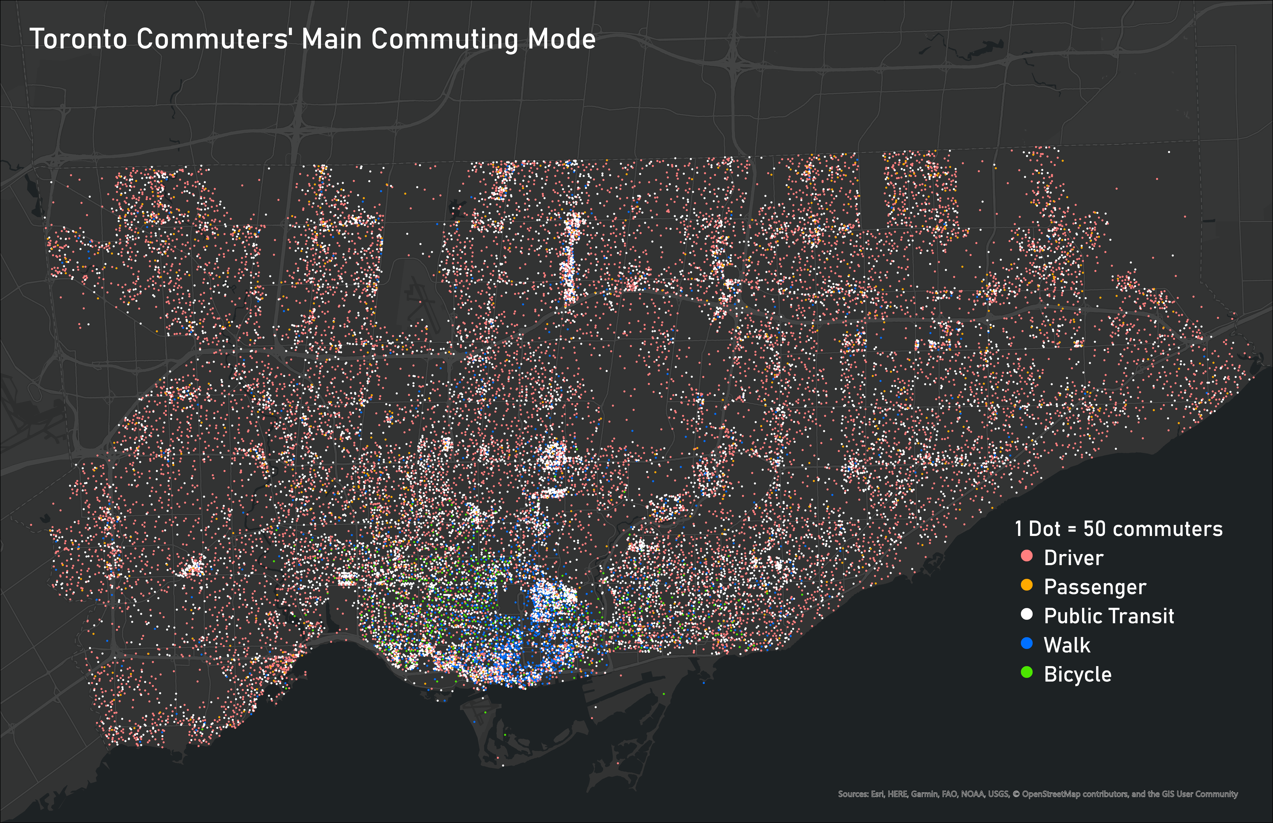 Ideas for Displaying Categorical and Time-Based Data
Posted 4 years ago
By Ben Klar
Deciding the best way to visualize your data is one of the most important steps in making sure that message is clear and understood by the reader. But when you are working with many different variables, it can be challenging to display them all together on one map to show the connections between different categorical […]
Read More

