 Readability
Posted 4 years ago
By Johnny Chang in the COGS Blog
Something I’ve always struggled with, going back to when I was getting my Bachelors in Computer Science, was balancing elegance and readability when writing code. There’s something deeply satisfying, to me at least, in condensing 30 lines down to 3. Or eliminating it altogether! During my first coop term, in a story for another day, […]
Read More
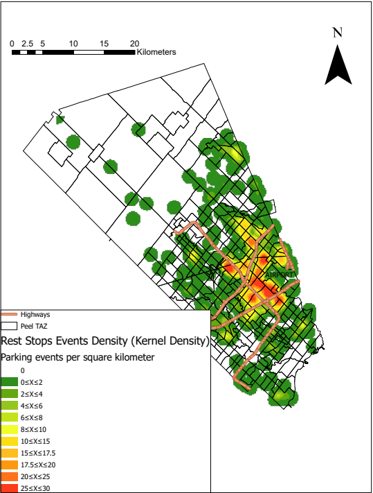 Distribution of Truck Rest Events in the Region of Peel
Posted 4 years ago
By Elanakayon Annalingam in the YorkU Blog
For long-haul truck drivers finding space to rest is a major issue. They face many hours-of-service regulations that present issues for accessing rest at different periods throughout the day. Areas of considerable freight activity need to focus on addressing these needs. The Region of Peel contains the municipalities of Mississauga, Brampton, and Caledon and is […]
Read More
 Presenting at GIS Day 2020
Posted 4 years ago
By Jack McIlraith in the Western Blog
Like all other events, whether professional, academic or even social, GIS day events at Western went online this year. The organizers of GIS day at Western, Western Libraries, put together four days of free online lightning talks, workshops, demonstrations and networking sessions. Due to the online format, students and professionals from across and even outside […]
Read More
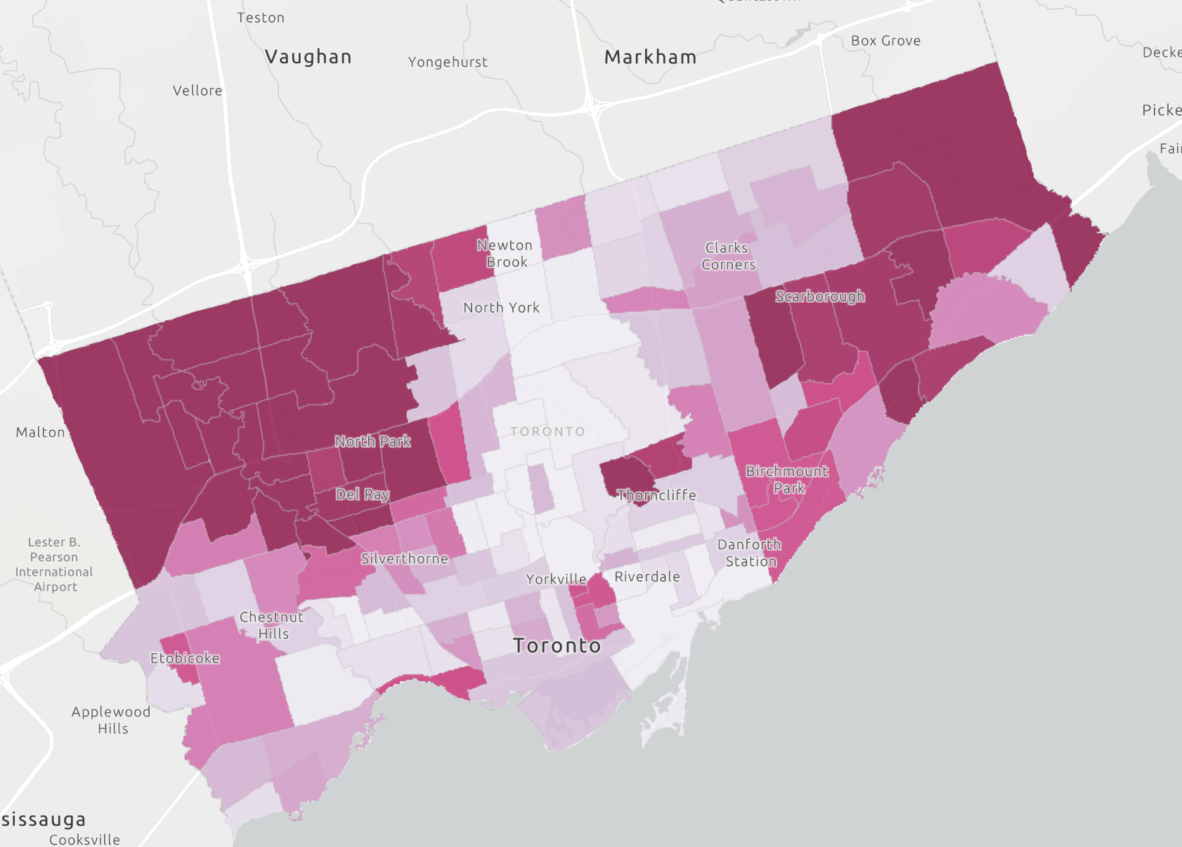 Using Geoenrichment to analyze socioeconomic factors affecting the spread of COVID-19 in Toronto, Ontario.
Posted 4 years ago
By Caitlyn North in the Western Blog
Using Geoenrichment to analyze the spread of COVID-19 in Toronto, Ontario
Read More
 A ‘Mind Map’ of GIScience Basics
Posted 4 years ago
By Erin Li in the UCalgary Blog
This ‘mind map’ was originally created for my PhD candidacy exam preparation, to help me organize, understand, and memorize knowledge and concepts regarding GIScience. The ‘mind map’ includes four main parts: architecture design, database management systems, geospatial data, and data manipulation. Additionally, I briefly went over the basic concepts and technologies of photogrammetry and digital […]
Read More
 Exploring NDVI using ArcGIS Online
Posted 4 years ago
By Nicole Moguilevskaia in the UofT Blog
Hi everyone! My name is Nicole and I am a third year GIS major at the University of Toronto. As part of my degree, I get to take many fascinating courses related to GIS. This past semester, I completed GGR337: Environmental Remote Sensing. The course highlighted things such as satellite sensors, digital image processing, and […]
Read More
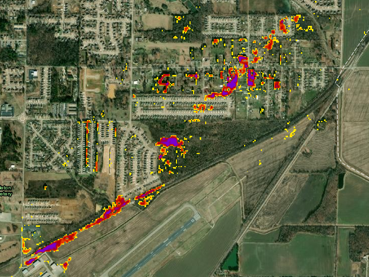
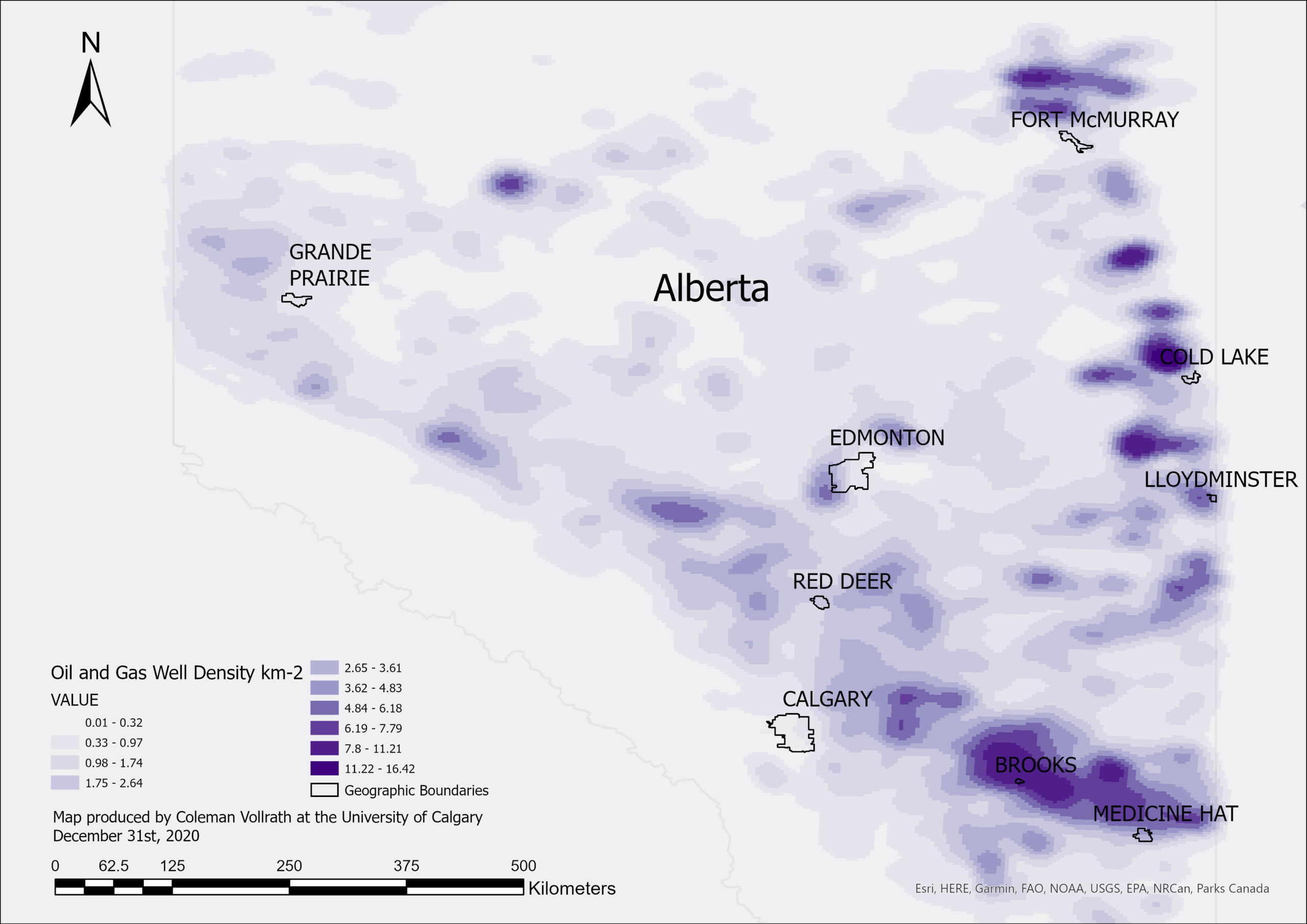 Identifying Dense Oil and Gas Producing Regions for Methane Emissions Verification Screenings in Alberta, Canada Using ArcGIS Pro
Posted 4 years ago
By Coleman Vollrath in the UCalgary Blog
Identifying dense oil and gas producing regions in Alberta for methane emissions verification screenings with kernel density analysis
Read More
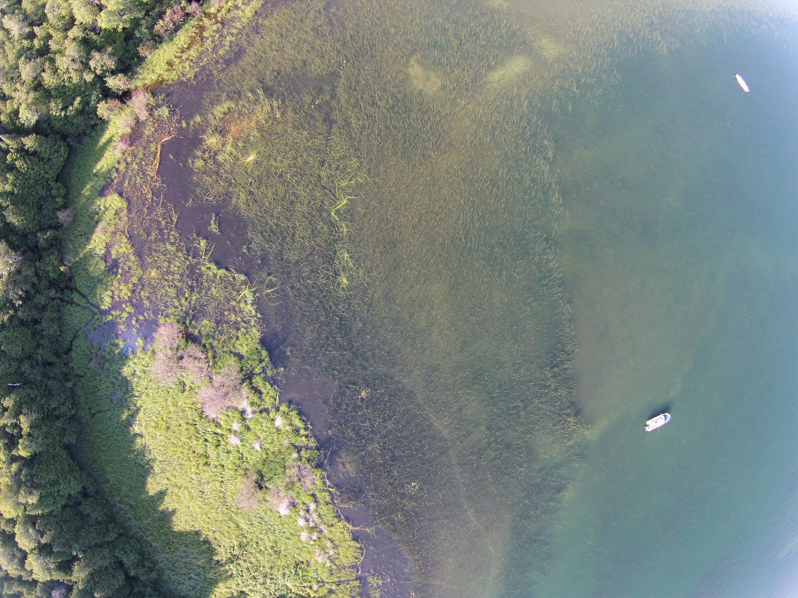 Creating websites using ArcGIS Hub: Atlas of Coastal Wetlands in Georgian Bay
Posted 4 years ago
By Sherry Chen in the McMaster Blog
ArcGIS Hub was used to create our interactive Atlas of Coastal Wetlands in Georgian Bay. For an ecology lab without any programmers or web design specialists, we published an interactive atlas (that is mostly under construction) to present and share qualitative, quantitative, and geographic data collected, published papers, photos and videos of sampling sites, and […]
Read More
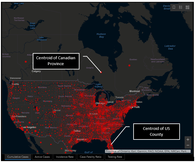 Geovisualization of Health Data: Some examples from COVID-19 maps.
Posted 4 years ago
By Beau Ahrens in the Dalhousie Blog
With the proliferation of COVID-19 geovisualization, also comes fundamental problems with the way these maps are presenting information to the viewer.
Read More
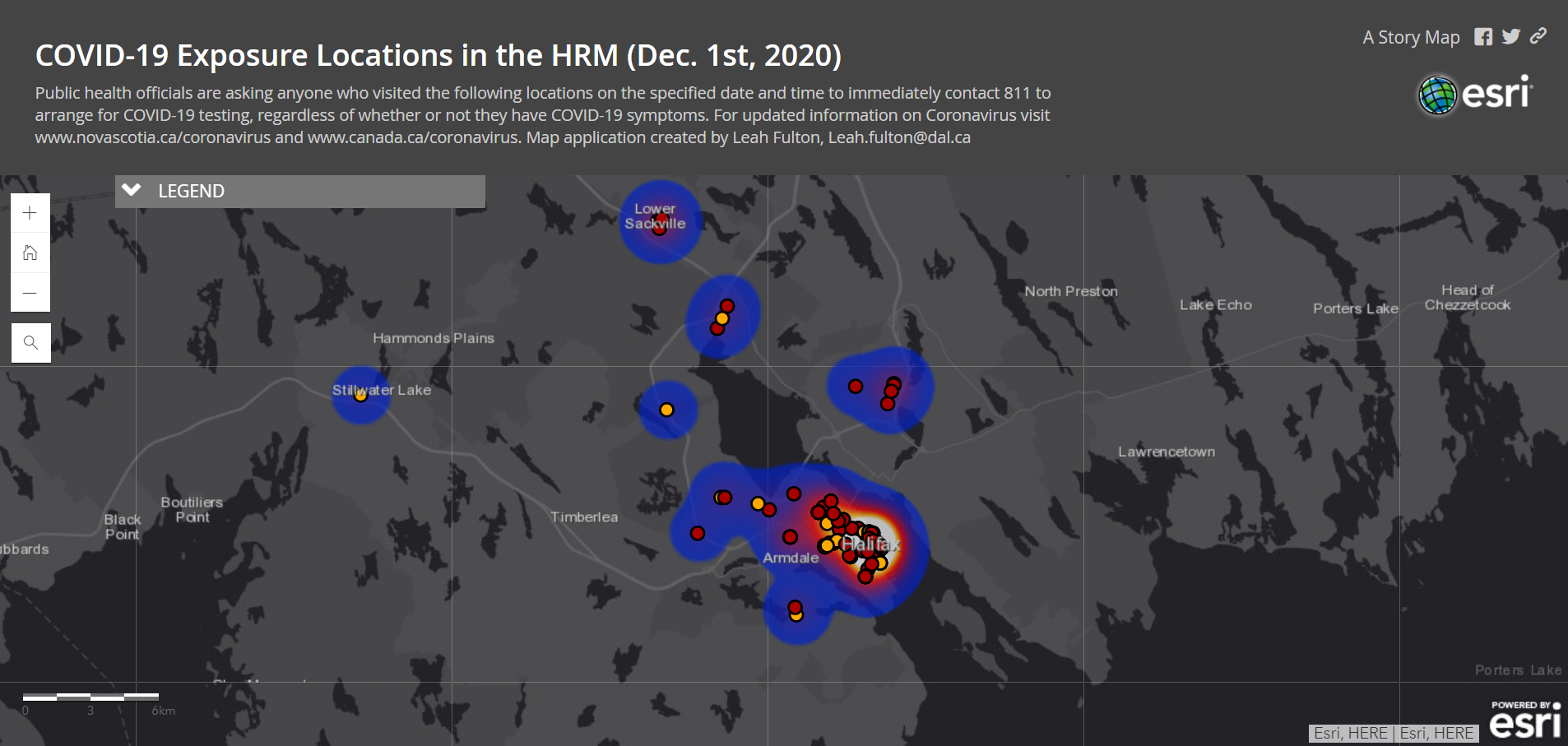 Transforming COVID-19 Data into Web Mapping Applications.
Posted 4 years ago
By Leah Fulton in the Dalhousie Blog
Geography has played a significant role throughout the COVID-19 pandemic, both locally and globally. With a second wave on the rise, understanding where COVID-19 exposure sites are is essential reducing community spread. Governments have been providing updated information regarding COVID exposure sites to increase public awareness. In Nova Scotia, such data includes the date, time, […]
Read More

