 From Digital Chaos to Structure: How GIS Taught Me the Importance of Data Management
Posted 1 year ago
By Molly Ingenmey in the COGS Blog
This blog post is a reflection on how over the course of this year I have learned to embrace data management, instead of disregarding it.
Read More
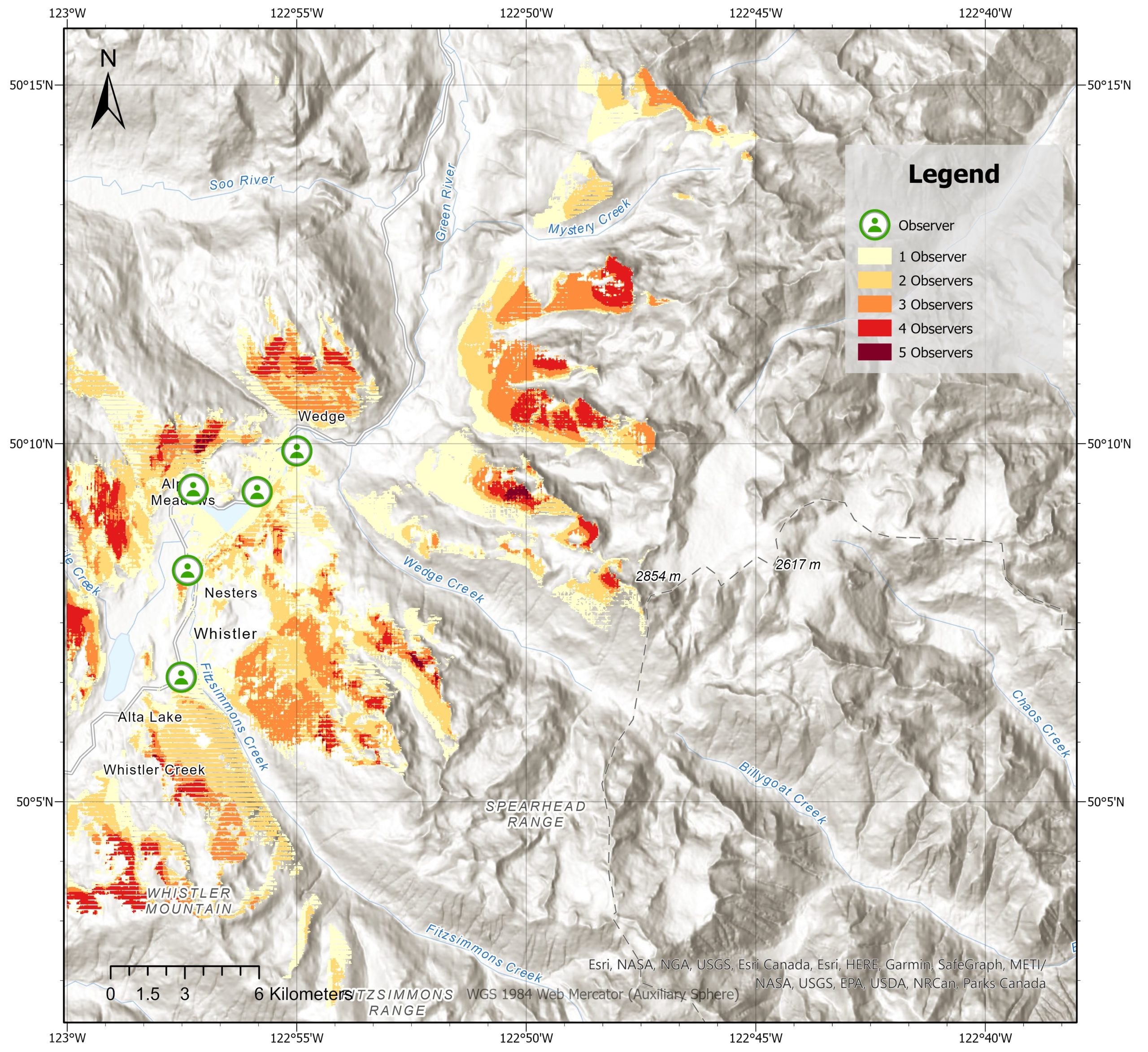 Analyzing Spatial Relationships in Mountain Regions: Visibility and Distance Analysis
Posted 1 year ago
By François d'Entremont in the COGS Blog
Are you ready to be blown away by the magnificent mountains of Whistler, British Columbia? Whistler is not only famous for its stunning landscape and outdoor activities but also for being an excellent site for analyzing spatial relationships. In this blog post, we will delve into the importance of visibility and distance analysis in mountainous […]
Read More
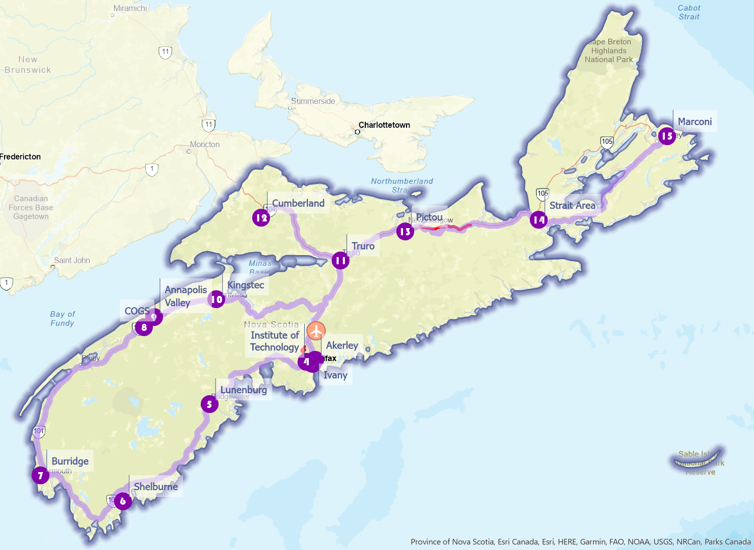 NSCC Campus Crawl – A Nova Scotia Route Optimization Guide
Posted 1 year ago
By Cindy Lu in the COGS Blog
In one of our Location Analytics course projects, we are asked to utilize ArcGIS Pro Network Analyst extension to identify optimal routes for subjects of our interest. Travelling has always been my passion, but logistics planning can be tricky: within a limited timeframe, how can one maximize their travel footprint? Given the landscape and infrastructure […]
Read More
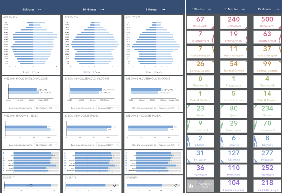 Diving into ArcGIS Business Analyst
Posted 1 year ago
By Cindy Lu in the COGS Blog
As a student in the Geospatial Data Analytics program at COGS, I had the opportunity to explore the capabilities of the Esri Business Analyst extension in ArcGIS Pro. I was impressed by how the platform draws from various data sources to provide a comprehensive tool for users to incorporate various demographic variables and business profiles […]
Read More
 Fantasy Maps in ArcGIS Pro using Digital Elevation Models
Posted 2 years ago
By Connor Dalzell in the COGS Blog
Feeling creative? Here’s a quick tutorial on turning DEM’s into vibrant fantasy maps!
Read More
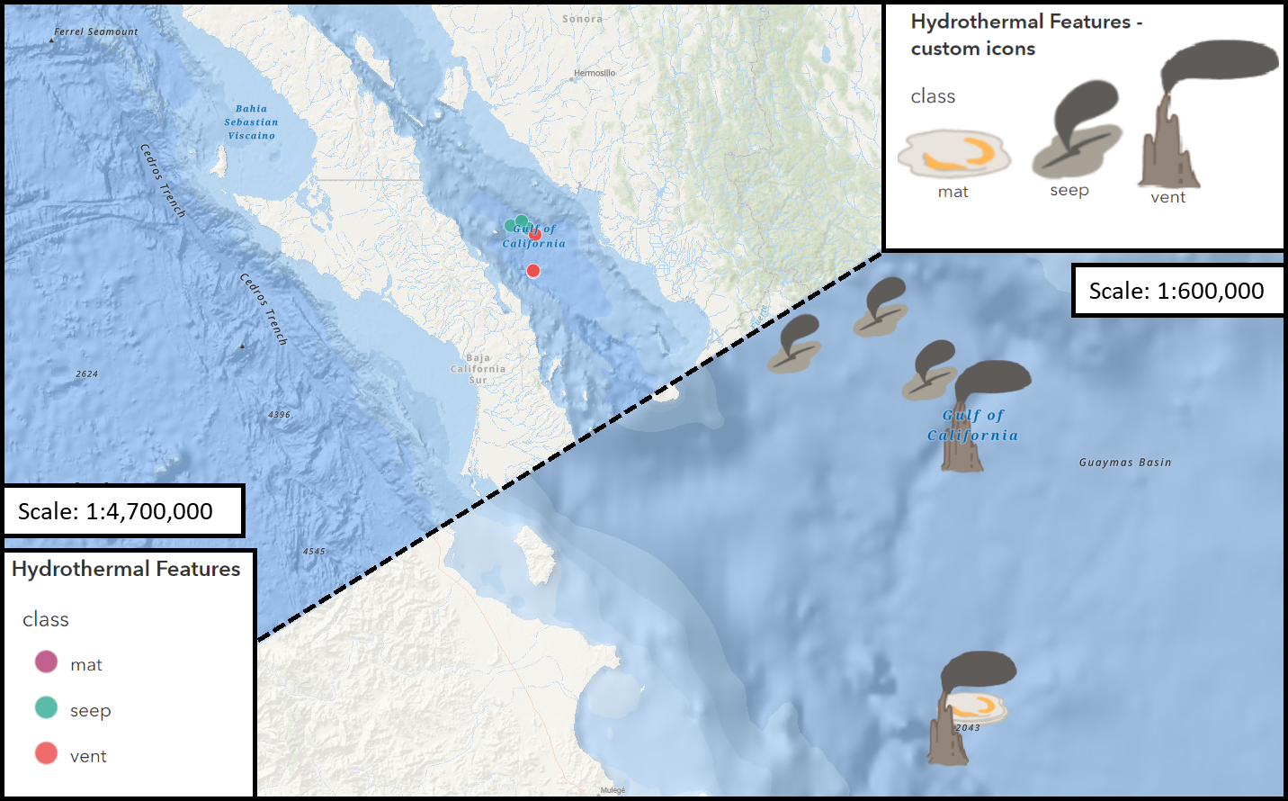 Working with Custom Picture Markers – Seafloor Hydrothermal Features
Posted 3 years ago
By Connor Dalzell in the COGS Blog
My first foray into creating custom image icons for points in ArcGIS pro... and a few lessons I learned along the way!
Read More
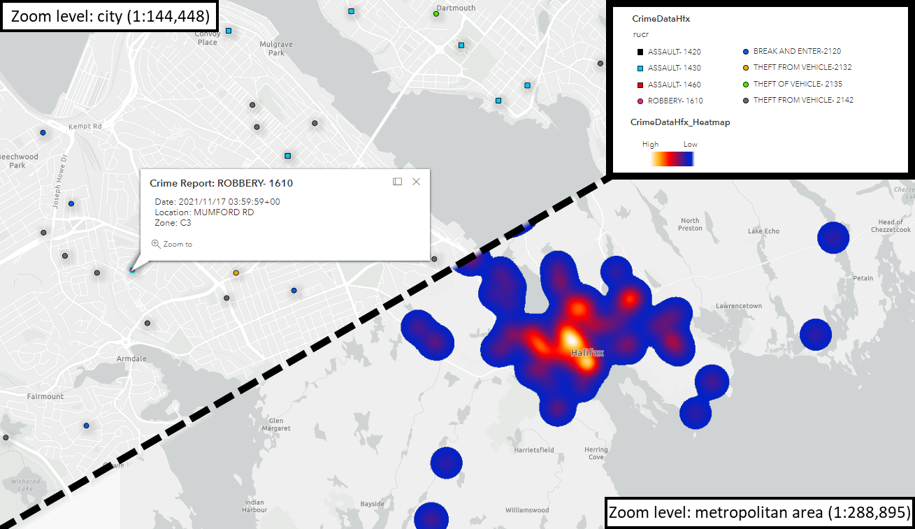 Assessing Crime in Halifax – from Spreadsheet to Web Map
Posted 3 years ago
By Connor Dalzell in the COGS Blog
My first foray into adapting datasets for Web Mapping! Here, I walk through the process of modifying a .csv of reported crimes in Halifax, using Excel and ArcGIS Pro, for display in ArcGIS Online.
Read More
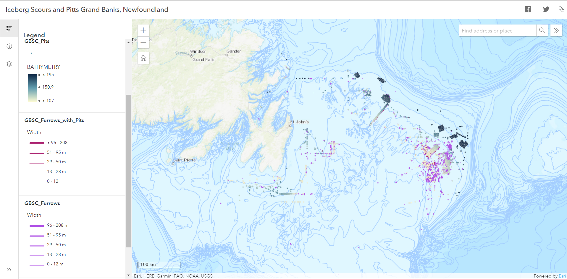 Orientation Analysis of Iceberg Scours and Pits on the Grand Banks of Newfoundland Using ArcGIS Pro and Online
Posted 3 years ago
By Laura Sinclair in the COGS Blog
While studying for my final exams, I decided to try out some of the ArcGIS techniques that I learned this past term. I am in my first term of the Advanced Certificate program in GIS at COGS and have learned many new skills over the semester that I will have to understand well to apply […]
Read More
 Cleaning data is your friend
Posted 3 years ago
By Madeline Lawler in the COGS Blog
In a perfect world, a geospatial project would be provided with data that requires no additional cleaning. You could start mapping or executing an analysis from the get-go with the initial data, saving a lot of time, energy, and brain power. The above scenario is rarely the case, as most GIS practitioners know. It is […]
Read More
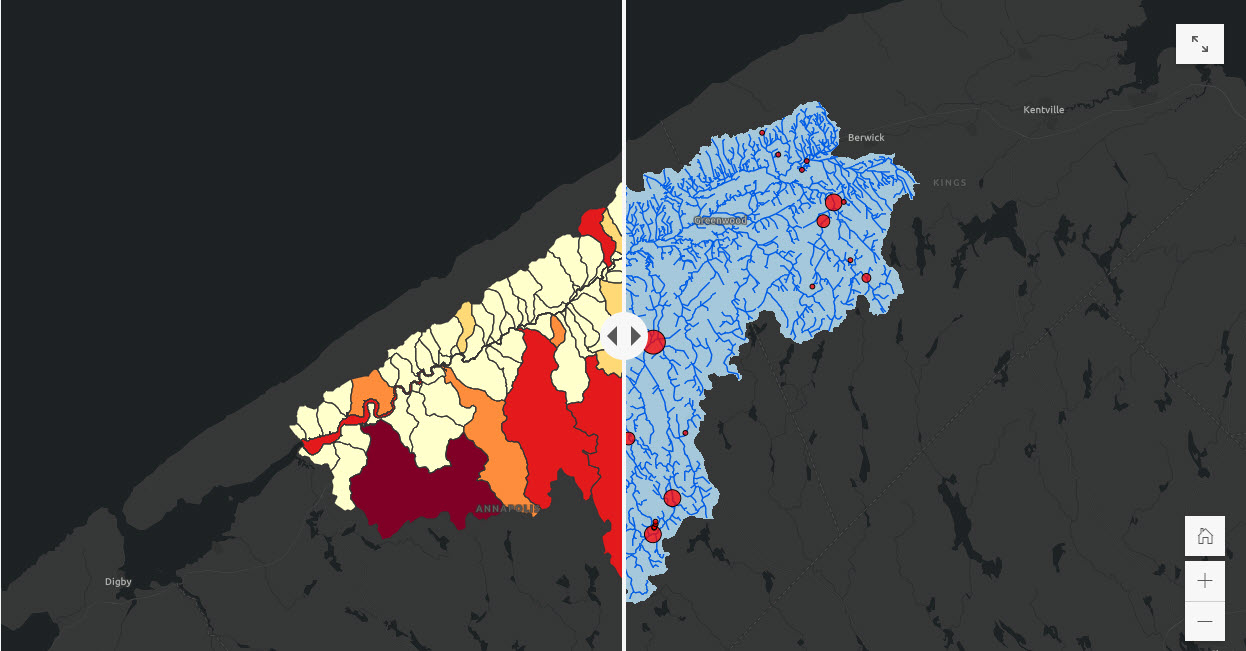
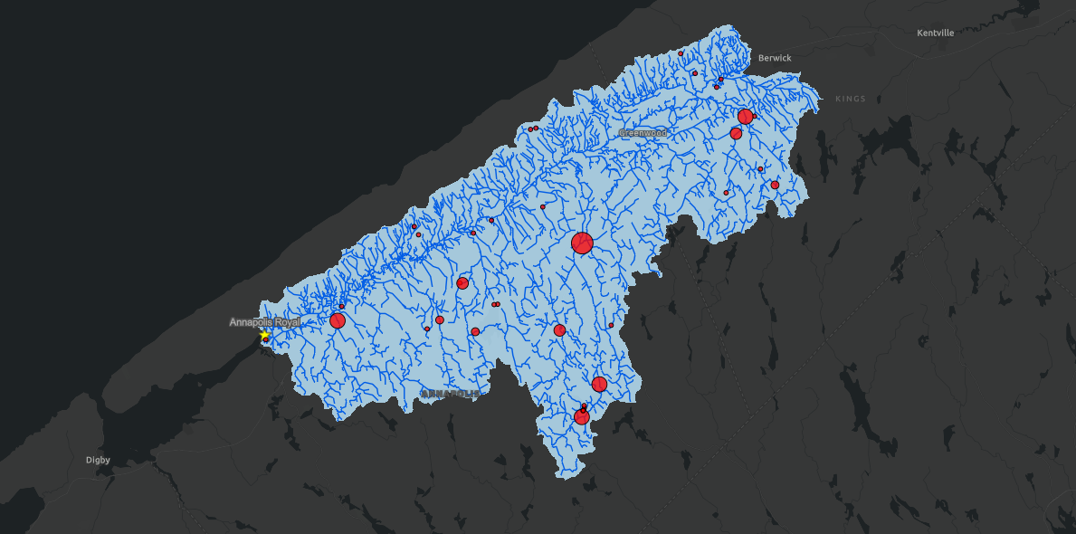 Assessing fish passage in Nova Scotia
Posted 3 years ago
By Madeline Lawler in the COGS Blog
While exploring different options for my capstone project, I was approached by the Department of Fisheries and Oceans in assessing fish passage or the ease of migration for saltwater to freshwater migratory fish species in Nova Scotia.
Read More

