
 Creating an Animated Map of Oil and Gas Drilling Activity in Alberta, Canada with ArcGIS Pro
Posted 3 years ago
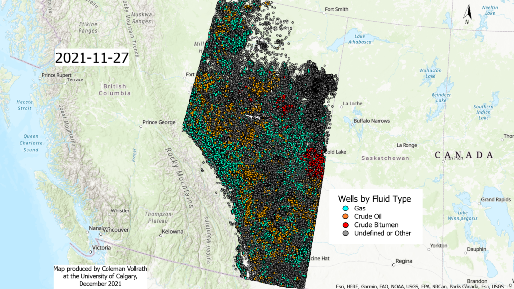
Creating an animated map of oil and gas drilling activity in Alberta, Canada with ArcGIS Pro
 Creating an Animated Map of Oil and Gas Drilling Activity in Alberta, Canada with ArcGIS Pro
Posted 3 years ago
Creating an animated map of oil and gas drilling activity in Alberta, Canada with ArcGIS Pro
 Reflecting on the 2021 ECCE App Challenge
Posted 3 years ago
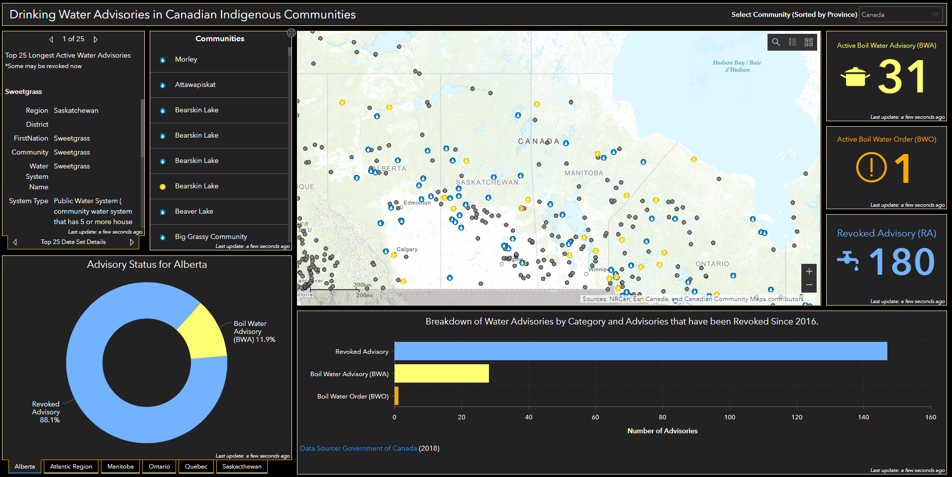
Reflecting on the 2021 ECCE App Challenge as a first-timer where we mapped the problem that Indigenous Canadians continue to face accessing clean water.
 Identifying Dense Oil and Gas Producing Regions for Methane Emissions Verification Screenings in Alberta, Canada Using ArcGIS Pro
Posted 4 years ago
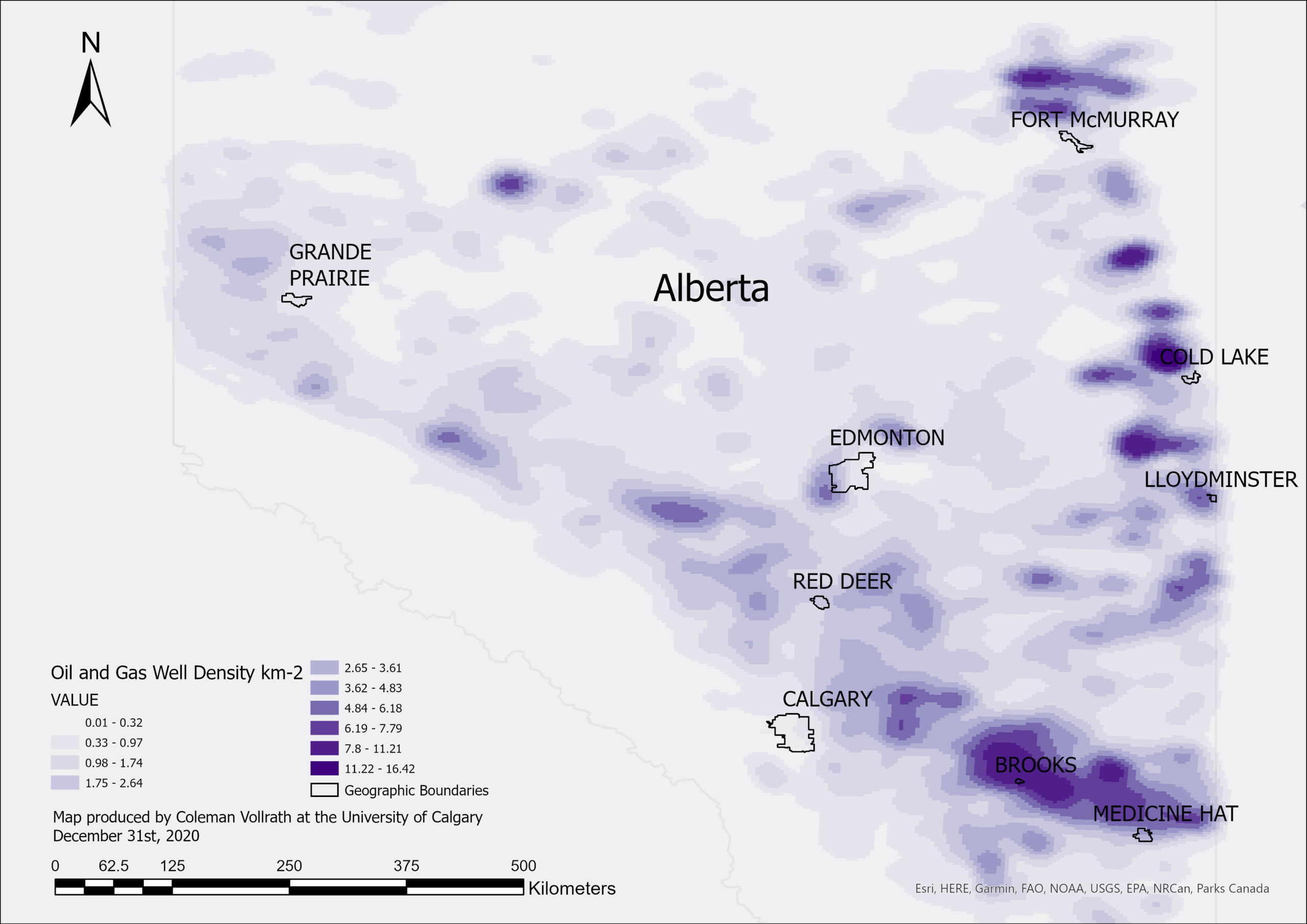
Identifying dense oil and gas producing regions in Alberta for methane emissions verification screenings with kernel density analysis
 Visualizing Geolocated Methane Concentration Measurements in ArcGIS Pro
Posted 4 years ago
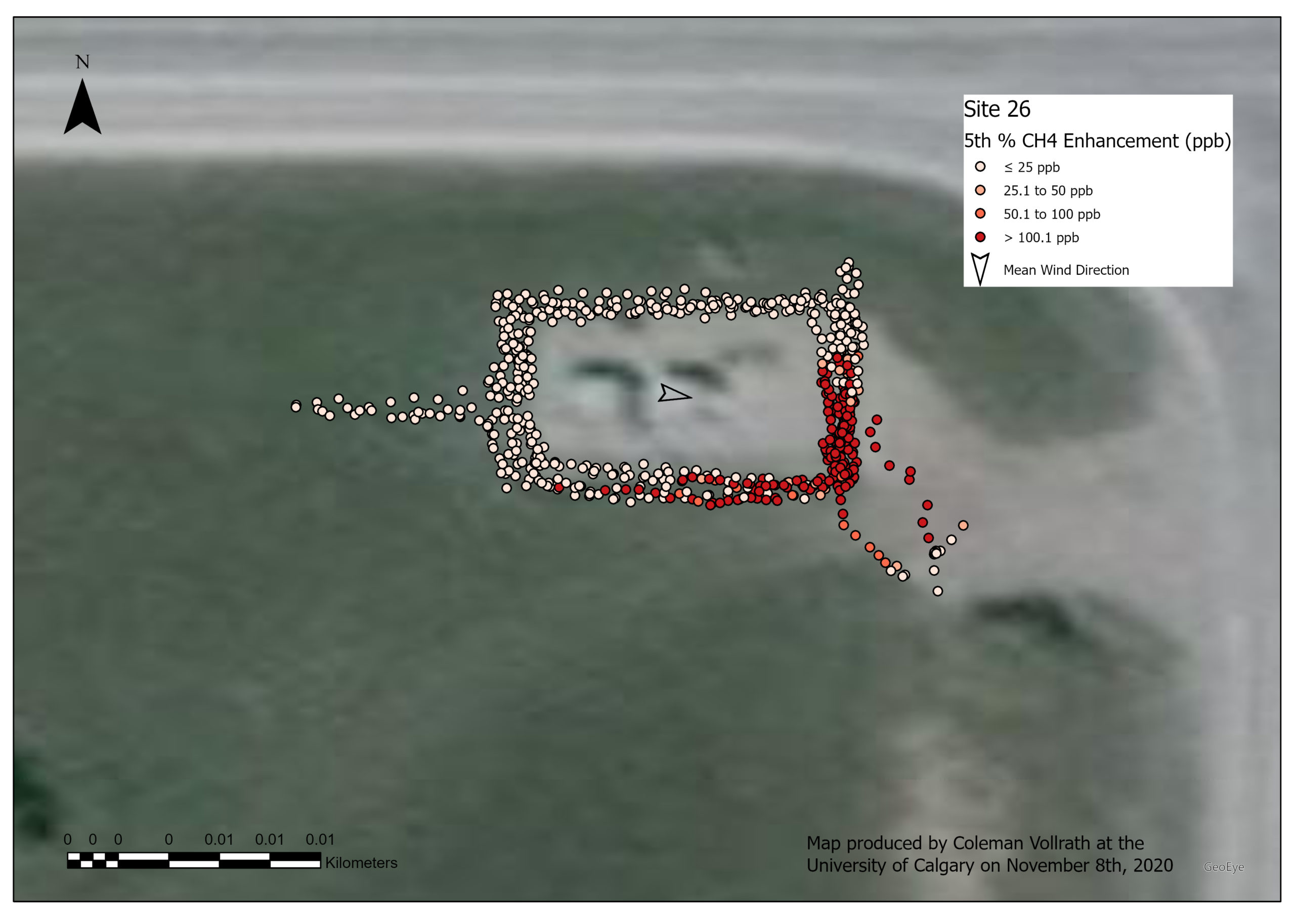
How to use ArcGIS Pro for concentration mapping of methane concentrations measured with a portable device, helping to detect methane leaks from oil and gas production facilities.