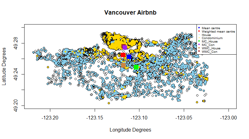
 Analyzing the Distribution of Houses and Condominiums of Vancouver Airbnb
Posted 3 years ago
By Sana Hashim in the UofT Blog
This blog post is about my first spatial data science assignment. The purpose of this assignment was to map out the location the Vancouver Airbnb and analyze the various trends of the properties, specifically the House and Condominiums. I was given a non-spatial csv file that contained the ID, Property Type (House or Condominium), Room Type, Bedroom Numbers, Price, and Review Scores of 5,618 properties. The very first thing I […]
Read More
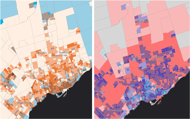
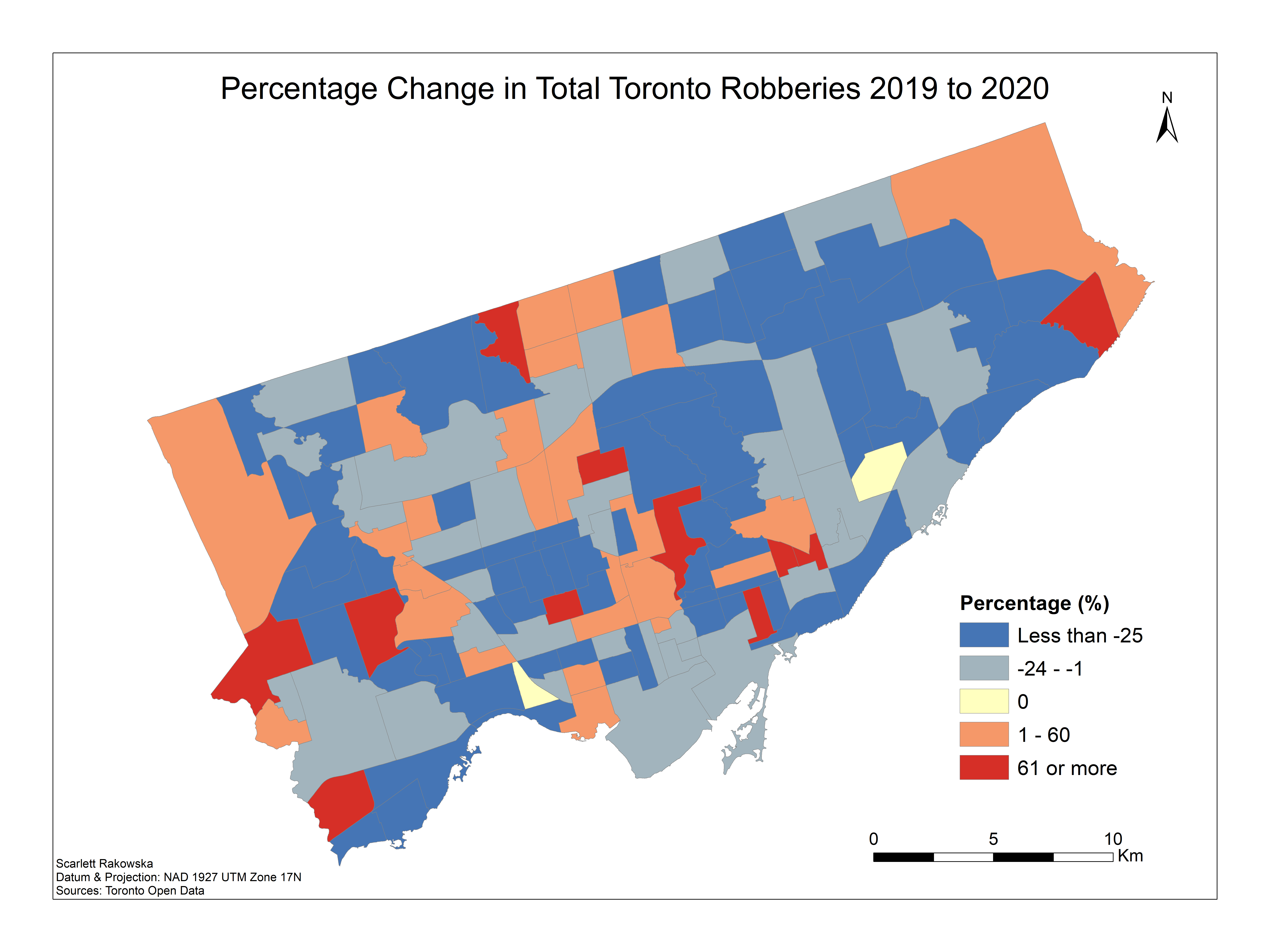 Analyzing the Change in Toronto Crime Data from COVID-19
Posted 3 years ago
By Scarlett Rakowska in the UofT Blog
About a year ago, I wrote a blog post analyzing Toronto Crime Data using Kernel Density from the 2019 data of major crime indicators. After the COVID-19 restrictions were put in place in March 2020 for the city of Toronto, I was curious to see the changes in crime in Toronto from 2019 to 2020. […]
Read More
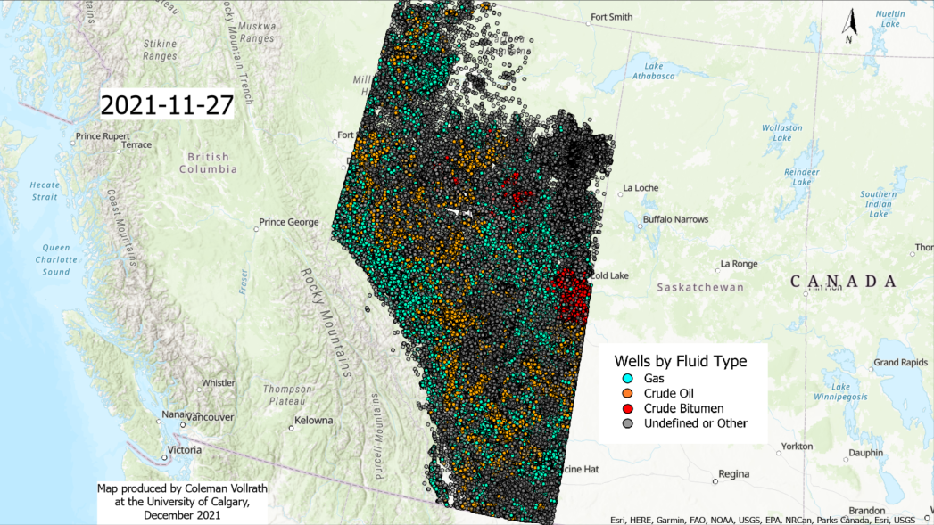 Creating an Animated Map of Oil and Gas Drilling Activity in Alberta, Canada with ArcGIS Pro
Posted 3 years ago
By Coleman Vollrath in the UCalgary Blog
Creating an animated map of oil and gas drilling activity in Alberta, Canada with ArcGIS Pro
Read More
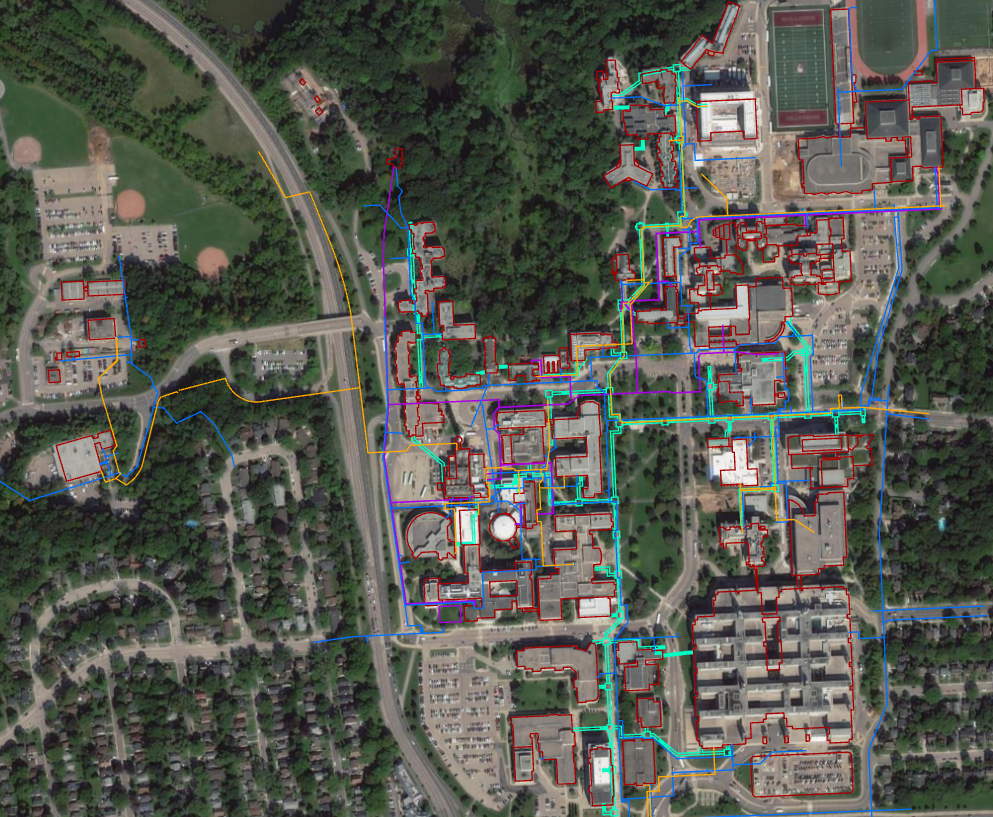
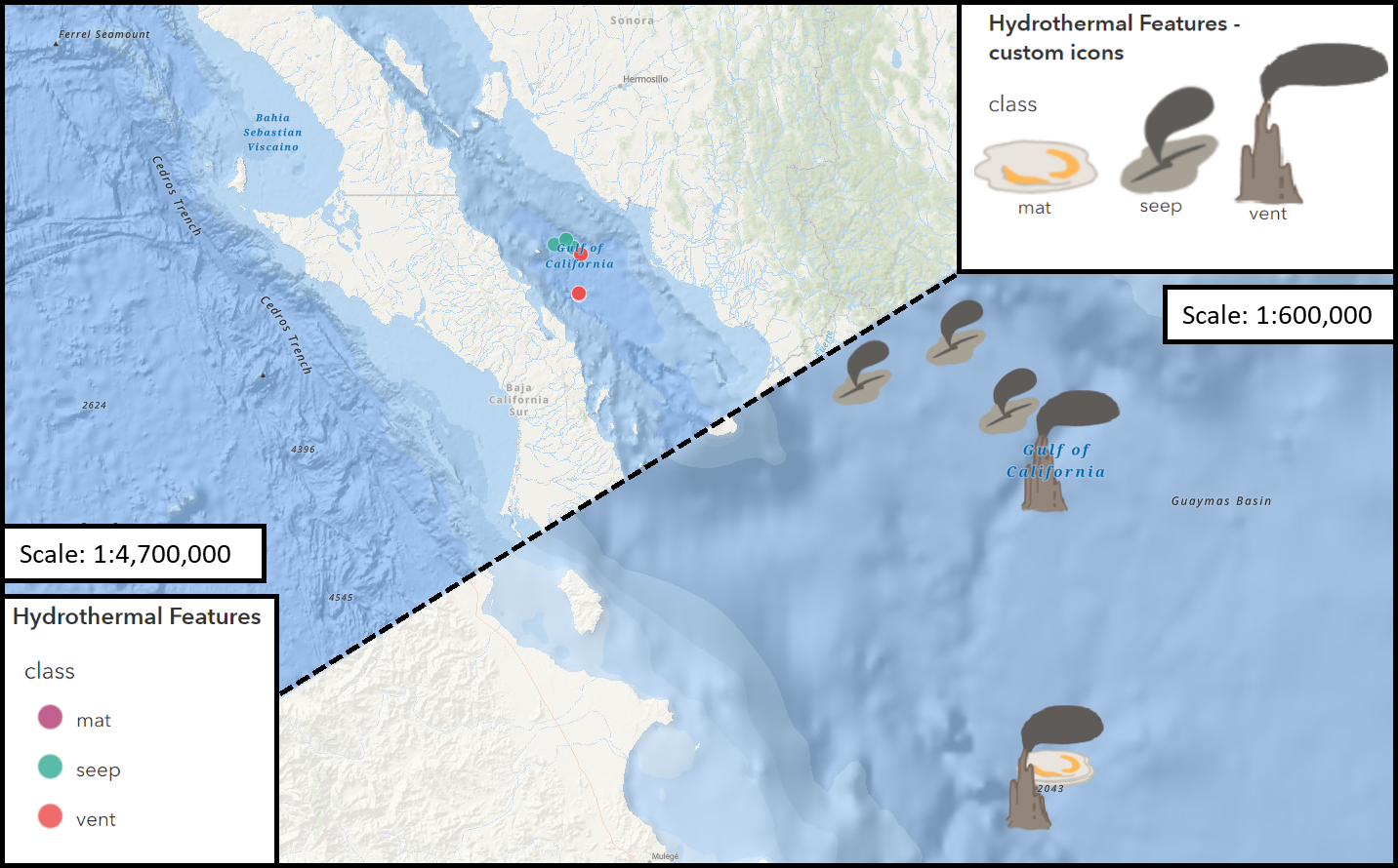 Working with Custom Picture Markers – Seafloor Hydrothermal Features
Posted 3 years ago
By Connor Dalzell in the COGS Blog
My first foray into creating custom image icons for points in ArcGIS pro... and a few lessons I learned along the way!
Read More
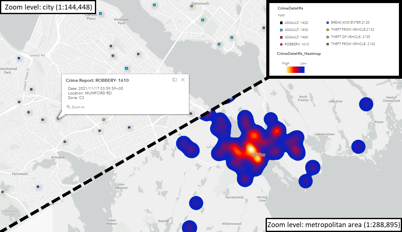 Assessing Crime in Halifax – from Spreadsheet to Web Map
Posted 3 years ago
By Connor Dalzell in the COGS Blog
My first foray into adapting datasets for Web Mapping! Here, I walk through the process of modifying a .csv of reported crimes in Halifax, using Excel and ArcGIS Pro, for display in ArcGIS Online.
Read More
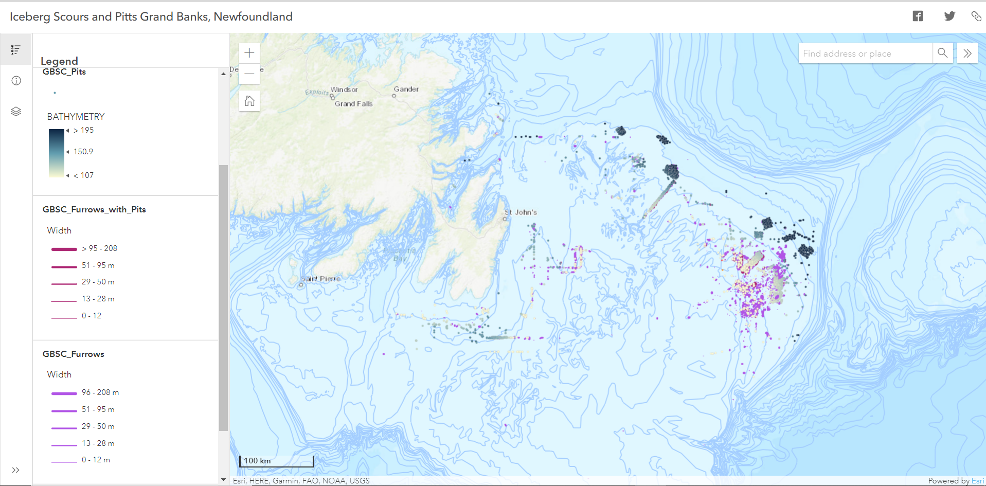 Orientation Analysis of Iceberg Scours and Pits on the Grand Banks of Newfoundland Using ArcGIS Pro and Online
Posted 3 years ago
By Laura Sinclair in the COGS Blog
While studying for my final exams, I decided to try out some of the ArcGIS techniques that I learned this past term. I am in my first term of the Advanced Certificate program in GIS at COGS and have learned many new skills over the semester that I will have to understand well to apply […]
Read More
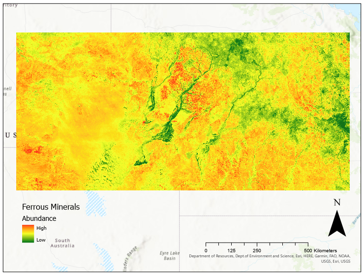 Mineralogical Analysis using Remote Sensing, Machine Learning, and ArcGIS Pro
Posted 3 years ago
By Jonathan Spence in the McMaster Blog
Due to the global pandemic, scientists worldwide have had to find remote alternatives to their usual in-person research. This is no different for geologists, many of whom have not been able to access the field sites they would usually visit to collect data. Thus, many earth scientists have turned to remote sensing as an alternative […]
Read More
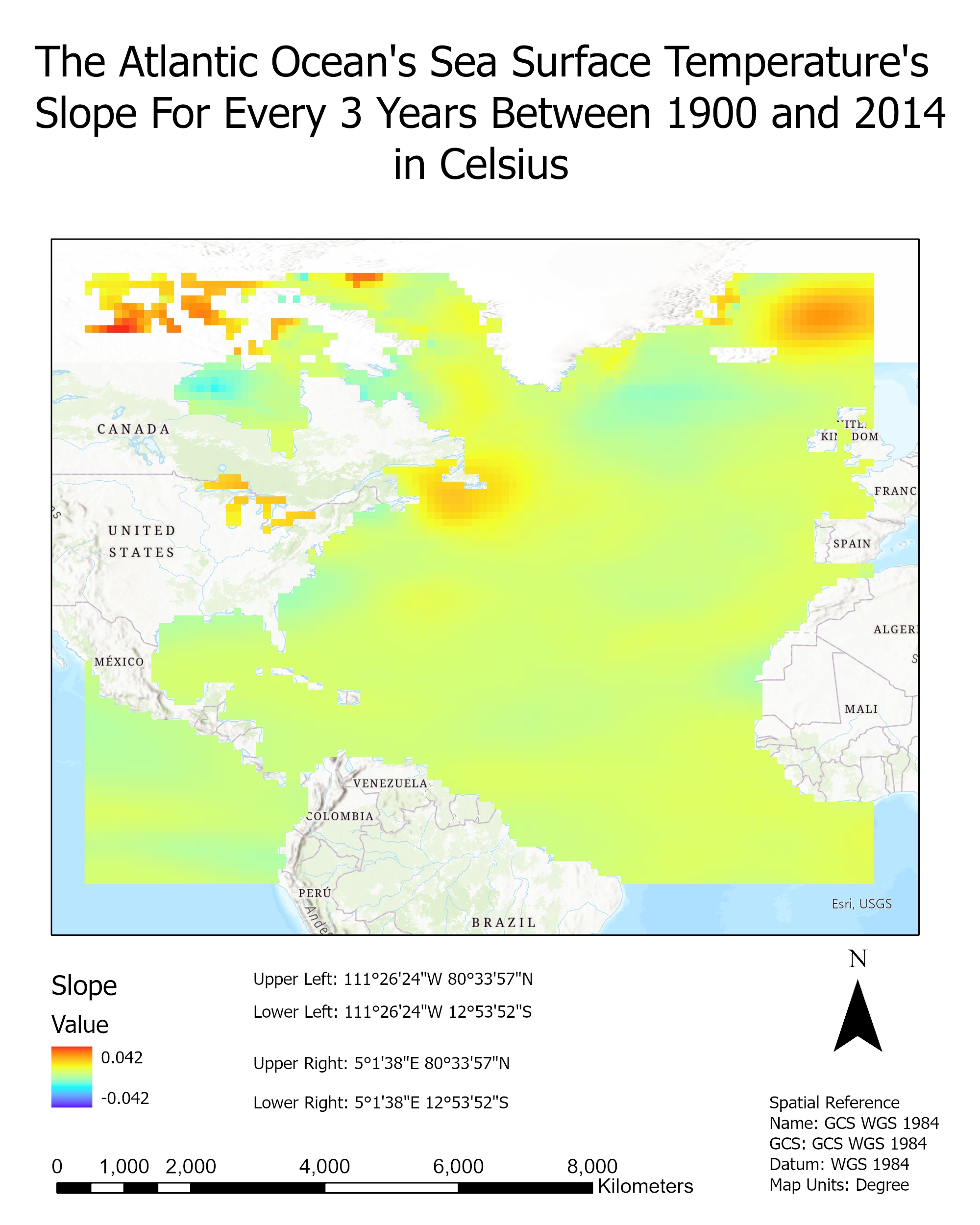 Analyzing the Changes in the Atlantic Ocean’s Sea Surface Temperature from 1900 to 2014 using ArcGIS
Posted 3 years ago
By Sana Hashim in the UofT Blog
This blog post showcases part of my analysis for a school assignment. I was given a CSV file that modeled the sea surface temperature of the Atlantic Ocean for every three years from 1900 to 2014 in degrees Celsius. The data were collected from the COBE SST dataset from the Japanese Meteorological Agency. Using the data file, I […]
Read More
 Winning this year’s ECCE app challenge on reducing the unequal exposure to air pollution in Canada
Posted 3 years ago
By Sherry Chen in the McMaster Blog
The ECCE annual app challenge started in 2015 and continued earlier this year (2021). This year was my second time participating. Like last year, we spent the entire week working virtually, which helped reduce commute time but was instead spent waiting for the other person’s screen to unfreeze. I am proud of our team for […]
Read More
 A Geographic Information Systems (GIS) Summer Student in the Department of Facility Services at McMaster University
Posted 3 years ago
By Madina Sulaymonova in the McMaster Blog
This summer I had the great pleasure of being a part of a great team and taking on an amazing opportunity offered by Facility Services at McMaster University as a Geographic Information Systems (GIS) Summer Student for a 4-month work term. This opportunity was brought to my attention by my professor Patrick DeLuca who taught […]
Read More

