 GIS Day at McMaster University: Perspectives from an ECCE Student Associate
Posted 8 months ago
By William Russell in the McMaster Blog
Every year around GIS Day, McMaster University holds an exciting series of lighting talks and demonstrations from members of the University community using GIS. This year, there were 12 speakers who spoke on topics, whose level of expertise ranged from co-op undergraduate students to PhD candidates to Research Assistants to Postdoctoral Fellows. This post aims […]
Read More
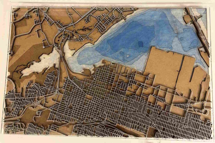
 3D model of the Halifax Harbour Waterfront
Posted 9 months ago
By Cameron Robertson in the Dalhousie Blog
This project considered what is required to create impactful and representative visualizations as well as how planners can leverage them to explain the effects of SLR and EH. This section reviews principles, guidelines, and observations that have been made when visualizations are created and presented. This section then reviews past research which has been completed […]
Read More
 Hospital and Park Accessibility in Vancouver, BC, Canada: A Geospatial Analysis
Posted 9 months ago
By Max Taylor Echeverria in the Western Blog
For my third-year GIS final project, I decided to develop accessibility maps for two critical variables in selecting an ideal place to live in Vancouver, BC: hospitals and parks, as a young professional or recent graduate. The significance of these factors lies in their impact on our health and well-being. Why Hospitals and Parks? Hospitals […]
Read More
 2023 ECCE App Challenge: ConservNation Canada
Posted 10 months ago
By Alex Furukawa
It’s been several months since the whirlwind of the App Challenge held this past spring has come and gone. While I can’t speak to the entirety of this challenge and the resulting app developed with Team GIS (Gauging Impacted Species) consisting of myself, Daniel Van Veghel and Henry Gage, this post will elucidate upon some […]
Read More
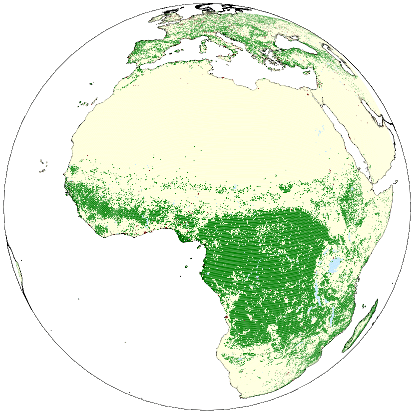 SIMULATING GLOBAL DEFORESTATION USING A NOVEL SPHERICAL GEOGRAPHIC AUTOMATA MODELLING APPROACH
Posted 10 months ago
By Bright Addae in the SFU Blog
Every summer, occurrences of wildfire across Canada causes not just environmental problems but also has serious health implications. This, coupled with widespread deforestation across the globe including region such as the Amazon Forest and Congo basin motivated me to participate in the 2023 Esri Canada GIS Scholarship for SFU competition. As an extension of my […]
Read More
 Mapping Inclusivity: Esri Canada Competitions and Advancing Gender-Inclusive Campus Design
Posted 11 months ago
By Hawjin Falahatkar in the UCalgary Blog
Hello everyone! My name is Hawjin Falahatkar, and I am currently pursuing an M.Sc. in Geography at the University of Calgary, working in the Fast Accessible Mapping & Mobility (FAMM) research lab directed by Dr. Victoria Fast. Drawing from an urban planning and design background and an interest in accessibility research, I employ the power […]
Read More
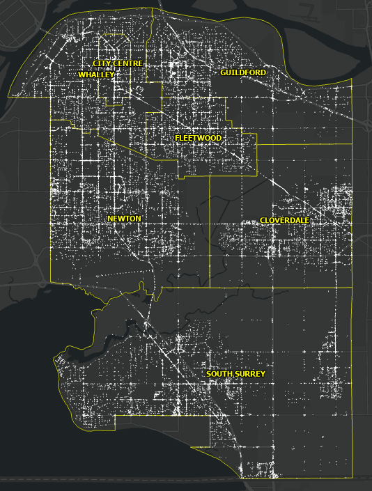 Pavement Marking Inventory using GIS and Computer Vision – Part II
Posted 1 year ago
By Omar Algiasena in the BCIT Blog
Aligned with the City of Surrey’s Digital Transportation Strategy, which aims to create a user-centric and data-driven Intelligent Transportation System, significant strides were made in 2022. The city collaborated with a student from the GIS Department at the British Columbia Institute of Technology (BCIT) to develop a deep learning model. This model automates the collection […]
Read More
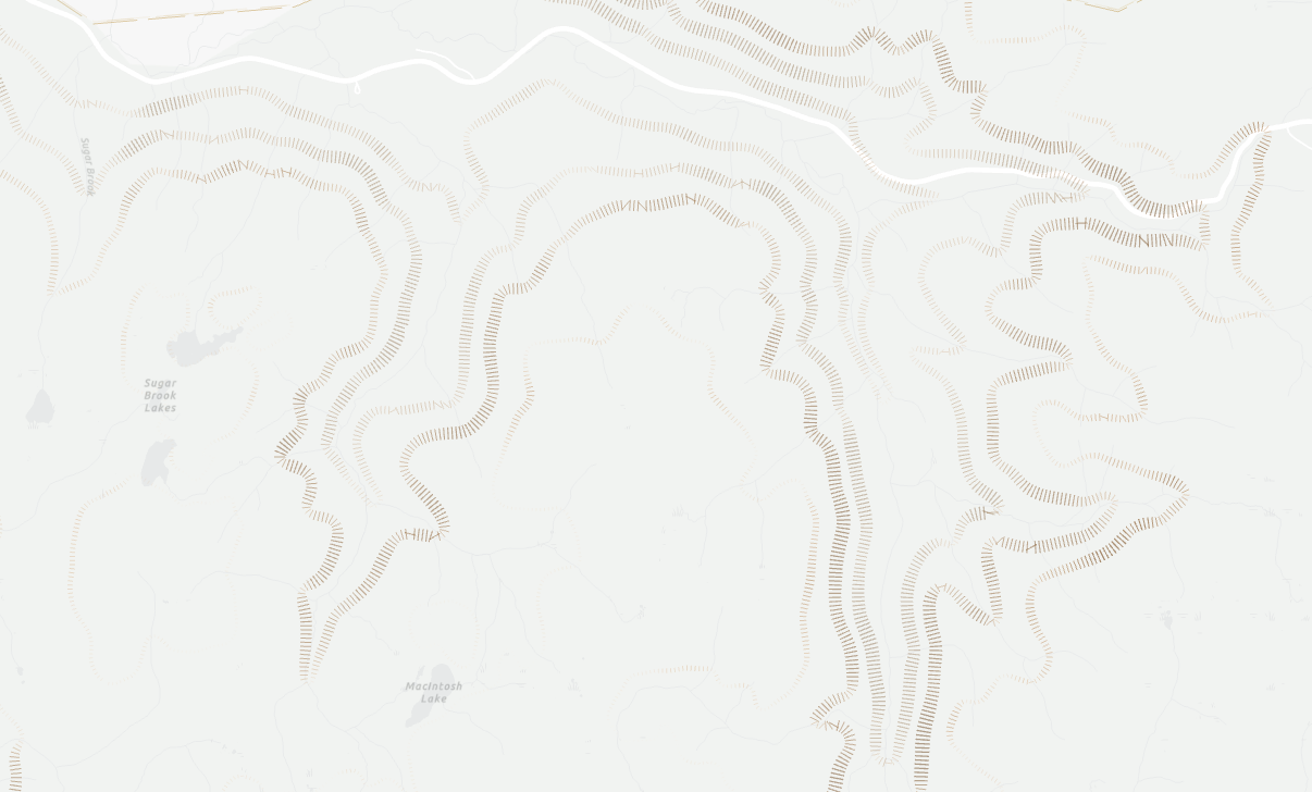 Attribute Driven Hachure Lines
Posted 1 year ago
By Nic Beauchamp in the Dalhousie Blog
Learning new mapping techniques is a great way to expand cartographic skills, and can increase one’s sense of balance and visual hierarchy for future endeavours
Read More
 Introduction to Discrete Global Grid System
Posted 1 year ago
By Bright Addae in the SFU Blog
Discrete Global Grid System (DGGS) have been proposed as a new geospatial technology and Earth reference system which utilizes a spherical tessellation of space to represent the Earth’s surface and is global in scope. The DGGS framework offers a discrete way for spatial referencing, using cells as the smallest unit of its base rather than […]
Read More
 From Digital Chaos to Structure: How GIS Taught Me the Importance of Data Management
Posted 1 year ago
By Molly Ingenmey in the COGS Blog
This blog post is a reflection on how over the course of this year I have learned to embrace data management, instead of disregarding it.
Read More

