 Interning at CBRE’s Location Intelligence Team
Posted 2 months ago
By Jason Ellis in the BCIT Blog
Introduction CBRE is a commercial real estate firm devoted to providing clients with top of the line real estate services. One of these services happens to be using GIS to locate and call attention to areas which fit a client’s desired location for future development or relocation. As a BCIT student currently in their Advanced […]
Read More
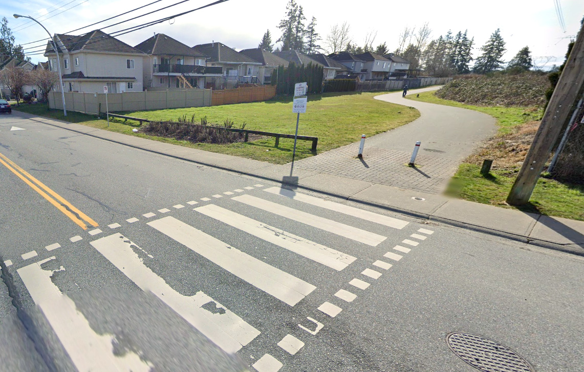
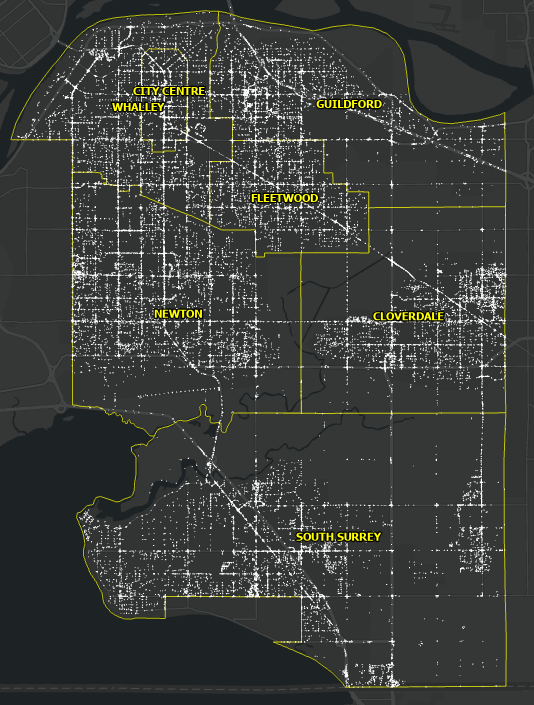 Pavement Marking Inventory using GIS and Computer Vision – Part II
Posted 1 year ago
By Omar Algiasena in the BCIT Blog
Aligned with the City of Surrey’s Digital Transportation Strategy, which aims to create a user-centric and data-driven Intelligent Transportation System, significant strides were made in 2022. The city collaborated with a student from the GIS Department at the British Columbia Institute of Technology (BCIT) to develop a deep learning model. This model automates the collection […]
Read More
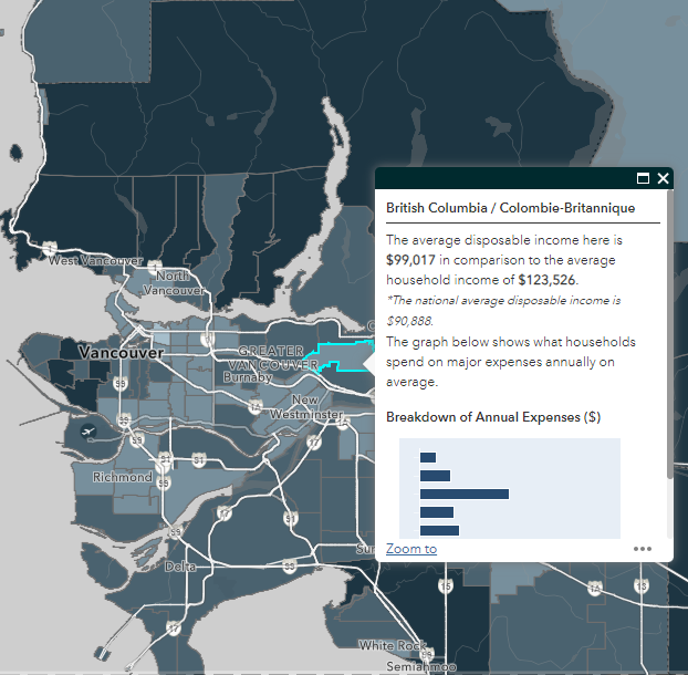
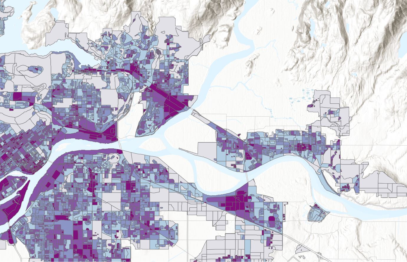
 A Day in a Life of a GIS Intern at CBRE
Posted 1 year ago
By Junior Thiensirisak in the BCIT Blog
As a BCIT Advanced Diploma GIS student, part of the curriculum involves an industry sponsored project or practicum. Earlier this year, I was fortunate and grateful to start an internship at CBRE working with their Location Intelligence team here in Vancouver, BC. CBRE is the largest commercial real estate services and investment firm globally and […]
Read More
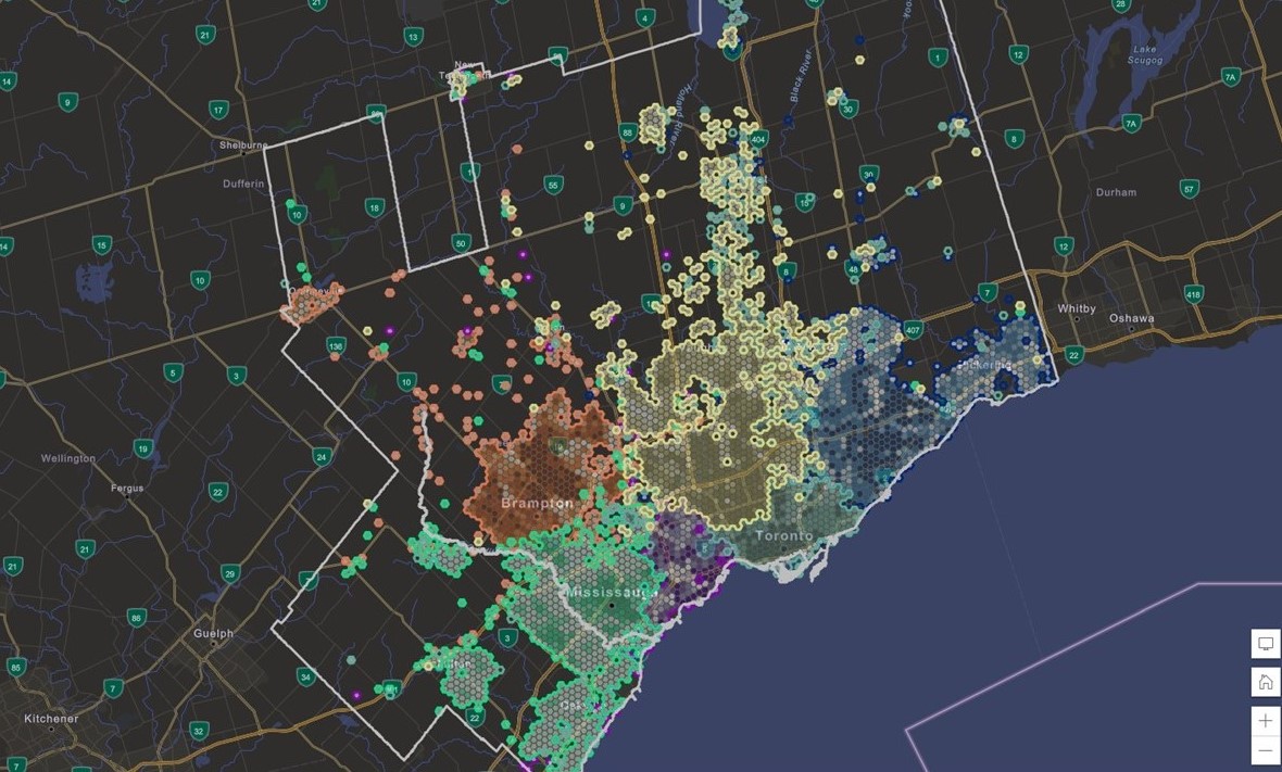 Looking at Favourite Mall Destinations Throughout Toronto’s Metropolitan Area
Posted 2 years ago
By Enrique Pedroso in the BCIT Blog
Blog Summary: Thorough understanding of a location is fundamental for real-estate professionals and stakeholders. Geospatial visualizations and data have the capacity to capture a geographic snapshot in time explaining the synergy and interaction between people and areas of interest. In this blog post I describe how GIS and data are used at CBRE to visualize […]
Read More
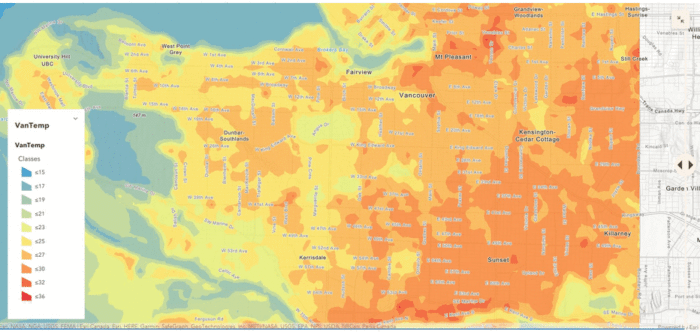
 Urban Landcover Mapping: Using Deep Learning to Extract Impervious Surfaces
Posted 2 years ago
By Mitchell Bailey in the BCIT Blog
The first of multiple blog posts in which Esri Deep Learning technology is utilized for urban landcover mapping and impervious surface coverage.
Read More
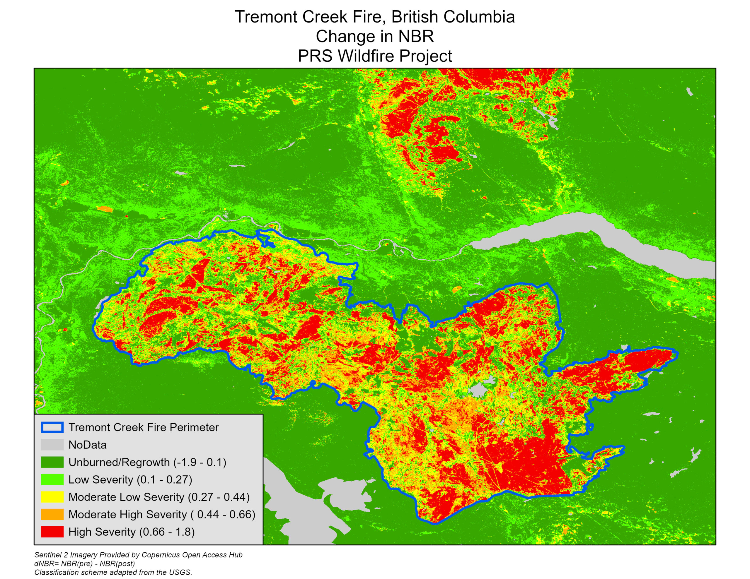 Using Optical Imagery and Fuzzy Logic to Map Wildfires in British Columbia
Posted 2 years ago
By Eli Braunstein in the BCIT Blog
Exacerbated by human-induced climate change, wildfires have become increasingly severe and devastating in recent years. In British Columbia over the past decade, wildfires have consistently cost hundreds of millions in damages and pose serious health threats to the population as the smoke lingers over populous areas throughout the province. For our British Columbia Institute of […]
Read More
 A challenge worth tackling: Looking back at this year’s ECCE App Challenge Experience
Posted 2 years ago
By Enrique Pedroso in the BCIT Blog
Being open to new challenges is something to embrace. Despite the learning curve that may come with a new challenge, the opportunity to apply what you know and adapt to the circumstance is an excellent learning opportunity. This is one of the many aspects that drew my team members and I to this year’s Esri […]
Read More
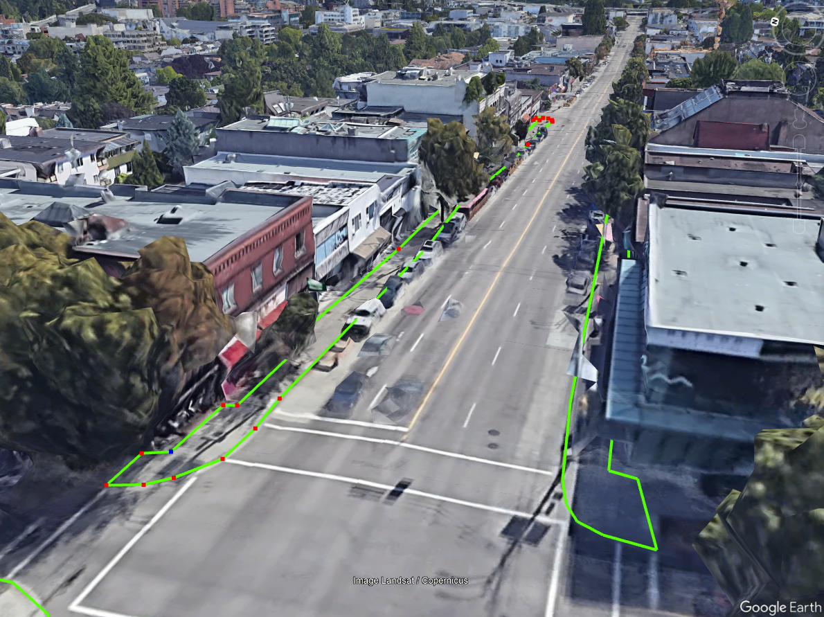
 Pavement Marking Inventory using GIS and Computer Vision – Part I
Posted 2 years ago
By Charlotte Choy in the BCIT Blog
In this series of blog posts we will explore and detail the ways in which we combine the powers of GIS and computer vision to automate extraction of pavement markings from aerial orthophotos using ArcGIS Image Analyst.
Read More

