 “Seeing” Peatland Stress from Space: Relationships between Sentinel satellite data and peat moisture. Part 1
Posted 3 days ago
By Alex Furukawa in the McMaster Blog
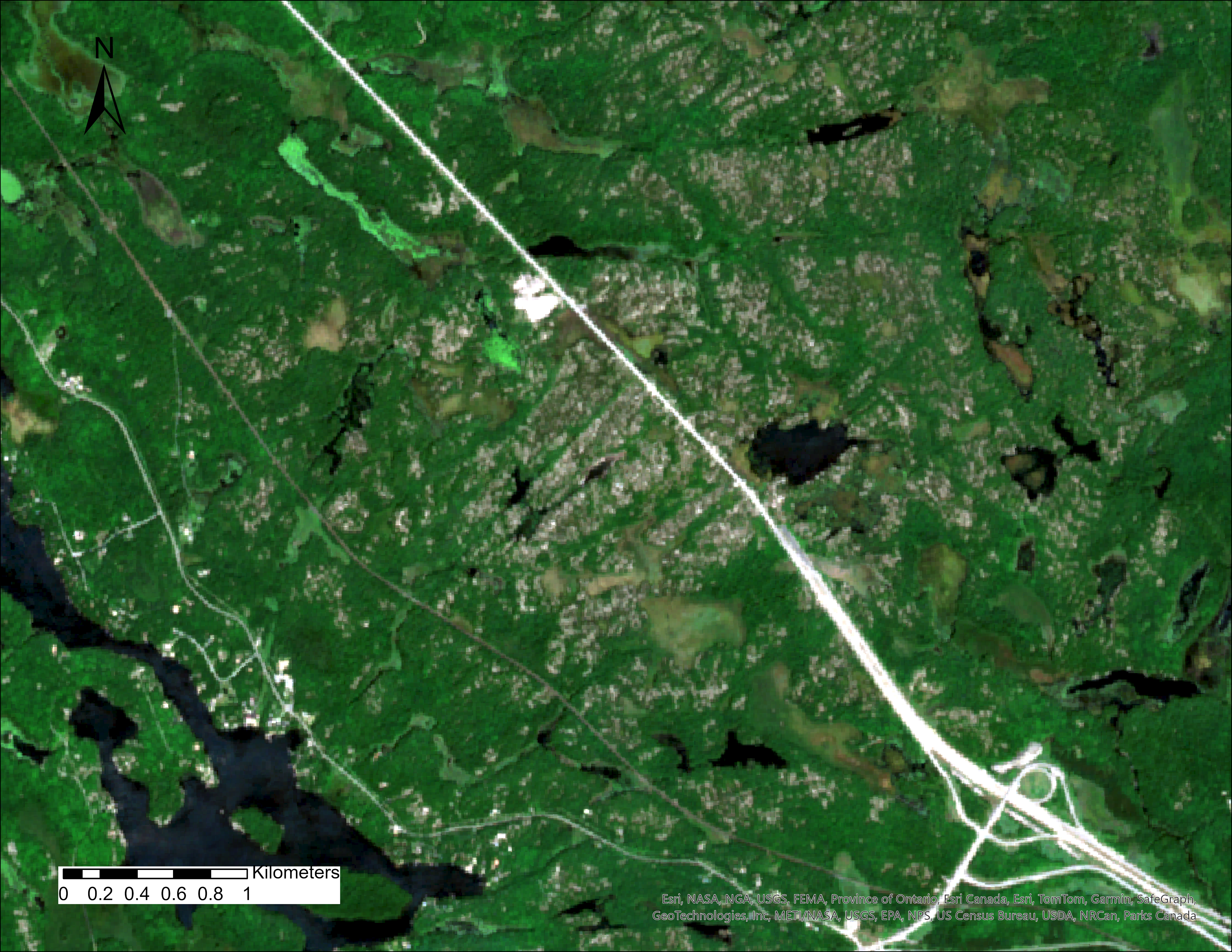
This is the first in a multi-part series detailing the process of linking in-situ peatland water table data to satellite data. While monitoring the water table, or moisture status of a peatland is by no means a complicated task that is usually accomplished simply with a groundwater well, they beg the question of ‘ungauged basins’ […]
Read More
 University of Waterloo GIS Day 2023 Recap
Posted 1 month ago
By Ben Woodward in the UW Blog
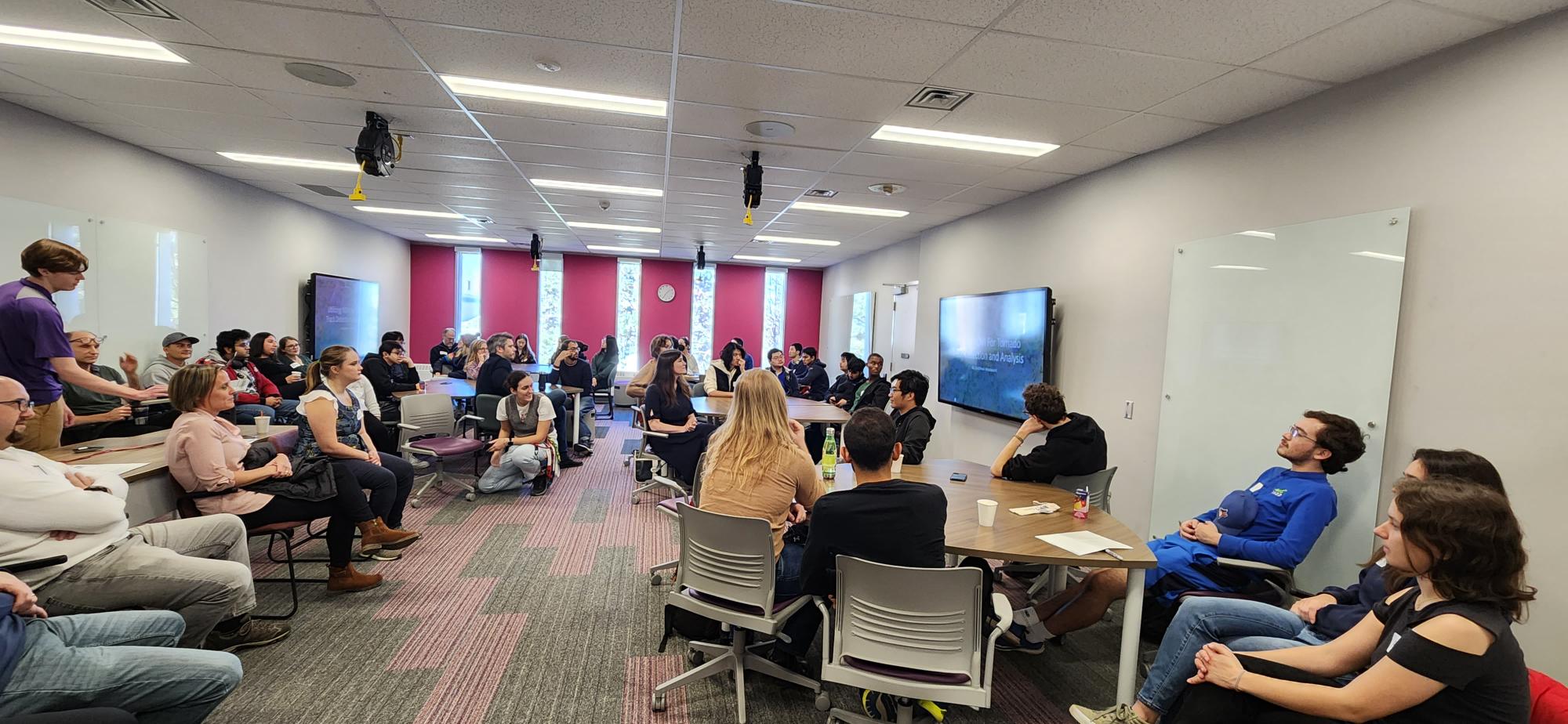
By: Weronika Fydrych November 15th marked 2023’s GIS Day, the international celebration of everything geospatial! To participate, the University of Waterloo’s ECCE group, along with the Waterloo Association of Geography Students, the Univeristy of Waterloo Geospatial Centre, and Environment Technology and Instructional Support (ETIS) worked together to organize the University of Waterloo’s first in-person GIS […]
Read More
 Evaluation of influential variables on Calgary’s dwelling price (Spatial Autoregressive Model)
Posted 1 month ago
By Marjan Jahanbani in the UCalgary Blog
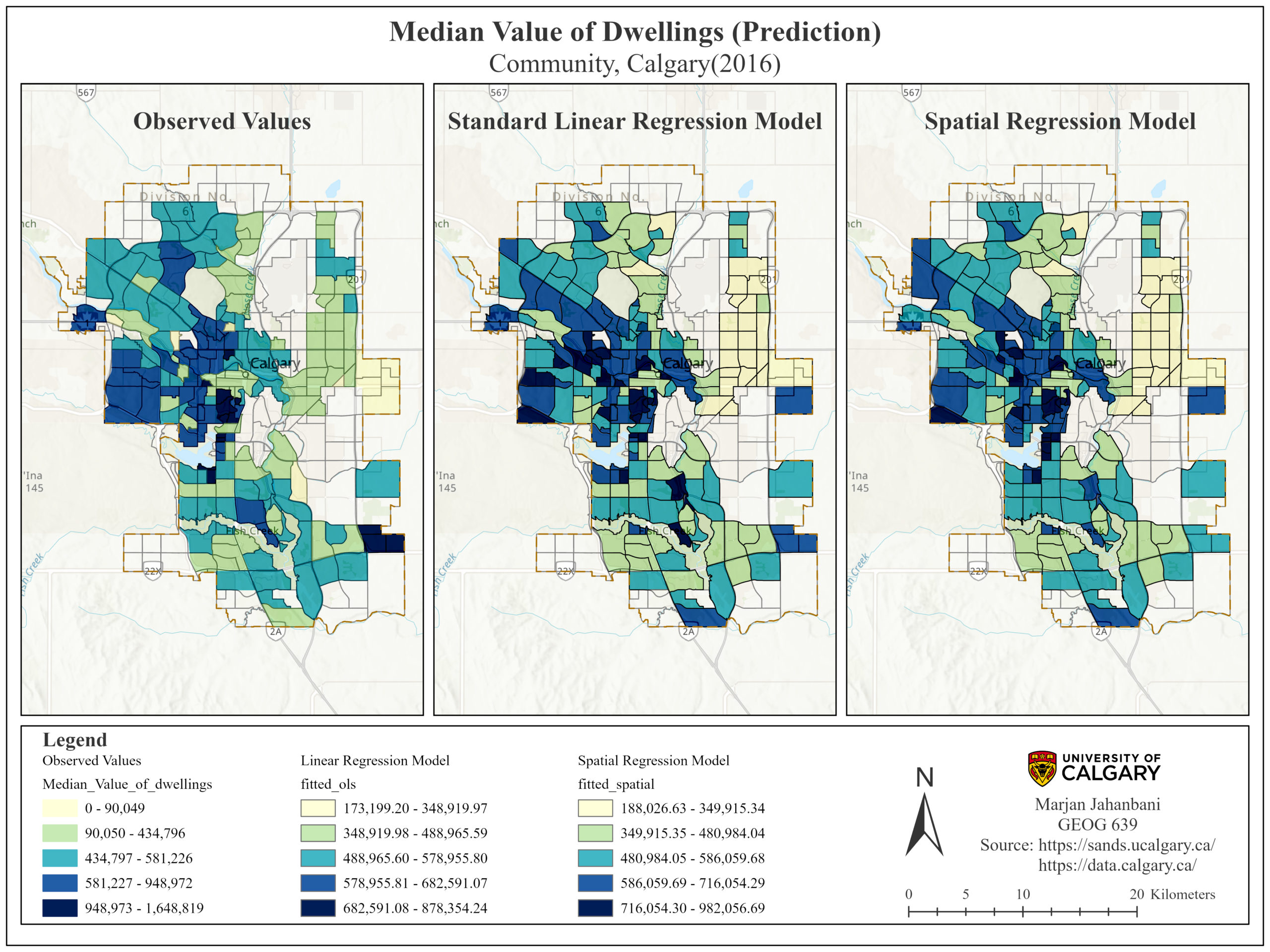
demands as well as the communities’ needs. This project aims to describe the relationship of some influential socio-economic variables on the median value of dwellings in Calgary based on the community census data (2016).
Read More
 The Upscaling of Winter Wheat Aboveground Nitrogen Content Estimation Using Geostatistical Analysis
Posted 2 months ago
By Mohammad Rokhafrouz in the Western Blog
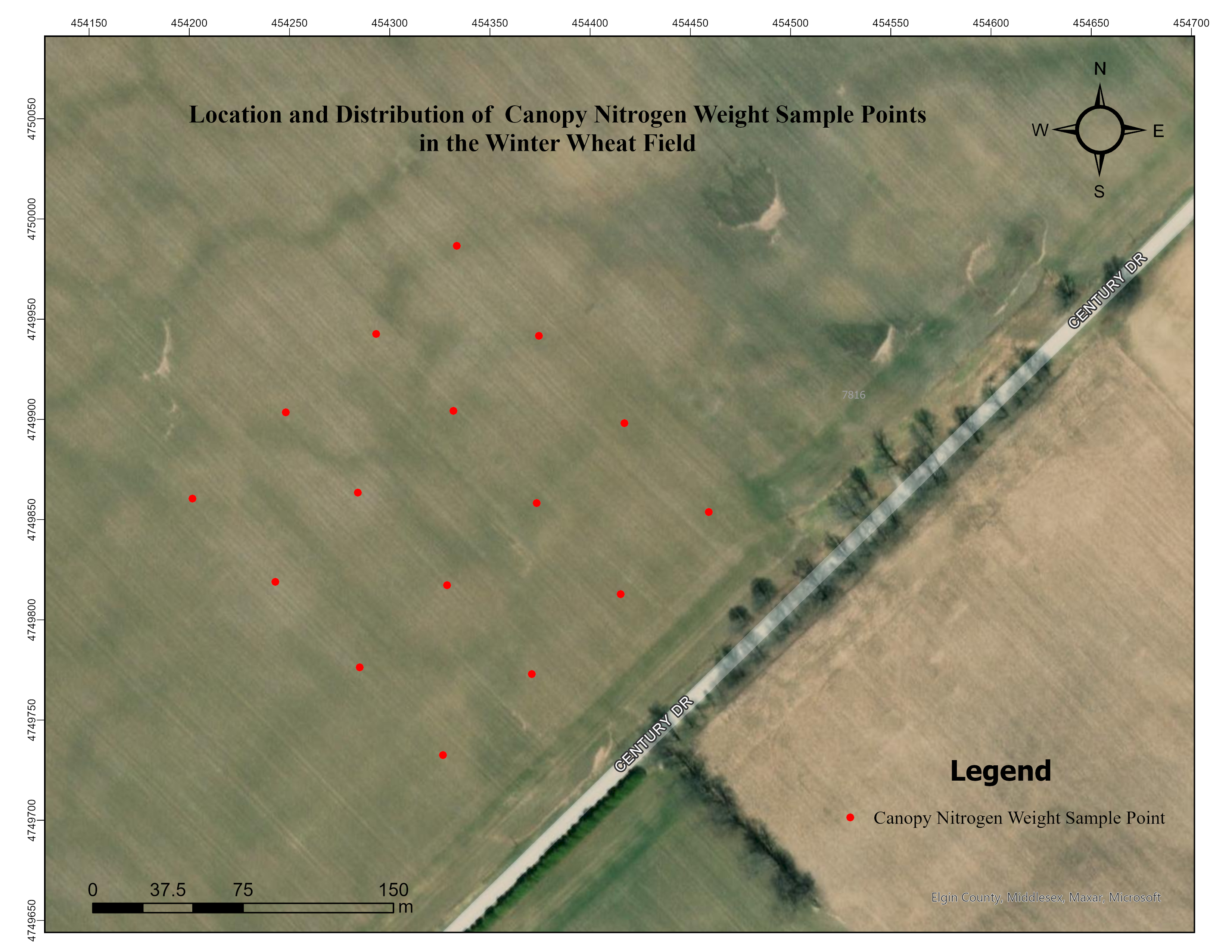
Introduction Nitrogen is the most essential and demanded nutrient for plants [1]. It is also one of the most costly to supply, making commercial fertilizers a major expense in agriculture [2]. Nitrogen deficiency reduces crop growth and yields [3], while overapplication may have unwanted environmental impacts and cost of production [4]. Therefore, managing nitrogen fertilizers […]
Read More
 Interning at CBRE’s Location Intelligence Team
Posted 2 months ago
By Jason Ellis in the BCIT Blog
Introduction CBRE is a commercial real estate firm devoted to providing clients with top of the line real estate services. One of these services happens to be using GIS to locate and call attention to areas which fit a client’s desired location for future development or relocation. As a BCIT student currently in their Advanced […]
Read More
 Emergency Response at the University of Western Ontario: Accessibility Analysis of Code Blue Emergency Phones
Posted 2 months ago
By Henry Shaver in the Western Blog
Background University campuses are busy places, with thousands of students and faculty frequenting the grounds every day – and the University of Western Ontario is no exception. With 38,000 students enrolled in the Fall of 2022, this large number of young adults brings numerous safety concerns. (Western Communications, 2022). The following campus safety concerns were […]
Read More
 Transit Orientated Communities: A BA Group Co-op Showcase
Posted 3 months ago
By Harry Cheung in the UW Blog
My name is Harry, and I am currently on my third co-op term working as a Spatial Data Analyst with BA Group’s GIS team. BA Group provides transportation planning and engineering services to public and private organizations for the movement of people and goods in urban environments. The primary focus of my work revolves around conducting […]
Read More
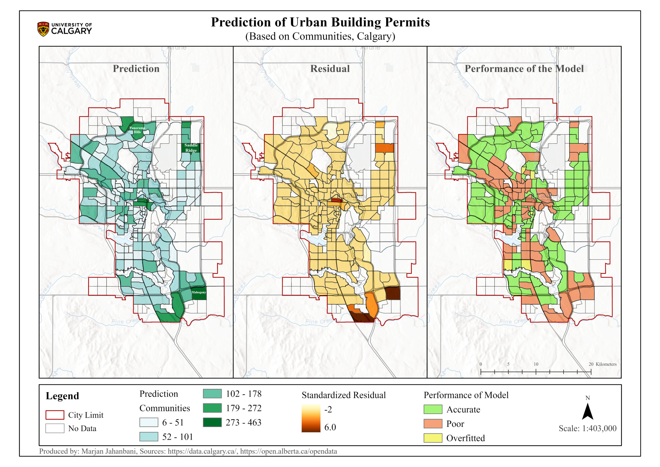 Prediction of Urban Building Permits: Forest-based Classification and Regression (Calgary, Canada)
Posted 3 months ago
By Marjan Jahanbani in the UCalgary Blog
This blog post represents the application of Forest-based classification and regression in th estimation of Calgary's building permits.
Read More
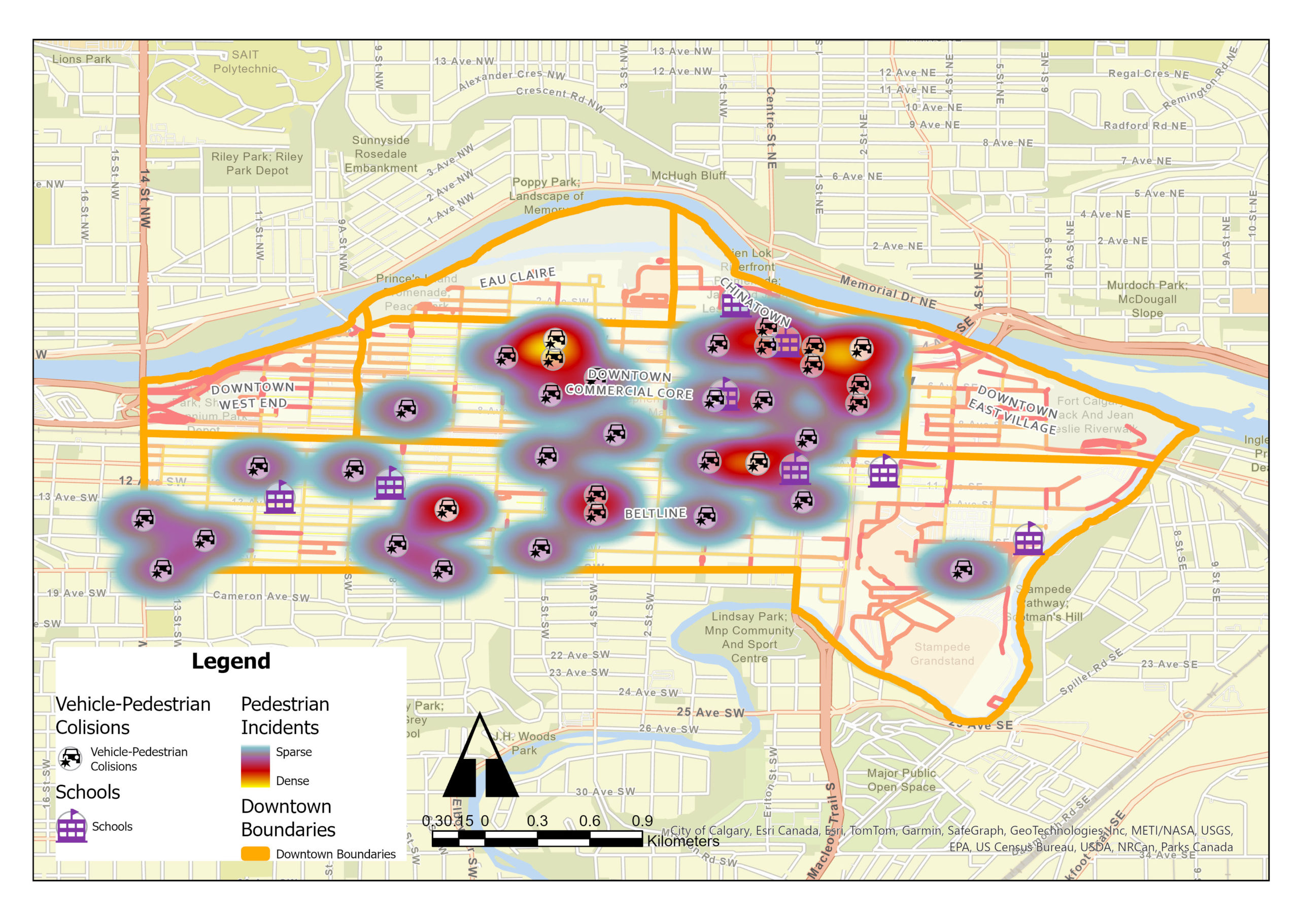 GIS Insights for School Safety and Active Transportation
Posted 5 months ago
By Shahrzad Sarabi in the UCalgary Blog
Identification of Collision Hotspots and Risk Levels for Pedestrian Safety in School Zones in Downtown Calgary Introduction In the dynamic urban landscape of downtown Calgary, ensuring pedestrian safety, especially in school zones, emerges as a critical challenge. My study employed Geographic Information Systems (GIS) tools for an extensive analysis of pedestrian-vehicle collision data, focusing on […]
Read More
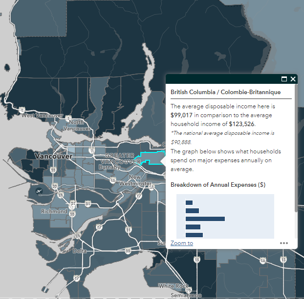
 Gaining more experience with Experience Builder: Building Web Apps with ArcGIS Experience Builder
Posted 5 months ago
By Alex Furukawa in the McMaster Blog
Recently, as an ECCE associate I was fortunate to be able to partake in a two-day course offered by Esri Canada: Building Web Apps with ArcGIS Experience Builder. While I have dabbled a bit in the self-guided lesson options available through the Esri Course Catalogue, this was the first instructor-led course for me (and the […]
Read More

