 GIS Insights for School Safety and Active Transportation
Posted 8 months ago
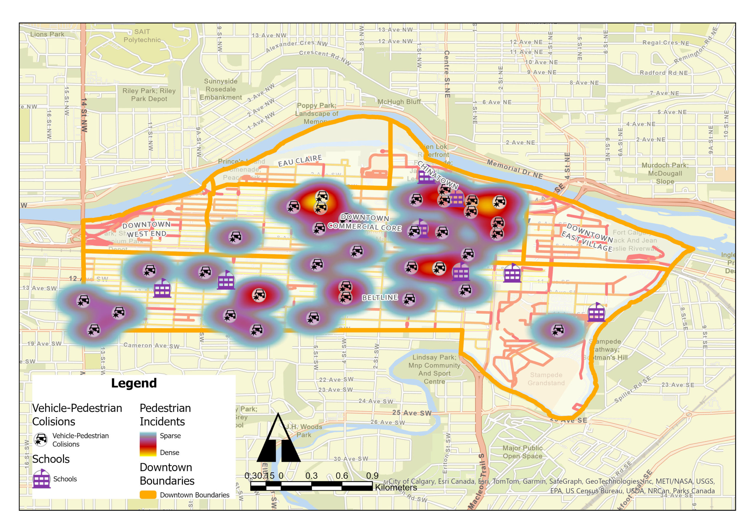
Identification of Collision Hotspots and Risk Levels for Pedestrian Safety in School Zones in Downtown Calgary Introduction In the dynamic urban landscape of downtown Calgary, ensuring pedestrian safety, especially in school zones, emerges as a critical challenge. My study employed Geographic Information Systems (GIS) tools for an extensive analysis of pedestrian-vehicle collision data, focusing on […]