 A behind-the-scenes look at one participant’s ECCE App Challenge week.
Posted 4 years ago
By Emma Sherwood in the McMaster Blog
Emma Sherwood, a first-time App Challenge participant, discusses her experience and contributions, and how her team worked together to create their winning ArcGIS Hub and video.
Read More
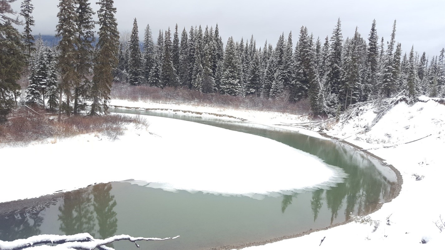
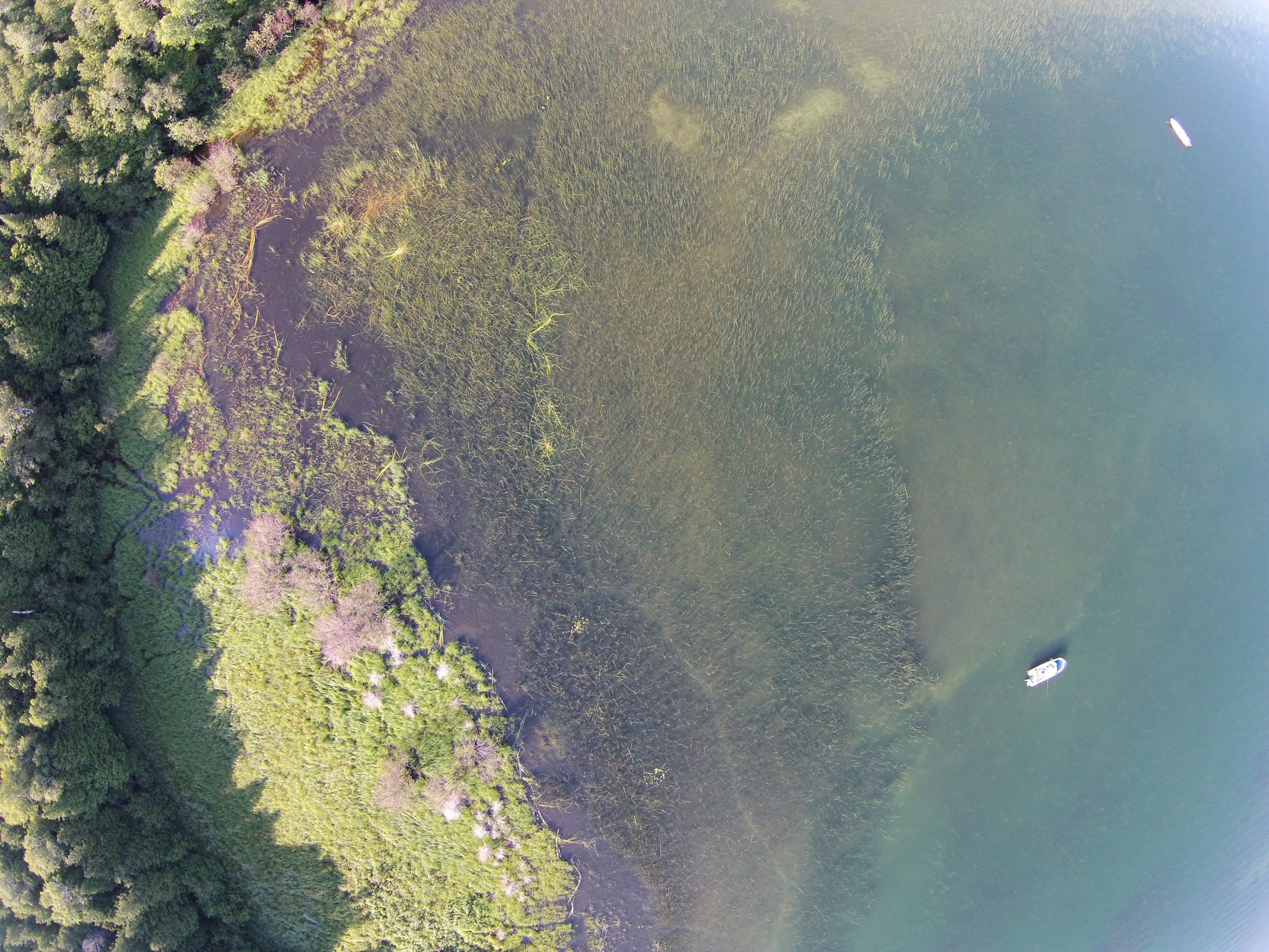 Creating websites using ArcGIS Hub: Atlas of Coastal Wetlands in Georgian Bay
Posted 4 years ago
By Sherry Chen in the McMaster Blog
ArcGIS Hub was used to create our interactive Atlas of Coastal Wetlands in Georgian Bay. For an ecology lab without any programmers or web design specialists, we published an interactive atlas (that is mostly under construction) to present and share qualitative, quantitative, and geographic data collected, published papers, photos and videos of sampling sites, and […]
Read More
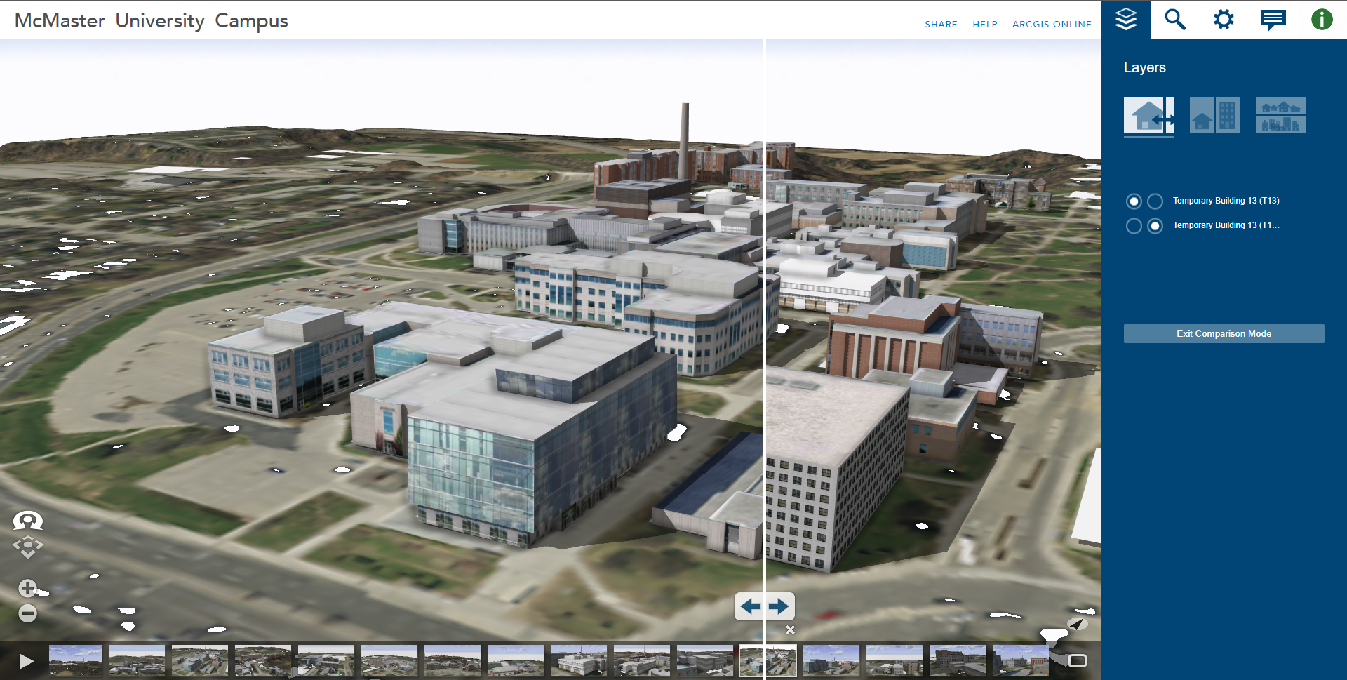 Using ArcGIS CityEngine for GeoDesign on McMaster Campus: Part 2
Posted 4 years ago
By Junli Hu in the McMaster Blog
This article continues from the initial two steps outlined in Part 1, where an initial 3D environment for the McMaster University campus was constructed using digital elevation data, aerial imagery, and 3D models for campus buildings available for download from the SketchUp 3D Warehouse website. In this second part, the remaining steps are outlined, describing […]
Read More
 Using ArcGIS CityEngine for GeoDesign on McMaster Campus: Part 1
Posted 4 years ago
By Junli Hu in the McMaster Blog
Esri’s ArcGIS CityEngine is an advanced three-dimensional (3D) modelling software for creating realistic, interactive, and immersive urban environments (Fabricius, 2020). CityEngine allows users to build entire 3D cities effectively in one step, design urban environments, master 3D content creation, and bring a community vision to life (Fabricius, 2020). If we take a look at case […]
Read More
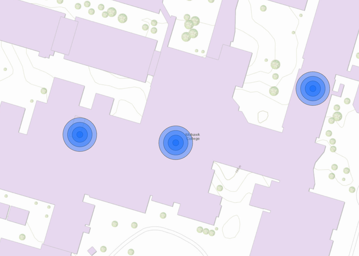 Custom Tools in ArcGIS Pro – An Alternative to the Multiple Ring Buffer Tool
Posted 4 years ago
By Madina Sulaymonova in the McMaster Blog
Various skills and tasks in terms of coding and the use of ArcGIS Pro can be enhanced through a GIS Programming course taught by Dr. Darren Scott. An assignment that caught my attention and would like to share in this article is about the use of custom tools in ArcGIS. Custom tools can be used […]
Read More
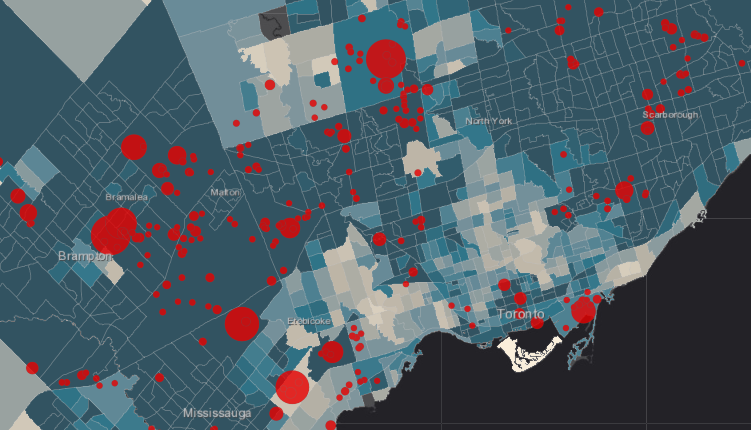
 How food secure/insecure are Hamilton’s neighbourhoods? Using Python and ArcGIS’s Network Analyst Module to map Hamiltonians’ access to healthy food
Posted 4 years ago
By Daniel Van Veghel in the McMaster Blog
My name is Daniel Van Veghel, and I am a fourth year Arts & Science student at Mac. I am working to complete my Minor in GIS, and this semester I am taking “GIS Programming” through Mac’s School of Earth, Environment and Society. The course aims to show how Python can be a useful tool […]
Read More
 Where GIS meets the field
Posted 4 years ago
By Emma Sherwood in the McMaster Blog
GIS requires data, and this often means going out to the field. Learn about Emma Sherwood's co-op and research assistant experiences in the field, collecting data for four different projects across Canada.
Read More
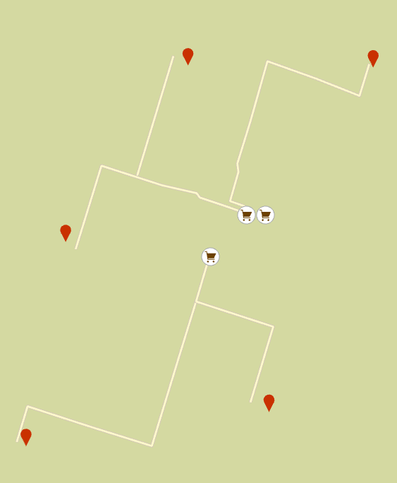
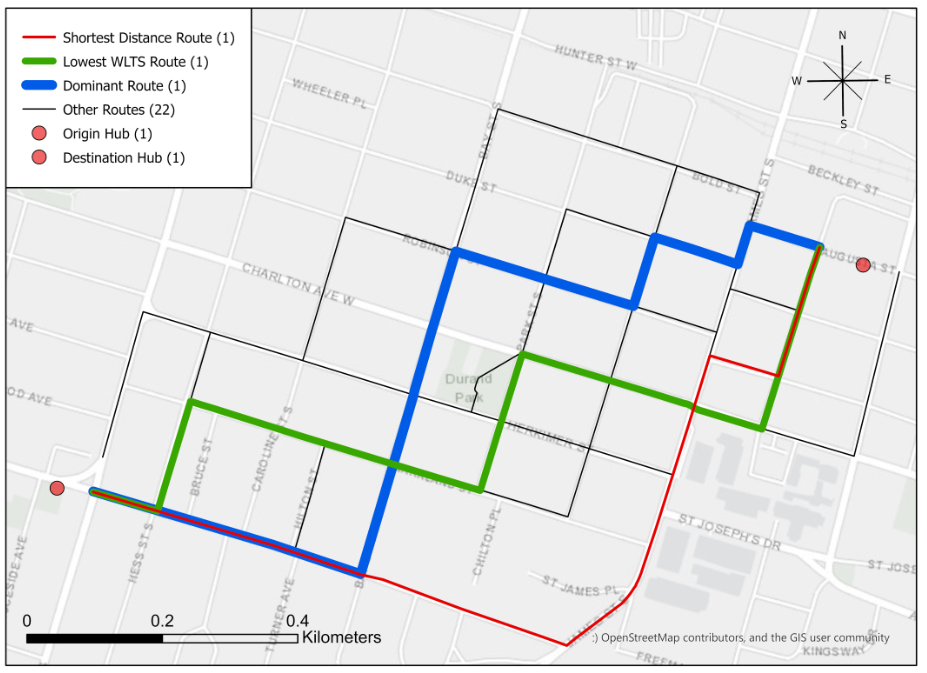 Are Dominant Routes the Safest Routes in a Bike Share System? An Investigation of Hamilton Bike Share using Weighted Level of Traffic Stress
Posted 4 years ago
By Rajveer Ubhi in the McMaster Blog
An analysis of the safety of dominant biking routes, using a level of traffic stress classification of Hamilton's cycling network.
Read More
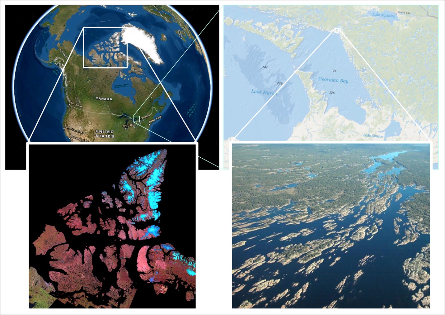 Is the world’s largest freshwater archipelago losing islands? How water levels impact coastal marshes
Posted 4 years ago
By Sherry Chen in the McMaster Blog
An archipelago is a collection of islands. Canada is home to 2 of the biggest, a saltwater and a freshwater archipelago. The saltwater archipelago is in the northern part of Canada (> 35 K islands) that no one during geography class was able to fully draw. It is the world’s second largest saltwater archipelago. The […]
Read More
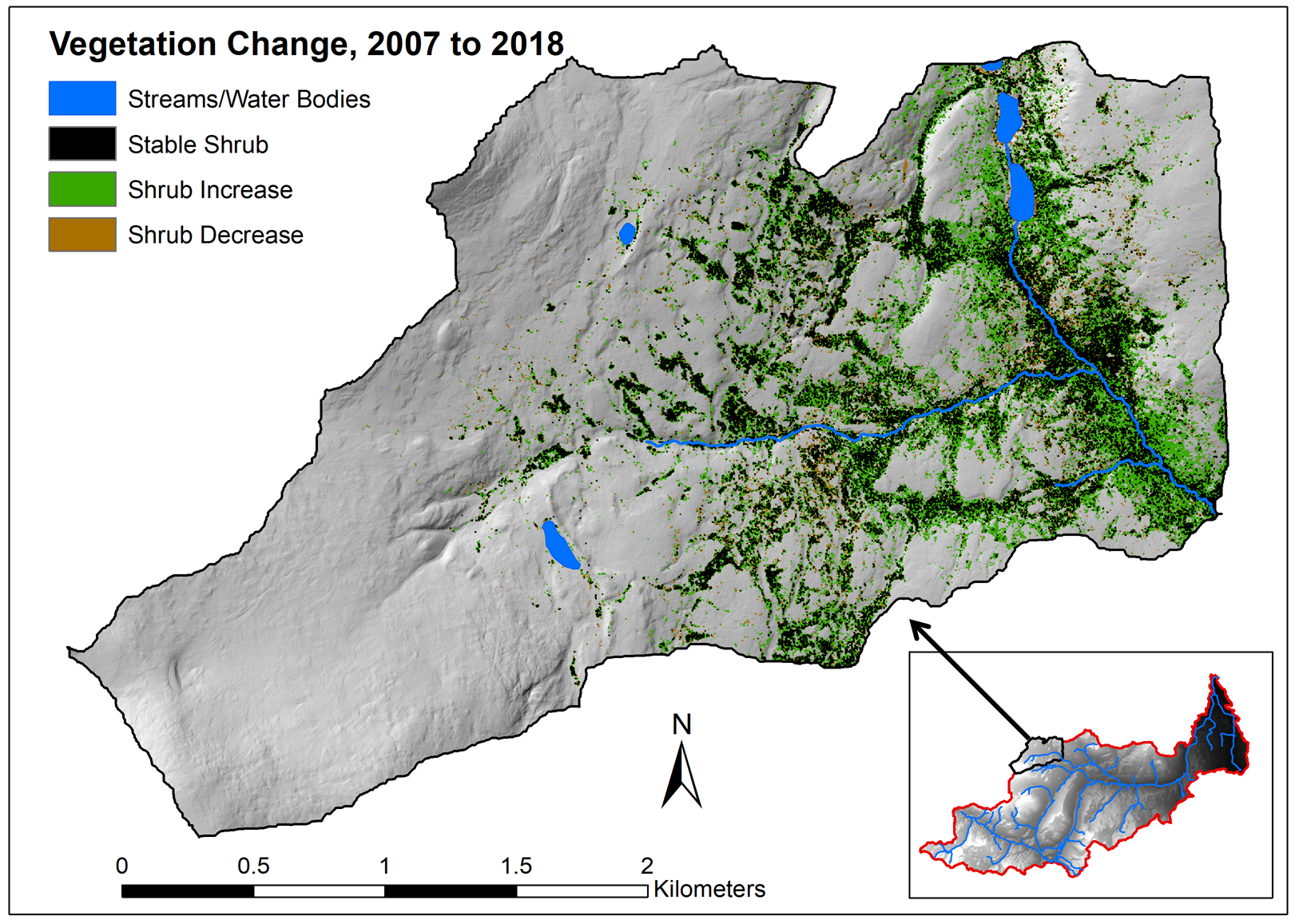 Evaluating vegetation change in Wolf Creek, YT with multi-temporal LiDAR: Part 1
Posted 5 years ago
By Sean Leipe in the McMaster Blog
In this post, I’ll be giving a summary of my current MSc progress in the McMaster Watershed Hydrology Group. This thesis project has two main components: using LiDAR and other remotely sensed imagery to quantify vegetation change over time in a subarctic research watershed, and comparing how these changes vary over different landscape properties. This […]
Read More

