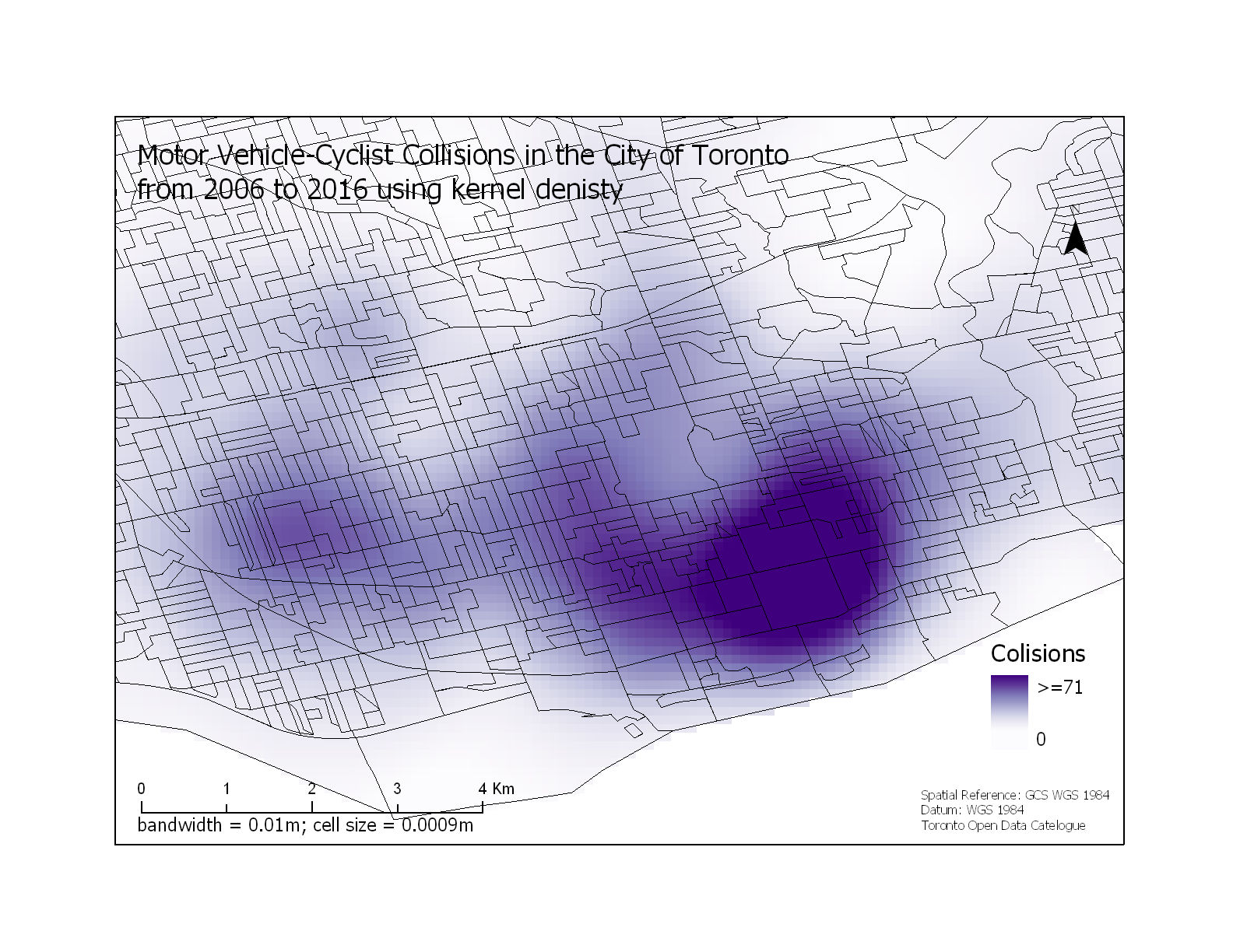
 Motor Vehicle-Cyclist Collisions in the City of Toronto
Posted 7 years ago
By Rajveer Ubhi in the McMaster Blog
With the gradual increase in environmental, economic and public health problems from the growing global community that uses motorized vehicles as their primary source of transportation, there has been a large interest in the use of bicycles as an alternative form of transportation. Despite the benefits of cycling, studies have shown that people are discouraged […]
Read More
 What is GeoAI?
Posted 7 years ago
By Anastassios Dardas in the McMaster Blog
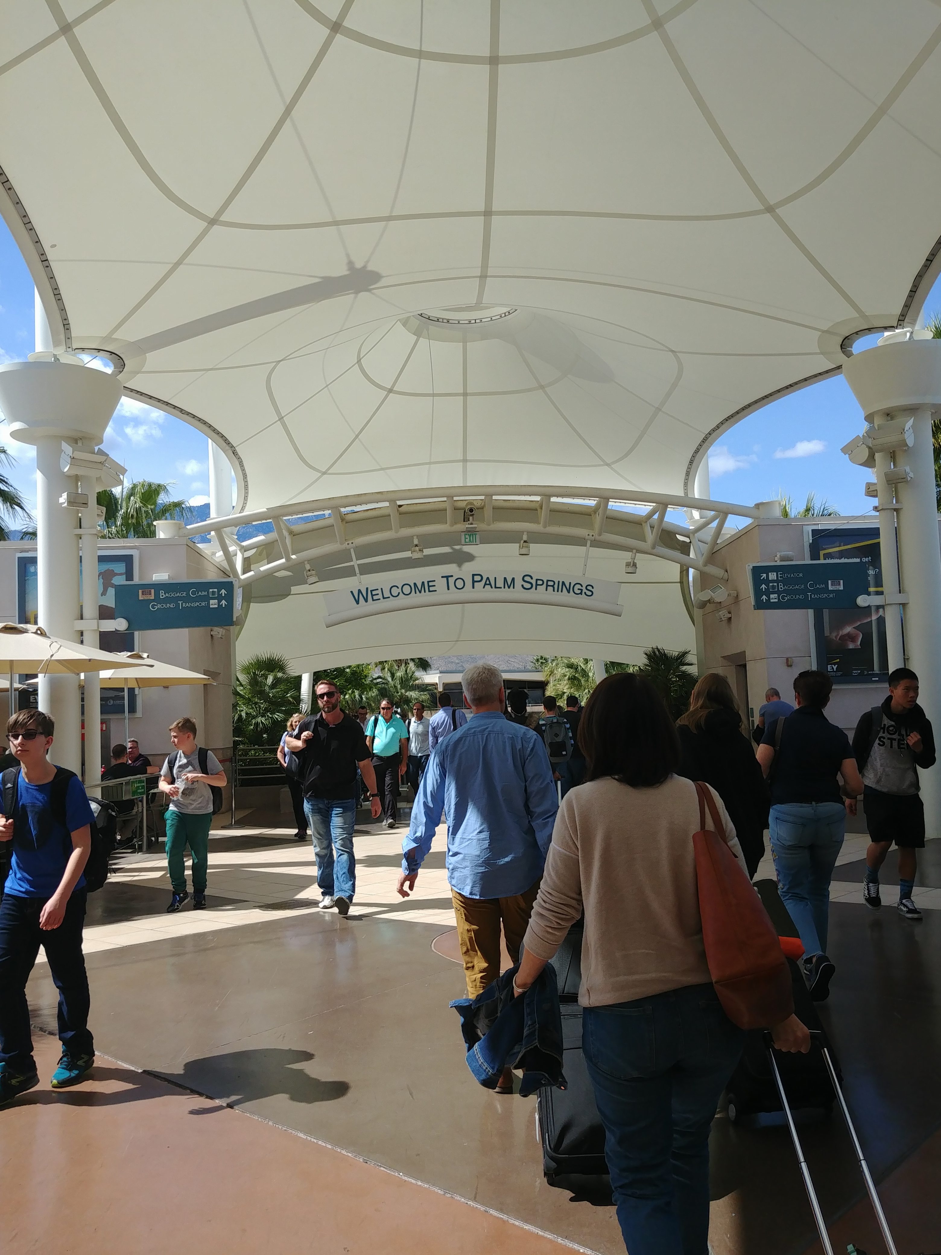
DevSummit 2018 This past early March, my fellow McMaster Student Associate, Matt Brown and I had the opportunity to attend to the 2018 Esri Developer’s Summit located in Palm Springs, California. As Matt mentioned in his recent blog, this is our second time attending, all huge thanks to the ECCE Student Associates Program. Last year, […]
Read More
 2018 Esri FedGIS Conference: Student Assistantship Experience
Posted 7 years ago
By Claudia Wong in the UCalgary Blog
Last March, I attended the 2018 Esri Federal GIS Conference in Washington, D.C. as part of Esri’s student assistantship program. The student assistantship program allows students passionate about GIS software or geospatial applications to help assist the Esri staff with the conference logistics, while also attending the conference with attendance fees covered. Over the span […]
Read More
 Esri DevSummit 2018 – My Experience Learning to Code in California
Posted 7 years ago
By Matthew Brown in the McMaster Blog
At the beginning of March, I got the opportunity to attend the 2018 Esri Developer’s Summit (DevSummit for short) along with my fellow McMaster Student Associate Tasos Dardas. This conference occurs annually in sunny Palm Springs, California. This is my second time attending, thanks to the ECCE Student Associates program, which provides free registration to […]
Read More
 Discover ‘Machine Learning’ – without acquiring an Engineering Degree
Posted 7 years ago
By Denise Vachon in the COGS Blog
If you haven’t heard of Machine Learning or Kaggle, you’re going to want to. Allow me to introduce you to the future of GIS predictive modelling. Machine learning explores the study and construction of algorithms that can learn from data and make data-driven decisions. Its applications are all around you. When the advertisements you see in […]
Read More
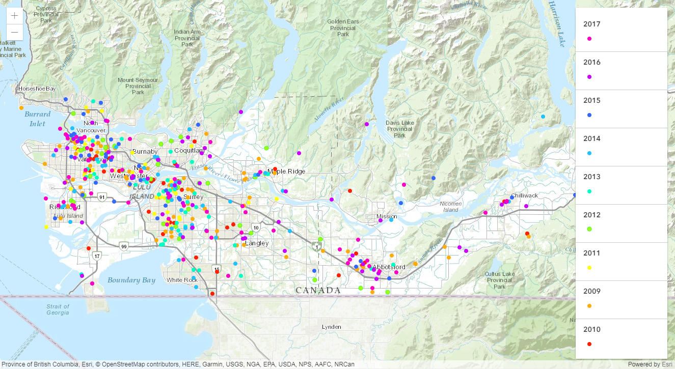 Homicide Analysis in Metro Vancouver
Posted 7 years ago
By Thea Mai in the UVic Blog
Canada measures crime using the crime severity index: an index that measures the volume and severity of police-reported crime. Crime has dropped significantly over the last decade. However, in the past two years it has increased again. A homicide is defined, by Stats Canada as first and second degree murder, manslaughter, and infanticide [1]. Most […]
Read More
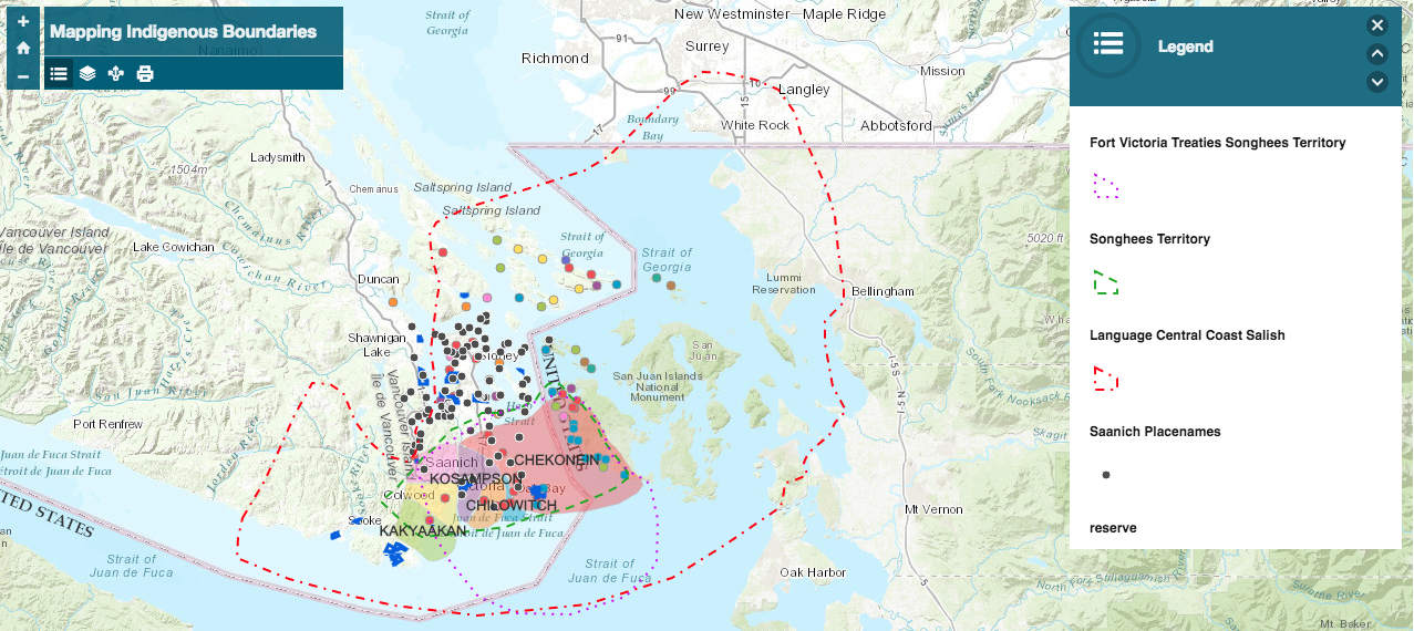 Mapping Indigenous Boundaries
Posted 7 years ago
By Emily Swartz in the UVic Blog
GIS is often focused on those things that can be defined through hard lines, singular points and polygons. For me as a settler, my home can be easily defined by the boundaries of the state I am from and the edges of my house, this has been shaped by growing up with an understanding of […]
Read More
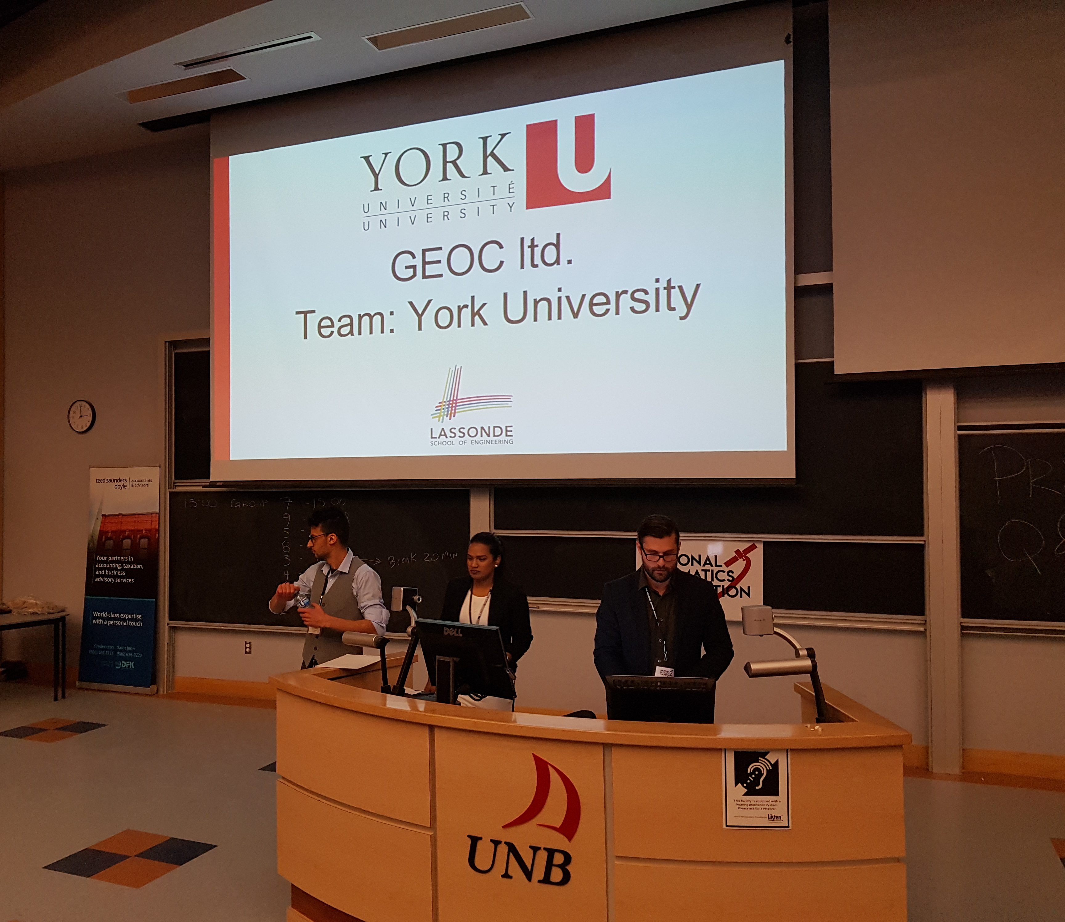 York University Attends National Geomatics Competition
Posted 7 years ago
By David Recchia in the YorkU Blog
From Left to Right: Patricia Dhup, Ario Hadian and David Recchia. After the competition, we got the chance to have some fun and enjoy a Canadian classic, Curling. It was a great pleasure to be able to represent York University alongside my kick-ass teammates, Patricia Dhup and Ario Hadian, at the first ever National Geomatics […]
Read More
 ECCE App Challenge 2018 has begun
Posted 7 years ago
By Michael Leahy in the Main Blog
This year’s ECCE App Challenge has begun! This is the fourth annual iteration of this event since the challenge was first introduced by the Esri Canada GIS Centres of Excellence in 2015. We have seen many great apps produced each year by students using ArcGIS technology, and we anticipate to a record number of participating […]
Read More
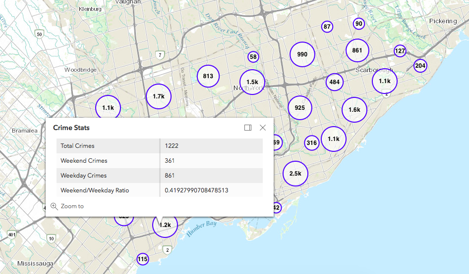 Custom point clustering for ArcGIS JavaScript API 4.6
Posted 7 years ago
By Michael Leahy in the Main Blog
When working on custom web mapping applications that need to display many point features, there is a natural need for point clustering for both performance and to improve the visualization of the point distribution. We’ve had the ability to do this for quite some time with the ArcGIS API for JavaScript in the 3.x version. […]
Read More

