 Creating a 3D City Model with ArcGIS CityEngine
Posted 6 months ago
By Ngoc Phan in the UNB Blog
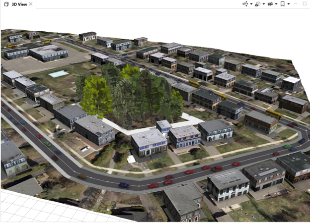
This post demonstrates the process of constructing a 3D city model using ArcGIS CityEngine, leveraging data from sources like OpenStreetMap, including network, footprint, and terrain databases. The project is a component of the “3D Geographical Information Systems” course at the Geodesy and Geomatics Department, University of New Brunswick. 1. Collecting data Using the “Get Map […]
Read More
 LOD1 Generation Using ArcGIS Pro
Posted 6 months ago
By Ngoc Phan in the UNB Blog
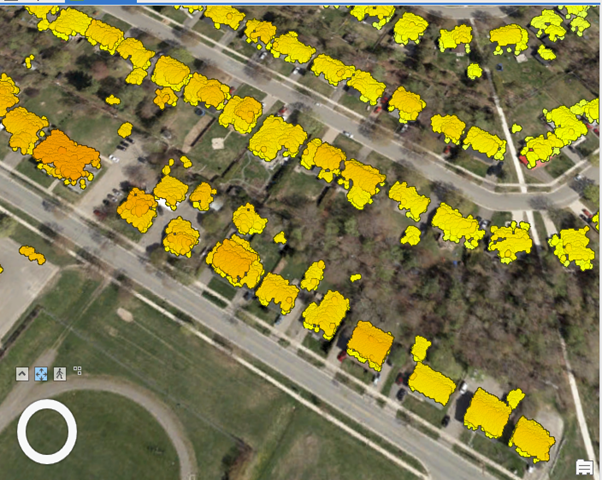
This article aims to provide insights into LOD1 generation utilizing ArcGIS Pro within the context of the “3D Geographical Information Systems” course offered by the Geodesy and Geomatics Department at the University of New Brunswick. The process of constructing LOD1 involves three fundamental steps outlined below. 1. Understanding LOD1 LOD1, or Level of Detail 1, […]
Read More
 Using Analytic Hierarchy Process to Determine Optimal Locations for Fire Observation Towers in Iran’s Shafarood Forest
Posted 1 year ago
By Mersedeh Khoshkholgh in the UNB Blog
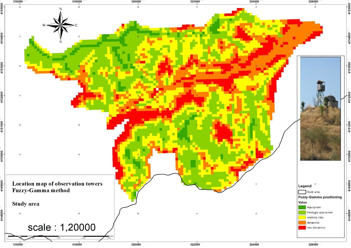
SummaryForests have been seriously affected by fire; therefore, it is necessary to detect fire from the observation towers. Currently, the number of observation towers and the effectiveness of their distribution is unknown. The aim of the current research is to determine the current and potential areas that can be seen from the observation towers. Another […]
Read More
 Ortho Mapping Historical Aerial Photos
Posted 1 year ago
By Dechen Wangmo in the UNB Blog
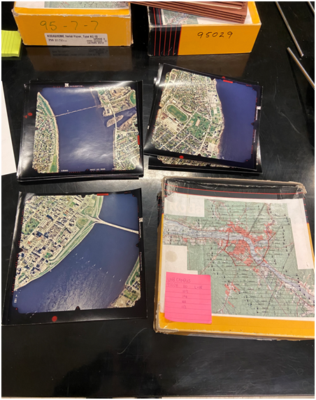
I have been working on ortho mapping historical aerial photographs as part of my work study programme. The aerial photograph was shot in 1995 and shows the city of Fredericton. An orthophoto is an aerial photograph or satellite image that has undergone geometric correction to make the scale uniform and follows a specific map projection. […]
Read More
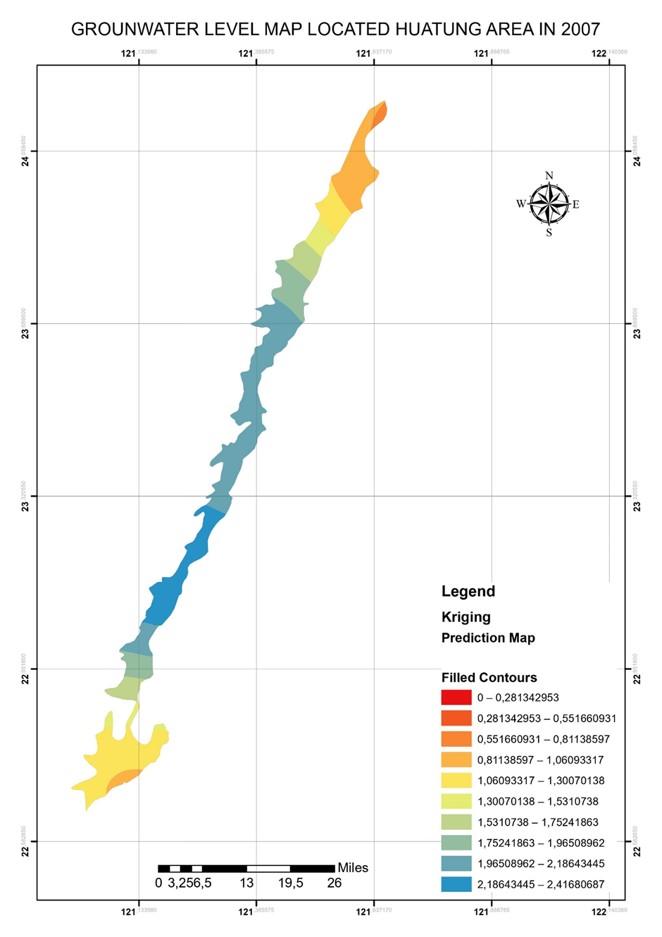 Computational method of ArcGIS Ordinary Kriging tool
Posted 2 years ago
By Ngoc Phan in the UNB Blog
ArcGIS provided outstanding and friendly interpolation tools to common users. I unitized Kriging tool in ArcGIS to interpolate the data points a long time ago. However, understanding its method is a different story. My previous background is in Applied Geology, particularly Groundwater modeling. I, therefore, had a chance to learn the meaning of the ArcGIS […]
Read More
 The Equalizers App Challenge journey – from the view of a first timer
Posted 3 years ago
By Nana Agyei Owusu Afriyie in the UNB Blog
When my professor emailed me about being an Esri Canada Centres of Excellence Associate, I was initially very excited about the opportunity. However, upon hearing about the App Challenge, though I always think of myself as capable of anything, I honestly thought maybe he rated me a bit too highly and I wasn’t up to […]
Read More
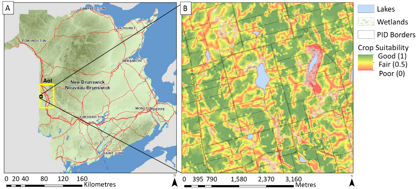 Farmland Assessment Value and Potato Crop Suitability in Carleton County, New Brunswick
Posted 3 years ago
By Kamille Lemieux in the UNB Blog
In New Brunswick, farmlands (> 5 ha) are classified as non-residential and are assessed at market value. In contrast, freehold timberlands are assessed at one hundred dollars per hectare, while farm woodlots are assessed at one dollar per hectare [1,2]. This blog addresses the extent to which the assessed market value of farmlands reflects soil […]
Read More
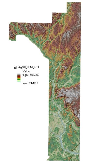 Workflow and Tools Used to Derive a Digital Elevation Model (DEM) of the “Potato Belt” Area in New Brunswick
Posted 3 years ago
By Kamille Lemieux in the UNB Blog
I am a first-year student working towards a Master’s degree in Forestry at the University of New Brunswick (Fredericton campus). My research project is on LiDAR-based potato crop suitability mapping in the “Potato Belt” area in New Brunswick. The aim of this research is to improve New Brunswick’s food security strategy, especially in terms of expanding farming activities across forested […]
Read More
 Discovering The Usage of ArcMap for Nautical Chart Data
Posted 5 years ago
By Alex Scott in the UNB Blog
So far with my time studying Geomatics at the University of New Brunswick I’ve seen just how versatile ArcGIS can be. During the winter term I was taking an ocean mapping course that broke down the fundamentals of positioning and recording regions of the seafloor. One topic of interest that was assigned to us was […]
Read More
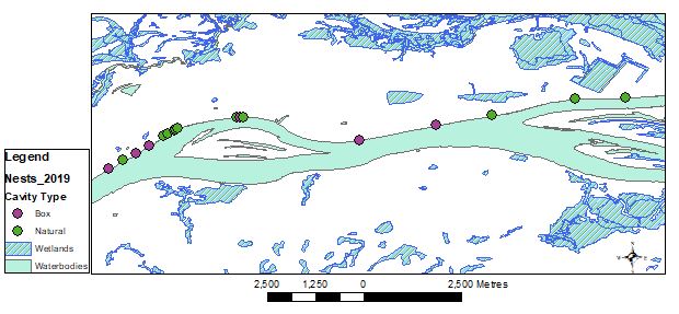 Using the GeoNB Data Catalogue and VBScript to obtain habitat-level site characteristics for cavity-nesting duck nest sites
Posted 5 years ago
By Heidi Harding in the UNB Blog
I am currently working on my Master’s of Science in Forestry at the University of New Brunswick, looking at nesting habitat use and availability for cavity-nesting ducks in the Saint John River floodplain. Field work for this project involves going out into the floodplain and locating both the natural cavities that cavity-nesting ducks have evolved to use as […]
Read More

