
Creating a 3D City Model with ArcGIS CityEngine
This post demonstrates the process of constructing a 3D city model using ArcGIS CityEngine, leveraging data from sources like OpenStreetMap, including network, footprint, and terrain databases. The project is a component of the “3D Geographical Information Systems” course at the Geodesy and Geomatics Department, University of New Brunswick.
1. Collecting data
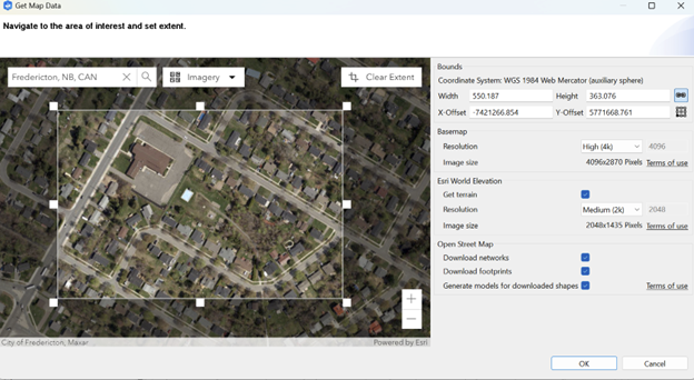
Using the “Get Map Data” tool, a focused study area within Fredericton City was selected, establishing the boundary and coordinate system (WGS 1984 UTM zone 19). Key data, such as terrain, traffic network, and footprint information, was downloaded from OpenStreetMap to serve as the foundation for building the 3D model, as illustrated in Figure 1.
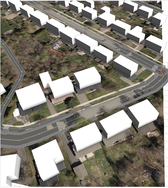
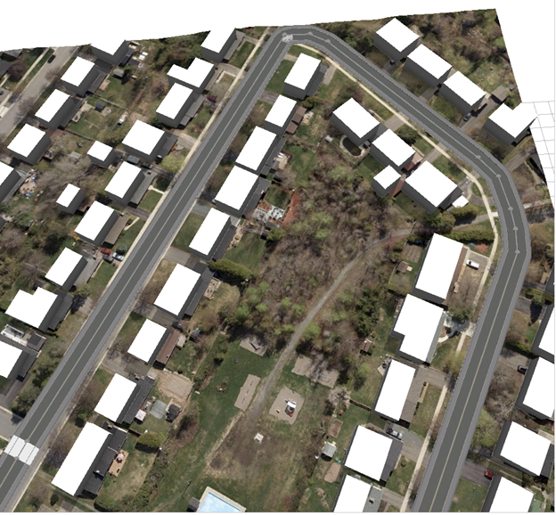
However, a challenge emerged when the city streets did not align well with the existing terrain, as depicted in Figure 2. To address this issue, the “Align Graph to Terrain” and “Align Terrain to Shape” tools were employed, aligning graph nodes to the height map and adjusting the terrain to match the footprint shape, as shown in Figure 3.
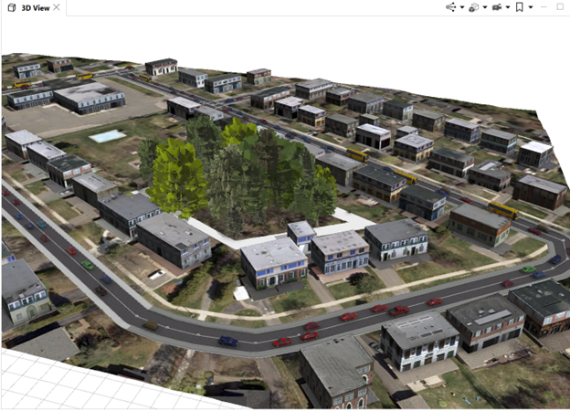
2. Designing City
In the design phase of the 3D city model, the Complete Street Rule, developed by David Wasserman – an expert from Esri, played a crucial role. This rule facilitates visualizing street and sidewalk designs and generating associated reporting metrics. Street styles, tree types, and building styles were determined to suit the urban environment. Notably, the “Realistic” building type was chosen, and Figure 5 presents a glimpse of the resulting model for a section of Fredericton city.
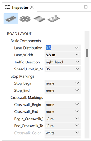
The Complete Street Rule offers users diverse display options for designing their models, including texture, traffic density levels, lane width, traffic direction, and more. Additionally, plant distribution, such as selecting plants for Zone 6, contributes to a more suitable urban representation.
It is important to note that this mini project serves as a practical exercise, providing insights into the process of building a 3D city model using ArcGIS CityEngine rather than a comprehensive model for other purposes.
References
1. Esri Canada GIS Centres of Excellence: https://ecce.esri.ca/
2. Complete Streets in CityEngine:
- Tutorial material: https://hed.esri.ca/resourcefinder/data/files/CityEngine_CompleteStreets.pdf