 Using the GeoNB Data Catalogue and VBScript to obtain habitat-level site characteristics for cavity-nesting duck nest sites
Posted 5 years ago
By Heidi Harding in the UNB Blog
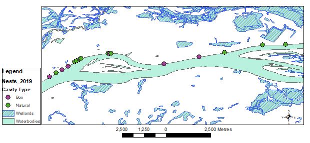
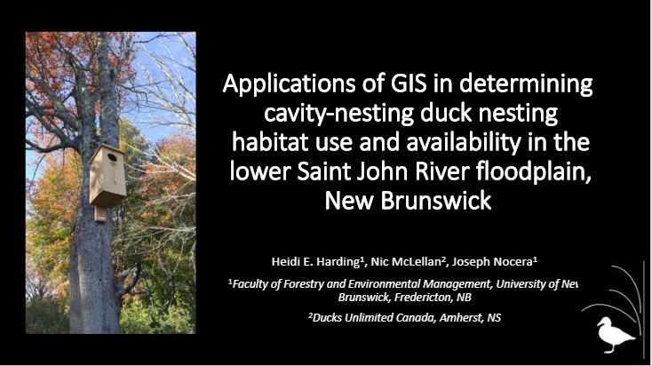
I am currently working on my Master’s of Science in Forestry at the University of New Brunswick, looking at nesting habitat use and availability for cavity-nesting ducks in the Saint John River floodplain. Field work for this project involves going out into the floodplain and locating both the natural cavities that cavity-nesting ducks have evolved to use as […]
Read More
 Using across-method triangulation to supplement location information
Posted 5 years ago
By Brittany Barber in the Dalhousie Blog
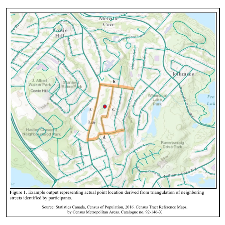
There is growing attraction for social and behavioral scientists to apply geographic information systems (GIS) theory and methods. The term “geocoding” is now commonplace amongst population health researchers and draws attention to connecting attributes of people to the characteristics of place. Partly due to the increasing availability and access to locational information, researchers are now […]
Read More
 Teaching with Story Maps
Posted 5 years ago
By Caitlin Cunningham in the Dalhousie Blog
This year I’m trying to be a bit more creative in the classroom and reduce my reliance on PowerPoint. So, when asked to give a guest lecture a couple of weeks ago, I decided to give story maps a try as a teaching tool. Story maps are a useful tool for communicating and engaging an […]
Read More
 Data Wrangling with Python and R, Part 2: LiDAR Validation with Differential GPS
Posted 5 years ago
By Sean Leipe in the McMaster Blog
One major part of my field season this past summer in the Yukon involved validating both of our LiDAR datasets with a differential GPS unit (dGPS for short). Independently quantifying survey accuracy is an essential part of any project involving LiDAR. Without knowing the LiDAR return accuracy in terms of elevation compared to the “true” […]
Read More
 Using ArcGIS and MCDM to Generate a Residential Solar Panel Suitability Map for the City of Airdrie
Posted 5 years ago
By Xuyang Han in the YorkU Blog
Motivation Behind this Project The world׳s energy demand is growing fast because of population growth and technological advancements. It is therefore important to look for a reliable, cost-effective, and renewable energy source to meet rising energy demand in the future. Solar energy, among other renewable sources of energy, is a cost-efficient energy source. Furthermore, solar […]
Read More
 Identifying the critical source areas of nitrate load in an agricultural watershed in PEI using the SWAT model
Posted 5 years ago
By Kang Liang in the UNB Blog
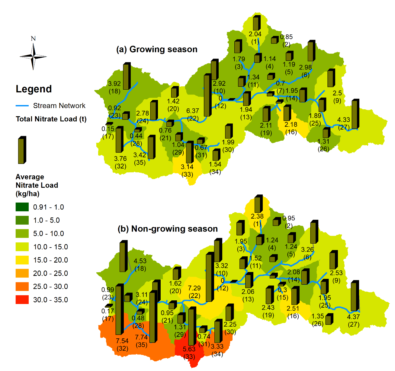
Background Nitrate pollution caused by intensive agricultural activities has drawn increasing intention around the world over the past few decades (Liu et al., 2016; Milovanovic, 2007; Ongley et al., 2010; Sith et al., 2019; Van Meter et al., 2017). Nitrate pollution is threatening the health of receiving water bodies leading to hypoxia or eutrophication of […]
Read More
 Developing A Level of Traffic Stress (LTS) Network using R and ArcMap
Posted 5 years ago
By Rajveer Ubhi in the McMaster Blog
While cycling is a physical activity with recognized benefits, injury events do occur. Between 2006 and 2017, 890 cyclists died in Canada, averaging 74 deaths per year. Collisions with motor vehicles made up 73% of these fatal cycling events. In addition to deaths, about 7,500 cyclists were seriously injured every year during the same period […]
Read More
 My Top Five Takeaways from the Halifax User Conference
Posted 5 years ago
By Heidi Harding in the UNB Blog
When I heard that ECCE student associates could attend the local Esri Canada User Conference (UC), I jumped at the opportunity. After all, my interest in applying GIS to topics in wildlife ecology and management is what drew me back to school to pursue a graduate degree. I can’t help but find GIS technologies exciting. […]
Read More
 Valuable Experience from the 2019 ECCE App Challenge
Posted 5 years ago
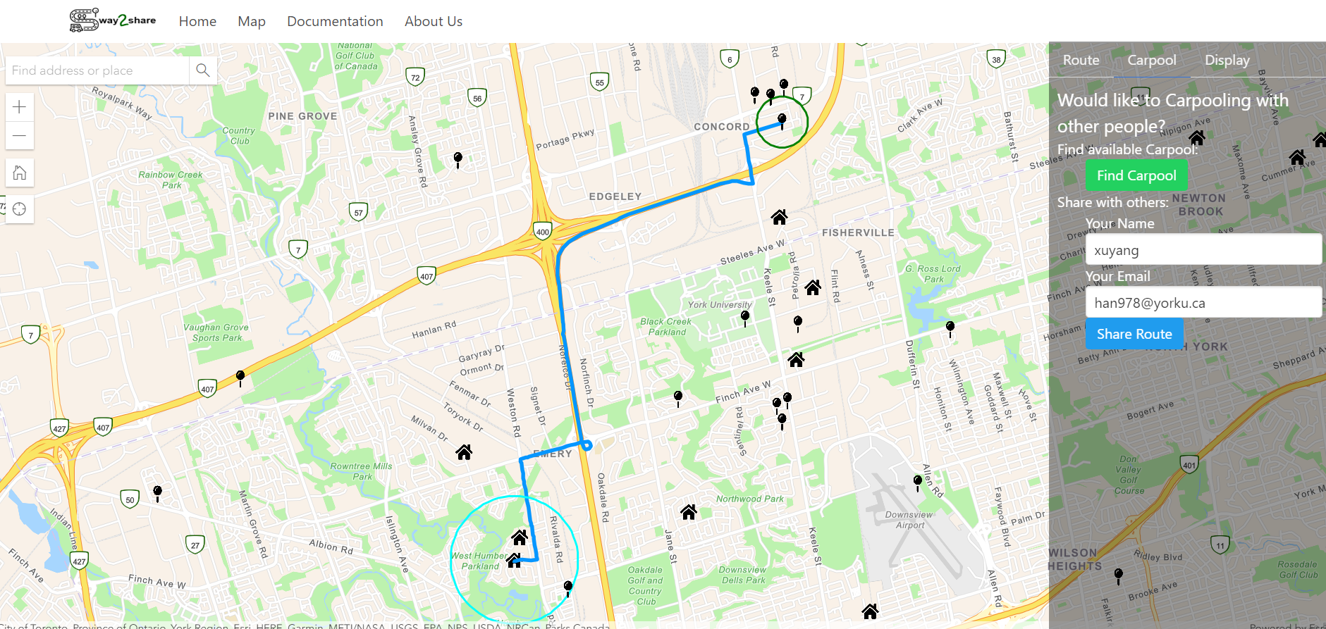
By Xuyang Han in the YorkU Blog
Check out more details about the App Challenge team ‘Awesome Engineers’ and the app that Xuyang Han writes about below on the team’s profile page. Earlier this year, three engineering students at York University, Xuyang Han, Muhammad Usman and Aman Ullah attended the 2019 Esri App Challenge. I would like to share this valuable experience […]
Read More
 To Kampala and Beyond
Posted 5 years ago
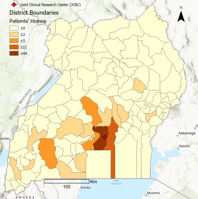
By Gabrielle Bruser in the Western Blog
Hello Esri family, My name is Gabrielle Bruser and I am a second year Masters student in Health Geography. I am new to the Esri Canada Centre of Excellence (ECCE), and I wanted to introduce myself and share my progress with my research (or lack thereof). I spent the last summer collecting data at the […]
Read More

