 Hot Spot Analysis of Essential Service in Toronto
Posted 5 years ago
By Alexander Tabascio in the UofT Blog
During this time of COVID-19, social distancing has effected our ability to travel and access essential service as we would typically do. For many without a car, active modes of transportation such as walking or biking, are the only alternative, but can these services be reached? On April 17, Statistics Canada, along with the Canada […]
Read More
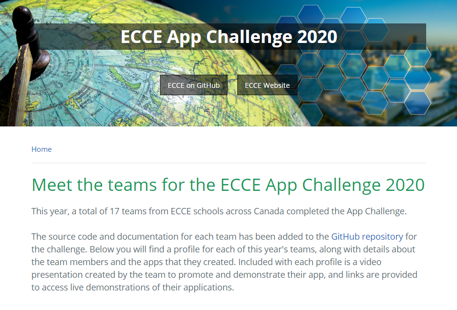 Meet the Teams of the ECCE App Challenge 2020
Posted 5 years ago
By Michael Leahy in the Main Blog
This year, we held the sixth annual ECCE App Challenge since the competition began in 2015. It has been a long wait for the first teams that started their projects over two months ago, on February 14th. The final team to participate this year completed their work just over two weeks ago, on April 5th. […]
Read More
 Geospatial technology in the age of COVID-19
Posted 5 years ago
By Alexander Wray in the Western Blog
The COVID-19 pandemic has affected the entire world. Universities and colleges were forced to rapidly move classes online, cities have implemented far-reaching physical distancing policies, and many businesses have closed or transitioned their options to remote, takeout, or delivery online models. This situation has demonstrated how interconnected our globalized world has become, and exposed existing […]
Read More
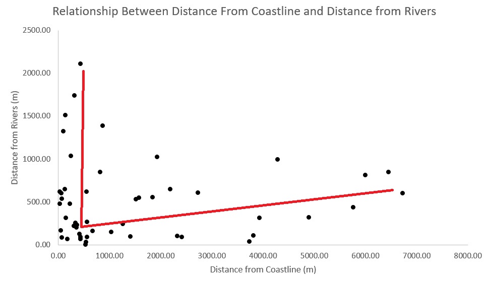 GIS Summary of SNAP 2019 (Part 3): Analyzing Extracted Results
Posted 5 years ago
By Todd Wong in the McMaster Blog
This third part of my four-part series will go through a case study in which we analyze and determine variables generated from several tools. Our case study involves 50 early bronze age sites on Naxos (Figure 1), an island located in the Aegean that is the largest of the Cycladic sister islands with a rich […]
Read More
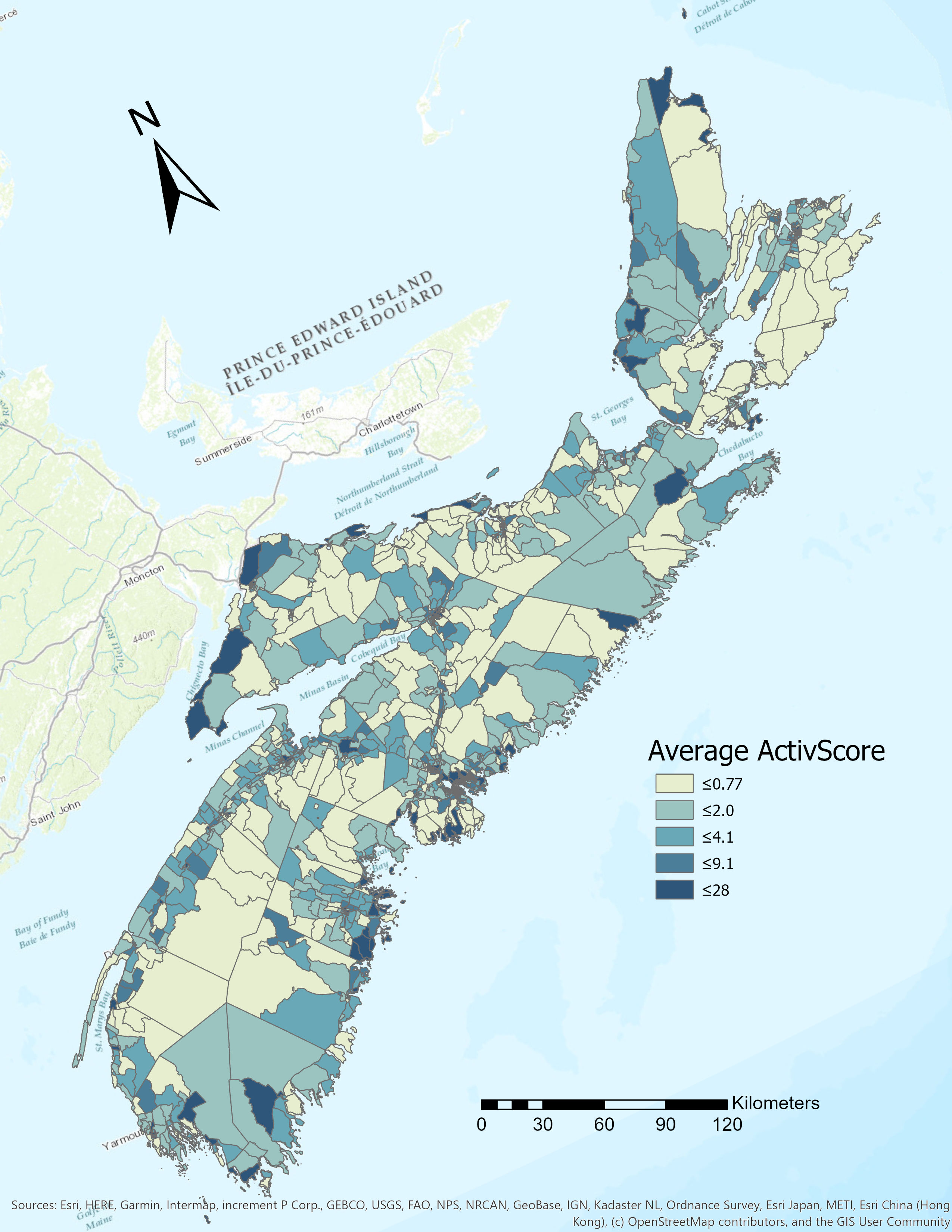 ActivScore: A Physical Activity Potential Score for Nova Scotia
Posted 5 years ago
By Lily Barraclough in the Dalhousie Blog
Chronic illness is a prevalent concern, especially in Canada where it accounts for a high proportion of annual mortalities (Statistics Canada, 2017). Encouraging physical activity is important to prevent chronic illness, increase the overall mental and physical well being of the population, and increase the use of active transportation to facilitate more sustainable communities (Booth, […]
Read More
 COVID-19 Web Mapping Application: step-by-step
Posted 5 years ago
By Scarlett Rakowska in the UofT Blog
Hello, My name is Scarlett, and I am a third-year undergraduate student at the University of Toronto Mississauga, studying Geographical Information Systems (GIS). After the World Health Organization announced COVID-19 a pandemic, on March 19, 2020, I viewed an Esri Canada webinar presented by Chris North and Mike Gregotski called “Responding to the COVID-19 Crisis […]
Read More
 Is mapping really the ultimate equalizer?
Posted 5 years ago
By Robert Arku in the UW Blog
When I was seven (7) years old, one of my favorite leisure activities was drawing the political map of my country, Ghana in West Africa, showing all then ten (10) administrative regions. I was very proud of my drawings (on hindsight, I should have had them framed). This map was a basic map which visually […]
Read More
 Modeling Line Features on DGGS Grids in the R-ArcGIS Environment
Posted 5 years ago
By Erin Li in the UCalgary Blog
A Glance at DGGS As a candidate for a new Earth reference standard, Discrete Global Grid System (DGGS) was confirmed by the Open Geospatial Consortium (OGC) as “a spatial reference system that uses a hierarchical tessellation of cells to partition and address the globe” in 2017. DGGS has been recognized as the most potential foundation […]
Read More
 Story Maps as Part of the Virtual Conference?
Posted 5 years ago
By Caitlin Cunningham in the Dalhousie Blog
The World Health Organization has officially declared COVID-19 a global pandemic which is causing conferences around the world to be cancelled, leaving organizers scrambling to find ways to hold virtual conferences. Could Story Maps be part of the solution? I think so. Story maps are a useful tool for communicating and engaging an audience through […]
Read More
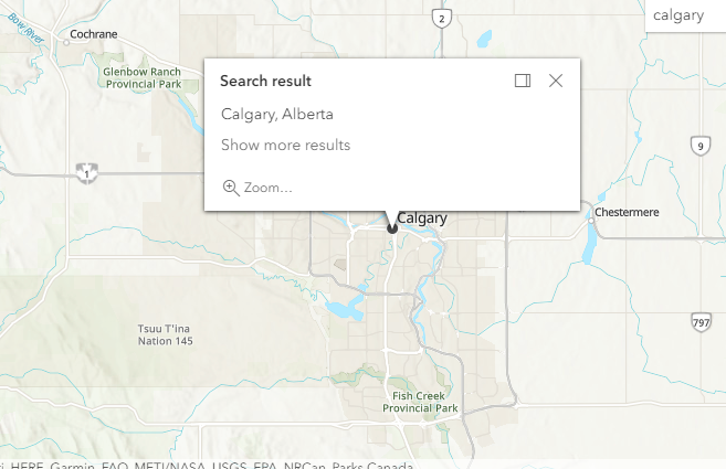 Get started with the ArcGIS world Geocoding service
Posted 5 years ago
By Changlin Yang in the UCalgary Blog
Hello everyone, My name is Changlin and I am a second year masters student from Geomatics Engineering at the University of Calgary. This post is about my recent experience working with the ArcGIS World Geocoding Service to find geographical locations of different places. This experience is related to one of the project tasks of a […]
Read More

