 App Challenge 2019, GISquad
Posted 5 years ago
By Michele Tsang in the McMaster Blog
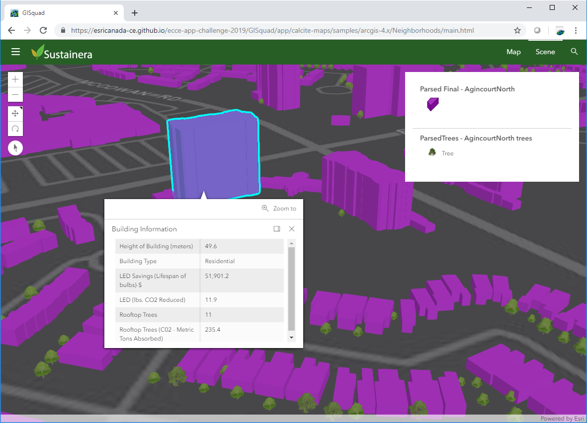
The App Challenge project that Michele discusses below can be viewed from her team’s profile on the ECCE GitHub website: https://esricanada-ce.github.io/appchallenge/2019/teams/mac/GISquad/ This year I participated in the ECCE App Challenge for the third time. My team included Matthew Brown, lead designer, Tasos Dardas, lead developer, and myself, lead researcher. Our App, Sustainera, is a web […]
Read More
 Processing Millions of Bikeshare GPS Points with ArcGIS
Posted 5 years ago
By Matthew Brown in the McMaster Blog
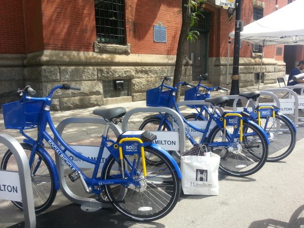
For this post I wanted to dive into some of the work I’ve been doing for my Master’s thesis in the Transportation Research Lab at McMaster. Our lab has a partnership with the folks at SoBi Hamilton, who manage the city’s bike share program. If you don’t know what a bike share program is, it […]
Read More
 11 Reasons You Should Attend the Esri Developer Summit
Posted 5 years ago
By Ed Taylor in the McMaster Blog
1) You don’t have to be a developer to benefit Technical literacy and systems of engagement are proliferating in geographic disciplines, so even if your interests are far removed from software development, you will come away understanding new ways to augment your work and connect with your audience. The plenary session at the 2019 Esri […]
Read More
 A Glance at Enterprise Geodatabases and Publishing Content
Posted 5 years ago
By Anastassios Dardas in the McMaster Blog
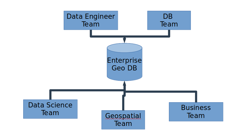
Introduction All of us in the field of GIS already know what a geodatabase is. Most of us know how to properly create one, especially for single-use or for our own personal projects. Depending on the GIS project, most of the time academic institutions just need personal or file geodatabases. For industry and government, it […]
Read More
 Esri MOOC Review: “Cartography.” – A Great Free Resource
Posted 5 years ago
By Matthew Brown in the McMaster Blog
Education nowadays is extremely expensive. The average Canadian tuition cost for the 2017-18 school year was $6,571 – a 3.1% increase from the previous year (Statistics Canada, 2017). E-Learning platforms like Udemy, SkillShare, and Teachable are on the rise as more cost-effective ways of learning new skills or subjects. My university education has been extremely […]
Read More
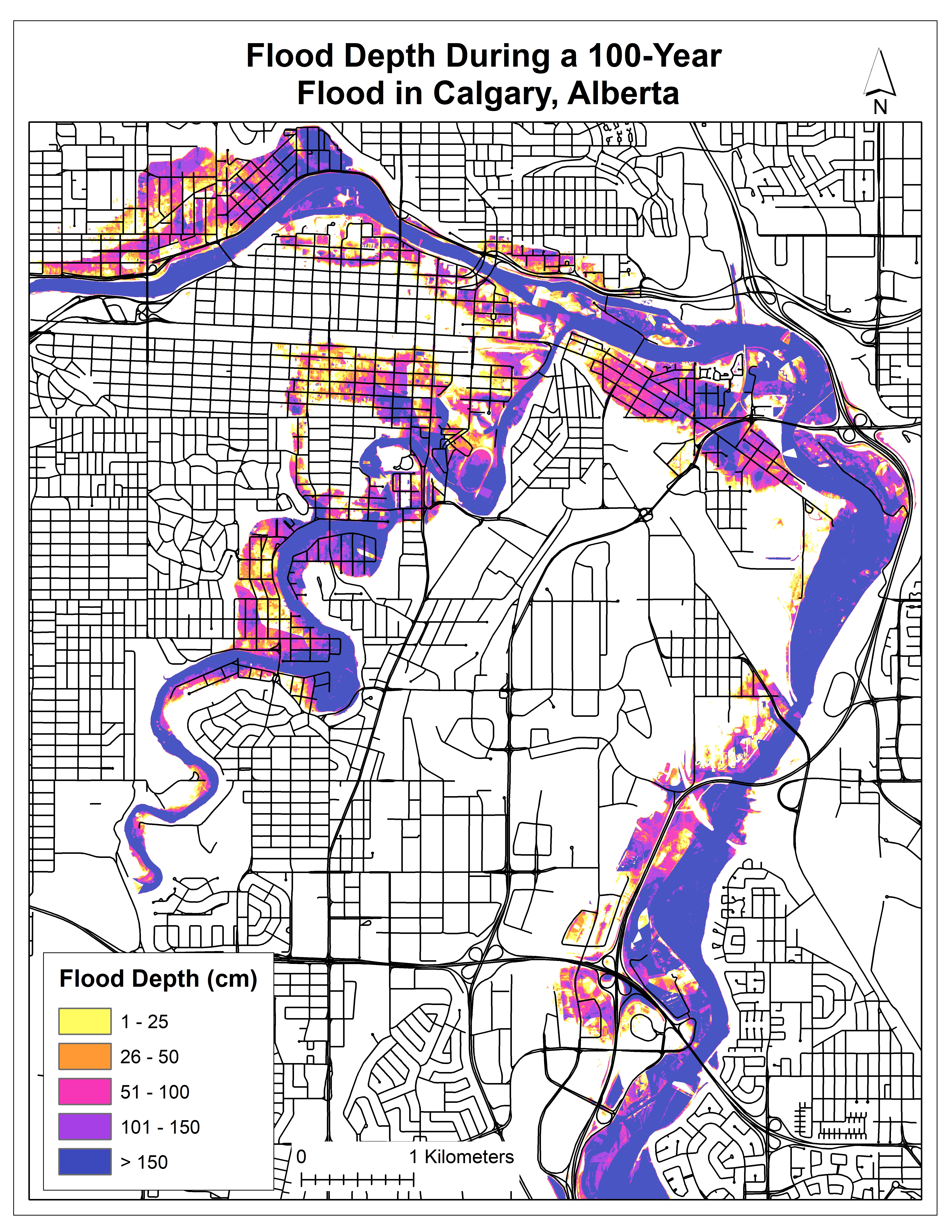 Flood Depth Mapping in Calgary, Alberta
Posted 5 years ago
By Michele Tsang in the McMaster Blog
I am currently in the second year of my M.Sc. degree at McMaster University, working with my supervisor, Dr. Darren Scott. Right now, I am in the middle of processing my data and have some preliminary results to share. Extreme weather events, such as floods, can cause severe consequences to the road network, such as […]
Read More
 “Nuggets” from the ESRI User Conference Toronto!
Posted 6 years ago
By Ed Taylor in the McMaster Blog
This post is inspired by the attendee I overheard at this year’s Toronto User Conference saying “It’s the little nuggets you pick up at conferences that really make them worth it.” So here are the “nuggets” I picked up at the UC, hopefully there’s something golden here for you! Visual Studio Code is a free […]
Read More
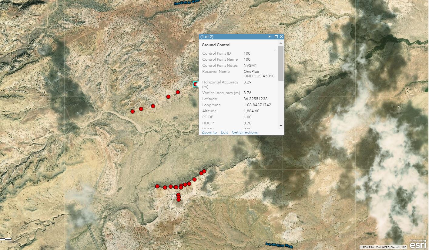 Using Mobile GIS Applications to Collect Data in New Mexico, USA
Posted 6 years ago
By Rajveer Ubhi in the McMaster Blog
This year I spent most of the summer in Utah and New Mexico, USA, collecting data for my undergraduate thesis, attending conferences related to petroleum geology, and helping process the data of Master’s and PhD students part of Dr.Bhattacharya’s Quantitative Sedimentology Laboratories. My work included recording GPS coordinates of ground control points (GCPs) used for image […]
Read More
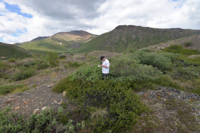 Integrating GIS and Field Work in Wolf Creek, Yukon Territory
Posted 6 years ago
By Sean Leipe in the McMaster Blog
I’ve spent the past summer working as a research assistant for my M.Sc supervisor Dr. Sean Carey, before officially starting grad school in September. Through helping out the other grad students in our lab, I’ve learned tons of valuable hydrology-specific GIS skills (which I could write about in a future blog post), but I want […]
Read More
Going Beyond the Horizons of ArcGIS Desktop
Posted 6 years ago
By Anastassios Dardas in the McMaster Blog
Any of you visiting the Centre of Excellence or visiting Esri’s main site is likely a user of ArcGIS products, especially ArcGIS Desktop and to certain extent ArcGIS Online. What the academic courses taught you are the GIS concepts, how to think like a GIScientist, and how to use the tools, mainly ArcGIS Desktop. But […]
Read More

