
Using Mobile GIS Applications to Collect Data in New Mexico, USA
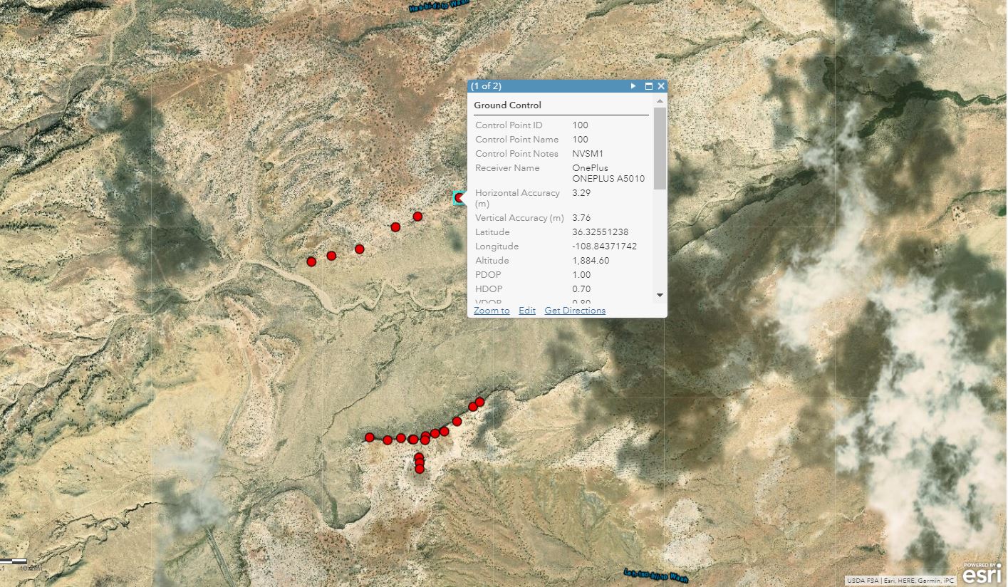
This year I spent most of the summer in Utah and New Mexico, USA, collecting data for my undergraduate thesis, attending conferences related to petroleum geology, and helping process the data of Master’s and PhD students part of Dr.Bhattacharya’s Quantitative Sedimentology Laboratories. My work included recording GPS coordinates of ground control points (GCPs) used for image correction and datum anchoring of pictures taken using a drone. The pictures are later stitched together using photogrammetry software like Pix4D to create a 3D-model of the outcrops being studied. In previous years, the laboratory made use of handheld GPS units. The problem with this is that the vertical and horizontal accuracy is plus/minus 30 meters. This year, I implemented the use of the Esri Collector App to record GPS coordinate data.
Esri’s Collector for ArcGIS is a mobile application that can collect and update information in the field, sync offline data to an online map, capture and share photos or videos and achieve enhanced spatial accuracy of plus/minus 3 meters using the GPS receivers built into most Android, iOS or Windows phones and an external receiver (using an SXBlue external receiver, spatial inaccuracy can be as small as 2 to 3 centimeters). By using Esri Collector, I was able to plan out where our team would lay out the GCPs a day before, execute coordinate retrieval at a much faster pace in the field, increase the accuracy of each coordinate, and take notes, pictures, and videos at each site – all this on my phone without having to take out a pencil, paper or even use Wi-Fi!
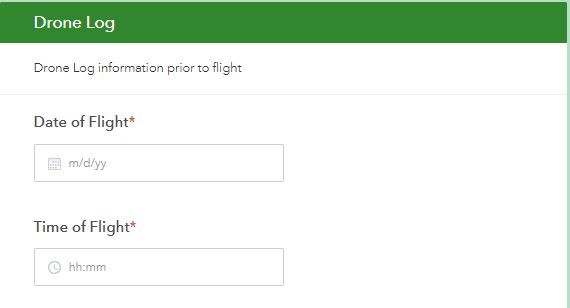
When flying a drone in the United State or Canada, there are multiple laws that need to be followed. One of the laws that we had to abide by is that every time a drone is air-born to capture photos or videos used for educational purposes, a drone log needs to be completed by the drone pilot or crew members. A drone log is a record of drone activities that must be recorded prior to a flight for safety purposes; information includes date, time, drone type, drone pilot, crew members, and wind direction to name a few. In previous years, the laboratory made use of a notebook to record drone logs. The problem with this is that notebooks can easily be damaged, misplaced, or lost. This year, I implemented the use of Survey123 for ArcGIS to record drone logs.
Survey123 for ArcGIS is a form-centric data gathering solution that makes sharing and processing surveys possible by asking questions and recording answers in mobile devices that sync with an ArcGIS Online account. I was able to use Survey123 for ArcGIS to create a survey that acted as a drone log that asked many of the generic drone logging questions. The survey was then completed in the field either by the drone pilot or the crew members on their phones prior to every drone launch and uploaded to my ArcGIS Online account for storage and further processing in a web map when we returned from the field.
Esri has come a long way in generating mobile applications for field work that can be used by students, professionals and, companies in many different disciplines. I think the ability to record data without Wi-Fi in the field that later syncs to an ArcGIS Online account when you are back online and on a network is what makes these applications so convenient for scientists, especially those in the Earth and Environment disciplines. With the Esri Canada User Conference in Toronto coming up, I am looking forward to updates on previous GIS mobile applications and an introduction to new GIS mobile applications that I can implement during the field season next summer!
To check out my trip to the United States and some of the places I visited, check out this StoryMap I made.