 11 Reasons You Should Attend the Esri Developer Summit
Posted 5 years ago
By Ed Taylor
1) You don’t have to be a developer to benefit Technical literacy and systems of engagement are proliferating in geographic disciplines, so even if your interests are far removed from software development, you will come away understanding new ways to augment your work and connect with your audience. The plenary session at the 2019 Esri […]
Read More
 “Nuggets” from the ESRI User Conference Toronto!
Posted 6 years ago
By Ed Taylor
This post is inspired by the attendee I overheard at this year’s Toronto User Conference saying “It’s the little nuggets you pick up at conferences that really make them worth it.” So here are the “nuggets” I picked up at the UC, hopefully there’s something golden here for you! Visual Studio Code is a free […]
Read More
Spatial statistical analysis of African conflicts
Posted 6 years ago
By Ed Taylor
Spatial statistical analysis of African conflicts What trends can we uncover given the traits of actors, such as nations, and information on a phenomenon of interest, such as violent conflict? What methods can be used to establish relationships between a study phenomenon and variables that can potentially be used to explain such trends? Are the […]
Read More
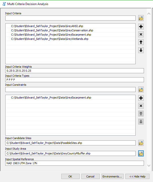 Scripting multi-criteria decision analysis
Posted 7 years ago
By Ed Taylor
Background My first foray into GIS above the introductory level was a raster-based course instructed by Patrick Deluca here at McMaster University. Among the work assigned for the course was a final project focused around multi-criteria decision analysis (MCDA), a process described by Voogd as to ‘investigate a number of choice possibilities in the light […]
Read More
 Contrasting Conferences: GIS in Education and Research and ESRI User Conference Toronto
Posted 7 years ago
By Ed Taylor
As a new addition to the ECCE group of student associates at McMaster University I was rife with anticipation to attend two compelling events hosted by Esri Canada – the GIS in Education and Research Conference (held at Hart House, University of Toronto) and the Toronto User Conference (held at the Toronto Congress Centre). Being […]
Read More

