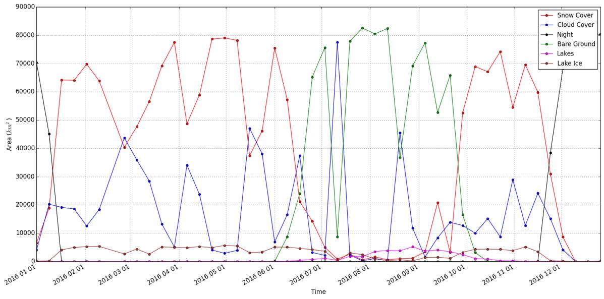
 Python script to retrieve time-series changes in snow cover area from MODIS
Posted 7 years ago
By Yulia Antropova in the Carleton Blog
As a part of Directed Studies in Geomatics course supervised by Dr. Murray Richardson at Carleton University I developed a tool that allows a user to easily produce time-series plots of snow-cover area and other relevant pieces of information (e.g. bare ground, cloud, and night cover) for any region (defined by an input shape file) […]
Read More
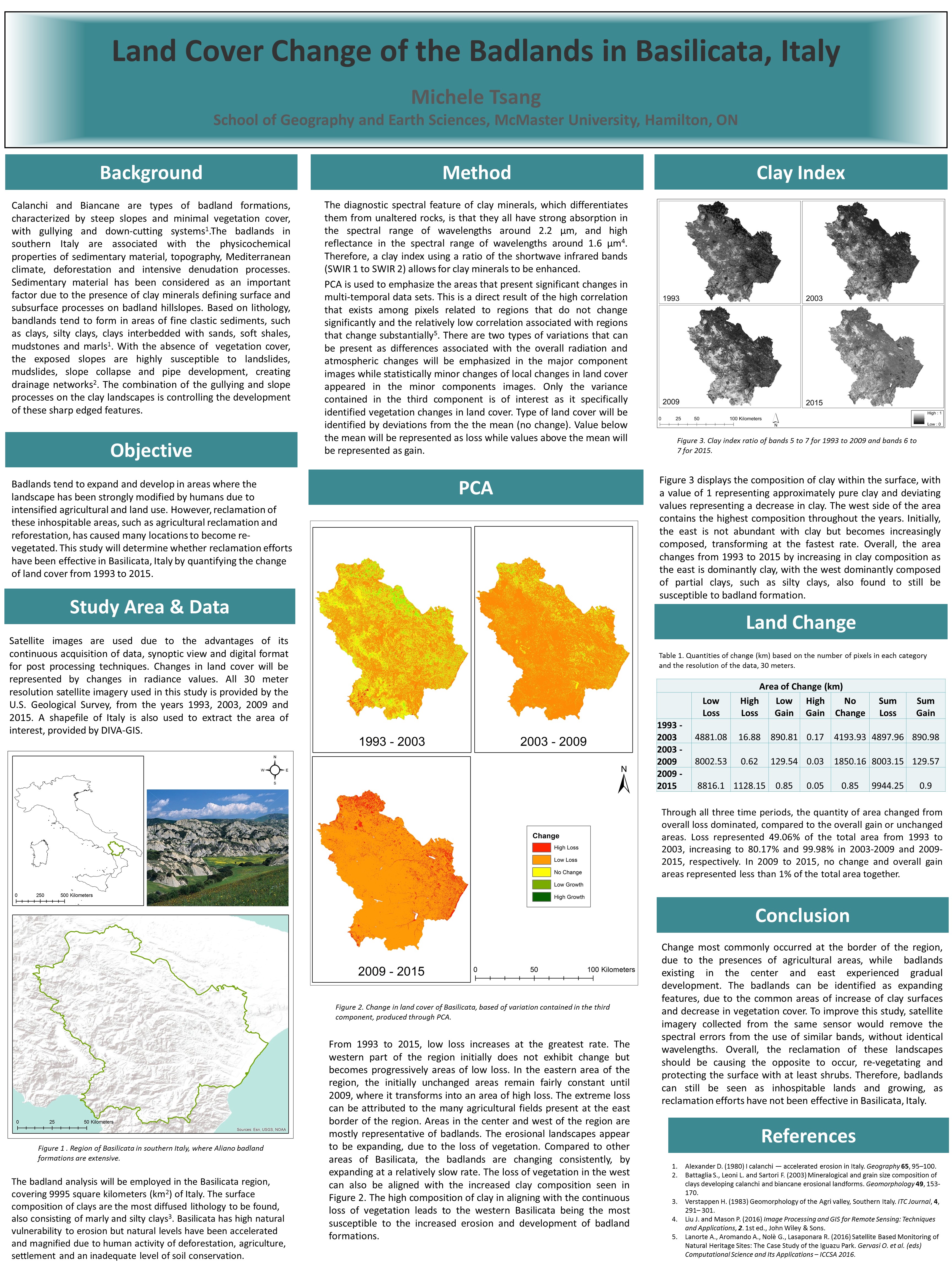 Land Cover Change in the Badlands of Italy using Remote Sensing
Posted 7 years ago
By Michele Tsang in the McMaster Blog
I am currently a first year Master’s student at McMaster University, working for Dr. Darren Scott. I just graduated from McMaster in April 2017, with a degree in Honors Earth and Environmental Science and a minor in GIS. During my fourth year, I completed an undergraduate thesis with the help of my supervisor, Patrick DeLuca. […]
Read More
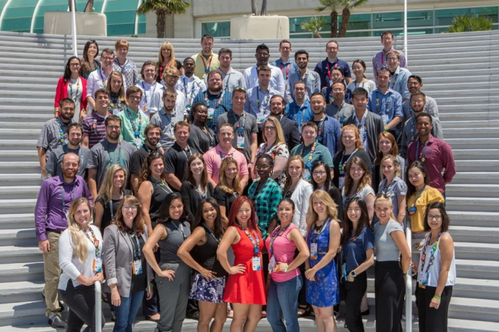 2017 Esri User Conference: A Student Perspective
Posted 7 years ago
By Morgan Moe in the UCalgary Blog
This spotlight article features a guest post from Morgan Moe, at the University of Calgary who recently attended the Esri User Conference in San Diego in July as a volunteer through the Esri Student Assistantship Program. Group photo of the 2017 Esri Student Assistants (Morgan Moe is in the 2nd row, fifth from the right) […]
Read More
 An Introduction to the Advanced Geographic Sciences Diploma at COGS
Posted 7 years ago
By Mykhala Penney in the COGS Blog
My name is Mykhala Penney and I am an ECCE Student Associate for the Centre of Geographic Sciences (COGS), enrolled in the Post-Graduate Advanced Geographic Sciences Program. Before COGS, I attended the University of Toronto where I completed a specialist degree in the field of geography, environmental science and GIS. After deciding that I wanted to […]
Read More
Navigating GIS Without Computer Science Knowledge
Posted 7 years ago
By Jessica Smith in the Carleton Blog
I’m in my final push: 4th year at Carleton University. When I first started studying at Carleton, I had no idea what Geomatics was. A student who I met on my first day said he was majoring in Geomatics and the first thing I said was “ew”. But wait…I needed to meet a Geomatics requirement […]
Read More
 Education and Research from Esri Canada @ the Esri UC, 2017
Posted 8 years ago
By Michael Leahy in the Main Blog
Last week, many staff from Esri Canada were fortunate to attend the Esri User Conference in San Diego. The conference hosted an impressive 16,000 attendees, 268 paper sessions, 324 workshops, and 354 demos (full stats reported on the Esri Blog). The plenary session was a great start to the week, with many talks highlighting the […]
Read More
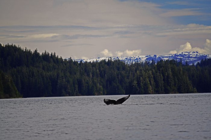 Collision Course: the daunting repercussions of an ever-increasing human race in coastal waters
Posted 8 years ago
By Danielle Derrick in the Carleton Blog
Looking out into Chatham Strait from Warm Springs Bay, Southeast Alaska. These past couple of months I’ve had the pleasure of working closely with the Alaska Whale Foundation (AWF) on both current and future research topics. AWF was founded in 1996 as a 501(c)(3) nonprofit organization dedicated to conserving Alaska’s marine mammals and their habitat […]
Read More
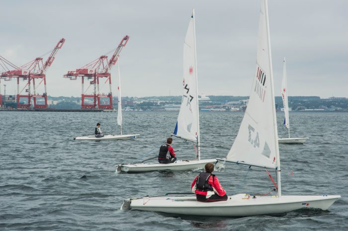 Marine Pollution in the Halifax Harbour Pt. III: Academics into Action
Posted 8 years ago
By Simon Ryder-Burbidge in the Dalhousie Blog
A cruise ship enters the Halifax Harbour in the distance. Thus far, in a series of posts, I have chosen to use this space to describe a project that my graduate class with the Marine Affairs Program at Dalhousie University has undertaken to set up a long term data collection project monitoring marine pollution around the […]
Read More
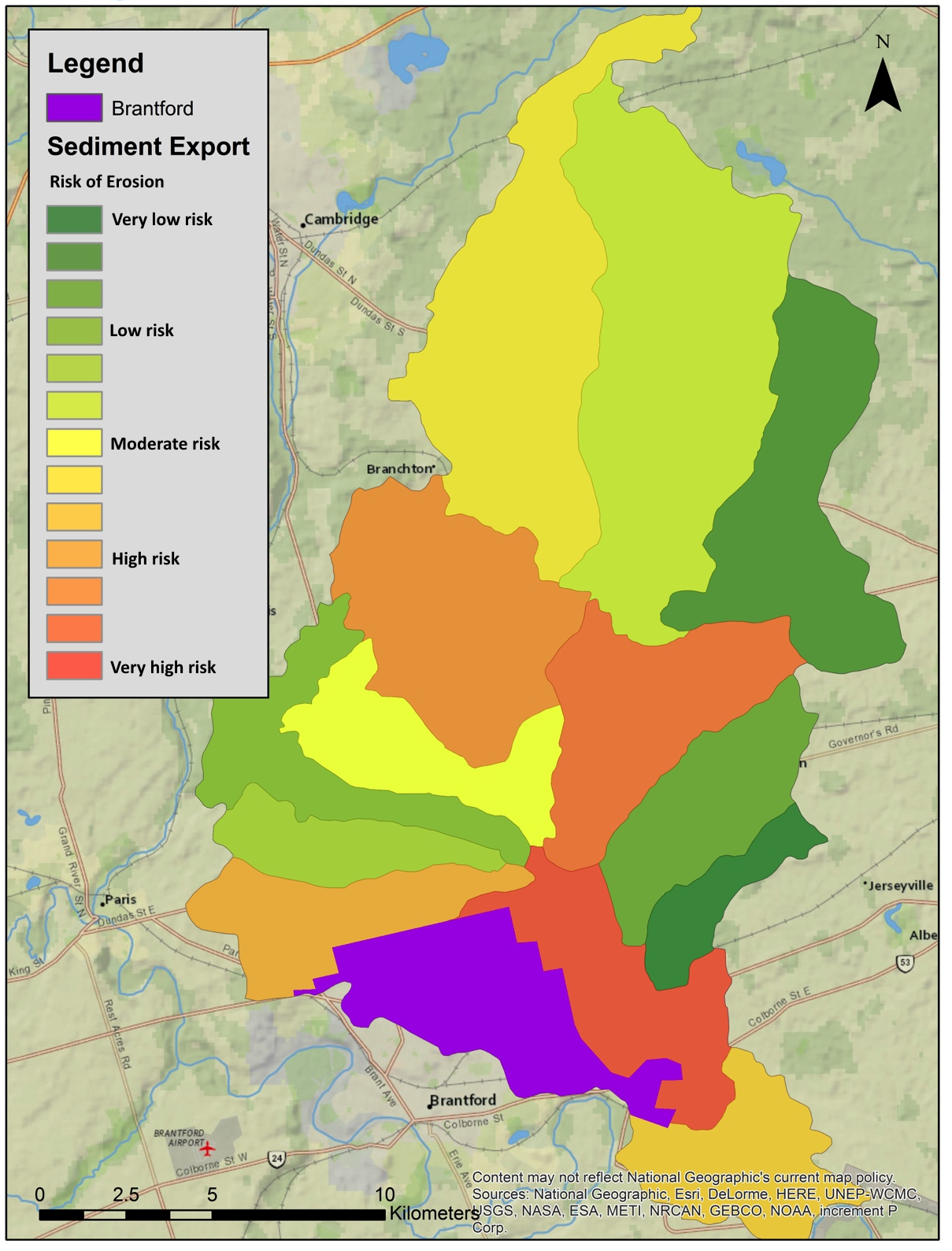 Quantifying Agricultural Erosion
Posted 8 years ago
By Benjamin Meinen in the UW Blog
This spotlight article is from Benjamin Meinen, one of the ECCE student associates at UW. He is a graduate of the Honours Geography and Environmental management undergraduate program at UW, and will be continuing his studies as a Masters student in Geography. Below he describes some of his work on a recent project for modelling […]
Read More
 Linking App-Building and Cartography – Experiences from the 2016 Esri Canada App Challenge
Posted 8 years ago
By Anthony Lee in the SFU Blog
Hi Everyone, Congratulations to the winners and participants of the 2017 Esri Canada App Challenge! With the recent conclusion of the 2017 Esri Canada App Challenge, I’ve decided to write about my overall positive experiences with the 2016 Esri Canada App Challenge. Some of the students in my multimedia cartography (GEOG 351) class participated in […]
Read More

