
Collision Course: the daunting repercussions of an ever-increasing human race in coastal waters
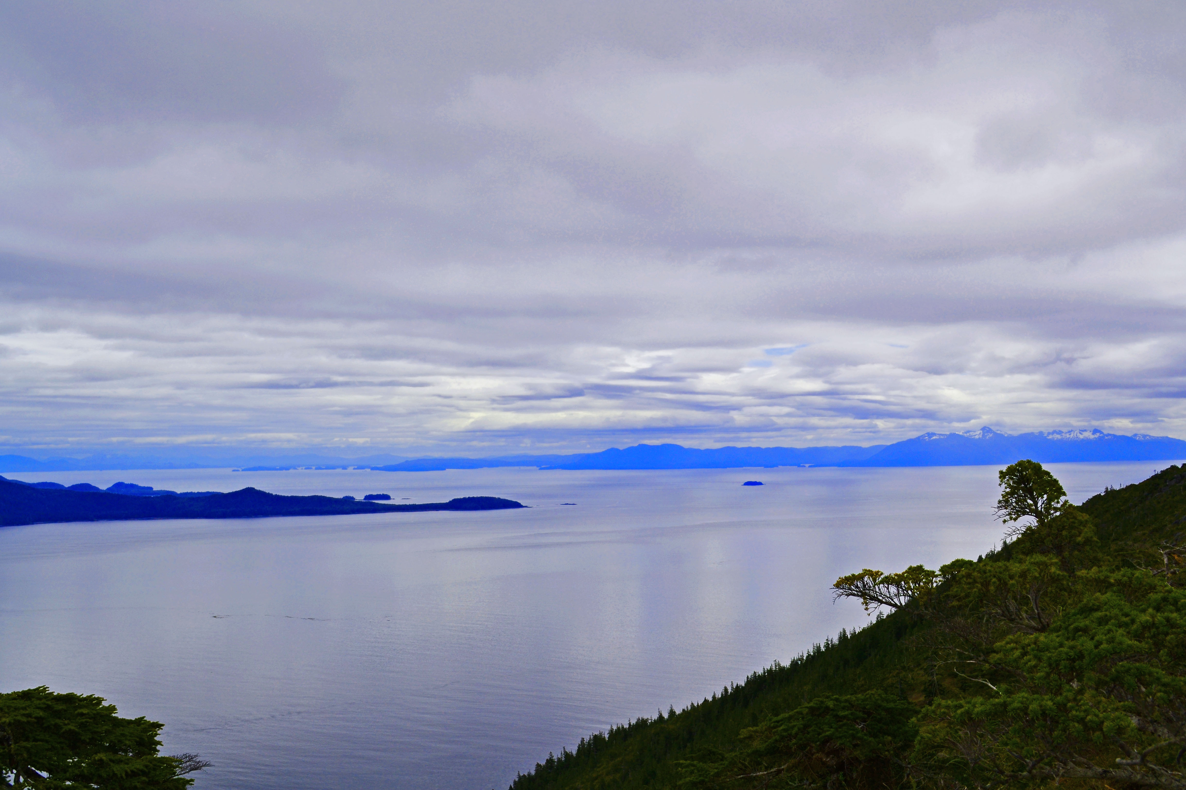
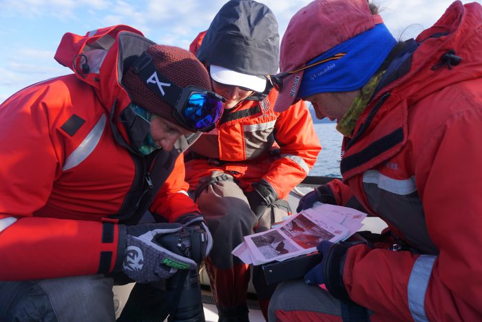
These past couple of months I’ve had the pleasure of working closely with the Alaska Whale Foundation (AWF) on both current and future research topics. AWF was founded in 1996 as a 501(c)(3) nonprofit organization dedicated to conserving Alaska’s marine mammals and their habitat through conservation and research. Since their beginnings in 1996, they have since established a research base in Southeast Alaska (more precisely Baranof Island) in Warm Springs Bay known as the Center for Coastal Conservation. Over the very short course of my stay at the station, I was involved in several different projects, two of which incorporated GIS into the base and analytical aspects of the project. So, allow me to tell you a little bit about one of the projects I was introduced into.
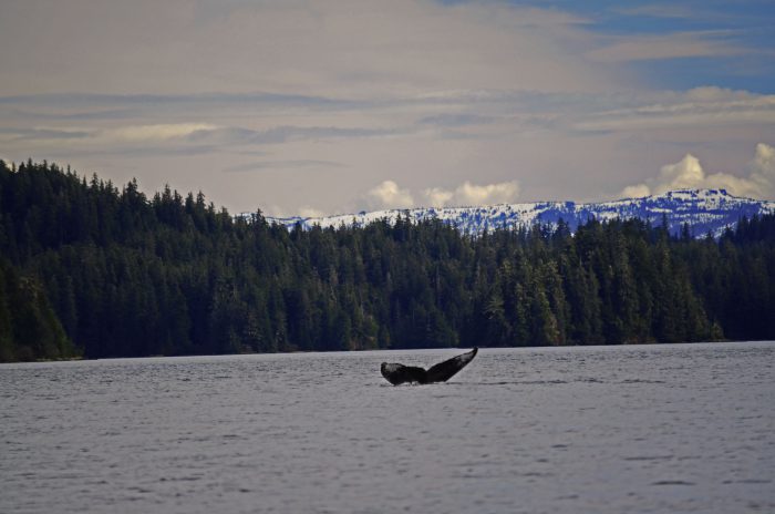
For starters, the key marine mammal studied at the Alaska Whale Foundation is the Humpback Whale (Megaptera noveangliae). These baleen whales are highly migratory and spend the summer months in productive cool waters in the North Pacific bordering British Columbia and Alaska. They primarily feed on larger zooplankton such as euphausiids and crab zoea, as well as small schooling fish (i.e. herring, mackerel, sand lance, capelin) (Baker et al, 1985; DFO, 2009; Neilson & Gabriele, 2016). The majority of these prey species make up dense prey patches where the whales can use a variety of feeding tactics to target the prey. Most may not already know, but humpback whales were hunted commercially throughout the 1800s until 1965 until they became internationally protected and enlisted as an endangered species (DFO, 2009). The global pre-exploitation population was estimated at over 120,000 individuals, and in the North Pacific alone had dwindled to approximately 1,500 following the whaling era (Gambell, 1976; DFO, 2009). Since then, they have made a remarkable recovery to 20,000 individuals in the North Pacific and growing at an annual rate of 4.9-6.8% annually.
Unfortunately, the 20,000 whales that call Alaska home has also become an increasingly popular area for travel. Of the various vessel types that frequent Alaskan waters, cruise ship tourism is the fastest growing travel sector in the world (CLIA, 2010). There is now a growing concern of how these vessels contribute to the degradation of the marine environment. Impacts to cetaceans can occur through two primary mechanisms: the alteration of the underwater sound environment and through collisions (Harris et al, 2012). In either case, the proximity of the whale to the ship is crucial. The vast majority of collisions occur in coastal areas where the whales concentrate for feeding or breeding (Laist et al, 2001), or where there is habitat overlap and high levels of human traffic (Laist et al, 2001; Knowlton and Kraus, 2001; Panigada et al, 2006; Fonnesbeck et al, 2008; Vanderlaan et al, 2008). Humpback whales are the second most species affected by vessel collisions, particularly because they are long-lived and have low rates of reproduction (Laist et al, 2011). Adding to the already high vulnerability of the whales with vessel encounters, vessels require long distances to slow their speeds and avoid collisions, some requiring thousands of meters to alter their course (Silber et al, 2009). Cruise ships use the interconnected fjords of the southeastern panhandle of the state (“Southeast Alaska”) to access major ports of call, including Skagway, Juneau, Sitka, and Ketchikan (Harris et al, 2012). The interconnected fjords are also prime foraging habitat for humpback whales, which peak in abundance in the summer months May through September after migration from winter breeding grounds (Harris et al, 2012). The number of collisions in Southeast Alaska have been increasing at a rate of 5.7% annually from 1978 to 2011, which closely matches the annual growth rate of humpback whales (Hendrix et al, 2012).
Understanding the interaction between large ships and large whales has become a global conservation issue owing to the dramatic increase in commercial waterborne traffic in recent decades (Andrew et al, 2002; Ross, 2005), and the emerging issue of the deleterious impacts that large vessels may have on individuals and populations of whales (Gende et al, 2011). Separating whales and vessels in both space and time (Vanderlaan & Taggart, 2009; Redfern et al, 2013), or reducing vessel speed (Guzman et al, 2013) are two of the most common methods adopted to reduce collision threat to cetaceans. In some cases, the management approach to reroute vessel paths can be both feasible and effective. For example, in the Bay of Fundy, slight changes in routing of vessels can reduce the relative risk of collision by up to 62% (Vanderlaan et al, 2008). In other cases, however, this may not be an appropriate action to take, either because whale distribution may shift over time, or because ships may not be able to reroute around high-use whale habitat (Gende et al, 2011). Ship strikes can jeopardize the viability of small populations and are becoming an increasing conservation issue in Southeastern Alaska as the number and frequency of ships continue to increase in areas known to harbor humpback whales. To better improve humpback whale conservation a detailed analysis is required to: (1) explore the areas of overlap between Southeastern Alaskan humpback whales and vessel traffic, and (2) determine the collision risk and the degree of lethality to humpback whales in relation to vessel traffic.
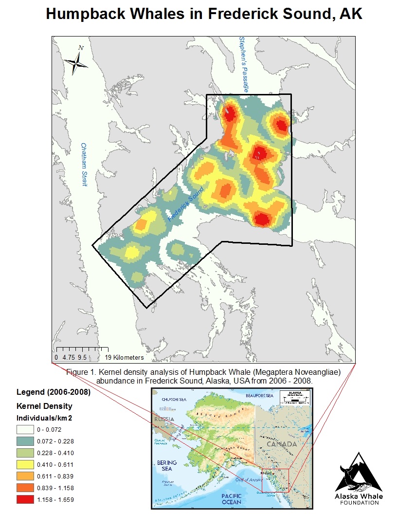
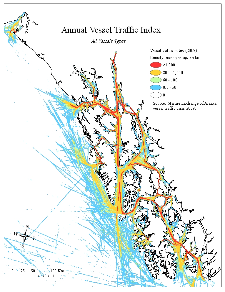
And that’s just it, the Alaska Whale Foundation is attempting to better understand the spatial overlap of cruise ships in an area known to harbor a high concentration of humpback whales during the summer months. This pilot project could allow us to better understand the behaviour of these whales so that we can provide better conservation action for the animals potentially at risk in this area. The project is currently looking for funding to pursue future field research in the hopes to better understand the relationship between these elusive whales and the increasing number of vessels passing through the area. With the integration of GIS and statistical analyses we can provide both visual and sound statistics to help make the connection between two knowledge gaps.
“I alone cannot change the world, but I can cast a stone across the waters to create many ripples.” – Mother Theresa
References
Andrew R.K, Howe B.M, Mercer J. A. 2002. Ocean ambient sound: comparing the 1960s with the 1990s for a receiver off the California coast. Acoustic Research Letters Online 3: 65–70.
Baker C.S, Herman L.M, Perry A, Lawton W.S, Straley J.M, Straley J.H. 1985. Population Characteristics and Migration of Summer and Late-Season Humpback Whales (Megaptera novaeangliae) in Southeastern Alaska. Marine Mammal Science 1(4): 304 – 323.
Cruise Lines International Association (2010). 2010 CLIA cruise market overview. Available at: http://www.cruising.org. Accessed 26 April 2017.
DFO. 2009. Recovery potential assessment of humpback whales, Pacific population. DFO Can.
Fonnesbeck C. J, Garrison L. P, Ward-Geiger L. I, Baumstark R. D. 2008. Bayesian hierarchical model for evaluating the risk of vessel strikes on North Atlantic right whales in the SE United States. Endangered Species Research 6: 87–94.
Gambell, R. 1976. World whale stocks. Mammal Review 6: 41-53.
Gende S.M, Hendrix A.N, Harris K.R, Eichenlaur B, Nielsen J, Pyare S. 2011. A Bayesian approach for understanding the role of ship speed in whale-chip encounters. Ecological Applications 21(6): 2232-2240.
Guzman H.M, Gomez C.G, Guevara C.A. 2013. Potential vessel collisions with Southern Hemisphere humpback whales wintering off Pacific Panama. Marine Mammal Science 29(4): 629-642.
Harris K, Gende S.M, Logsdon M.G. 2012. Spatial pattern analysis of cruise ship-humpback whale interactions in and near Glacier Bay National Park, Alaska. Environmental Management 49: 44-54.
Hendrix A. N, Straley J, Gabriele C, Gende S. 2012. Bayesian estimation of humpback whale (Megaptera novaeangliae) population abundance and movement patterns in Southeast Alaska. Canadian Journal of Fisheries and Aquatic Science 69: 1783-1797.
Knowlton A.R, Kraus S.D, 2001. Mortality and serious injury of northern right whales (Eubalaena glacialis) in the western North Atlantic Ocean. Journal of Cetacean Research and Management. (Special Issue) 2, 193–208.
Laist D.W, Knowlton A.R, Mead J.G, Collet A.S, Podesta M. 2001. Collisions between ships and whales. Marine Mammal Science 17: 35–75.
Neilson J.L, Gabriele C.M. 2016. Humpback Whale Monitoring in Glacier Bay and Adjacent Waters 2015: Annual Progress Report. Natural Resource Report NPS/GLBA/NPR – 2016/1354. National Park Service, Fort Collins, Colorado.
Panigada S, Pesante G, Zanardelli M, Capoulade F, Gannier A, Weinrich M.T, 2006. Mediterranean fin whales at risk from fatal ship strikes. Marine Pollution Bulletin 52: 1287–1298.
Redfern J.V, McKenna M.F, Moore T.J, Calambokidis J, Deangelis M.L, Becker E.A, Barlow J, Forney K.A, Fiedler P.C, Chivers S.J. 2013. Assessing the risk of ships striking large whales in marine spatial planning. Conservation Biology 27(2): 292-302.
Ross D. 2005. Ship sources of ambient noise. IEEE Journal of Oceanic Engineering 30: 257–261.
Silber G. K, Bettridge S, Cottingham D. 2009. Report of a workshop to identify and assess technologies to reduce ship strikes of large whales. U.S. Department of Commerce, NOAA Technical Memorandum NMFS-OPR-42. 55 pp.
Vanderlaan A.S.M, Taggart C.T, Serdynska A.R, Kenney R.D, Brown M.W. 2008. Reducing the risk of lethal encounters: vessels and right whales in the Bay of Fundy and on the Scotian Shelf. Endangered Species Research 4: 283-297.
Vanderlaan A.S.M, Taggart C.T. 2009. Efficacy of a voluntary area to be avoided to reduce risk of lethal vessel strikes to endangered whales. Conservation Biology 23(6): 1467-1474.