 Mapping Risk to Public Health from Radon
Posted 7 years ago
By Mark Bennett in the Dalhousie Blog
Radon is the 2nd leading cause of lung cancer after smoking in Canada, and attributed to 16% of lung cancer deaths. Nova Scotia has developed and released a map outlining the risk of radon exposure based on environmental factors (https://novascotia.ca/dhw/environmental/radon.asp). These factors were equally weighted to produce the outcome of radon risk and relied on […]
Read More
 Webscraping in GIS
Posted 7 years ago
By Anastassios Dardas in the McMaster Blog
Data in the Digital Age Data is the foundation of insightful information for research and organizations, and thus drives their successes. The critical role that data plays in our society has led to a race to collect and mine data. Over the course of the 20th century, incredible methods such as the introduction of Neilson […]
Read More
 SolVES 3.0: A Software to Map Social Values in Marine Spatial Planning
Posted 7 years ago
By Simon Ryder-Burbidge in the Dalhousie Blog
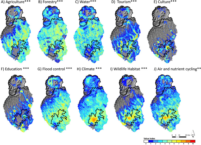
Marine spatial planning (MSP) is now recognized internationally as an important part of marine and coastal management. MSP offers a tool for policymakers to demarcate specific areas of distinct stakeholder values when managing shared-use spaces. This process places public participation, communication, and collaboration at the centre of ocean governance (Nutters & Pinto da Silva, 2012). […]
Read More
 Automating Suitability Mapping with ArcPy
Posted 7 years ago
By Sean Leipe in the McMaster Blog
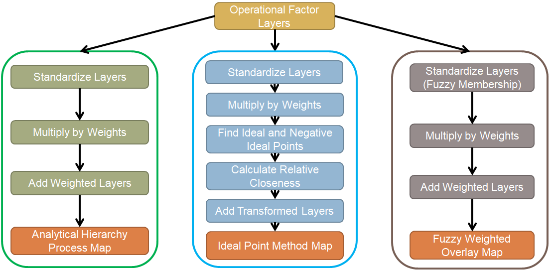
For my undergraduate thesis last year, I created maps representing susceptibility to calanchi erosion in the Basilicata region of Italy using 3 different Multicriteria Decision Analysis (MCDA) decision rule techniques. All of these procedures involve several repetitive steps that could have been automated by a Python-based tool, but I didn’t have any experience with programming […]
Read More
 Using GIS to Model Transportation Problems – A case study of Hamilton, Ontario’s Highways
Posted 7 years ago
By Matthew Brown in the McMaster Blog
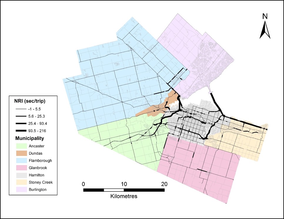
As I hinted at in my last post, I want to now take the opportunity to share some of the research that I conducted for my undergraduate thesis. My topic stemmed from an idea about the controversy I grew up around in my home town of Hamilton, Ontario surrounding the two local highways – the […]
Read More
 Carleton to SFU: Connecting through education
Posted 7 years ago
By Danielle Derrick in the SFU Blog
I am delighted to be someone who previously wore the ECCE label proudly as a Carleton undergraduate student, and am just as excited to be carrying that honor onwards to Simon Fraser University as a master’s student. My background is a little abstract in comparison to the majority of the students that are a part […]
Read More
Accessibility on Campus
Posted 7 years ago
By Josh Karon in the YorkU Blog
Hi Everyone, My name is Josh Karon and I am a fourth-year student in Geomatics at York University. I am currently working on an engineering capstone project with the goal of assessing York’s Keel campus with respect to people with accessibility needs. Many of the buildings on campus are, let’s just say, from another generation […]
Read More
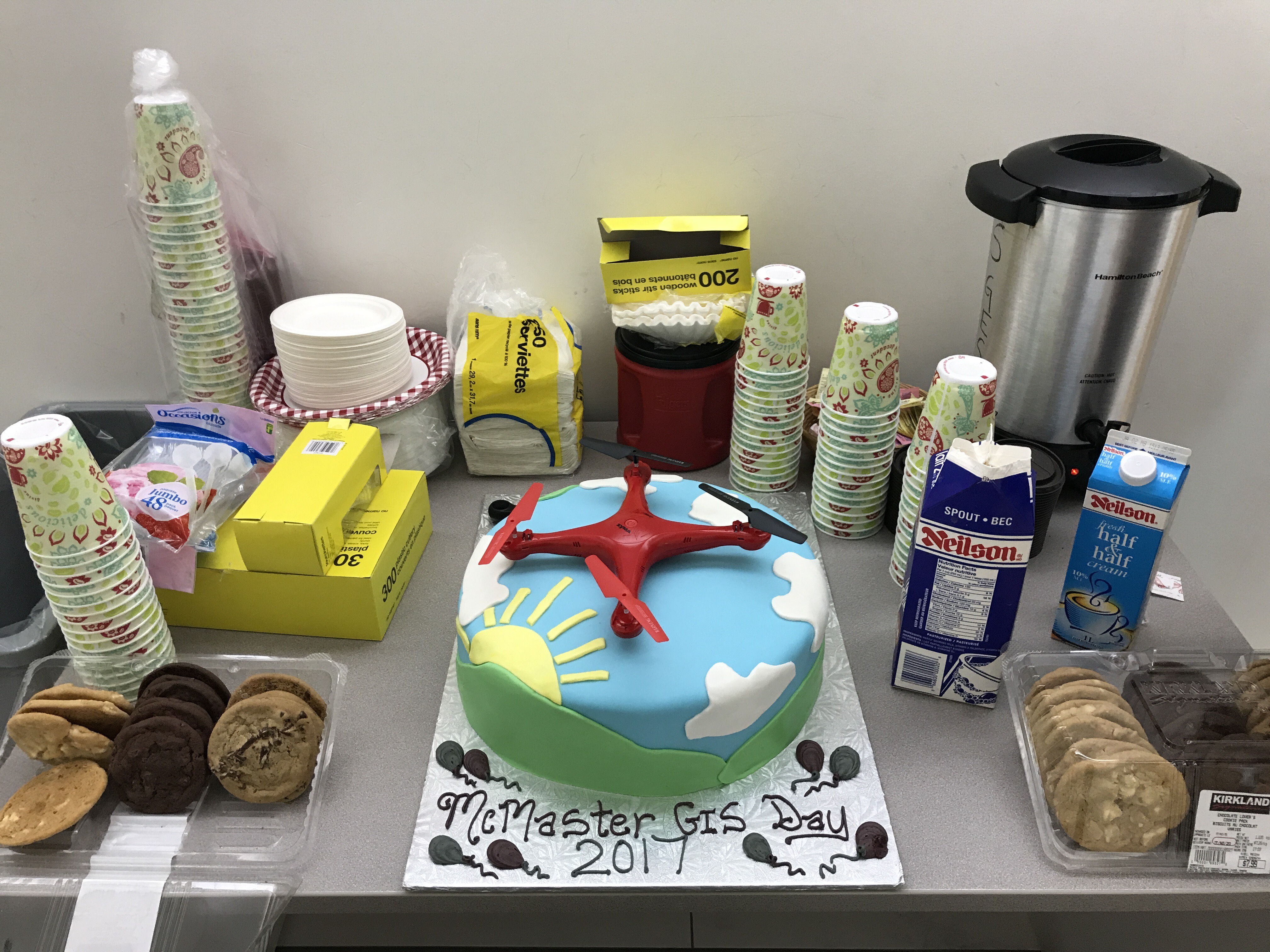 GIS Day at McMaster
Posted 7 years ago
By Michele Tsang in the McMaster Blog
McMaster University held their annual celebration for GIS Day on November 17, organized by Patrick DeLuca. The day consisted of lightning talks focusing on research from both the natural and social sciences. The talks showcased how interdisciplinary GIS is as there were presenters from the McMaster Institute of Transportation and Logistics, School of Geography and Earth Sciences, […]
Read More
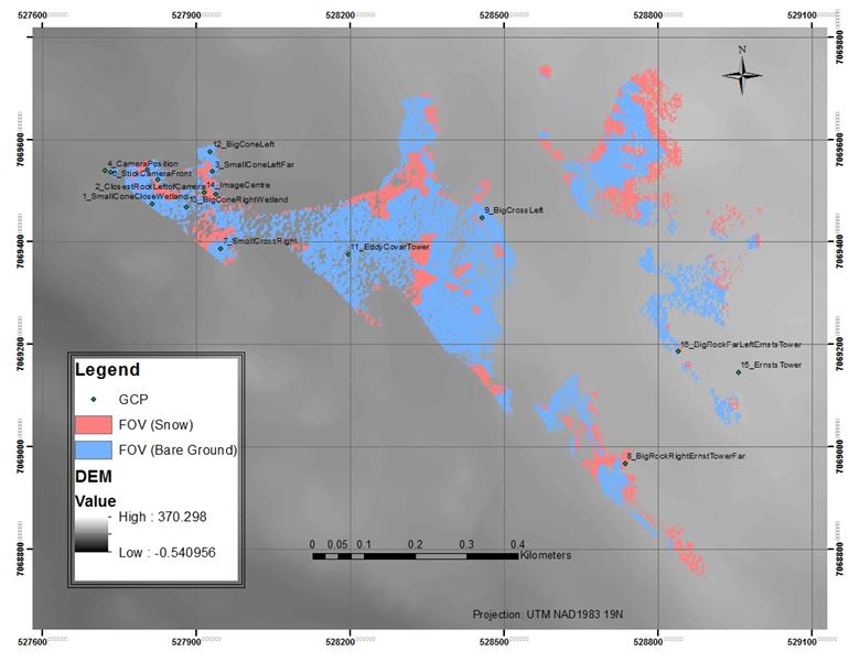 Monitoring of seasonal changes in snow cover area in the Apex river watershed using ground camera and in situ observations.
Posted 7 years ago
By Yulia Antropova in the Carleton Blog
Monitoring of snow cover area in the Apex river watershed in Nunavut, Canada at different temporal and spatial scales is important to better understand and predict freshwater resource supply in that area. My previous post describes retrieval of changes in the snow-cover for a large area using MODIS 8-day composite snow cover products with a spatial resolution […]
Read More
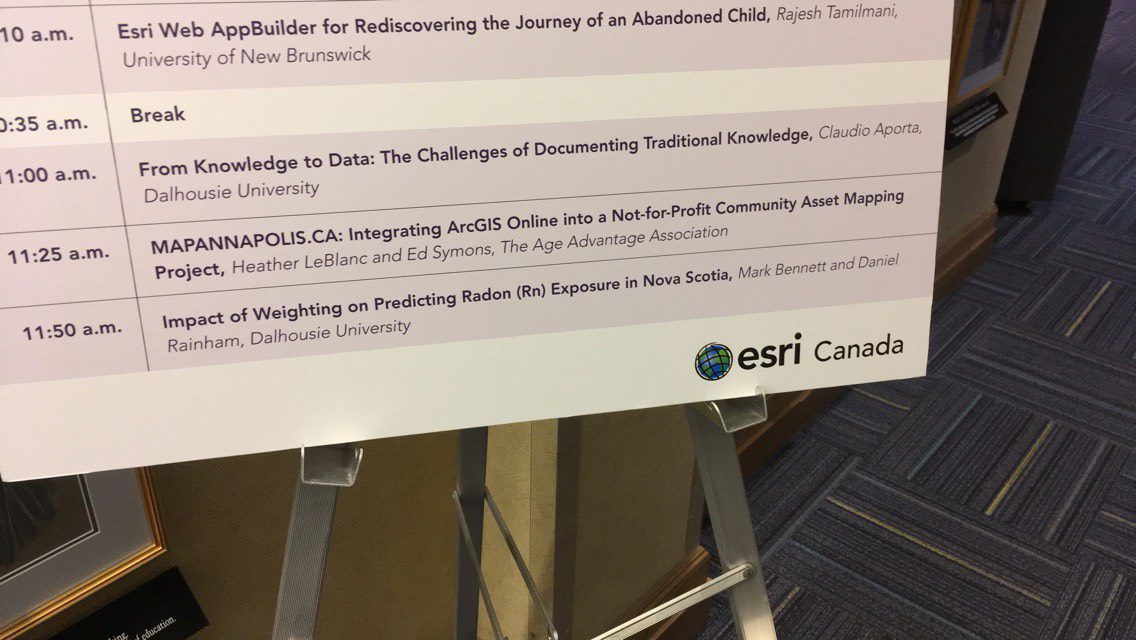
GIS in Education and Research and ESRI Canada User Conference: My Experience
Posted 7 years ago
By Rajveer Ubhi in the McMaster Blog
A few weeks ago, I got the chance to attend the GIS in Education and Research Conference hosted at the University of Toronto. The day started off with a plenary session in the Hart House. Alex Miller, President and founder of Esri Canada, began the conference with a short talk on GIS: the science of […]
Read More

