 Could the Esri International User Conference use a little more fish?
Posted 5 years ago
By Danielle Derrick in the SFU Blog
I can’t deny it, GIS has played a major role in both my studies and past jobs, but Esri was never on my radar as a place to explore for a future career because of where my academic background stems from. Let me provide you with some context. I’m an aspiring ecologist and conservation biologist, […]
Read More
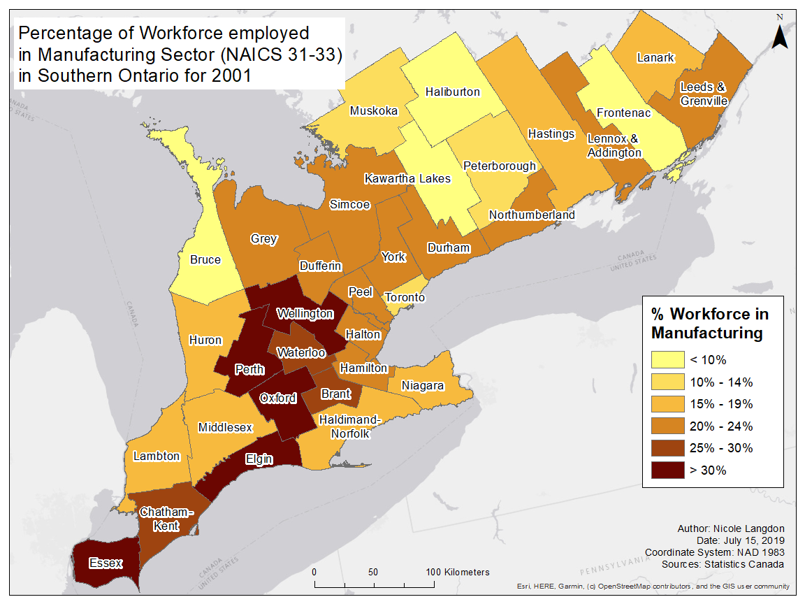 The Changing Landscape of Manufacturing in Canada
Posted 5 years ago
By Nicole Langdon in the McMaster Blog
This past summer I had the pleasure of working with a professor from McMaster University’s Labour Studies Department to map the labour sheds of manufacturing workers in populous parts of Canada. The intersection of a shrinking manufacturing sector, higher commute times, stagnating wages, and increased housing costs makes for a rich discussion of the ways […]
Read More
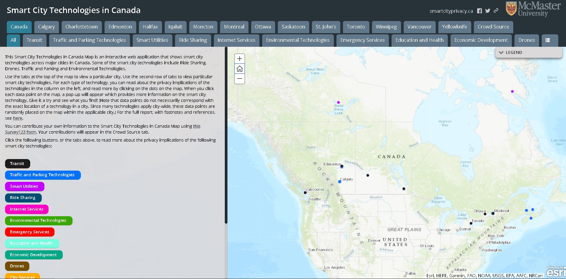 The Privacy Implications of Smart Cities: Developing a Web App and Interactive Survey
Posted 5 years ago
By Rajveer Ubhi in the McMaster Blog
Smart cities, and smart technologies, are emerging in many local contexts across Canada. Smart city technologies have quickly moved from development to adoption, often outpacing the social and political deliberations necessary to consider their effects in detail-particularly their effects on the privacy of Canadians (Bannerman, 2018). Dr. Sara Bannerman and her research team at McMaster […]
Read More
 My plan for ECCE blogging in 2020
Posted 5 years ago
By Alexander Wray in the Western Blog
Hello! I am excited to be back for another year of being a Student Associate of the Esri Canada Centre of Excellence program. I am a second-year Masters student at Western University, working with Dr. Jason Gilliland in the Department of Geography and Human Environments Analysis Lab. I have an Honours Bachelor’s of Environmental Studies […]
Read More
 Data Wrangling with Python and R, Part 1: “Fun” with LiDAR Buffers
Posted 5 years ago
By Sean Leipe in the McMaster Blog
One realization that keeps hitting me throughout my MSc is how many little things need to be dealt with in order to do even basic analysis using real-world data. My supervisor once told me that about 70% of the work that gets done in our lab is what he calls “data wrangling”, which I would […]
Read More
 Mapping Cultural Character
Posted 5 years ago
By Nikki Rogers in the UCalgary Blog
As a second year Masters of Geographic Information Systems (GIS) student at the University of Calgary, I have applied Esri software to a wide variety of topics and problems, often to areas not traditionally thought of as applicable to GIS. This past summer, I had the opportunity to see how GIS and sociology can come […]
Read More
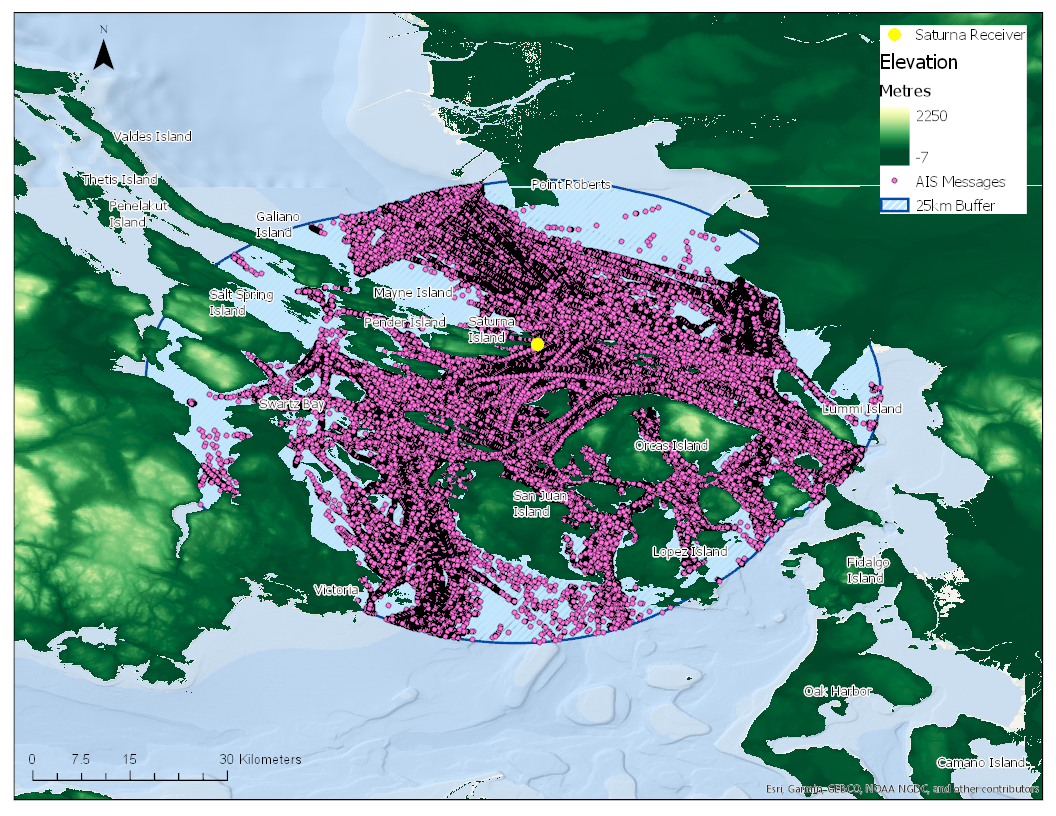 Big Data and the Power of ArcGIS Pro
Posted 5 years ago
By Andrea Nesdoly in the UVic Blog
As a MSc student at the University of Victoria, the research I am conducting feeds my passions: GIS, remote sensing, and machine learning/data mining. My research involves analyzing automatic identification systems (AIS) vector data. AIS is an automated and autonomous system that allows the transmission of vessel position data and vessel identification information via VHF […]
Read More
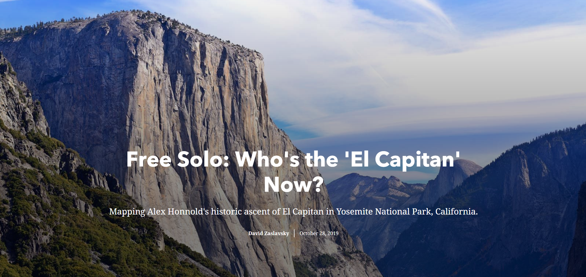 The Esri Toronto User Conference: Day 2’s ArcGIS StoryMaps
Posted 5 years ago
By David Zaslavsky in the McMaster Blog
When I attended the second day of the Esri User’s Conference on October 9, I was excited for the day full of workshops and breakout sessions. While every session I walked away from had something that was useful, the session that I enjoyed and learned from the most was a walk-through of the updated ArcGIS […]
Read More
About Me
Posted 5 years ago
By Kendra Munn in the SFU Blog
Hi I’m Kendra and this is my second time as an ECCE student associate at SFU. My academic interests primarily revolve around GIScience, Environmental Science (the applied biology side of things), and how these two intersect to find solutions to spatially-based environmental problems. My current research focuses on how meaningful analyses can be carried out […]
Read More
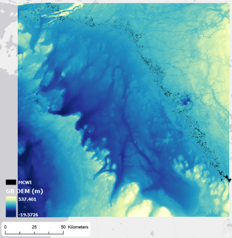 Clipping a big DEM to a small shapefile and using Con to get specific depths
Posted 5 years ago
By Sherry Chen in the McMaster Blog
For my undergrad independent project, I am creating an atlas of coastal Eastern Georgian Bay with the Pat Chow-Fraser Lab at McMaster University. The atlas covers wetland information such as fish and vegetation community, water quality indices, wetland area and volume, and more. I primarily work on calculating wetland area and volume at five different […]
Read More

