 ArcPy: Convolution Filtering
Posted 7 years ago
By Claudia Wong in the UCalgary Blog
ArcGIS is a powerful tool that supports various industries and sectors. However ArcGIS might not have built-in tools for every problem or an easy workflow to solve a problem. These missing built-in functions range from lacking a concave hull generator (to compute a concave hull from a series of points provided as a feature class) […]
Read More
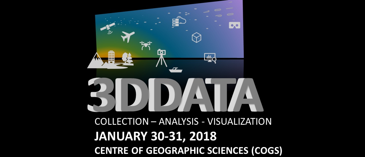 Working towards a National Imagery Strategy – Notes from a 3D-Data Workshop
Posted 7 years ago
By Denise Vachon in the COGS Blog
The booming world of 3D Technology is more compelling than I anticipated. In the last week of January, the Canadian Institute of Geomatics (CIG) Nova Scotia Chapter and the Geomatics Association of Nova Scotia (GANS) held a 3D-Data Workshop at the Centre of Geographic Sciences (COGS). Hundreds from industry, non-profit, academia, and all levels of […]
Read More
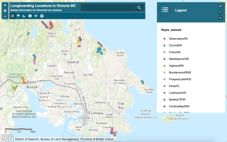 WebApp for Longboarding Locations in Victoria, BC
Posted 7 years ago
By Trilby Buck in the UVic Blog
This project was prepared by Trilby Buck (4th year Geomatics student) for an advanced GIS course at the University of Victoria under the supervision of Robin Kite. This is the WebApp Link Background All too often longboarders are involved in serious accidents at higher rates than skateboarding (Fabian et al., 2014). This is because longboarders […]
Read More
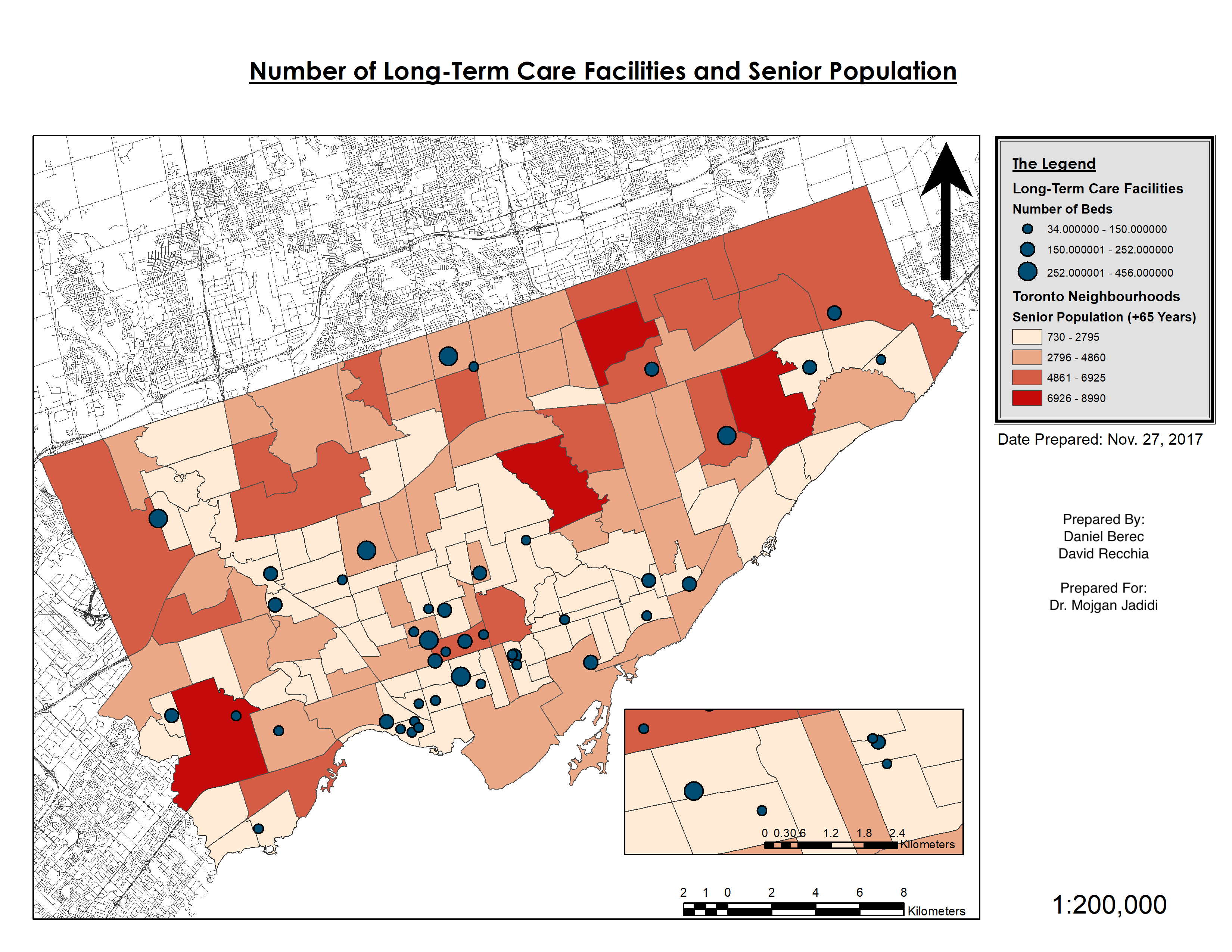 Growing Old In Toronto: A Glance into Toronto’s Aging Population and Long-Term Care Facilities
Posted 7 years ago
By David Recchia in the YorkU Blog
David Recchia (3rd Year Geomatics Engineering Student) Daniel Berec (3rd Year Geomatics Engineering Student) This post is a brief summary of a term project prepared for the GIS course at York University. Toronto is getting old—roughly 35 percent of the metropolitan’s population is over the age 50 (Statistics Canada, 2018). Recognizing this increasingly […]
Read More
 A Western University Undergrad GIS Project
Posted 7 years ago
By Aiden Poole in the Western Blog
Hello everyone, Western University recently was added as an ESRI Canada Centre of Excellence. We are very excited to be a part of this elite group of GIS schools in Canada. As a new associate, I thought I would share one of my projects that I completed with Western’s other new associate, Peter Coxford. As […]
Read More
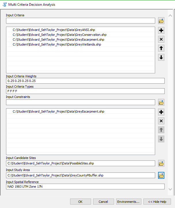 Scripting multi-criteria decision analysis
Posted 7 years ago
By Ed Taylor in the McMaster Blog
Background My first foray into GIS above the introductory level was a raster-based course instructed by Patrick Deluca here at McMaster University. Among the work assigned for the course was a final project focused around multi-criteria decision analysis (MCDA), a process described by Voogd as to ‘investigate a number of choice possibilities in the light […]
Read More
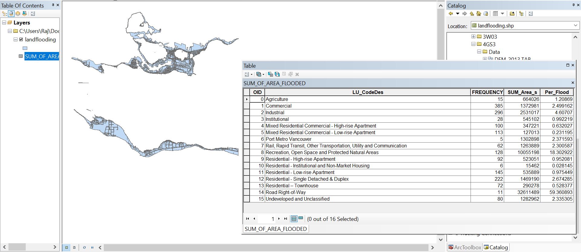 Land Flooding Tool for ArcMap generated using Python
Posted 7 years ago
By Rajveer Ubhi in the McMaster Blog
This year I enrolled into GEOG 4GS3: GIS Programming offered at McMaster University. The course offers advanced treatment of GIS focusing on the creation of scripts to enhance productivity by automating time-consuming and repetitive tasks. Some of the learning outcomes include understanding the fundamental components of the Python language, developing Python scripts, working with the […]
Read More
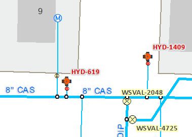 Working on Geometric Networks
Posted 7 years ago
By Jen Ranni in the COGS Blog
This spotlight article was contributed by Jen Ranni, a student at COGS. She is getting started on a case study that will examine to building network datasets for the City of Cambridge water distribution systems using ArcGIS. We’re looking forward to hearing more about the results of her work when the project is completed. Hey, […]
Read More
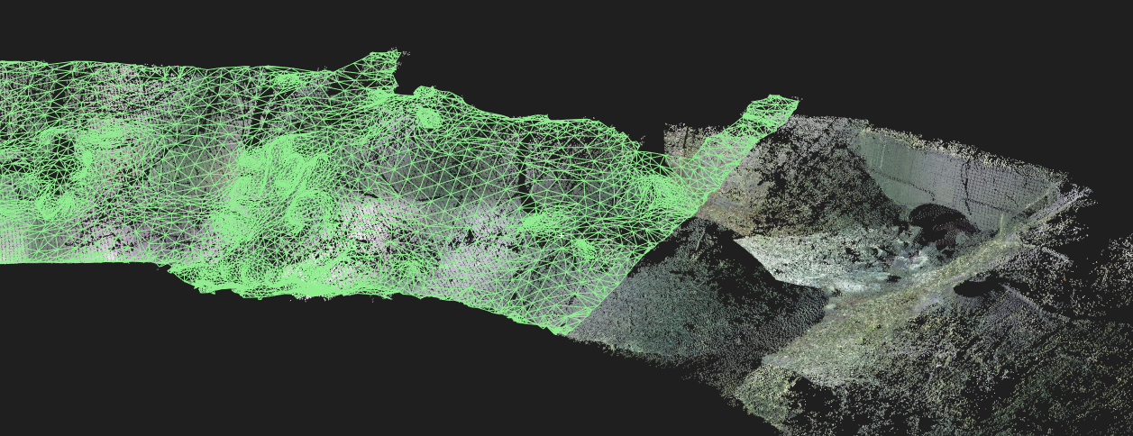 Streambank Erosion
Posted 7 years ago
By Benjamin Meinen in the UW Blog
Over the past few months, I have been working with my advisor (Dr. Derek Robinson) on using new and emerging technologies for modelling streambank erosion. Due to the immediate hydrologic connectivity of eroded bank sediments to a stream network, the effects of streambank erosion can have significant impacts on surface water quality. The controls on […]
Read More
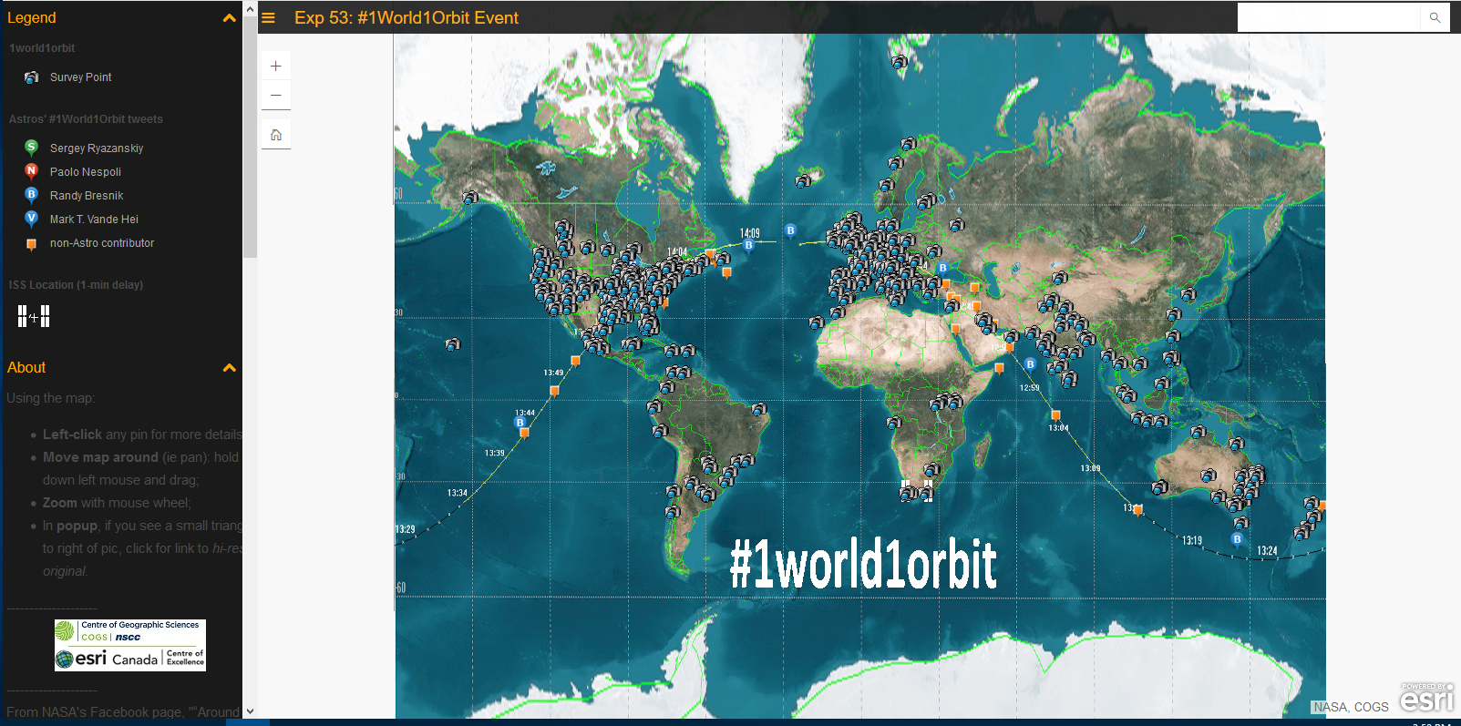 #1world1orbit
Posted 7 years ago
By Michelle Brake in the COGS Blog
Have you ever wondered what Earth looks like from the International Space Station? Back in October some amazing folks at the International Space Station captured and shared their view as they orbited Earth. The images were captured 400km above the earth on October 23rd, 2017, from 8:25am to 10:05am ET. NASA then asked those of […]
Read More

