 How to Facilitate Collaborative Learning in GIS
Posted 5 years ago
By Sabrina Ornawka in the Carleton Blog
This past semester, I had the opportunity to facilitate learning in an Introduction to Geomatics course in a unique way – through collaboration. This meant that we were not sitting at computers, reading from a geomatics textbook or online learning course, or even working directly with mapping software! This was through the PASS program at […]
Read More
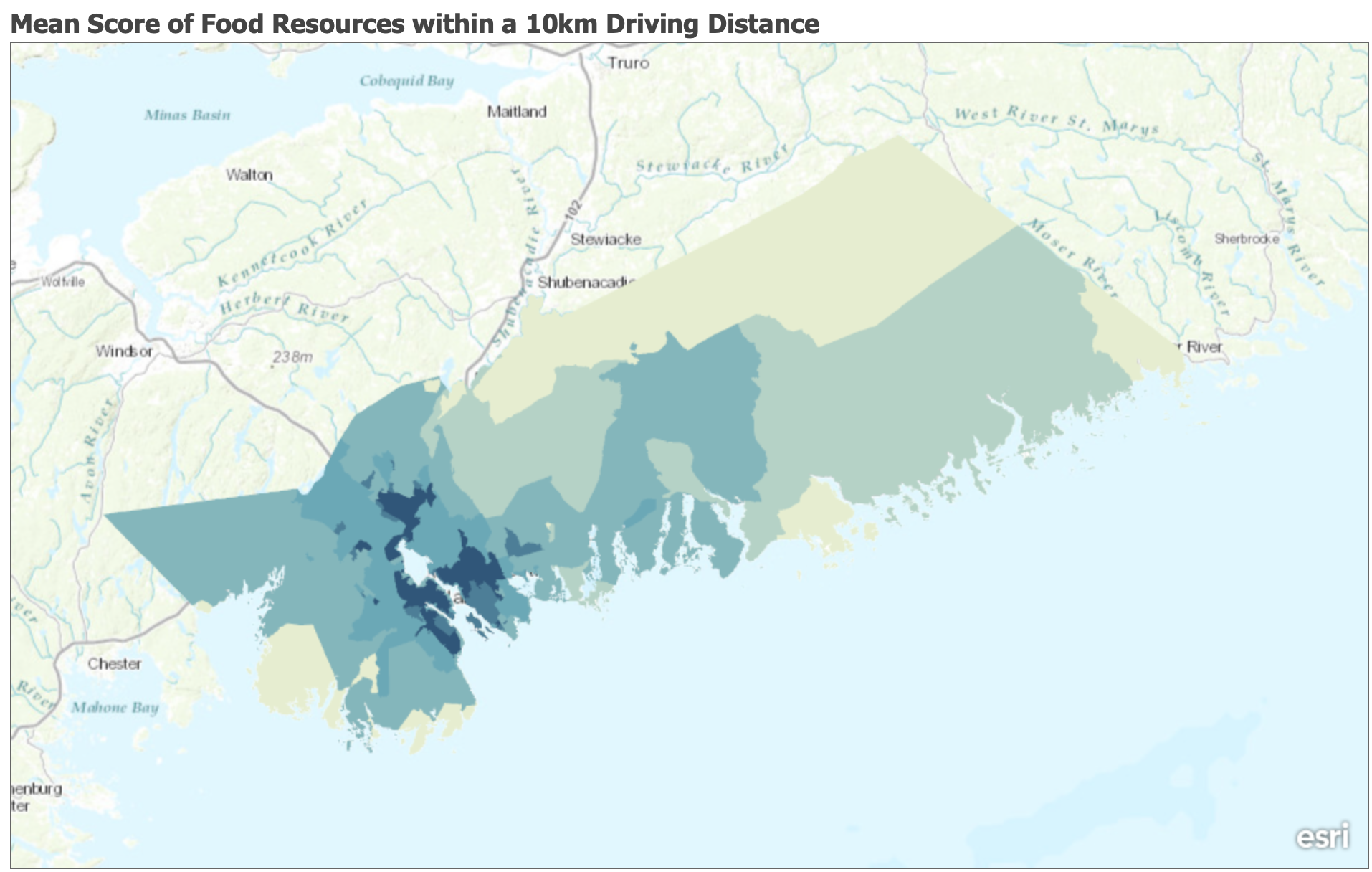 Addressing Food Accessibility in the Halifax Regional Municipality
Posted 5 years ago
By Leah Fulton in the Dalhousie Blog
In Canada, Nova Scotia ranks amongst the highest for household food insecurity, second to the Territories. Households are increasingly having more difficulty obtaining food that contribute to a healthy diet due to cost, quality, and access. Furthermore, municipalities are at the forefront of these concerns, whether it is due to loss of agricultural land, sprawling […]
Read More
 Teaching with GIS
Posted 5 years ago
By Alexander Wray in the Western Blog
Geographic information systems (GIS) can be intimidating at first glance for the unfamiliar person. Esri has made some excellent progress in developing more intuitive point-and-click applications such as ArcGIS Online and ArcGIS Pro, however, there is a steep learning curve in using a GIS. Over this past term, I have had many opportunities to introduce […]
Read More
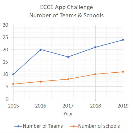 Growth of the ECCE App Challenge!
Posted 5 years ago
By Jaydeep Mistry in the UW Blog
What is the ECCE App Challenge? The ECCE App Challenge is a coding competition held by Esri Canada. It is designed to help promote GIS innovation and creativity within the Centres of Excellence that are located across Canadian universities and institutions. Growth in the Number of Teams Although the challenge first started in 2015 with just […]
Read More
 GIS Summary of SNAP 2019 (Part 2): Landscape Archaeology Analysis with ModelBuilder and Python
Posted 5 years ago
By Todd Wong in the McMaster Blog
Introduction Over the past few months I have been investigating a new methodology of finding settlement patterns using GIS. The current method of settlement patterns often involves deep research and field studies. In this report I wish to add a new element to settlement pattern analysis. This method can also add more information to landscape […]
Read More
 Interesting Student Projects in GIS
Posted 5 years ago
By Benjamin Brunson in the YorkU Blog
During this past term, I was the TA for an introductory GIS course at York University. For most students, this course is their first contact with ArcGIS products, and the course culminates in an application-oriented final project. This year, the theme for the project was “Social Awareness and/or Crowd-Sourcing.” I was impressed with the students’ […]
Read More
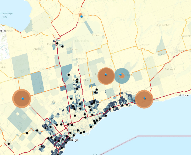
 Beginnings of my ECCE Student Associateship, Graduate Studies and Animal GPS Tracking Research
Posted 5 years ago
By Jack McIlraith in the Western Blog
As a new ECCE Student Associate and beginning graduate student at Western University, I am looking forward to continued refinement of my geographical information science (GISci) knowledge and skills in the upcoming two or so years. My master’s research will be on the movement behaviour of feral swine, including pack (sounder) assignment, territoriality, and habitat/movement […]
Read More
Speed up your Python Scripts using Ubuntu and GNU Parallel
Posted 5 years ago
By Cameron Fitzpatrick in the Carleton Blog
Introduction NOTE: This blog post is not an overview of Linux-based environments, it assumes a base knowledge and that Python is set up. I’m sure one of the main reasons most of us have gotten into Python is to automate long tedious workflows that must be repeated for multiple sets of data. The beauty of […]
Read More
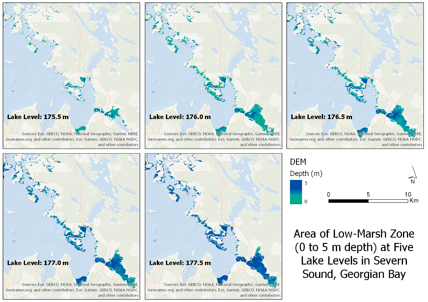 Clipping a Large DEM to a Large Shapefile and Getting Raster at Specific Elevations/Depths
Posted 5 years ago
By Sherry Chen in the McMaster Blog
When given the task of clipping a large DEM of Georgian Bay to a large shapefile of wetlands running along eastern and northern Georgian Bay at five different lake levels between specific depths, it led to more crashes than I expected. I found similar problems online and I want to show how I overcame it. […]
Read More
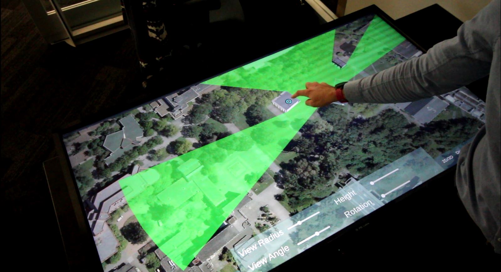 Creating a Touchtable Application: An Exploration of Features
Posted 5 years ago
By Matthew Plaudis in the UVic Blog
I titled this blog post An Exploration of Features because it is exactly that: exploratory. From the outset of this project – which was to completely redesign a once very successful urban planning application for a touchtable, the overall sense among my labmates and I was that it was an exploration: we were about to […]
Read More

