 ECCE App Challenge – DayCare Finder
Posted 7 years ago
By Rajveer Ubhi in the McMaster Blog
The ECCE App Challenge is a coding competition held by Esri Canada to help promote innovation and creativity within the Centres of Excellence. Apps powered by GIS technology and open data are created to help address a problem related to a specific theme which changes every year. Being my first year participating in the challenge, […]
Read More
 ECCE App Challenge 2018 – Helping Hands Toronto
Posted 7 years ago
By Sean Leipe in the McMaster Blog
The Esri Canada App Challenge is a week-long hackathon-type coding competition with the goal of creating a web application to solve problems based on a specific theme, built on Esri technology and using open data. It involves creating an operational app, submitting its source code, creating supporting documentation, and a video sales pitch. This was […]
Read More
 ECCE App Challenge 2018 – Marauders mApp
Posted 7 years ago
By Michele Tsang in the McMaster Blog
This year I participated in the ECCE App Challenge with my group members, Tasos Dardas and Matt Brown. The assigned topic of the app was anything of our choice, so we decided to focus on decentralized, renewable energy. Our app, Energy Revolution, demonstrates the feasibility of decentralized energy systems (DESs) by creating matrices showing the […]
Read More
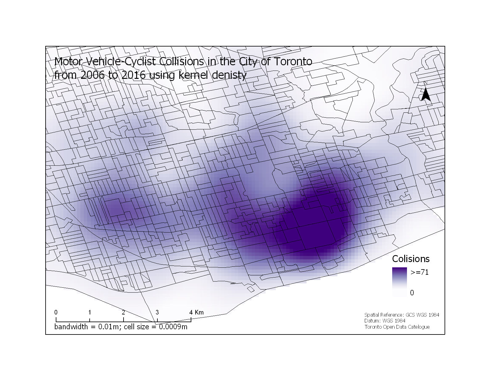
 Motor Vehicle-Cyclist Collisions in the City of Toronto
Posted 7 years ago
By Rajveer Ubhi in the McMaster Blog
With the gradual increase in environmental, economic and public health problems from the growing global community that uses motorized vehicles as their primary source of transportation, there has been a large interest in the use of bicycles as an alternative form of transportation. Despite the benefits of cycling, studies have shown that people are discouraged […]
Read More
 What is GeoAI?
Posted 7 years ago
By Anastassios Dardas in the McMaster Blog
DevSummit 2018 This past early March, my fellow McMaster Student Associate, Matt Brown and I had the opportunity to attend to the 2018 Esri Developer’s Summit located in Palm Springs, California. As Matt mentioned in his recent blog, this is our second time attending, all huge thanks to the ECCE Student Associates Program. Last year, […]
Read More
 Esri DevSummit 2018 – My Experience Learning to Code in California
Posted 7 years ago
By Matthew Brown in the McMaster Blog
At the beginning of March, I got the opportunity to attend the 2018 Esri Developer’s Summit (DevSummit for short) along with my fellow McMaster Student Associate Tasos Dardas. This conference occurs annually in sunny Palm Springs, California. This is my second time attending, thanks to the ECCE Student Associates program, which provides free registration to […]
Read More
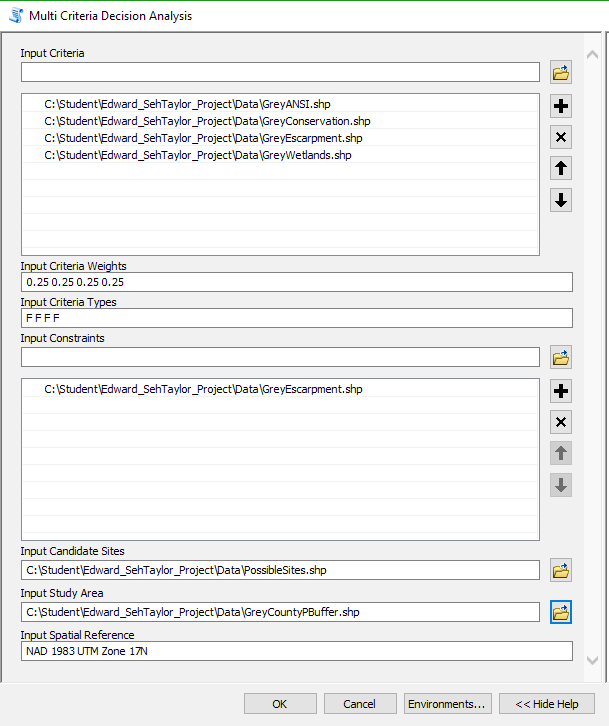
 Scripting multi-criteria decision analysis
Posted 7 years ago
By Ed Taylor in the McMaster Blog
Background My first foray into GIS above the introductory level was a raster-based course instructed by Patrick Deluca here at McMaster University. Among the work assigned for the course was a final project focused around multi-criteria decision analysis (MCDA), a process described by Voogd as to ‘investigate a number of choice possibilities in the light […]
Read More
 Land Flooding Tool for ArcMap generated using Python
Posted 7 years ago
By Rajveer Ubhi in the McMaster Blog
This year I enrolled into GEOG 4GS3: GIS Programming offered at McMaster University. The course offers advanced treatment of GIS focusing on the creation of scripts to enhance productivity by automating time-consuming and repetitive tasks. Some of the learning outcomes include understanding the fundamental components of the Python language, developing Python scripts, working with the […]
Read More
 Webscraping in GIS
Posted 7 years ago
By Anastassios Dardas in the McMaster Blog
Data in the Digital Age Data is the foundation of insightful information for research and organizations, and thus drives their successes. The critical role that data plays in our society has led to a race to collect and mine data. Over the course of the 20th century, incredible methods such as the introduction of Neilson […]
Read More
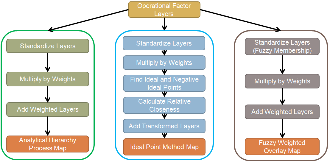
 Automating Suitability Mapping with ArcPy
Posted 7 years ago
By Sean Leipe in the McMaster Blog
For my undergraduate thesis last year, I created maps representing susceptibility to calanchi erosion in the Basilicata region of Italy using 3 different Multicriteria Decision Analysis (MCDA) decision rule techniques. All of these procedures involve several repetitive steps that could have been automated by a Python-based tool, but I didn’t have any experience with programming […]
Read More
 ECCE App Challenge – DayCare Finder


