 How to Facilitate Collaborative Learning in GIS
Posted 5 years ago
By Sabrina Ornawka in the Carleton Blog
This past semester, I had the opportunity to facilitate learning in an Introduction to Geomatics course in a unique way – through collaboration. This meant that we were not sitting at computers, reading from a geomatics textbook or online learning course, or even working directly with mapping software! This was through the PASS program at […]
Read More
 Speed up your Python Scripts using Ubuntu and GNU Parallel
Posted 5 years ago
By Cameron Fitzpatrick in the Carleton Blog
Introduction NOTE: This blog post is not an overview of Linux-based environments, it assumes a base knowledge and that Python is set up. I’m sure one of the main reasons most of us have gotten into Python is to automate long tedious workflows that must be repeated for multiple sets of data. The beauty of […]
Read More
 Rebuilding Constantinople in CityEngine
Posted 6 years ago
By Alan Armstrong in the Carleton Blog
This spotlight post is the second article from Alan Armstrong showcasing his creative work using CityEngine to build 3D models that re-create ancient city environments. His work received deserving recognition among other great works of mapping and cartography submitted for consideration during the plenary at the Fed UC last week. Hello again. I am back […]
Read More
 Investigation of Grounding Line Dynamics and Thinning of Milne Glacier, Nunavut Using In-situ and Satellite Data
Posted 6 years ago
By Yulia Antropova in the Carleton Blog
The line where glaciers transition from grounded to floating is particularly susceptible to changes caused by warming in the Arctic. Grounding line retreat is associated with ice thickness reduction and enhanced ice discharge. Milne Glacier, located on Ellesmere Island, Nunavut (Fig. 1), is a surge-type glacier [1]. Its bed is on a retrograde slope, therefore, […]
Read More
 Safer Cycling
Posted 6 years ago
By Alex Oestreicher in the Carleton Blog
Hello all, my name is Alex Oestreicher, and I’ve spent the last 4 months working at Ottawa city hall as a GIS Assistant, as part of the Carleton University Department of Geography and Environmental Studies practicum program. The practicum program is a program for 4th year honours students that provides them with a professional (albeit […]
Read More
 Playing “Where’s Waldo” with Abandoned Features
Posted 6 years ago
By Cameron Fitzpatrick in the Carleton Blog
Anyone who knows me well will know I love trains. Ever since I was 6 years old, I’ve been fascinated by their sheer size, power, and the mystery associated with where a train has come from, and where it is going. That’s why I wanted the focus of my final project for a second-year GIS […]
Read More
 Making the Old New Again
Posted 6 years ago
By Alan Armstrong in the Carleton Blog
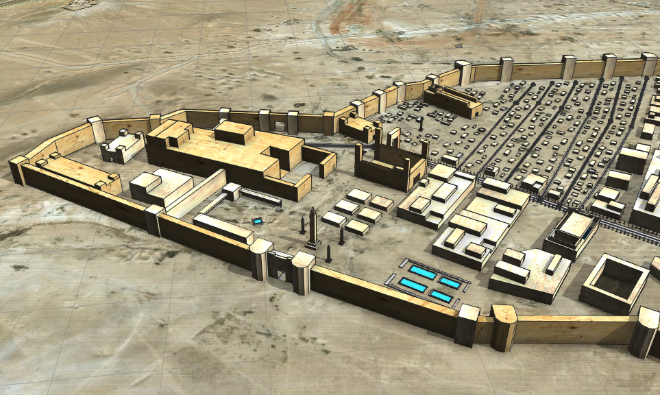
3D Reconstruction of Palmyra cir.300CE Using CityEngine Amidst all that is going on in the world presently, there is an ongoing struggle to preserve pieces of the past in all shapes and forms. This is experienced all around the world in almost every type of environment, and by almost every person on the planet. Whether […]
Read More
 My experiences so far…
Posted 6 years ago
By RJ Mitchell in the Carleton Blog
Hello Everyone, My name is RJ Mitchell and I’m a 3-rd year undergraduate student at Carleton University. I major in Geomatics Engineering and double-minor in Business: Entrepreneurship and Indigenous Studies. My original motivation to study geomatics was to eventually become a land surveyor, but the more I learn about the environmental applications of GIS, the […]
Read More
 A bit about me, and how I ended up here
Posted 6 years ago
By Ryan Parker in the Carleton Blog
Hello Internet! My name is Ryan Parker, and I’m a first-year masters student at Carleton University. I am doing a master of science in geography with a specialization in data science being supervised by Murray Richardson. When I’m not slaving away behind a computer you’ll normally find me skateboarding, snowboarding, rock climbing or some other […]
Read More
 About Me
Posted 6 years ago
By Alex Oestreicher in the Carleton Blog
Hello Everyone! My name is Alex Oestreicher. I am currently in my fourth year of my Geomatics major at Carleton University (Ottawa, ON). My background is largely in Geology, but after I discovered GIS in my 2nd year, I knew I had found my true calling. I was referred to the ECCE program by my […]
Read More
 How to Facilitate Collaborative Learning in GIS


