
Investigation of Grounding Line Dynamics and Thinning of Milne Glacier, Nunavut Using In-situ and Satellite Data
The line where glaciers transition from grounded to floating is particularly susceptible to changes caused by warming in the Arctic. Grounding line retreat is associated with ice thickness reduction and enhanced ice discharge.
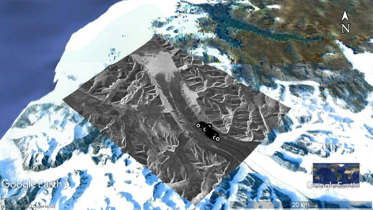
Milne Glacier, located on Ellesmere Island, Nunavut (Fig. 1), is a surge-type glacier [1]. Its bed is on a retrograde slope, therefore, it is particularly prone to marine ice sheet instability and may retreat rapidly in the coming decades.
To better understand and predict these changes, the grounding line location and the glacier’s thinning rate need to be determined.
In order to address these questions, I am working on the following steps within my MSc research project:
1) Mapping the current position of the Milne Glacier grounding line using the double-difference interferometry technique (i.e., InSAR) [2], [3] with spaceborne synthetic aperture radar (SAR) TerraSAR-X and Radarsat-2 data.
2) Determining ice thickness and validating the position of the grounding line derived from SAR using ice-penetrating radar (IPR) data collected in 2016 and 2018.
Preliminary results
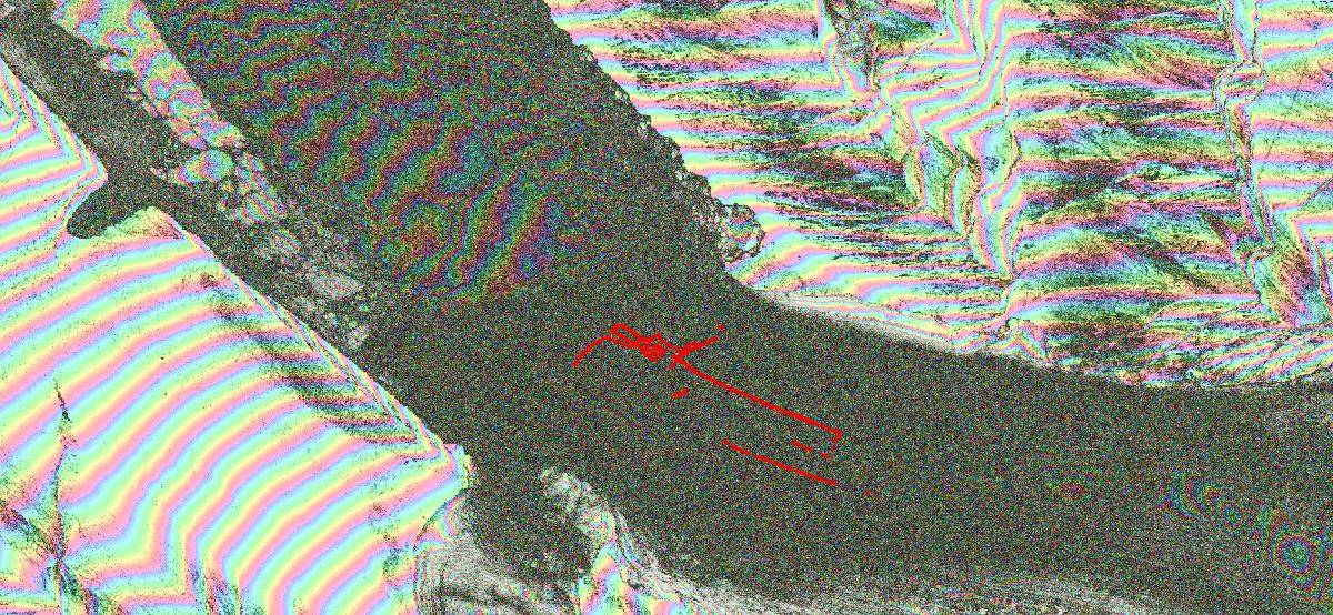
As a part of InSAR analysis, several interferograms were produced from sequential TerraSAR-X images acquired 11 days apart over the Milne Glacier in winter 2018 (Fig. 2).
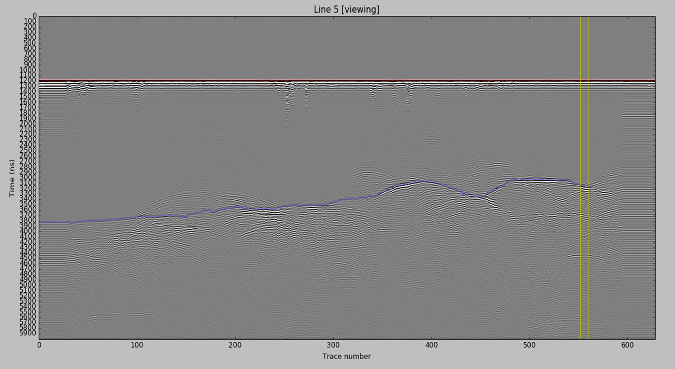
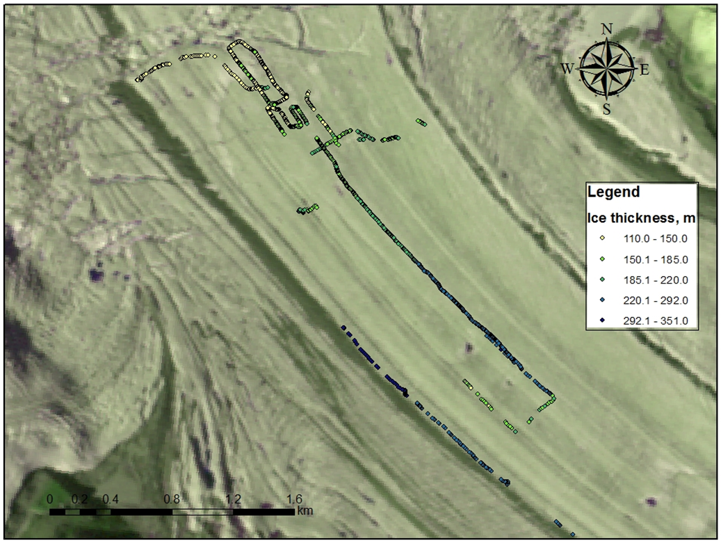
Ice thickness was calculated from the Ice Penetrating Radar (IPR) data collected on the Milne Glacier in summer 2016 and 2018 (Figs. 3, 4).
Conclusions
1) Interferograms produced from TerraSAR-X images show promising results for delineation of the position of the Milne Glacier grounding line. Interferometric fringes observed in Figure 2 shows that there is motion of glacier tongue close to the assumed area of the Milne Glacier grounding line. More images will be processed in order to complete delineation of the grounding line.
2) Figure 4 shows ice thickness along the glacier flow inferred from the IPR data. Collected IPR data will be further processed in order to distinguish the type of bed under ice (i.e., bedrock, water).
Co-authors:
Derek Mueller (1), Jill Rajewicz (1,2), and Achim Roth (3)
(1) Department of Geography and Environmental Studies, Carleton University, Ottawa, Ontario, Canada
(2) Nunavut Field Unit, Parks Canada, Iqaluit, Nunavut
(3) German Aerospace Center (DLR), German Remote Sensing Data Center, Oberpfaffenhofen, Germany
Acknowledgements:
- Natural Sciences and Engineering Research Council of Canada (NSERC)
- Polar Continental Shelf Program (PCSP)
- Northern Scientific Training Program (NSTP)
- Canadian Ice Service (CIS), Environment and Climate Change Canada
References:
[1] Jeffries, MO (1984). Milne Glacier, Northern Ellesmere Island, N.W.T., Canada: a Surging Glacier? J. of Glaciol., 30(105), 251–253.
[2] Rignot, E et al. (2011). Antarctic grounding line mapping from differential satellite radar interferometry, Geophys. Res. Lett., 38, L10504.
[3] Hogg, AE et al. (2016). Grounding line migration from 1992 to 2011 on Petermann Glacier, North-West Greenland. J. of Glaciol., 62(236), 1104–1114