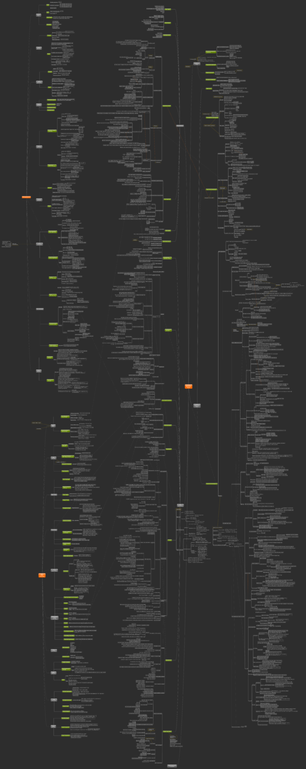
A ‘Mind Map’ of GIScience Basics
This ‘mind map’ was originally created for my PhD candidacy exam preparation, to help me organize, understand, and memorize knowledge and concepts regarding GIScience. The ‘mind map’ includes four main parts: architecture design, database management systems, geospatial data, and data manipulation. Additionally, I briefly went over the basic concepts and technologies of photogrammetry and digital image processing. I post it here in case anyone would find it helpful. The download link of the full-size image can be found at the end.
Specific topics covered by the ‘mind map’ are introduced below.
Architecture design
This section is about the architecture design that generally applies for all information systems. Four categories of information system architecture are covered, including the distributed architecture, hybrid architecture, composable architecture, and integrated architecture. Interoperability and modularity are two essential features for a modern information system.
Database management systems
This section mainly covers the development of database management systems (DBMS), including the conceptual level, logical level, and physical level development of a DBMS. The conceptual level development is independent of any physical implementation details and only focuses on the information structure in a database, where entity-relationship (ER) models, enhanced entity-relationship (EER) models, unified modelling language (UML), and object-modelling techniques (OMT) are commonly used. Logical level development aims to transform the result of conceptual design into a specific data model depending on the chosen DBMS. In the context of geospatial databases, the particular geographical data model is defined at this level of development. Relational DBMS, object-orientated DBMS, object-relational DBMS, and other NoSQL techniques are covered. Physical level development is responsible for a series of functions typically hidden from users, such as physical data storage, access method, index, query processing, query optimization, and concurrency and recovery. In particular, a group of spatial indices are explained in detail in the ‘mind map’, such as the grid file, point quadtree, k-D tree, linear quadtree, z-ordering tree, and R tree.
Geospatial data
This section covers the basic knowledge of geospatial data including the modeling space, coordinate systems and projection, entity-based and field-based models, vector and raster divide, etc. Data capture methods, data repository, data quality, spatial data model, and spatial data format are briefly introduced as well.
Data manipulation
In this section, the main effort is given to the algorithms of geodatabase operations like segment intersection, polygon intersection, clipping, windowing, spatial join, etc. Other common spatial analyses are also covered: computational geometric analysis, data model conversion, network analysis, map algebra, terrain related analysis, geostatistics, and spatial data mining.
Photogrammetry
Photogrammetry provides quantitative information on 3D objects from 2D images. I went through very basic topics like spatial resection, spatial intersection, relative and absolute orientation, geo-referencing, and aerial triangulation.
Digital image processing
Basic digital image processing techniques are covered in this section, including spatial filter, edge detection, edge linking, image segmentation, morphological transformation, object detection, etc.
In short, this ‘mind map’ concentrates on the geospatial database development and geospatial database operations. The other important concepts and commonly used analyses are also briefly introduced. Concepts regarding photogrammetry and image processing may not be complete simply because they are not my primary research interest, while I hope the organized concepts can somehow be a good reference. Again, I hope this ‘mind map’ to be helpful for anyone who would like to study or review knowledge about GIScience.
Cheers!

The full-size image linked above (10M) can be found here. If you’d like to work from the original document that I created using MindJet software, you can download it here.
A detailed explanatory document for the contents of this mind map is also available here.
References
Linder, W., 2009. Digital photogrammetry, Berlin: Springer.
Rigaux et al., 2002. Spatial databases: with application to GIS, San Francisco: Morgan Kaufmann Publishers.
Stefanakis, E., 2014. Geographic Databases and Information Systems, North Charleston, SC: CreateSpace Independent Publishing Platform.
Stefanakis, E., 2015. Web Mapping and Geospatial Web Services: An Introduction, North Charleston, SC: CreateSpace Independent Publishing Platform.
Tomlin, C.D., 1990. Geographic information systems and cartographic modeling, Englewood Cliffs, N.J.: Prentice-Hall.
Worboys, M. and Duckham, M., 2004. GIS: a computing perspective, Boca Raton: CRC Press.
