
Mobility Accessibility and GIS
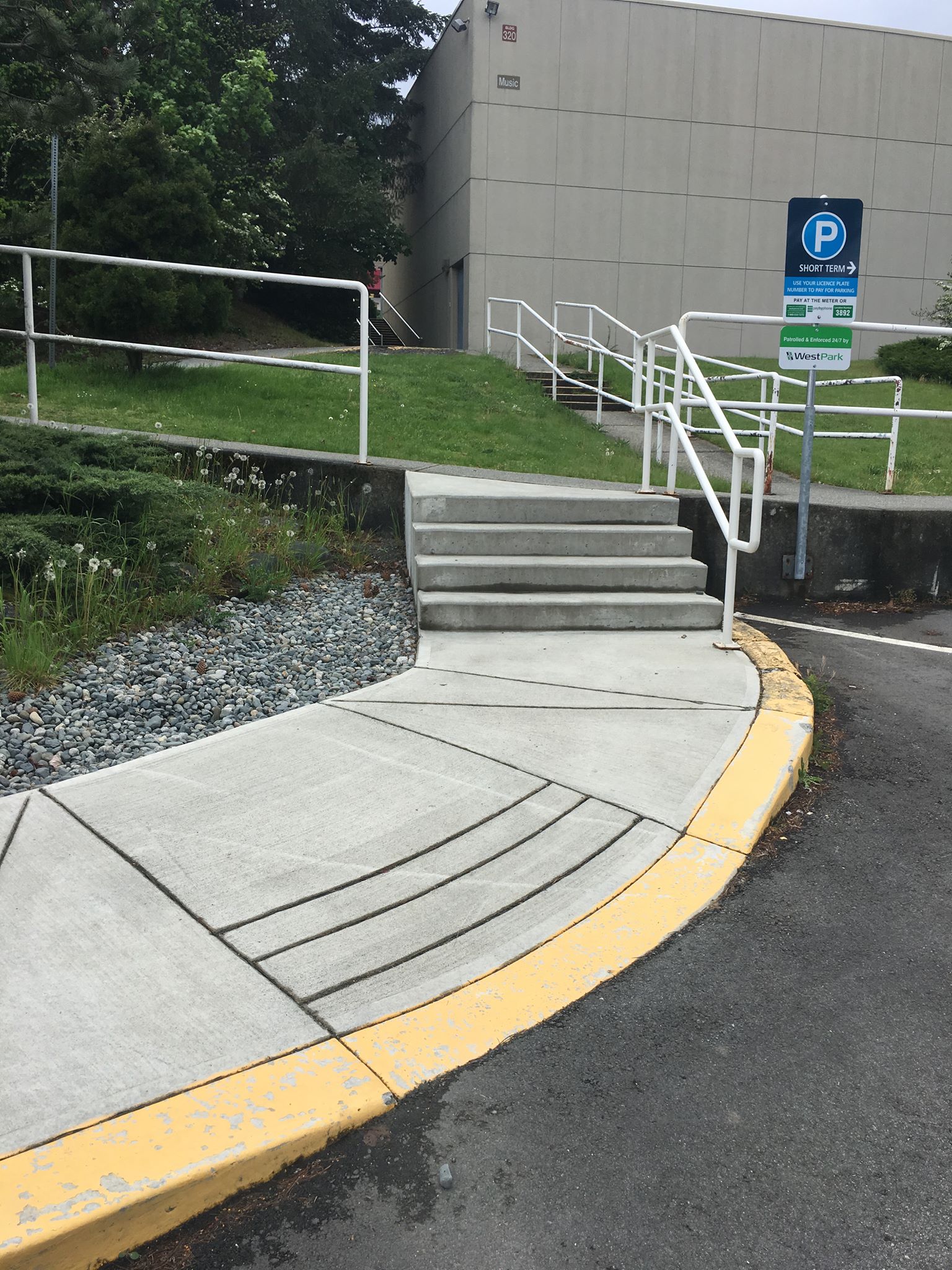
There is no such thing as a disabled individual – rather, everyone is differently-abled. However, most infrastructure is not equipped to handle everyone’s unique way of being. For example, individuals in wheelchairs, parents pushing strollers, individuals living with auditory or visual impairments, and people handling sports injuries all have specific mobility needs that may or may not be met by the built environment. For some, curbs and staircases are nothing to worry about, but for others they represent insurmountable blockades between the start and end points of a journey (Figure 1). In many cases, individuals living with mobility challenges must turn back and find another route to their destination when they encounter these obstacles.
Many maps/applications do not display these barriers in the built environment. Therefore, individuals living with mobility challenges are at an extreme disadvantage when it comes to utilizing modern mapping applications such as Google Maps or Maps by Apple. Many routes displayed by those apps will take people up staircases, over curbs, down steep hills, etc.
Accessibility studies using Geographic Information Systems (GIS) is the foundation of my master’s degree at the University of Calgary. There is a lot of work to be done regarding universal access studies, and GIS will certainly play an important role. I have been working with my colleague Shifa Hayat under the direction of Dr. Victoria Fast to make sense of urban accessibility with spatial data collection, analysis and visualization.
First, we needed a way to collect access mobility (AM) data in the built environment. Individual staircases, curb cuts, ramps, automated doors, and many other features needed to be located and described. We chose to utilize Esri’s Collector app for this portion of the project. Overall, the experience using the Collector app to build an AM database was positive and a great field experience (my geology undergraduate degree included many field schools where large volumes of data were painstakingly collected by hand). The Collector app is easily downloaded on a range of mobile devices and integrated into the ArcGIS Online platform, facilitating data uploads, downloads and edits from the cloud to the desktop environment. Additionally, it is intuitive and easy to use, allowing for fast and accurate data collection.
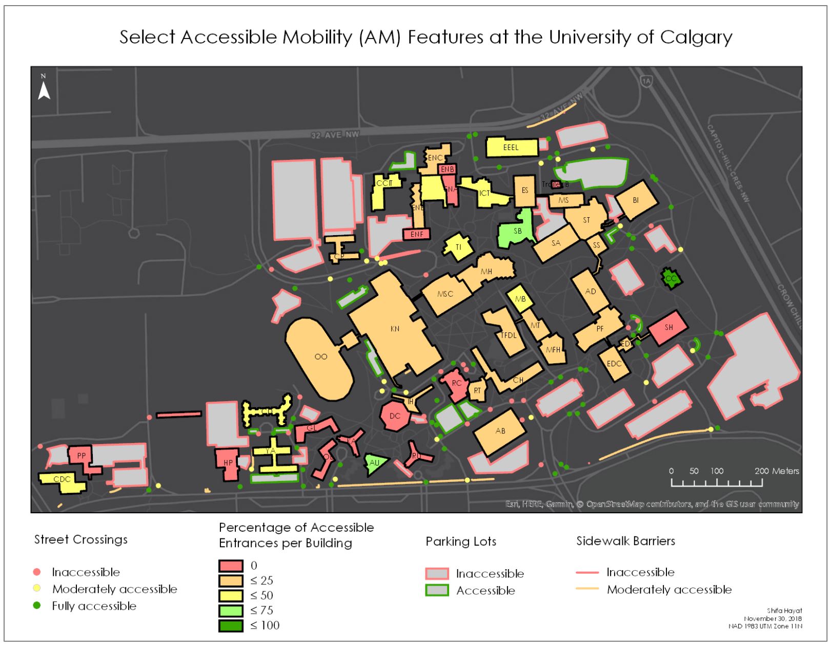
Shifa and I collected data from three post-secondary education campuses: The University of Calgary, Mount Royal University, and the Southern Alberta Institute of Technology/Alberta University of the Arts. We geocoded thousands of points, lines, and polygons over a span of two and a half months, setting the foundation for a plethora of academic research projects. I have integrated the datasets into my MGIS course work, using curb cut locations to explore cluster/outlier analysis and building access points to construct a spatial regression of building accessibility. Shifa produced maps describing the data (Figure 2; Hayat and Fast, 2019) and has performed extensive network analysis on the sidewalks.
Currently, I am collecting AM data on the Vancouver Island University (VIU) campus located in Nanaimo, British Columbia. VIU is located on a hill, with an elevation difference of approximately 90 meters from the bottom to the top. It is a challenging campus to navigate, with over 200 staircases embedded in a complex and steeply sloping sidewalk network. Regardless, VIU is committed to being on the cutting edge of access research to better the experiences of its students, staff and faculty. Evidently, this campus has produced many new complicated and fun challenges to our research team, and I am looking forward to continuing this exciting work!
References
Hayat, S., & Fast, V. (2019). Classifying and Mapping Accessible Mobility on Post-Secondary Campuses. Spatial Knowledge and Information Canada, 2019, 7(5), 3.
*Used with permission from the authors.