Sean Leipe – ECCE Student Associate at McMaster
I’ve just completed my 4th year at McMaster University, majoring in Earth and Environmental Sciences with a minor in GIS. Though I enjoy the core earth sciences I’ve been much more focused on the GIS side since enrolling in an introductory course back in 2nd year, and have taken every available GIS course since! This year was also my first year as an ECCE Student Associate, which has given me many new opportunities and resources. I entered the Esri Global Content Challenge, competed in this year’s App Challenge as part of Team Social Bikes, and took a pair of Esri courses on JavaScript and the Web App Builder.
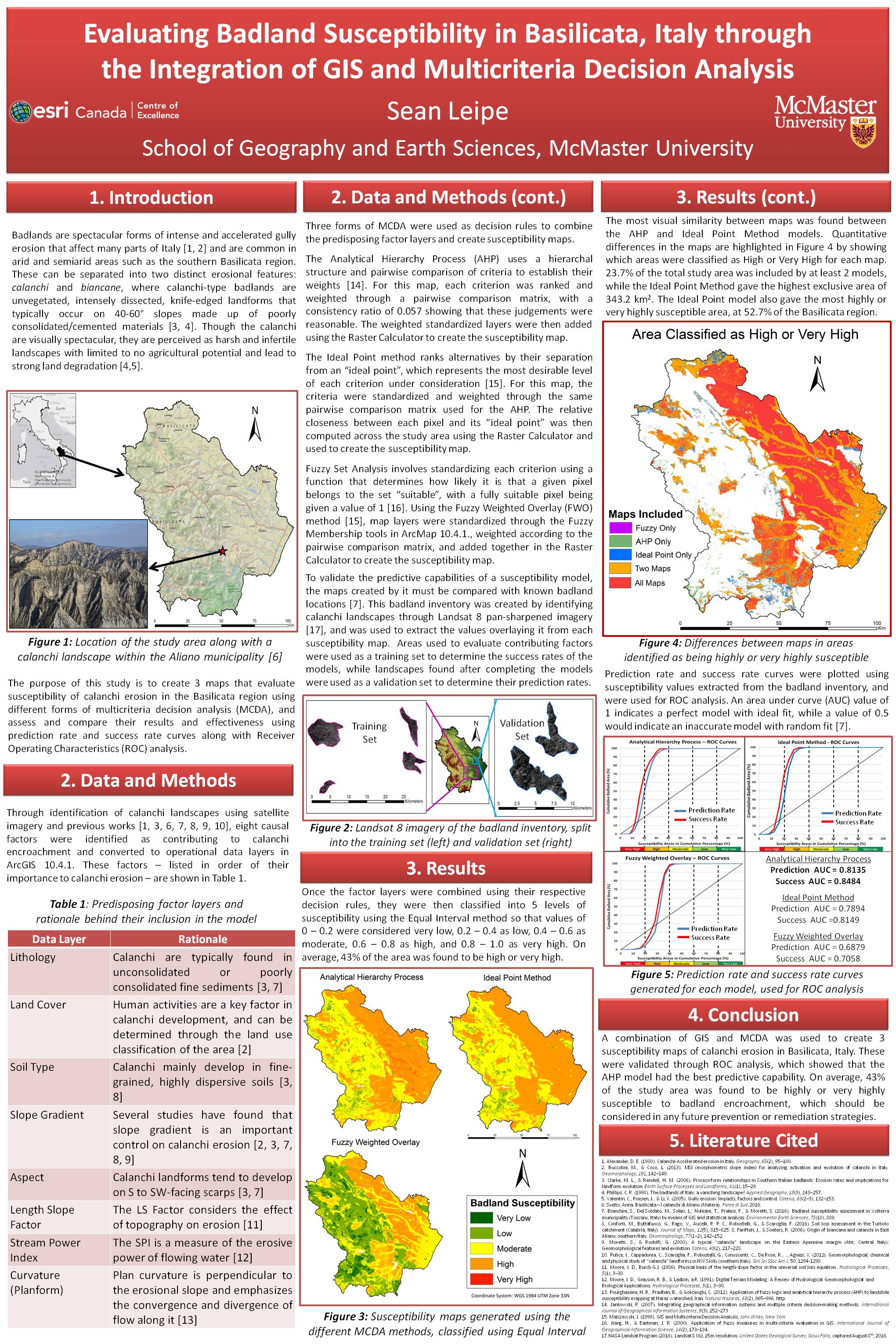
This year I worked on my undergraduate thesis with the help of my supervisor Patrick DeLuca, who runs the Esri Centre of Excellence here at McMaster. This work involved GIS-based susceptibility mapping of badland landforms in the Basilicata region of Italy, by combining predisposing factor layers through different multicriteria decision analysis (MCDA) decision rules. I condensed this work into a poster for my Esri Canada Young Scholar application and was pleasantly surprised to learn I was the top undergraduate student, coming in 3rd place overall! I’m very excited to have gotten this honour, and am looking forward to working on my next projects and competitions.
My experience has helped me land a job for this summer in the GIS unit of Agriculture and Agri-Food Canada’s Ottawa Research and Development Centre. My team is currently working on an interactive GIS-based model to estimate soil erosion in Prince Edward Island using geospatial climate, soil, terrain, and land cover/management data, which will hopefully be applicable to all of Canada in the future. Though it’s still very early in the process, I’m loving the work so far and how so much of it is real-world application of concepts and techniques I’ve learned in my GIS career so far.
I still have one more year of undergrad at McMaster, and I’m especially looking forward to taking our Python Scripting in GIS course and continuing my work with our Centre of Excellence. This will help me improve my Python skills and automation of basic tasks such as data standardization and layer combination, which will let me improve on my previous and future work. My current research interests involve integrating key geoscience fields such as geomorphology and geophysics with GIS, as I’m very interested in both sides and feel they have much to gain from each other.
I’m very thankful for the opportunities that Esri and Pat have given me as an ECCE Student Associate, and am looking forward to what the future holds for my GIS career!

