
The Completion of the ECCE App Challenge 2020
This was my second year completing the ECCE App Challenge. This year was exciting as I was able to build off of what I had learned about the challenge last year and it was my first time being a team leader. The challenge went differently than expected as it had to be completed through virtual team meetings and collaboration. Luckily, I had the opportunity to work with a great teammate, Jack McIlraith, a master’s student in the geography department at Western University, and the virtual transition was seamless with the shared use of ArcGIS online.
The topic of the challenge this year was Health. Our team decided to look into the accessibility and connectivity of active walking and cycling trails in the city of London, Ontario. An preview of our app, Accessible Active London, can be seen below.
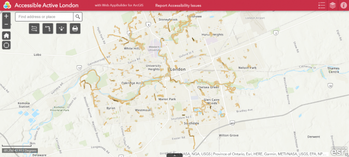
The main function of the app is to communicate to users the most accessible walking and cycling routes in the city. Users can use the accessibility rankings to plan their most accessible active transportation route. The app includes widgets which can allow users to generate directions to and from desired locations and determine the distance between points. A new feature I was introduced to this year was Survey123, which allowed us to include a survey within our application allowing users to report any accessibility issues.
Overall, this App Challenge was a fun experience where I was able to apply my GIS skills developed in university classes and work with new people. Every year it is exciting to see the different ideas and possibilities that come out of the App Challenge. The apps from this year, including ours, can be found here: https://esricanada-ce.github.io/appchallenge/2020/. Congratulations to the winners of this year’s App Challenge, QuaranTEAM, and everyone else who competed the challenge!