
Experience and thoughts with Web AppBuilder and ArcGIS
This is Philip, a third-year undergraduate student studying in GIS and CS at the University of Toronto Mississauga.
In April, I participated in the Esri App Challenge with Andrew Sud and Christine Cong, we designed a web application helping people to avoid tree allergies using Esri’s Web AppBuilder for ArcGIS. Although we did not win the competition, I gained lots of experience with applying my GIS related knowledge to the real-world phenomena, and determining which way can best present the issues and resolutions well.
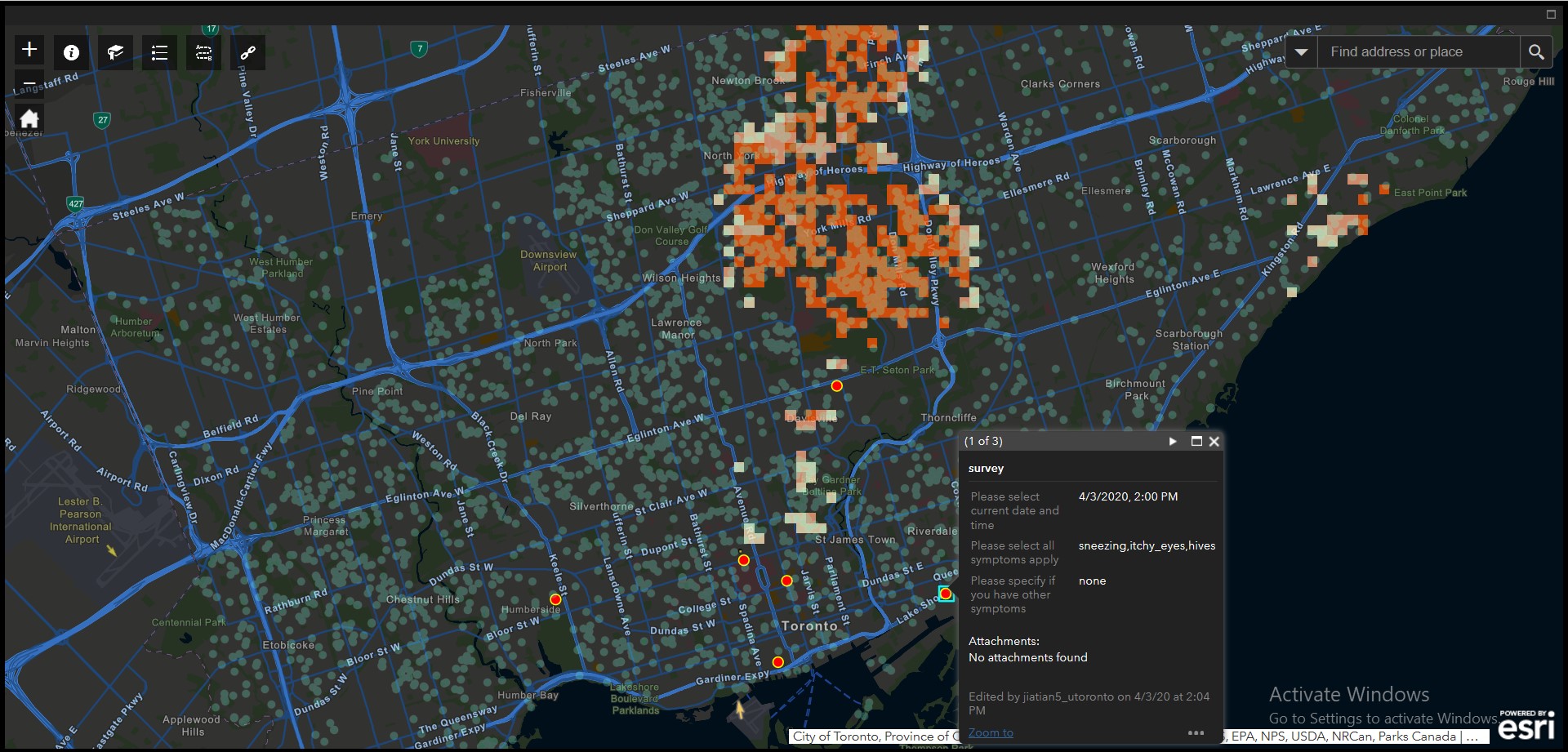
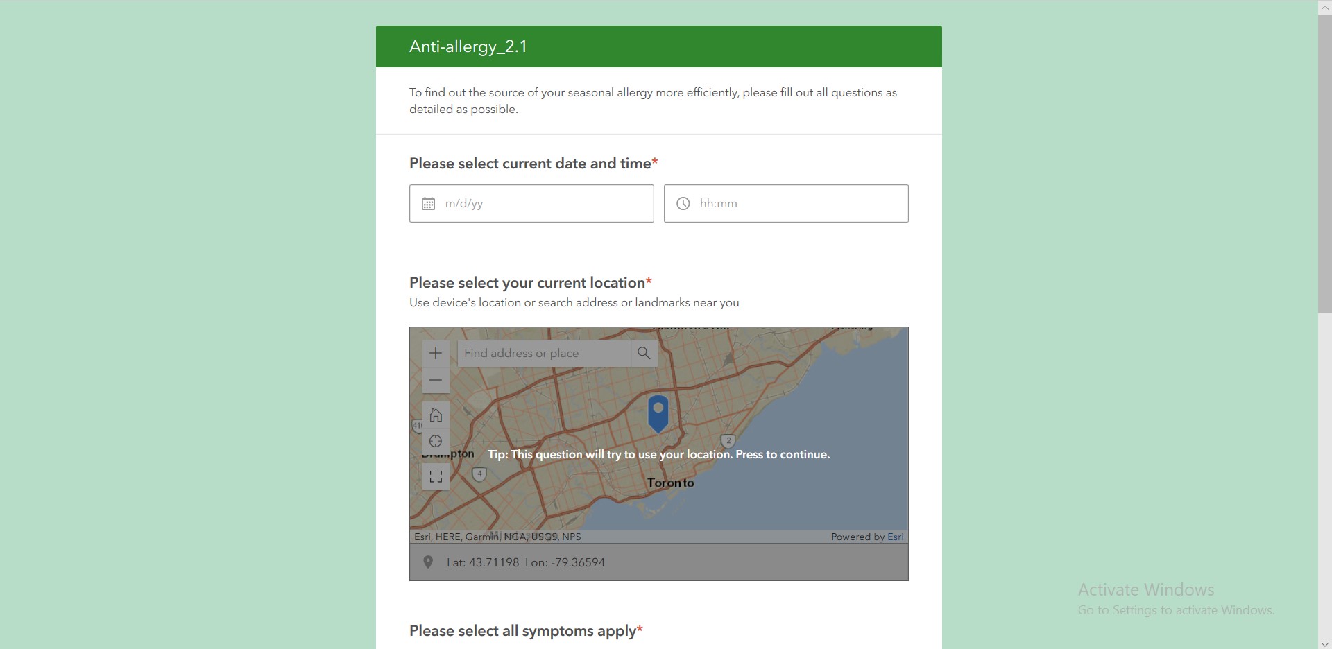
Figure 1 is a screenshot of our webapp, is includes trees spreading potential pollen in the Toronto area, and we applied hotspot analysis to determine the most dangerous areas to warn people with seasonal allergies caused by tree pollen. Additionally, we have also incorporated many functions to help patients travel safely, and to reporting their location, time, and allergy symptoms to help future users, as shown in Figure 2.
From my understanding of GIS so far, GIS is not more than its simple definition, e.g., in Wikipedia: “A geographic information system (GIS) is a conceptualized framework that provides the ability to capture and analyze spatial and geographic data.” The way I explain GIS to my peers is: GIS is a technique for using data, math, science, or even algorithms, to present a map or a 3D model, and to analyze it, which ultimately helps people and organizations to solve problems or make decisions. Enhancement to the internet and computers continues to supported the development of GIS applications and workers, in terms of collecting and analyzing data.
Starting in April, I also participated in the free massive open online course (MOOC), presented by Esri, to learn cartography with ArcGIS. This was a 6 weeks lesson that gave me a glance of the power of ArcGIS, and has motivated me to follow up feeds and updates regarding ArcGIS products and the GIS world. Along with the advancement of Artificial Intelligence, making maps and modeling are becoming easier than before. Maybe before long, the function of producing a map by hitting one single key will be implemented into GIS software, saving time on the cartography part of the map, allowing more effort and focus on analysis of maps.