Creating Your Own GIS Guidebook!
Last summer I worked as an Urban Planning Summer Student at my local municipality. My responsibilities included lots of development reviews and GIS work. I often found that I had to help my coworkers with basic GIS / ArcMap functions such as searching for an address or changing symbology. Instead of waiting to ask the few people in the building who knew how to use ArcMap, I figured it could be beneficial to make a basic GIS / ArcMap guide. Please note that all the images in this post are my own and I have also blurred out any potentially identifiable information.
What Even IS a GIS Guide?
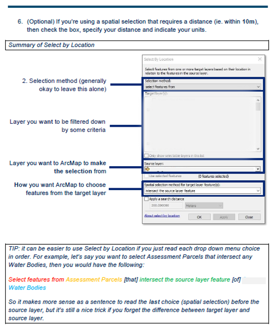
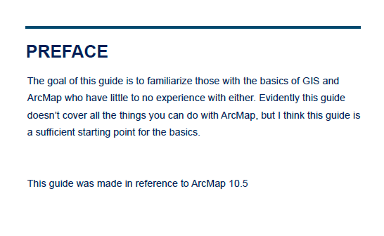
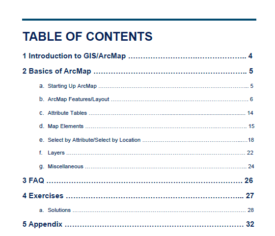
This GIS / ArcMap Basics guide includes what I believe to be a solid beginner understanding of utilizing ArcMap on a daily basis. Of course this is not comprehensive nor is it applicable in every scenario, but it covered a lot of the struggles my coworkers were having. Here is a look at my preface and table of contents to give an idea of what (Figure 1, Figure 2):
Since the goal was to provide a tailored user guide on how to perform simple tasks, this guide was more focused on using ArcMap for its geographical functions rather than the science behind GIS.
Why YOU Should Make a GIS Guide
To Help Others with GIS
The most obvious benefit of creating this guide, was for my coworkers. If they had a simple question, they had the option of looking it up in my guidebook instead of waiting to ask a GIS co-worker or trying to navigate a Google search. Although they may not always use it, you can find satisfaction knowing that your GIS guide will always be there if they do need some extra guidance.
To Help Yourself with GIS
While making this guide I noticed was how much it helped me with my own GIS skills. First of all, since I was making this guide for the true beginner, I had to go back to the very beginning of my GIS education. This really helped me appreciate how far I’ve come and how much knowledge I’ve actually learned! Secondly, solidifying my existing knowledge in GIS and ArcMap was a great refresher. Doing this especially in the summer is a great way to do some review before the school term starts! Lastly, in the future I can expand on this guide by including all the skills I’ve learned to act as my personal GIS guide ?. Instead of constantly googling how to create an address locator, I can interpret it using an easier method of instruction.
To Create a Finished Product
I’ve always been very interested and invested in the design of a finished product. I wanted to make this guide not only helpful but visually appealing as an approachable document. So this project not only provided me with opportunity to teach others and to refine my GIS skills, but I got to create a polished product that I can now proudly display. This was a side project born out of natural need for it and now it can be a representation of my creativity and GIS! I’ve included some pages from my guide (Figure 3, Figure 4) that can hopefully inspire you to make your own ?.