
Land-Cover Change Detection in Alberta, Canada (2000-2020)
The physical and biological cover on the Earth’s surface is called land cover comprising of different types of classes such as grasslands, forests, bare ground, water, and built-up zones like urban areas and roads. Why has land cover change attracted so much attention recently? Changes in land cover, especially tropical forest clearing, culminated in the potential effects of erosion, increased run-off and flooding, increasing CO2, climatological changes, and biodiversity loss (Mas, 1999). Therefore, studying land cover over a while not only provides information about the types of features, and vegetation but also helps to identify their impacts on ecosystems and communities. This post aims to show how much land area was affected by urban areas and quantifies the land cover change that occurred in the past 20 years.
Study Area
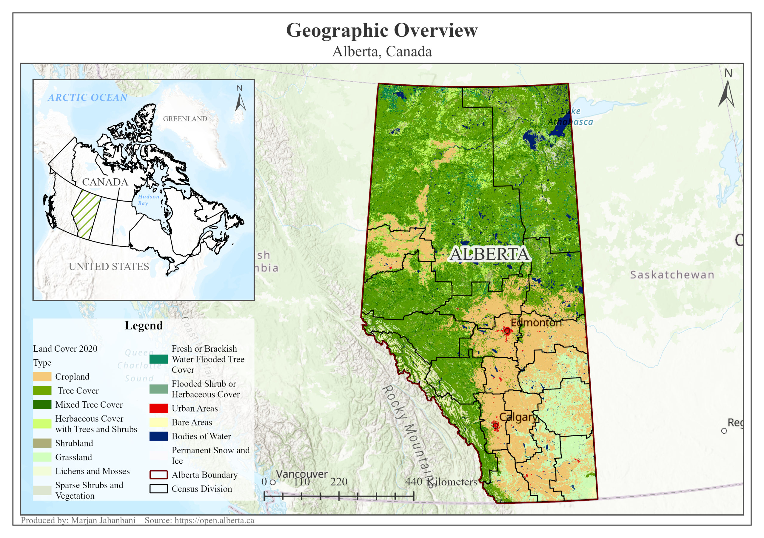
Alberta, situated in western Canada, is the fourth-largest province in Canada, with land covering about 662,697.62 km² accommodating more than 4 million people, also known for its stunning natural landscapes (About Alberta | Canada’s Alberta, n.d.)(Global Land Cover 1992-2020 – Overview, n.d.). As shown in Figure 1, the majority of the province is covered by diverse tree areas also cropland occupies the southeast of Alberta.
Result
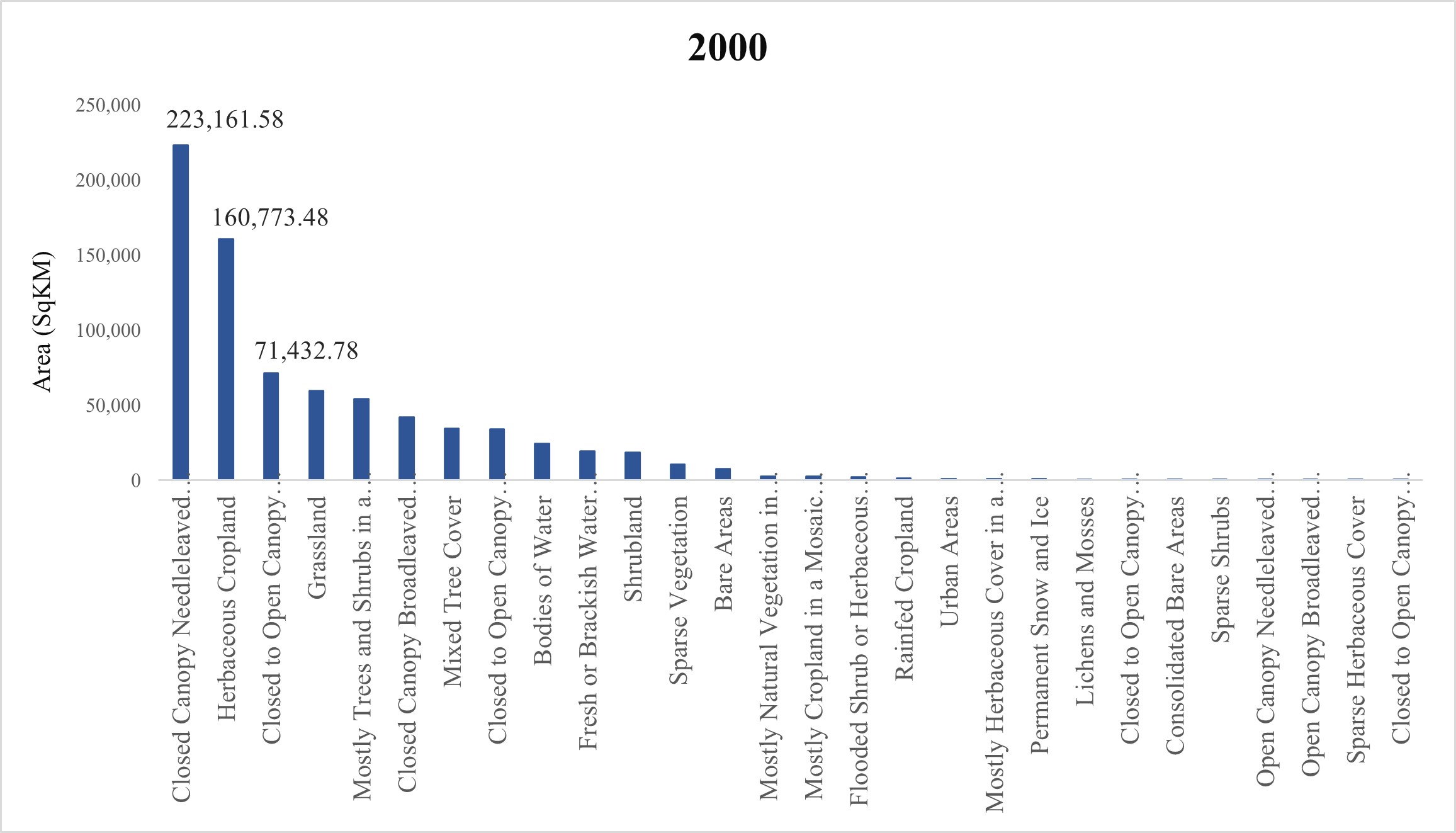
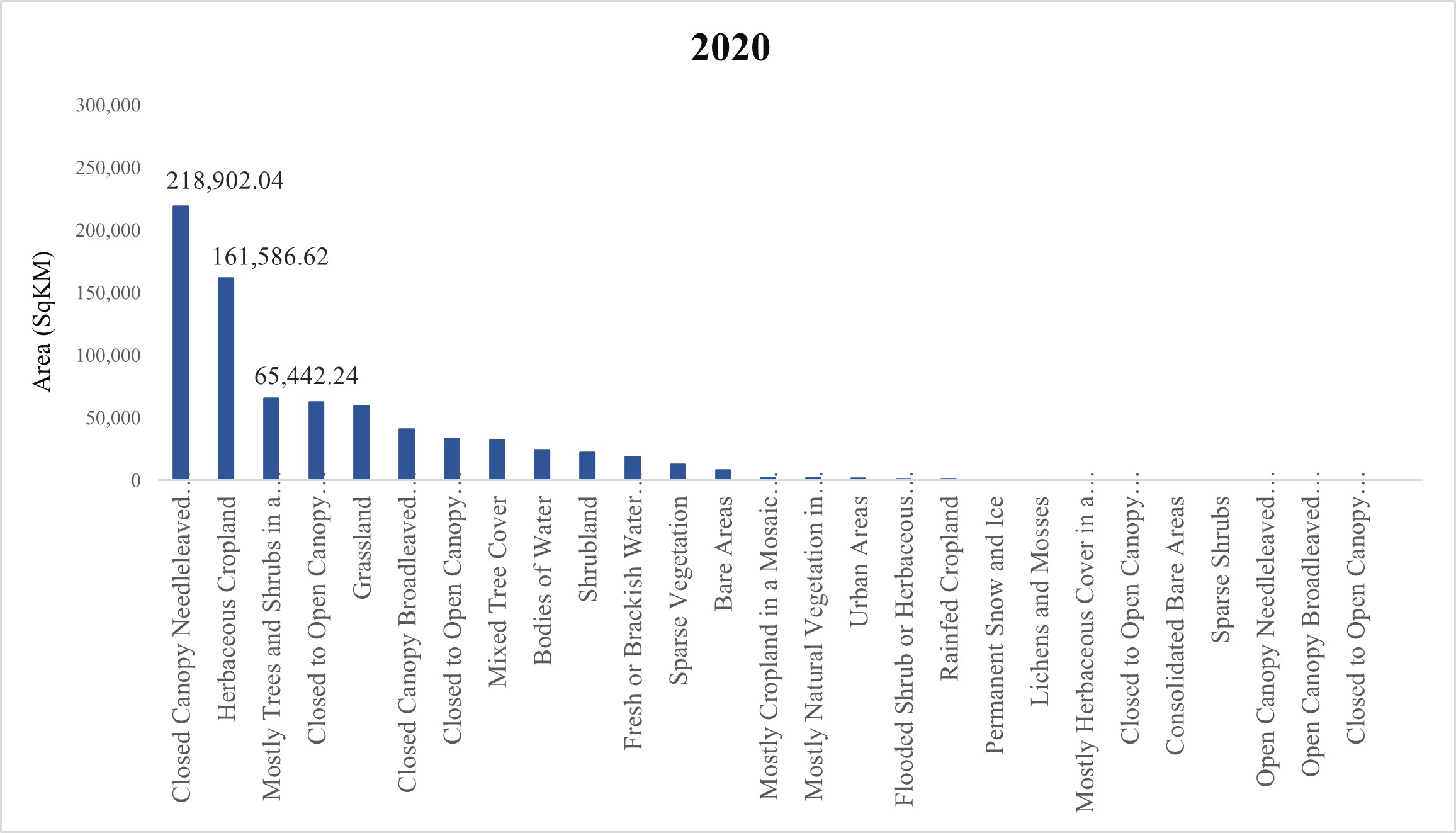
In this case, Esri Global Land Cover 1992-2020 was used to extract Alberta’s data in 2000 and 2020. In 2000, the province was classified into 28 categories which reached 27 classes in 2020. Indeed, one type of land cover named “Sparse Herbaceous Cover” was not observed after 2 decades. In both studied years, the type of land cover named “Closed Canopy Needle-leaved Evergreen Tree Cover” had the highest area in Alberta; however, the area of which reduced by approximately 2 percent in 2020. On the contrary, the second-largest area belongs to the category “Herbaceous Cropland” in both years which increased slightly by 0.5 percent. The urban areas had an area of 976.08 km2 in 2000 which grew to 1,937.17 km2 after 2 decades (Figures 2 and 3).
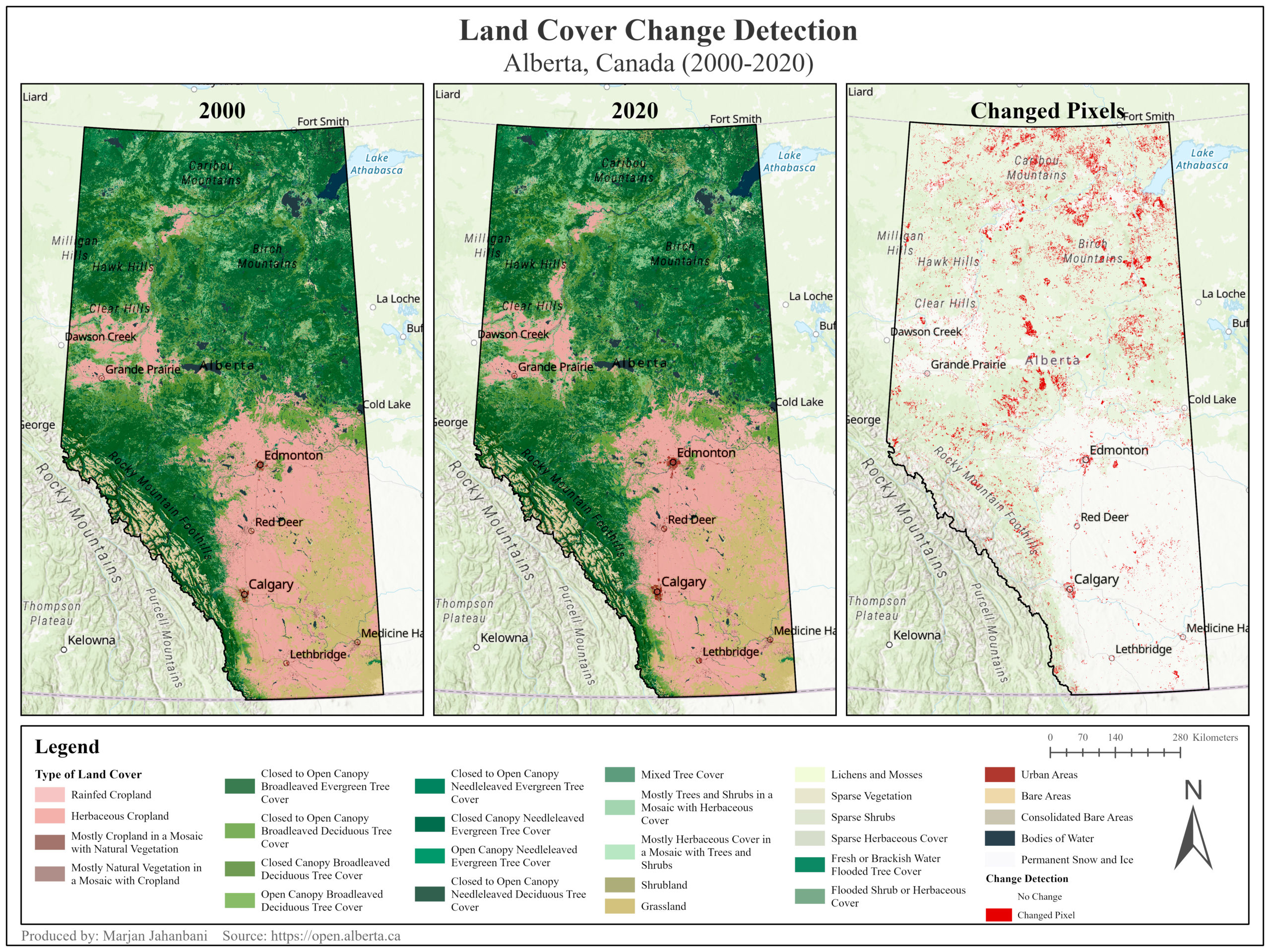
Generally, the area of changed and no changed pixels are about 29,305.81 and 633,391.81 km2 respectively. In other words, only a small ratio (about 4.4 percent) of Alberta’s area transformed within 20 years. A large part of the changed pixels can be observed in the northern part (Figure 4). Indeed, the category “Closed to Open Canopy Needle Leaved Evergreen Tree Cover” had the largest number of pixels changed to “Mostly Trees and Shrubs in a Mosaic with Herbaceous Cover” between 2000 and 2020. In addition, Alberta’s urban area expanded by a slight area of 961.09 km2 within 20 years indicating a low degree of human disturbance of the natural environment. In fact, the cities of Calgary and Edmonton contributed largely to the growth of urban areas (Figure 4).
To sum up, due to slight changes in land cover over two decades, it can be inferred that Alberta’s environment and land use conditions remained fairly steady during the studied period.
Reference
About Alberta | Canada’s Alberta. (n.d.). Retrieved November 19, 2023, from https://www.travelalberta.com/know-before-you-go/about-alberta
Global Land Cover 1992-2020 – Overview. (n.d.). Retrieved November 19, 2023, from https://www.arcgis.com/home/item.html?id=1453082255024699af55c960bc3dc1fe
Mas, J. . (1999). Monitoring land-cover changes: a comparison of change detection techniques. International Journal of Remote Sensing, 20(1), 139–152.
Open data – Open Government. (n.d.). Retrieved November 19, 2023, from https://open.alberta.ca/opendata