 A Glance at Enterprise Geodatabases and Publishing Content
Posted 6 years ago
By Anastassios Dardas
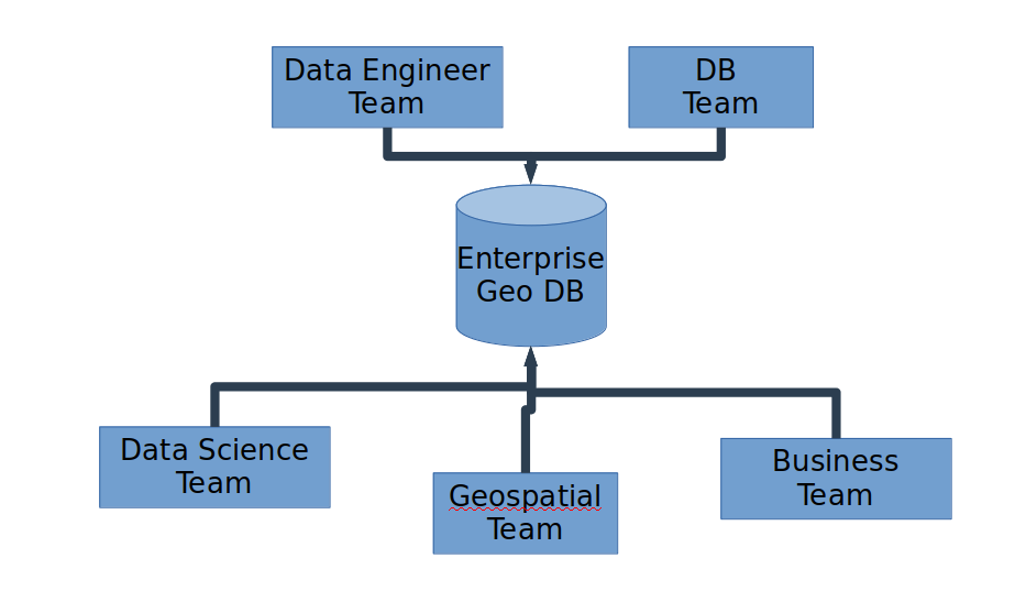
Introduction All of us in the field of GIS already know what a geodatabase is. Most of us know how to properly create one, especially for single-use or for our own personal projects. Depending on the GIS project, most of the time academic institutions just need personal or file geodatabases. For industry and government, it […]
Read More
 Going Beyond the Horizons of ArcGIS Desktop
Posted 6 years ago
By Anastassios Dardas
Any of you visiting the Centre of Excellence or visiting Esri’s main site is likely a user of ArcGIS products, especially ArcGIS Desktop and to certain extent ArcGIS Online. What the academic courses taught you are the GIS concepts, how to think like a GIScientist, and how to use the tools, mainly ArcGIS Desktop. But […]
Read More
 What is GeoAI?
Posted 7 years ago
By Anastassios Dardas
DevSummit 2018 This past early March, my fellow McMaster Student Associate, Matt Brown and I had the opportunity to attend to the 2018 Esri Developer’s Summit located in Palm Springs, California. As Matt mentioned in his recent blog, this is our second time attending, all huge thanks to the ECCE Student Associates Program. Last year, […]
Read More
 Webscraping in GIS
Posted 7 years ago
By Anastassios Dardas
Data in the Digital Age Data is the foundation of insightful information for research and organizations, and thus drives their successes. The critical role that data plays in our society has led to a race to collect and mine data. Over the course of the 20th century, incredible methods such as the introduction of Neilson […]
Read More
 Natural Language Processing: The Frontier to Qualitative GIS
Posted 7 years ago
By Anastassios Dardas
When people talk about GIS, there are several factors that come up to mind instantly, such as creating beautiful maps, spatial analyses, and quantitative data. But what about qualitative GIS? Does that come up in your mind? At this time of writing (2017), there is a good chance that the answer is no; however, I […]
Read More
 Blending R’s Hidden Gem and WebGIS Development: A Live Case
Posted 8 years ago
By Anastassios Dardas
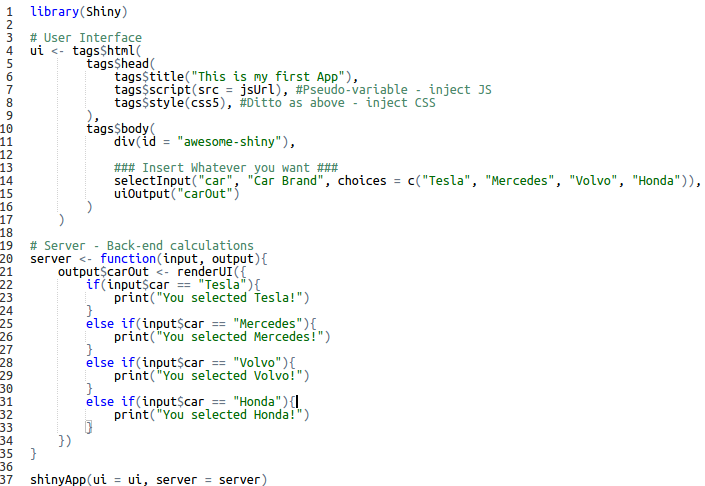
My teammates, Karl Chastko and Spencer Elford, and I competed this years Esri’s App Challenge on sustainable transportation. The development of our app (check it out) was something unique from the standard way of web development (i.e. HTML, CSS, and JavaScript). Some of you guys may be thinking, “What’s so unique?” Others may think that […]
Read More
 Why you should attend Esri’s Developers Summit (Palm Springs)?
Posted 8 years ago
By Anastassios Dardas
Last year, two of my friends (also student associates of Esri Canada) went to the 2016 Esri’s Developers Summit. When they came back, they said to me, “You should really go to this conference next year. You’re gonna love the experience. Plus, it is even more beneficial for you since you have some development background.” […]
Read More
 Why GIS and Computer Science Should Integrate Together?
Posted 8 years ago
By Anastassios Dardas
McMaster University hosted GIS Day (Nov. 18th – even though the official day was two days before) and we had presentations from a variety of applied disciplines and workshops. I presented the development side of GIS including last year’s ECCE App Challenge by ESRI. For this, I’m going to talk about the presentation, especially the […]
Read More
 A Glance at Enterprise Geodatabases and Publishing Content


