 GIS Development Student at Bruce Power
Posted 1 year ago
By Madina Sulaymonova in the McMaster Blog
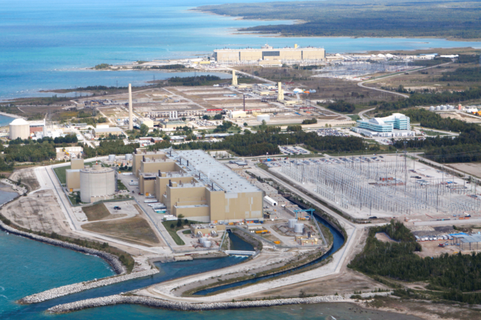
During the winter of 2022, an amazing opportunity came my way as a co-op student who thrives in expanding her connections and skills in GIS. I landed a position to work at Bruce Power as a GIS Development Student for an 8-month work term. Located on the eastern shore of Lake Huron, Bruce Power is […]
Read More
 Using Analytic Hierarchy Process to Determine Optimal Locations for Fire Observation Towers in Iran’s Shafarood Forest
Posted 1 year ago
By Mersedeh Khoshkholgh in the UNB Blog
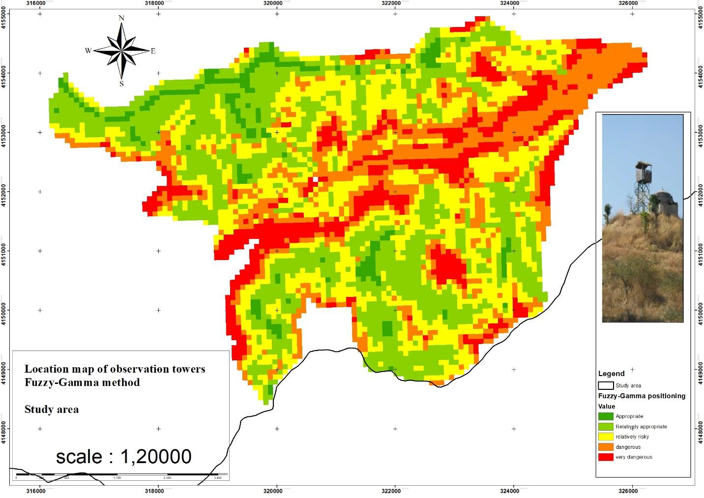
SummaryForests have been seriously affected by fire; therefore, it is necessary to detect fire from the observation towers. Currently, the number of observation towers and the effectiveness of their distribution is unknown. The aim of the current research is to determine the current and potential areas that can be seen from the observation towers. Another […]
Read More
 Where is the Carbon? Spatially mapping carbon on the seafloor
Posted 1 year ago
By Catherine Brenan in the Dalhousie Blog
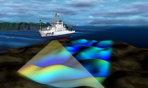
Hi everyone! My name is Catherine Brenan and I am an undergraduate student completing a combined honours in Environmental Science and Chemistry with a certificate in GIS at Dalhousie University. I am doing my research in the Oceanography department, specifically examining how to spatially map carbon on the seafloor in the Eastern Shore Islands. Background […]
Read More
 Ortho Mapping Historical Aerial Photos
Posted 1 year ago
By Dechen Wangmo in the UNB Blog
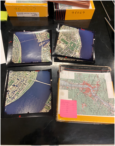
I have been working on ortho mapping historical aerial photographs as part of my work study programme. The aerial photograph was shot in 1995 and shows the city of Fredericton. An orthophoto is an aerial photograph or satellite image that has undergone geometric correction to make the scale uniform and follows a specific map projection. […]
Read More
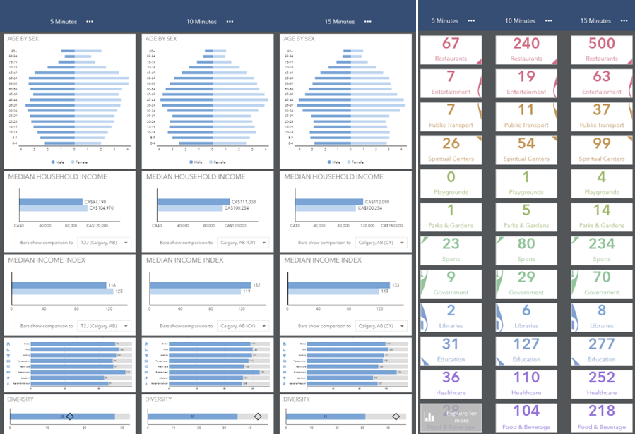 Diving into ArcGIS Business Analyst
Posted 1 year ago
By Cindy Lu in the COGS Blog
As a student in the Geospatial Data Analytics program at COGS, I had the opportunity to explore the capabilities of the Esri Business Analyst extension in ArcGIS Pro. I was impressed by how the platform draws from various data sources to provide a comprehensive tool for users to incorporate various demographic variables and business profiles […]
Read More
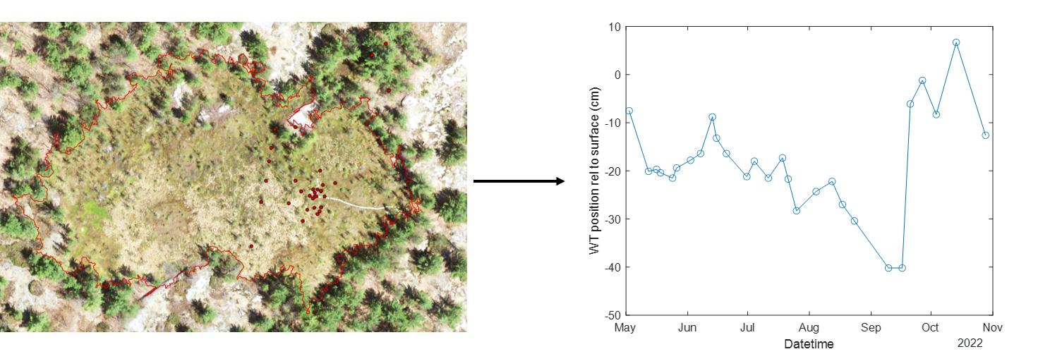 ArcGIS in Hydrological Field Data Collection: Reflections on the 2022 Field Season
Posted 1 year ago
By Alex Furukawa in the McMaster Blog
This post is an overview of our research lab’s recent usage of ArcGIS applications, specifically the mobile platform, in the collection of field hydrological data. Our lab, the McMaster Ecohydrology Lab, has integrated ArcGIS in our field data collection since 2018 with the Collector App, and has since shifted to Field Maps in 2021 along […]
Read More
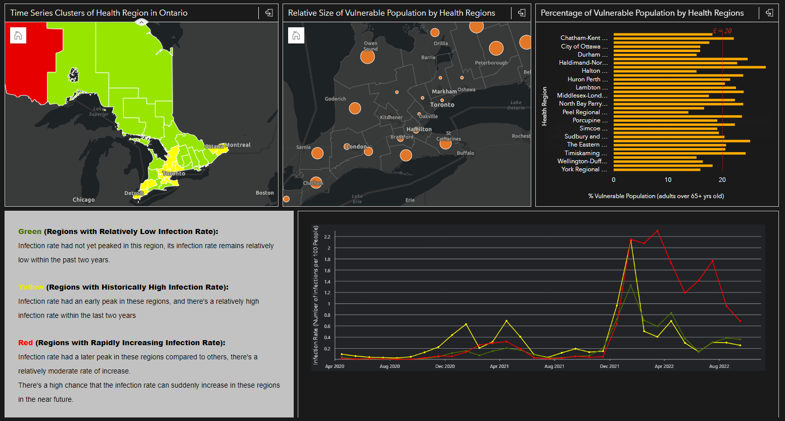 Integrating Space, Time and Geography with ArcGIS Insights: A Case Study of COVID-19 Infection Rates in Ontario Public Health Regions From 2020 to 2022
Posted 1 year ago
By Karlos Lao in the Western Blog
Introduction Tobler’s First Law of Geography “Everything is related to everything else, but near things are more related to distant things” reminds us how geography plays an important role in the spatial pattern of things that we see everyday. However, when it comes to analysis involving human mobility, epidemiology, or any spatial data that contain […]
Read More
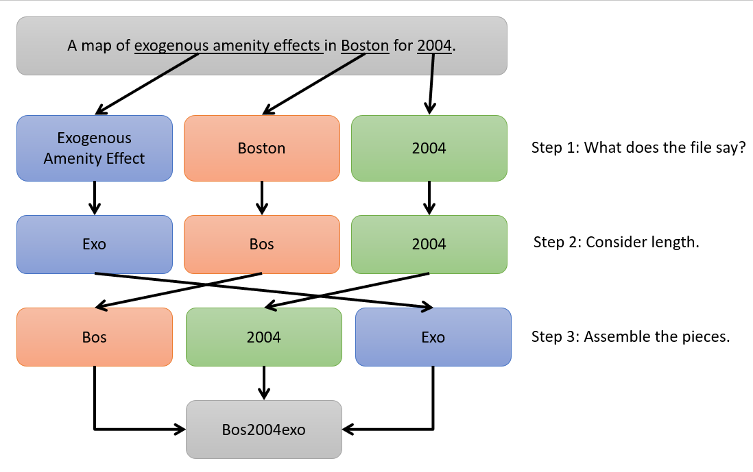 The Importance of Careful File Naming
Posted 1 year ago
By John Hutchenreuther in the Western Blog
When I was sitting in my courses learning how to use ArcGIS Pro to generate maps and analyze spatial data, I got the obligatory computer science warnings that come in any software course: put some thought into what you name your files. I did my best to take it seriously at the time, but when […]
Read More
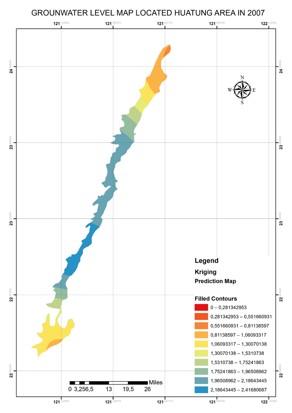 Computational method of ArcGIS Ordinary Kriging tool
Posted 1 year ago
By Ngoc Phan in the UNB Blog
ArcGIS provided outstanding and friendly interpolation tools to common users. I unitized Kriging tool in ArcGIS to interpolate the data points a long time ago. However, understanding its method is a different story. My previous background is in Applied Geology, particularly Groundwater modeling. I, therefore, had a chance to learn the meaning of the ArcGIS […]
Read More
 Apply to become a Student Assistant at the 2023 Esri User Conference in San Diego
Posted 1 year ago
By Maja Kucharczyk in the UCalgary Blog
Happy new year, everyone! My name is Maja Kucharczyk and I am a PhD candidate in Geography at the University of Calgary. This is my first blog post as an ECCE Student Associate. I very much look forward to continuing my GIS journey in 2023, especially when I look back on the opportunities I had […]
Read More

