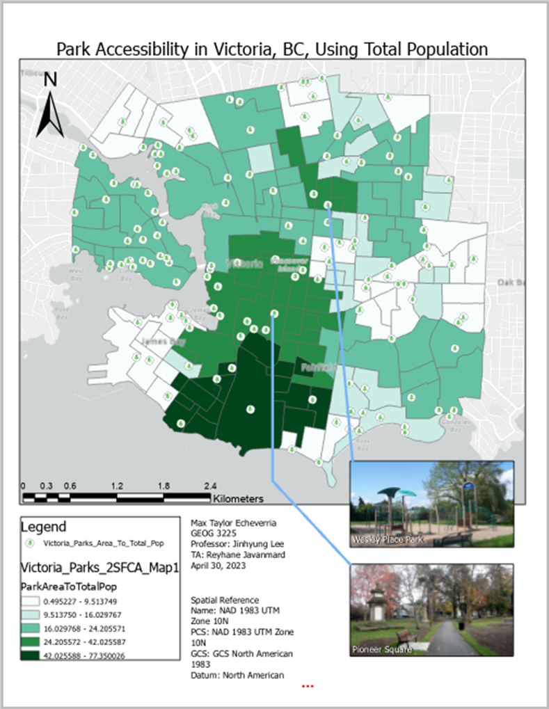
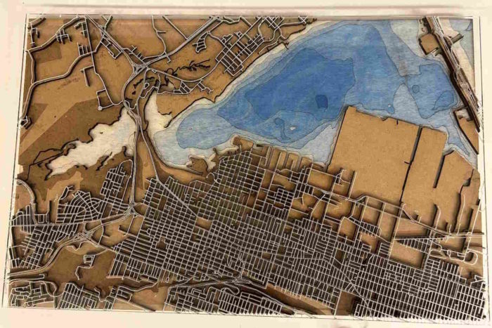
 Park Accessibility in Victoria, British Columbia using Daytime Population & Total Population.
Posted 4 months ago
By Max Taylor Echeverria in the Western Blog
For my third year Transportation Geography & GIS term project, I delved into essential questions about park accessibility in Victoria, BC: Daytime vs. Total Population: What is the level of accessibility for parks using daytime population values in Victoria, BC? Comparative Analysis: What is the level of accessibility for parks using total population values in […]
Read More
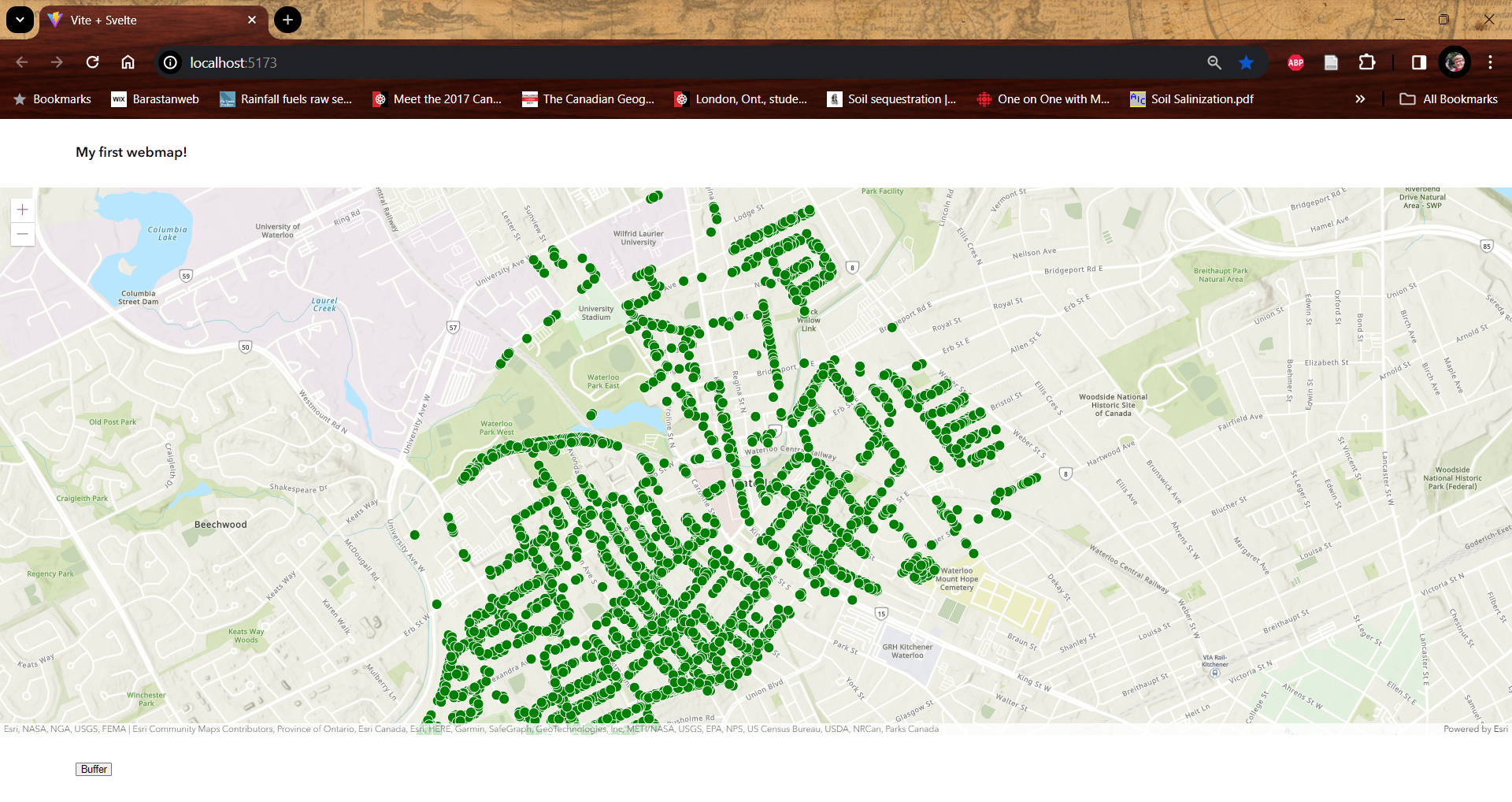 Getting Started with the ArcGIS SDK for JavaScript and Svelte
Posted 4 months ago
By Ben Woodward in the UW Blog
This post is part of a series on developing web maps, apps, and dashboards using Esri technology. This post will introduce the ArcGIS SDK for JavaScript, compare the JavaScript SDK to Experience Builder Dev, give a tutorial on how to build a web map using the JavaScript SDK and the Svelte JavaScript framework, and provide […]
Read More
 Getting Started with ArcGIS Experience Builder Dev Edition
Posted 4 months ago
By Ben Woodward in the UW Blog
This post is part of a series on developing web maps, apps, and dashboards using Esri technology. This post will go over how to get started with ArcGIS Experience Builder Dev Edition, compare Experience Builder Dev to Experience Builder in ArcGIS Online and to the ArcGIS SDK for JavaScript, and provide some additional resources to […]
Read More
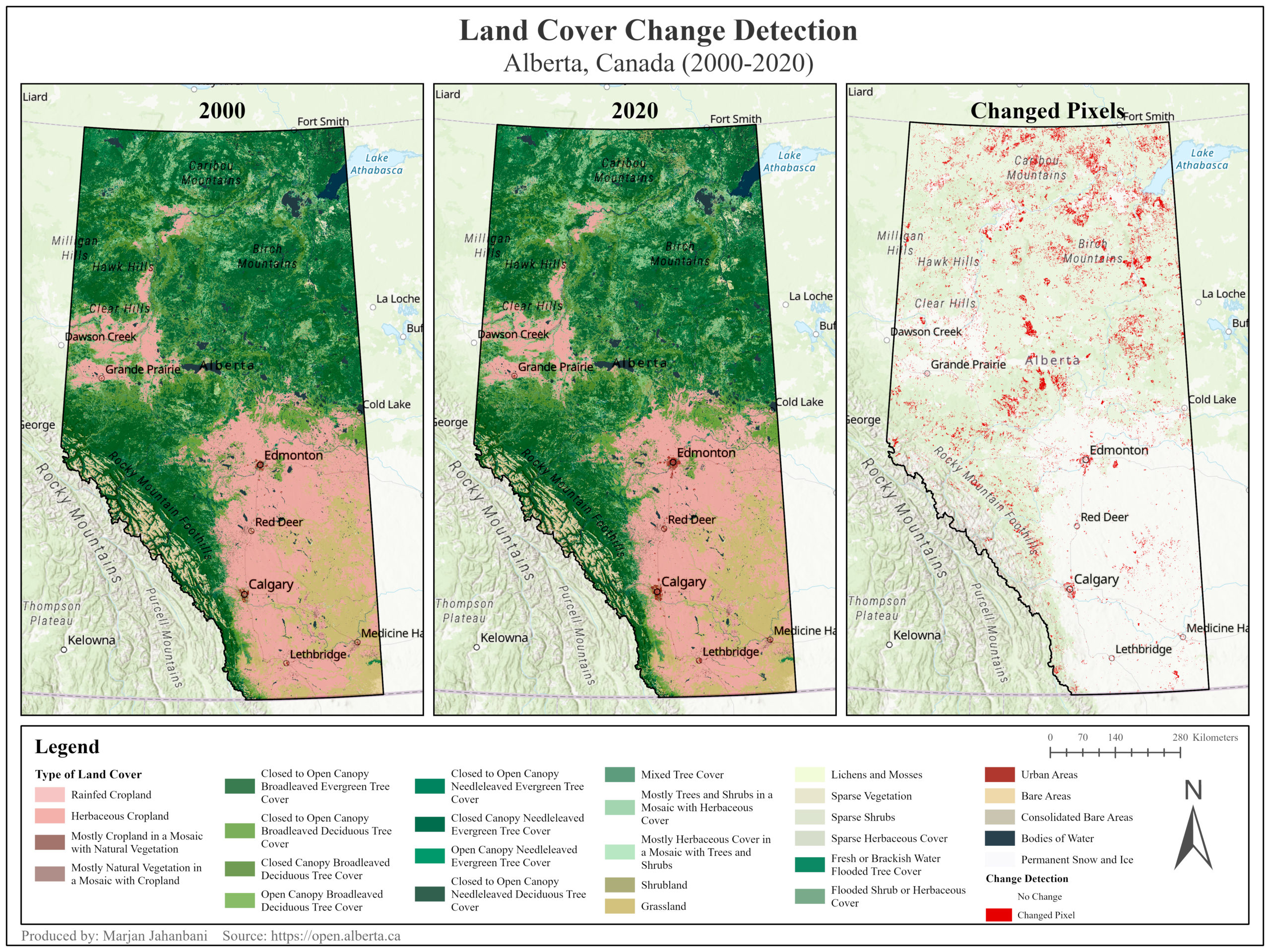 Land-Cover Change Detection in Alberta, Canada (2000-2020)
Posted 5 months ago
By Marjan Jahanbani in the UCalgary Blog
This post illustrates the transformation of land cover in Alberta Province (Canada) over 20 years.
Read More
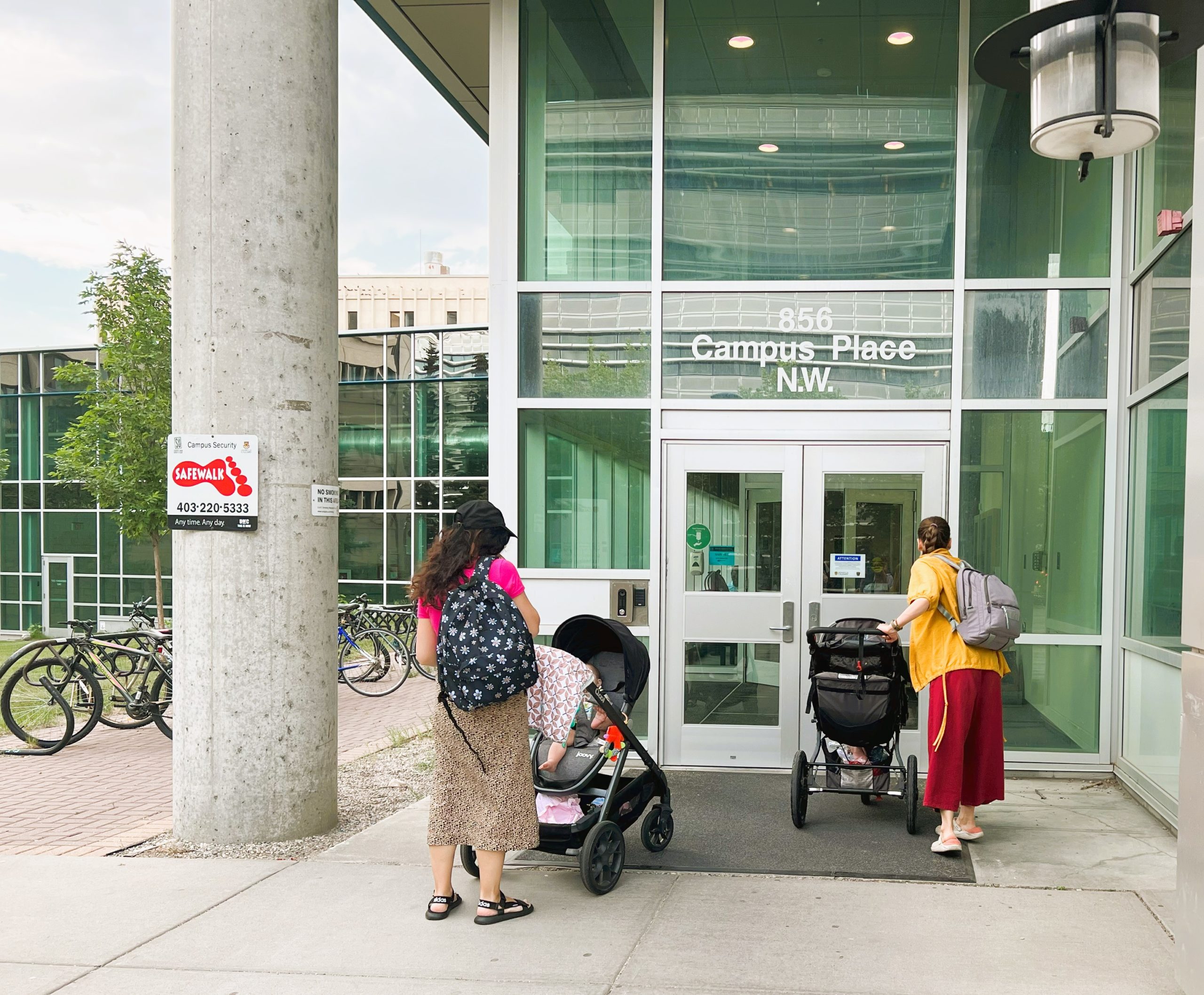
 GIS Day at McMaster University: Perspectives from an ECCE Student Associate
Posted 5 months ago
By William Russell in the McMaster Blog
Every year around GIS Day, McMaster University holds an exciting series of lighting talks and demonstrations from members of the University community using GIS. This year, there were 12 speakers who spoke on topics, whose level of expertise ranged from co-op undergraduate students to PhD candidates to Research Assistants to Postdoctoral Fellows. This post aims […]
Read More
 3D model of the Halifax Harbour Waterfront
Posted 6 months ago
By Cameron Robertson in the Dalhousie Blog
This project considered what is required to create impactful and representative visualizations as well as how planners can leverage them to explain the effects of SLR and EH. This section reviews principles, guidelines, and observations that have been made when visualizations are created and presented. This section then reviews past research which has been completed […]
Read More
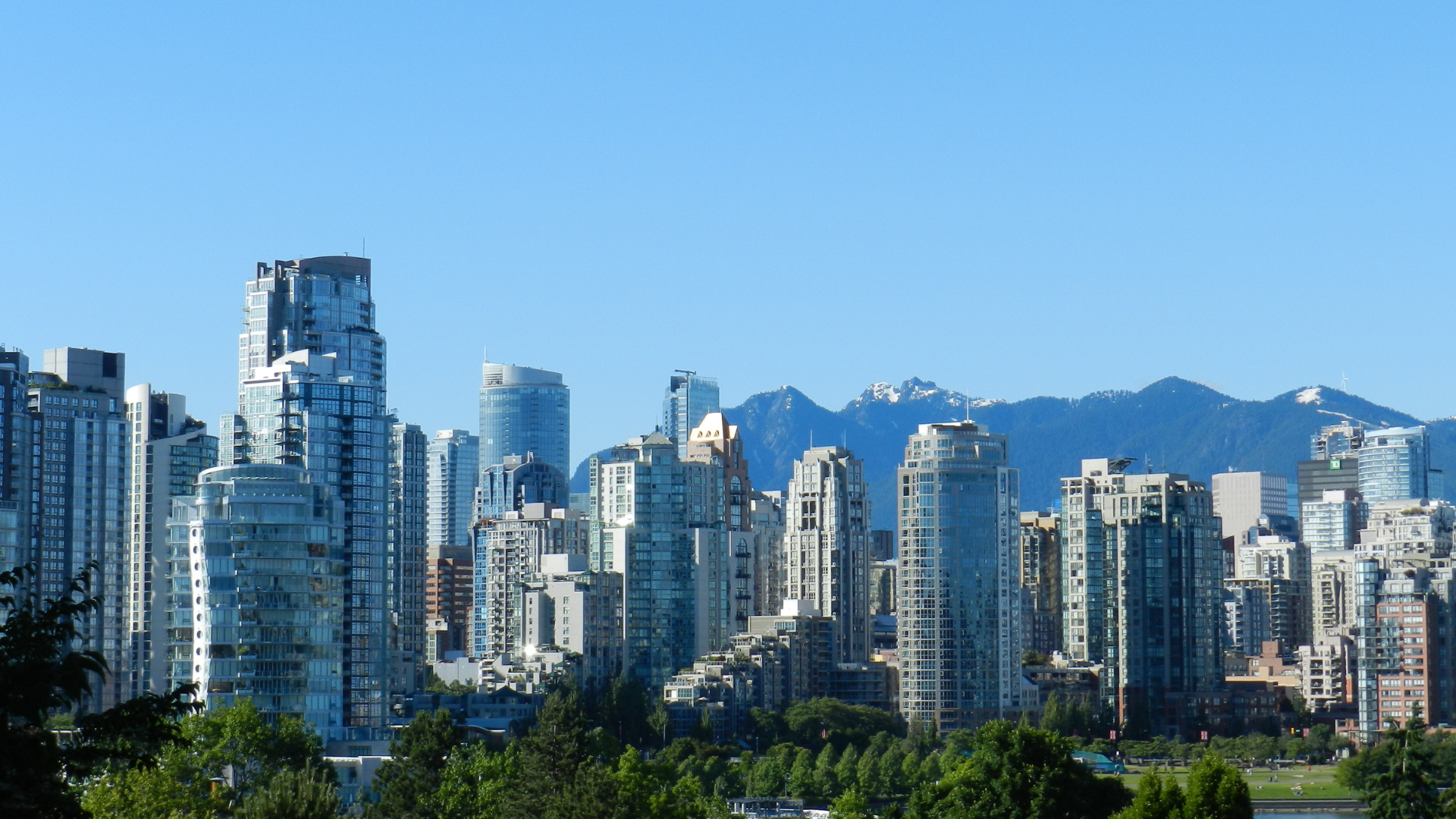 Hospital and Park Accessibility in Vancouver, BC, Canada: A Geospatial Analysis
Posted 6 months ago
By Max Taylor Echeverria in the Western Blog
For my third-year GIS final project, I decided to develop accessibility maps for two critical variables in selecting an ideal place to live in Vancouver, BC: hospitals and parks, as a young professional or recent graduate. The significance of these factors lies in their impact on our health and well-being. Why Hospitals and Parks? Hospitals […]
Read More
 2023 ECCE App Challenge: ConservNation Canada
Posted 7 months ago
By Alex Furukawa
It’s been several months since the whirlwind of the App Challenge held this past spring has come and gone. While I can’t speak to the entirety of this challenge and the resulting app developed with Team GIS (Gauging Impacted Species) consisting of myself, Daniel Van Veghel and Henry Gage, this post will elucidate upon some […]
Read More
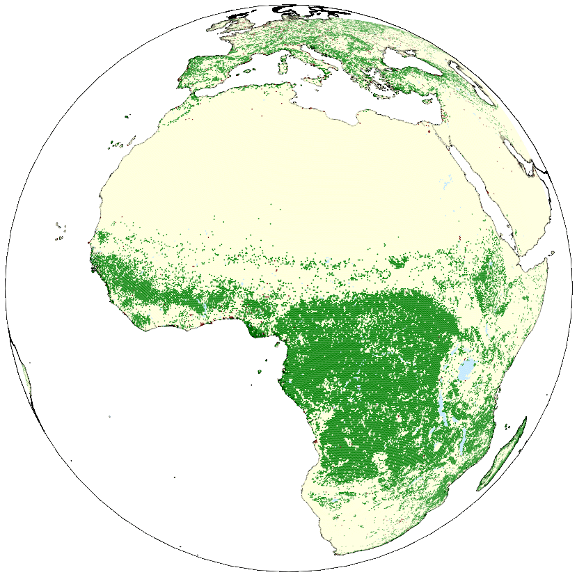 SIMULATING GLOBAL DEFORESTATION USING A NOVEL SPHERICAL GEOGRAPHIC AUTOMATA MODELLING APPROACH
Posted 7 months ago
By Bright Addae in the SFU Blog
Every summer, occurrences of wildfire across Canada causes not just environmental problems but also has serious health implications. This, coupled with widespread deforestation across the globe including region such as the Amazon Forest and Congo basin motivated me to participate in the 2023 Esri Canada GIS Scholarship for SFU competition. As an extension of my […]
Read More
 Mapping Inclusivity: Esri Canada Competitions and Advancing Gender-Inclusive Campus Design
Posted 7 months ago
By Hawjin Falahatkar in the UCalgary Blog
Hello everyone! My name is Hawjin Falahatkar, and I am currently pursuing an M.Sc. in Geography at the University of Calgary, working in the Fast Accessible Mapping & Mobility (FAMM) research lab directed by Dr. Victoria Fast. Drawing from an urban planning and design background and an interest in accessibility research, I employ the power […]
Read More

