
Discovering The Usage of ArcMap for Nautical Chart Data
So far with my time studying Geomatics at the University of New Brunswick I’ve seen just how versatile ArcGIS can be. During the winter term I was taking an ocean mapping course that broke down the fundamentals of positioning and recording regions of the seafloor. One topic of interest that was assigned to us was observing nautical charts from the National Oceanic and Atmospheric Administration (NOAA) and overlaying seafloor data to better understand the surrounding environment, such as what a ship’s navigator would do. The files that we were working with were American data provided as raster nautical charts (RNCs) using the Maptech BSB format, which is comprised of documentation, header, and image files. The display and distribution of mapped regions is presented online as follows:
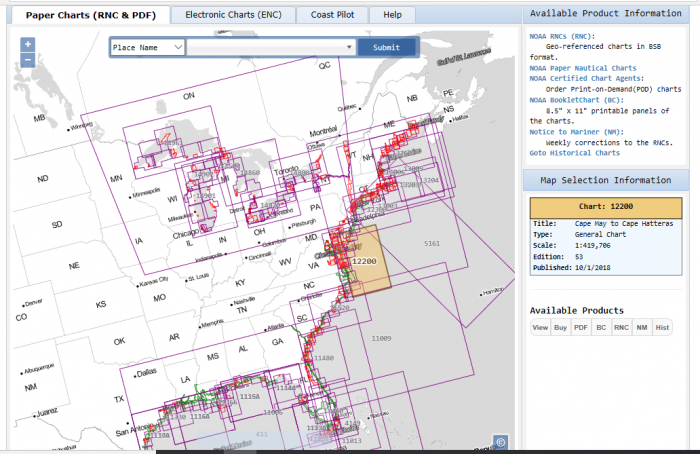
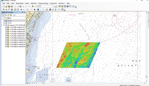
The polygon areas are separately surveyed pieces of the ocean and its features. Each area also came with its own bathymetric attributed grid (BAG) surface which was the depth and shape of the bottom that was measured from acoustic soundings. The cool part about all of this is the BAG data (along with the nautical chart) needed to be co-interpreted to show shipwreck dangers and elevation fluctuations, something that ArcMap is more then capable of doing. That being said the file format comes in a compressed GZ archive, and thus needed a file converter to make it accessible as a shapefile. Here is a demonstrated version that I created and used to identify various oceanic attributes and navigation tactics.
Before I had done this assignment, my knowledge of ArcMap’s capabilities was rather one dimensional, as I only knew of its use for land positioning and data modeling. I did not perceive it to be compatible with ocean applications. Having this experience was not only refreshing, but also reflective in the sense that the use for GIS programming is not singular. There are many different projects that you can apply it to to achieve really interesting results. As I continue my studies moving forward I hope to find many ways like this to bring ArcGIS into different application.