
Clipping a big DEM to a small shapefile and using Con to get specific depths
For my undergrad independent project, I am creating an atlas of coastal Eastern Georgian Bay with the Pat Chow-Fraser Lab at McMaster University. The atlas covers wetland information such as fish and vegetation community, water quality indices, wetland area and volume, and more. I primarily work on calculating wetland area and volume at five different lake levels for depths of 0 to 5 m. Lake level changes are important because they are an indicator of habitat availability for fish and wildlife communities. For example, low lake levels could decrease wetland area for fish spawning and nurseries. It was of interest to see how wetland marsh area and volume changes with changing lake levels for each coastal wetland along Georgian Bay.
In this blog, I will discuss the preliminary work for the project which involves using the ArcGIS raster calculator and a conditional statement to clip a DEM. I will also compare the conditional expression in the raster calculator to the IIf function in Arcade, and whether it would be useful for this project.
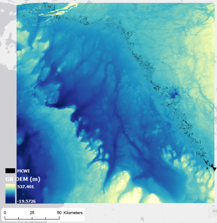
The goal was getting 5 DEMs at different lake levels with depths only from 0 to 5 m. It all started with two layers, the Georgian Bay DEM and the wetlands shapefile (MCWI created by Jon and Dan; see image below).
I first clipped the GB DEM to the MCWI shapefile. Afterwards, I needed to further narrow the DEM to 0 to 5 m. For this, I used the raster calculator and the expression:
con(“DEM” ≥ 0, 1, 0) & con(“DEM” ≤ 5, 1, 0)
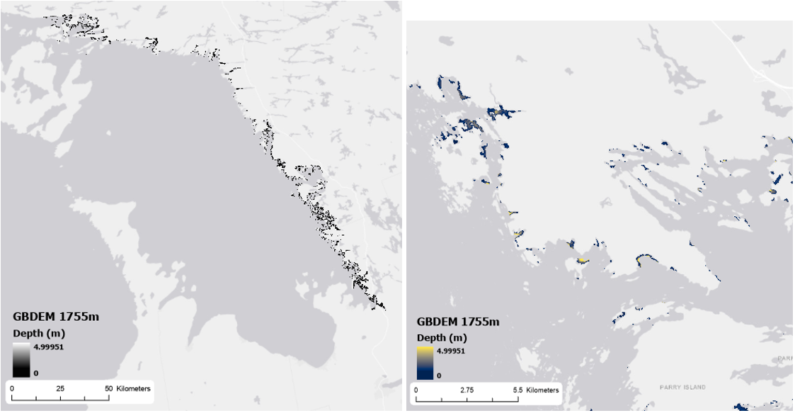
The output was then selected for “value = 1”. Lastly, the DEM was masked to this output. I repeated the process four more times for the DEM at different lake levels. One example is show in the images below:
It took me a while to perfect the process and I think there are more ways I can improve on it. The most challenging part was getting the large raster to only show values that were 0 to 5 m deep. I accomplished it using the conditional statement which reminded me of something else. During my visit to the Esri User Conference, the session about Arcade talked the IIf statement. The IIf statement is:
IIf(condition, trueValue, falseValue)
It is essentially identical to the con statement in the raster calculator. IIf is a logical function mostly used for ArcGIS Online whereas Con is a conditional evaluation tool that is used for rasters. I do not think I will be using Arcade for this project, particularly because it is mainly used for doing work on the fly. However, I am excited dabble into it when creating maps for pages in the atlas because there are many functions out there. One that I would consider using is Area. Stay tuned for more about my independent project and my thesis, and thank you for reading!