University of Waterloo GIS Day 2023 Recap

By: Weronika Fydrych
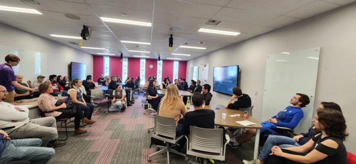
November 15th marked 2023’s GIS Day, the international celebration of everything geospatial! To participate, the University of Waterloo’s ECCE group, along with the Waterloo Association of Geography Students, the Univeristy of Waterloo Geospatial Centre, and Environment Technology and Instructional Support (ETIS) worked together to organize the University of Waterloo’s first in-person GIS day celebration since 2019. This year, the event was held in the Geospatial Centre at Dana Porter Library. The event featured 11 lightning talks from students, faculty, and staff from all corners of the University of Waterloo community. In between the two main lightning rounds, there were two workshops on Python in ArcGIS and WebGIS using the ArcGIS SDK for JavaScript.
The event started at 1 pm in the Geospatial Lab with half an hour for networking, reconnecting, and open discussions. At 1:30, we started our lightning talks starting with Matthew Woodward of the Northern Tornadoes Project, who described how NDVI can be used for tornado track detection and analysis. He was followed by three other fantastic presentations about transportation geography.
After the first round, we paused for cake and coffee, and then later reconvened to participate in one of two workshops: Introduction to Web Mapping and Web GIS by Ben Woodward, and a Python in ArcGIS Crash Course, hosted by Esri Canada’s very own Alex Smith.
The last round of lightning talks was kicked off by Weronika Fydrych with a presentation about ArcGIS QuickCapture. Weronkia was followed up by presentations on how the Town of Caledon uses ArcGIS Field Maps, how University of Waterloo’s Plant Operations use ArcGIS Dashboards, the amazing historical GIS projects and other work being done by the University of Waterloo’s Geospatial Centre, and the impact of Canada’s historic 2023 wildfire season. The days festivities were brought to a close with a presentation from University of Waterloo’s Dr. Grant Gunn about the potential impact of oil spills under ice.
Special thanks to the Waterloo Association of Geography Students for setting up GIS day, bringing the community together, and funding the event. We would also like to extend our gratitude to the Geospatial Centre for hosting the event, helping organize and advertize, and for providing two lightning talks, and ETIS for facilitating the lightning talks and for offering a Google Earth VR demonstration at the event. Thank yous also go out to Alex Smith for returning to his alma mater to deliver the Python workshop and for providing us with Esri swag, to all the students, faculty, and staff who stepped up to the plate to present a lightning talk, and most of all to the dozens of students, faculty, and staff from every faculty who joined us for the event.
For more information, Scott MacFarlane of ETIS kindly put together a web page showing additional photos and the full agenda: https://uwaterloo.ca/environment-technology-instructional-support/gis-day#:~:text=For%20years%2C%20MAD%20and%20the,you%20are%20interested%20in%20presenting.
The University of Waterloo is excited for next year’s GIS day, and many more to come!
