
Building a Better Disaster Response App: Reflections on the 2022 ECCE App Challenge
By: Ben Woodward and Justin Lo
Summary
Ben: Earlier this year, I participated in the ECCE app challenge as a member of team G(oose)IS. This team consisted of Justin Lo (another University of Waterloo ECCE student associate), Jason Sousa (who has now graduated), and me. In this blog post, Justin and I will give an overview of our app challenge entry, which was a spatially-oriented disaster response app called ReLinkeR. This app combines Esri and open-source technologies (most notably the web mapping library OpenLayers) to help those in disaster areas find the quickest safe route out of a disaster area. We will also reflect on what we learned from participating in the challenge.
The Idea Behind ReLinkeR
Ben: The purpose of ReLinkeR is threefold. First, it gives people on the ground (either citizens or disaster relief personnel) a platform they can use to report obstacles and safety hazards, such as fallen trees and power lines. Second, it allows citizens to find out if they can safely evacuate a disaster area and, if so, shows them the safest evacuation route. Third, it provides disaster relief coordinators with a web map that they can use to understand the disaster in real time and coordinate their response (e.g., where should hydro crews go to repair downed power lines).
Disaster Relief and Volunteered Geographic Information
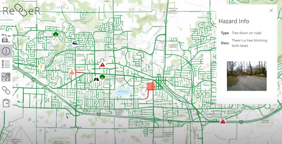
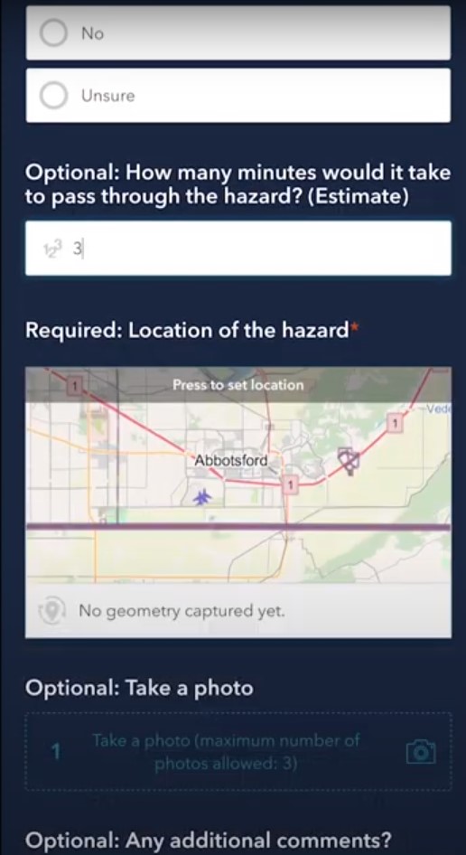
Justin: With ReLinkeR, the user can fill out a Survey123 form to identify hazards along a path. The user will choose the type of hazard from a list of hazard types that corresponds to the one they see in real-time. The user is also able to submit photographs of the hazard(s) which can be seen by all the people using the app. This information will be stored in a point feature which is placed on the map by the user.
A Versatile Solution
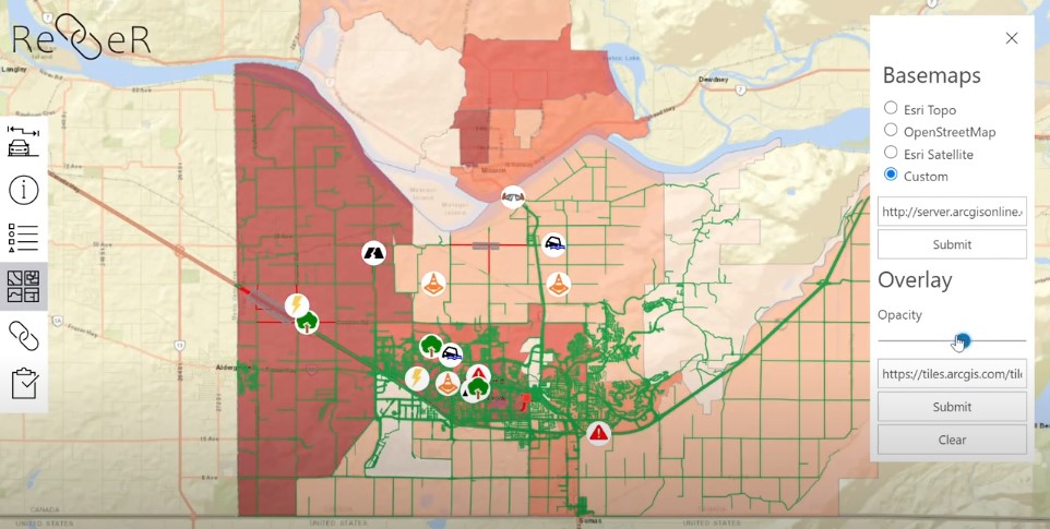
Ben: One of the key features of ReLinkeR is that municipalities with accurate road data and access to ArcGIS Online can deploy it in minutes. All officials need to do to set it up is paste in links to ArcGIS Online feature layers for roads, hazard points, and hazard polygons covering any location in Canada. The hazard points layer can then be connected to a Survey123, allowing citizens to add new hazards to the map. Additionally, custom base maps and overlays can be added to the tool by disaster response coordinators to gain further insights into the situation.
Tying it All Together
Justin: Our inspiration for creating this app was the flooding that took place throughout British Columbia in 2020. We wanted to create an app that could help people safely navigate hazards that resulted from natural disasters. We explain our mission statement and bring the components of ReLinkeR (our Survey123 form and hazard map) together in our ArcGIS Hub site which can be found here: https://relinker-uwaterloo.hub.arcgis.com.
Shortcomings and Future Improvements
Ben: The main shortcoming of this app is that it requires either WiFi or cell service to use, which may not be present in a disaster area. That said, if cellular data is available, it can be made instantly accessible to users by providing them with a hyperlink since it is a web app rather than a mobile app. This avoids the issue of users not adopting/downloading the app, as we saw with the federal government’s COVID alert app.
Another shortcoming of the app is that the user needs to manually set it up by pasting in links to the feature layers. In an improved version of the app, We would incorporate a lightweight database that would load the appropriate layers automatically based on parameters in the URL.
There are a few features we would have liked to add to this web app if we had more than a week to create our entry. First, while the app allows users to search for and zoom to their city using NRCAN’s Geonames API, it does not use the location on the user’s smartphone to automatically zoom them to their location. Second, the app does not consider traffic when plotting routes to safety, so it could create dangerous traffic jams if used en masse. Finally, the app does not provide a direct line of communication between disaster response teams and citizens, and thus does not deliver critical, non-spatial information to citizens as other systems like emergency alerts do.
Reflections
Ben: Participating in the Esri Canada App Challenge earlier this year was a fantastic occasion to take my GIS and web mapping skills to the next level. By helping build ReLinkeR, I improved my proficiency in the React web framework and learned how to use more advanced features in OpenLayers. On top of that, I learned how to integrate Esri solutions such as ArcGIS Online Feature Layers and Survey123 with open-source web mapping libraries like OpenLayers. Just as importantly, I enjoyed the opportunity to work with Jason and Justin, both of whom I have gotten to know over the past two years through the University of Waterloo’s Geospatial Club.
Justin: Taking part in the ESRI Canada App Challenge this year was a great opportunity to further my knowledge and experience with the suite of apps that ESRI provides. Most notably, I had the opportunity to work with ArcGIS Hub and ArcGIS Story Maps for the first time and integrate my results into the final product. Throughout the challenge period, I also learned from my fellow team members and got to know more about topics that they had expertise in. Overall, I thoroughly enjoyed creating this app with Ben and Jason, both of whom I have gotten to work with over the past two years through our shared interest at University of Waterloo’s Geospatial Club.