In July 2026, I had the pleasure of taking part in the International Society for Photogrammetry and Remote Sensing (ISPRS) Congress at the Metro Toronto Convention Centre. This year’s congress was especially meaningful because it returned to Canada for the first time in 54 years, after Canada last hosted the event in Ottawa in 1972. For readers less familiar with the ISPRS Congress, it is a quadrennial gathering of leading scientists, researchers and industry experts in photogrammetry and remote sensing. It provides an international forum to showcase cutting-edge research, encourage discussion and shape the future of geospatial technology and its applications across industries.

A week filled with intellectually stimulating scientific contents

The congress program featured a wide range of session formats designed to foster collaboration and highlight emerging technologies. These included daily plenary talks by prominent figures in remote sensing and photogrammetry, scientific and applied research presentations, poster sessions, industry project showcases, themed sessions on trending topics, open forums as well as technology lightning talks featuring new products and tools. There was no shortage of intellectually stimulating discussion about the latest research and development in using geospatial data to better understand our environments. As a bonus, I personally had the honor to deliver a poster presentation on my scholarly work related to the use of remotely sensed imagery to investigate urban greenery and rooftop vegetation. I enjoyed meeting like-minded researchers and generating dynamic conversations during the poster sessions. Their inputs and comments were tremendously valuable. Thematic tracks including the below ran in parallel, giving participants the flexibility to mix and match sessions that aligned with their interests.

Making meaningful connections across the photogrammetry and remote sensing community

I found the congress to be an excellent opportunity to meet face-to-face with people from all over the world working at the forefront of remote sensing and photogrammetry. In addition to participating in the congress, I volunteered my time to monitor technical sessions and support smooth delivery of presentations. It was especially rewarding to meet speakers, session chairs, organizing committee members and colleagues who shared a common goal: advancing and sharing geospatial knowledge. I am grateful for the opportunity to contribute back to the broader community. Did you know the event was organized and run entirely by volunteer committees from the Canadian Remote Sensing Society (CRSS)? This was a remarkable achievement given the size of the conference and the scale of the logistics involved. I am proud to have been part of it.

Highlights from the week-long congress

Big ideas shaping the future of geospatial science

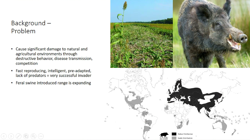
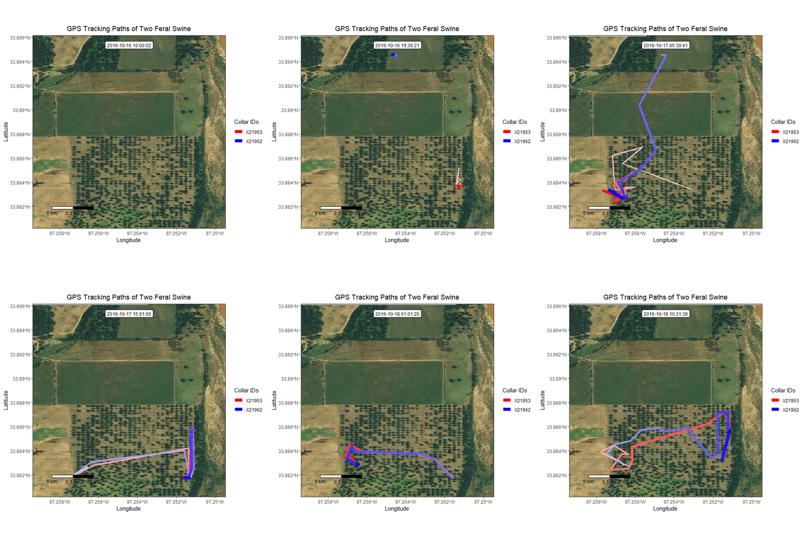
Although it was impossible to attend every session, several highlights stood out from my perspective as a participant. From the keynote speakers, I was reminded of the importance of combining human expertise and machine intelligence to develop next-generation geospatial products for the public good. Mr. Alex Miller from Esri spoke about the importance of creating a sustainable community map built from authoritative data collected close to the source to break down data silos across municipalities, bringing communities across the nation together to facilitate information sharing, promote innovations and generate better insights for business and policy decision-making. Remote sensing is widely recognized for detecting and monitoring human activities on Earth, but it also contributes significantly to maritime surveillance. Dr. Minda Suchan from MDA spoke about the use of satellite imagery to detect and track illegal vessels, monitor illegal fishing, and predict the impacts of oil spills, mining, and deforestation. Dr. Michael Daly from York University discussed the OSIRIS-REx mission to asteroid Bennu, which returned 121.6 grams of asteroid sample to Earth, more than twice the original target for scientific research. He also highlighted the creation of a precise 3D model that enables humans to examine an asteroid’s surface at high resolution for the first time. Another memorable example was the talk by Dr. Marguerite Madden from the University of Georgia on spatial-temporal analysis of elephant tracks, which demonstrated how GIS can help reduce conflicts with wildlife and increase human-wildlife coexistence. Dr. Xiaoxiang Zhu from the Technical University of Munich discussed the rise of foundation models where AI, earth observation (EO) and sustainability converge to support actionable insights for a more resilient planet. A concrete example that she provided was the first complete global 3D building atlas derived from EO data using AI to demonstrate how planetary scale geoinformation can support sustainable urban development and climate action. Dr. Jun Chen from Moganshan Geospatial Information Laboratory emphasized the research community must continue supporting open-source development so scientific advances can be translated more readily into industry applications and broader societal benefit.

3D reconstruction for both outdoor and indoor scenes

From the scientific and research presentations, I observed a strong emphasis on 3D reconstruction of spaces, not only for outdoors but also indoors. Using photogrammetry techniques, overlapping 2D aerial imagery collected from drones or 3D scanners can be used to create point clouds. When combined with terrestrial imagery, high-fidelity 3D models of buildings, warehouses, field sites, or larger areas can be generated. Advances in portable hardware and software have made these solutions more accessible than ever.

AI-enhanced geospatial analysis for cultural heritage

A central theme was the integration of classical geospatial techniques with artificial intelligence, machine learning, photogrammetry, LiDAR, radar, satellite imagery and multi-sensor fusion to improve spatial understanding, automation, accuracy and decision support. For instance, the application of hyperspectral analysis extends far beyond traditional uses in natural environments, such as detecting vegetation, minerals, and water bodies, it can also support the analysis of pigments and chemical compositions in ancient facades and sculptures at cultural heritage sites around the world. Machine learning was shown to be applied to 3D scans of ancient sites to detect damage such as cracks and crevices caused by weathering.

Mapping beneath the land surface and along coastlines

Underwater and coastal mapping were also major topics. Research studies related to refraction-aware georeferencing, underwater photogrammetry, bathymetric LiDAR, multibeam echo sounder enhancement, topo-bathymetric mapping, and coastal defense structure classification were presented. Together, these efforts aim to improve the accuracy, resolution, and reliability of shallow-water and seabed mapping, while acknowledging ongoing challenges such as turbidity, refraction, complex terrain and limited global ocean-floor coverage.

Digital twins for cities, heritage and infrastructure

Digital twin technologies spanning urban planning, low-altitude aviation, autonomous vehicles, forests, cultural heritage and building diagnostics were presented throughout the congress. Heritage-focused work included virtual reality (VR) reconstructions, digital restoration of ancient structures and UAV-based documentation for threatened UNESCO sites. Urban digital twins incorporated AI, cloud GIS, Gaussian splatting, high-definition (HD) maps, and visualization tools to support planning, infrastructure monitoring, simulation and decision-making.

Earth observation for environmental intelligence

Remote sensing and Earth observation studies covered forests, agriculture, land cover, soil moisture, drought, biomass, pests, wildfire, marine pollutants, and urban air quality. Many presented studies used Sentinel, EnMAP, PlanetScope, MODIS, VIIRS, TEMPO, aerial imagery, hyperspectral data and LiDAR in combination with CNNs, transformers, foundation models, self-supervised learning and ensemble methods. Results included improved crop classification, soil moisture estimation, forest inventory, biomass mapping, invasive pest prediction, drought early warning, wildfire progression monitoring and land cover validation.

Navigation and mapping in challenging environments

Many research presentations explored how mapping technologies can work in challenging places such as indoors, underground, in smoke or during poor weather. A key concept surrounded simultaneous localization and mapping (SLAM), the process a robot, drone or vehicle uses to figure out where it is while building a map of its surroundings at the same time. SLAM works by combining data from sensors such as radar, LiDAR, cameras, and motion sensors, then matching new observations to earlier ones so the system can track its movement and update the map as it goes. Although SLAM is not a new concept, there was an increased focus on semantic SLAM and the integration of 3D Gaussian splatting. Other research focused on improving radar-based maps, helping robots estimate their movement more accurately and calibrating radar-camera systems using moving objects in the environment.

Trusted, interoperable and secure geospatial data

There was also an emphasis on making location-based data more easily sharable, comparable, trusted and protected. Several sessions explained why common rules and shared formats matter: they help different tools, teams, and organizations understand the same data in the same way. Other work focused on improving map quality, such as checking land cover maps and correcting building outlines in shared mapping platforms. Security was another important theme, with research on stronger ways to protect and store geospatial data safely. As mapping systems become more automated and connected, they need clear rules, reliable information and safe mechanisms for data exchange.

GeoAI as a converging field with real-world impact

Looking back, the 2026 ISPRS Congress was both intellectually inspiring and personally meaningful. It showed me how rapidly geospatial science is evolving as AI, remote sensing, photogrammetry, digital twins, robotics, and shared data infrastructures come together to address real-world challenges. More importantly, it reminded me that progress in this field depends not only on advanced technology, but also on collaboration, openness and a shared commitment to applying geospatial knowledge for the public good. As AI and geospatial technologies continue to converge, geospatial artificial intelligence (GeoAI) is emerging as a powerful approach for translating complex spatial data into practical insight for business, environmental and operational decision-making. I left the congress with renewed appreciation for the people and ideas shaping the future of our field, and with excitement for where this global community will go next. As announced during the closing ceremony, the next ISPRS Congress will take place in Incheon, Korea in 2030. Until then, I will carry forward the inspiration from this memorable week in Toronto and cherish the connections made along the way.